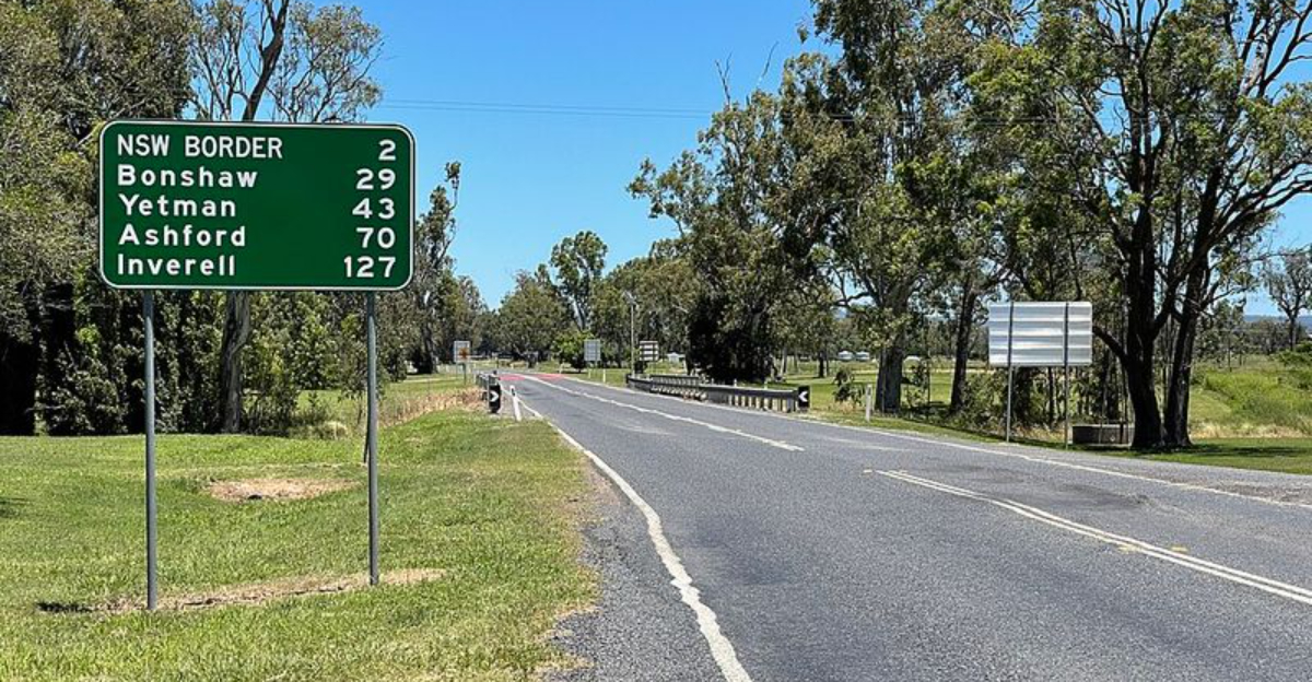
U.S. state borders might look simple on a map, but many of them have fascinating and surprising stories behind them. Some were drawn with rulers and math, while others shifted because rivers moved or old arguments got out of hand.
A few borders are so unusual that they have become landmarks all by themselves. Get ready to see the map of the United States in a whole new way.
1. Many Borders Are Straight Lines Because of Surveying
Pull out any map of the western United States and you will notice something right away: the borders look almost like graph paper. That is not a coincidence.
Most western state lines were drawn using latitude and longitude coordinates, not rivers or mountain ranges.
Surveyors measured the land and drew straight lines across it, often before many people even lived there. This made dividing new territory faster and easier for the government.
States like Wyoming and Colorado are almost perfect rectangles because of this method.
It is a practical approach, but it also means borders sometimes cut right through natural landscapes without any geographic logic.
2. Surveying Errors Created Crooked Borders
Early surveyors had one big problem: their tools were not very accurate. Compasses could be thrown off by magnetic rocks underground, and measuring long distances across rough terrain left plenty of room for mistakes.
The result? Some borders that were supposed to be perfectly straight ended up a little wobbly.
The border between California and Nevada is a well-known example. If you look closely at a detailed map, you can see it zigs and zags in certain spots instead of running in a clean, unbroken line.
These small errors have been preserved over time because correcting them would cause serious legal headaches for landowners and governments alike.
3. The Four Corners Is the Only Spot Where 4 States Meet
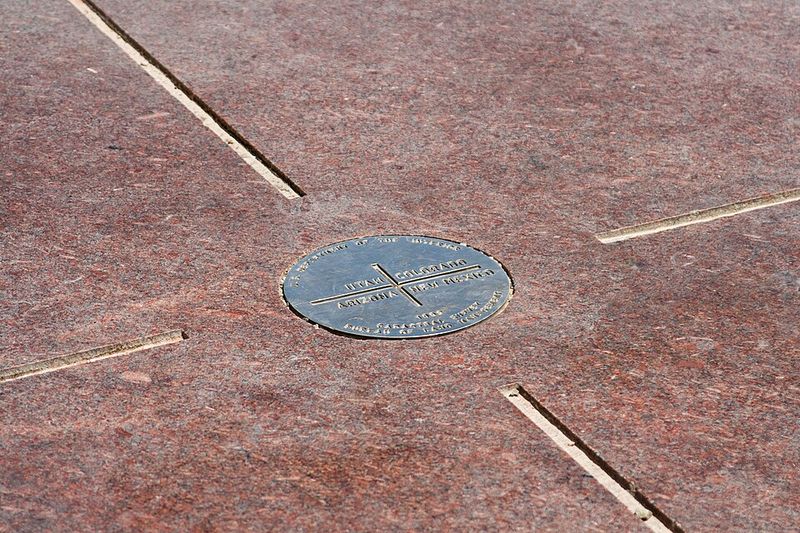
Somewhere in the middle of the desert Southwest, you can stand in four states at the same time. The Four Corners Monument marks the exact spot where Arizona, Utah, Colorado, and New Mexico all meet at a single point.
It is the only place in the entire United States where four states share one corner.
A bronze disk embedded in the ground marks the location, and visitors love posing with one limb in each state. The monument sits on Navajo Nation land and draws thousands of tourists every year.
No other quadruple border point exists anywhere else in the country, making this a truly one-of-a-kind geographic landmark.
4. The Mason-Dixon Line Became More Than a Border
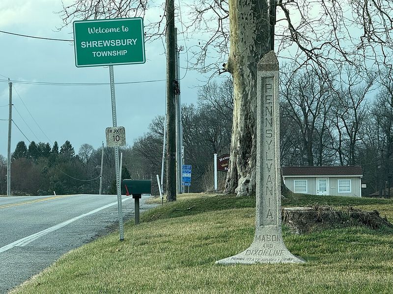
Back in the 1760s, two surveyors named Charles Mason and Jeremiah Dixon were hired to settle a land dispute between Maryland and Pennsylvania. Their carefully measured line finally ended years of arguing between the two colonies.
At the time, it was simply a property boundary.
Over the following century, though, the Mason-Dixon Line took on a much bigger meaning. It became the symbolic dividing line between the Northern and Southern states, especially during debates over slavery before the Civil War.
Today, people still use the term to describe cultural differences between the North and South, even though it was originally just about two neighbors disagreeing over land.
5. Some Borders Follow Rivers, But Rivers Move
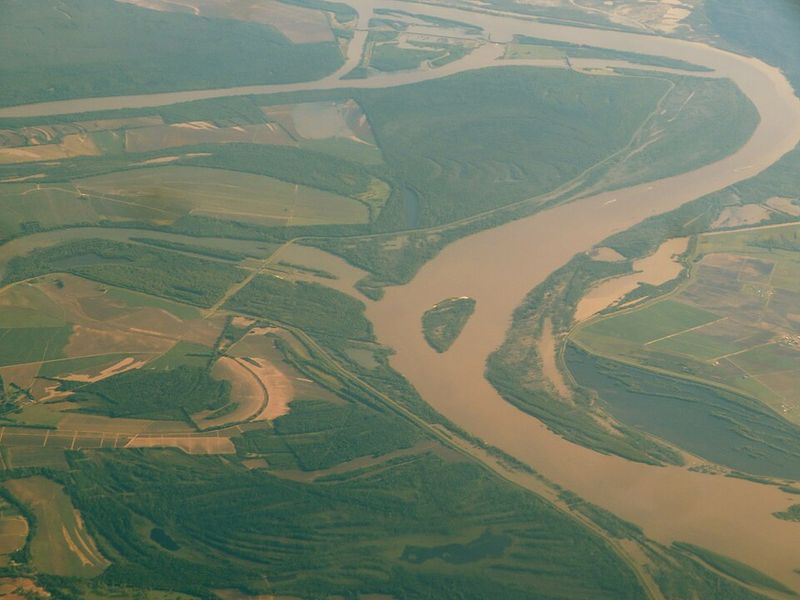
Rivers seem like natural, permanent dividing lines, but there is a catch: rivers do not stay still. Over time, rivers shift course through a process called erosion and sediment deposit.
When a river forms a state border, things can get legally complicated fast.
The Mississippi River is a prime example. It serves as the border for several states, including Missouri, Illinois, Kentucky, and Tennessee.
But when the river changes course, the official border does not automatically move with it.
This can leave parcels of land technically belonging to one state while physically sitting on the other side of the water, creating unusual ownership situations that sometimes end up in court.
6. Kentucky Has an Island Cut Off by a River Shift

Kentucky Bend is one of the strangest pieces of land in the country. This small strip of Kentucky territory is completely cut off from the rest of the state, surrounded on nearly all sides by Tennessee and the Mississippi River.
To reach it by land, you actually have to pass through Tennessee first.
The situation happened because the Mississippi River dramatically changed its course long ago, leaving this pocket of Kentucky stranded. Only a handful of people live there, making it one of the least populated areas in the entire state.
It is a quirky reminder that geography and politics do not always cooperate, and sometimes a river’s wandering ways can create truly bizarre results on the map.
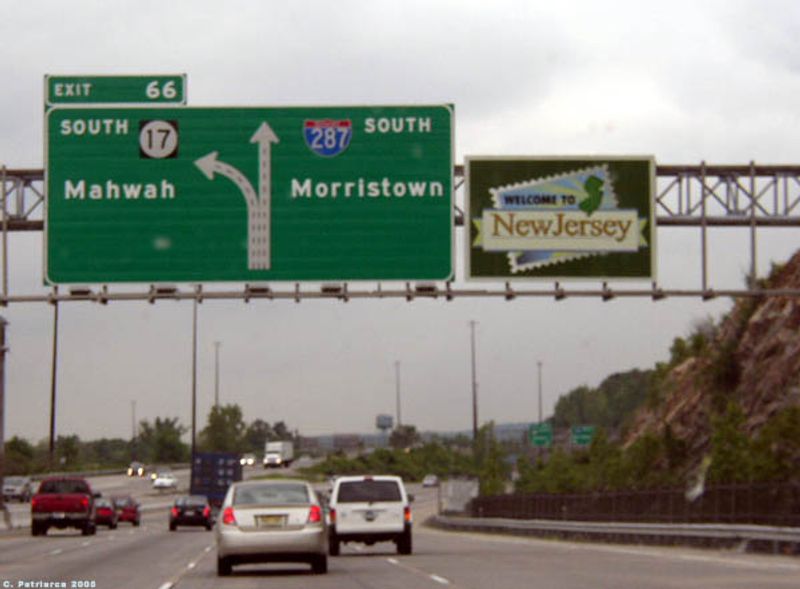
7. Texas Has the Most Bordering States
Everything is bigger in Texas, including the number of neighbors. Texas shares borders with four U.S. states: New Mexico to the west, Oklahoma to the north, Arkansas to the northeast, and Louisiana to the east.
No other state touches more American states while also sharing an international border.
That international border stretches about 1,254 miles along the Rio Grande, separating Texas from Mexico. It is one of the longest international borders in the Western Hemisphere.
Texas was once its own independent republic before joining the United States in 1845, which partly explains why it ended up with such a wide reach and such an impressive collection of neighboring territories.
8. Alaska Borders Only One U.S. State
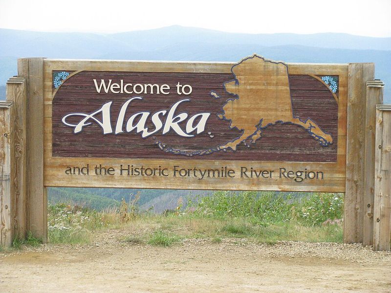
Alaska is the largest state in the U.S. by area, yet it shares a land border with only one country directly: Canada. It does not touch any other U.S. state by land at all.
The closest American state is Washington, but even that connection requires crossing Canadian territory or traveling by water.
This geographic isolation makes Alaska unique in ways that go beyond just its size. Supply chains, transportation, and even politics are all shaped by the fact that Alaska sits separated from the rest of the country.
Russia is actually closer to Alaska than any U.S. state, with only about 55 miles of water separating the two at the Bering Strait.
9. Some Borders Are Based on Old Colonial Claims

When European settlers first carved up North America, they did not exactly have accurate maps to work with. British colonial charters were often written with vague language like “extending westward to the sea,” which caused enormous confusion when different colonies claimed the same land.
Many eastern state borders are direct descendants of those messy colonial agreements. Virginia, Pennsylvania, Connecticut, and others all had overlapping claims that took decades to untangle.
Some disputes were settled peacefully through surveys, while others required legal battles that stretched on for generations. The crooked, irregular shapes of many eastern states today are a direct result of those centuries-old territorial arguments that nobody fully resolved cleanly.
10. Delaware Has a Perfectly Circular Border
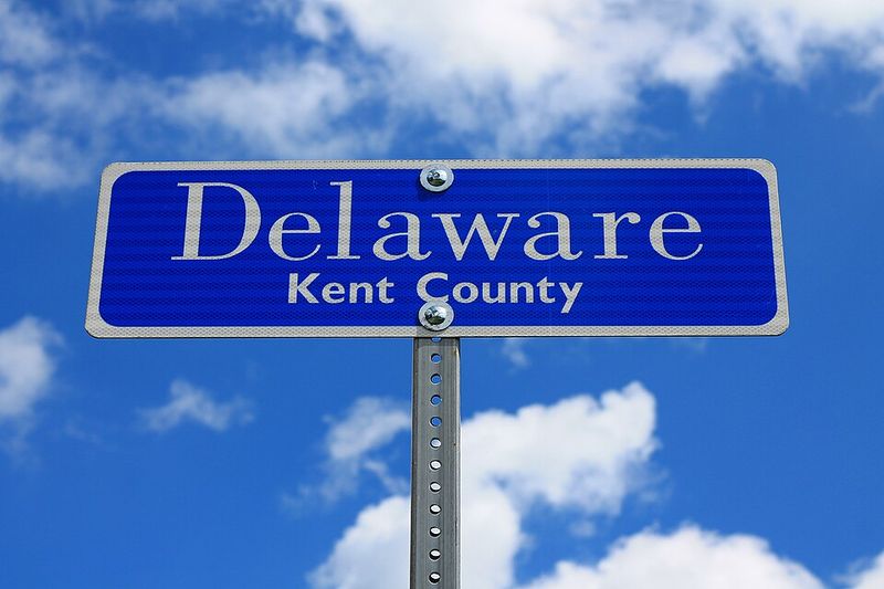
Most state borders follow straight lines or rivers, but Delaware does something completely different at its northern edge. A perfect arc, known as the Twelve-Mile Circle, forms the border between Delaware and Pennsylvania.
The circle is centered on the courthouse in the town of New Castle.
This unusual boundary dates back to a 1681 land grant given to William Penn, which specified that Pennsylvania’s southern border would follow a circular arc around New Castle. Surveyors did their best to map it accurately, though it took many years to finalize.
The result is one of the most visually distinctive borders in the entire country, standing out on any map as a smooth curve in a world of straight lines.
11. Michigan and Ohio Fought a War Over Their Border
In 1835, Michigan and Ohio nearly came to blows over a narrow strip of land about five miles wide that both states claimed. The dispute, known as the Toledo War, involved rival governors, competing militias, and a whole lot of angry speeches.
Fortunately, actual fighting was minimal, and no one was killed.
Congress stepped in to resolve the conflict. Ohio kept the Toledo Strip, which included the valuable port town of Toledo on Lake Erie.
Michigan was given the Upper Peninsula as compensation.
At the time, Michigan was furious about the trade, but the Upper Peninsula turned out to be rich in copper and iron ore, making it an incredible long-term gain for the state.
12. Water Borders Between States Are Hard to Define
Drawing a line on land is tricky enough, but drawing one across water is a whole different challenge. States that share lakes, rivers, or bays often end up in long legal battles over exactly where one state ends and the other begins.
New York and New Jersey have disputed their shared water boundaries multiple times over the centuries. Their disagreements have covered everything from the Hudson River to New York Harbor, requiring multiple court rulings and agreements to sort out.
The U.S. Supreme Court has actually stepped in to settle some of these water border cases.
Even today, the precise boundaries in certain lakes and coastal areas remain subjects of legal interpretation rather than simple lines on a map.


