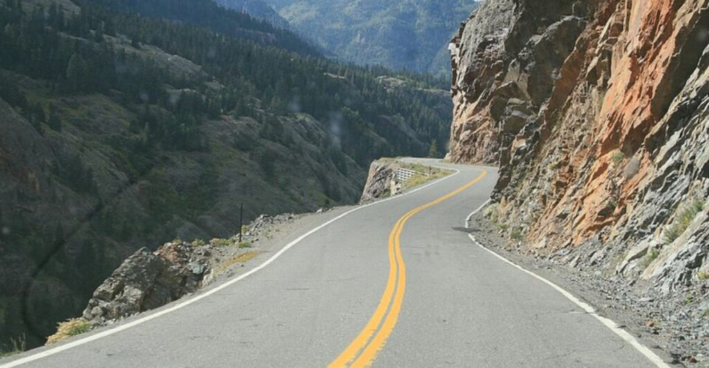
Some roads are built for speed, but a few seem built for trouble. Across the United States, certain highways have earned a grim reputation for high crash rates, deadly weather, and driving conditions that can catch even experienced motorists off guard.
Whether it is a mountain pass buried in snow or a sun-baked desert stretch that lulls drivers to sleep, these roads demand extra respect. Buckle up, because this list covers the highways where staying alert is not just smart, it is survival.
Interstate 4 (I-4) – Florida

Florida sunshine hides a dark secret: I-4 has been called the deadliest highway in America so consistently that transportation officials have practically given it a permanent spot on the danger list. Running about 132 miles between Tampa and Daytona Beach, it slices straight through the heart of Orlando, where theme park tourists, daily commuters, and massive trucks all compete for the same lanes.
Construction seems to never stop on I-4. Shifting lanes, confusing detours, and temporary barriers pop up constantly, making an already stressful drive even trickier.
Add in the sheer volume of distracted drivers rubbernecking at billboards or fumbling with GPS devices, and the recipe for disaster writes itself.
Fatality rates on I-4 have regularly topped national averages, with some stretches recording alarming crash numbers year after year. Driving here requires full attention, a healthy following distance, and zero tolerance for distractions.
If you must travel I-4, avoid peak hours whenever possible. Morning and late afternoon rush hours turn this highway into a gridlocked, nerve-wracking experience that even locals dread.
Patience and caution are your best co-pilots on this notorious stretch of Florida asphalt.
Interstate 95 (I-95)
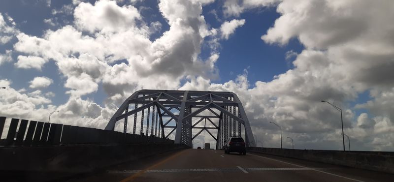
Stretching nearly 1,920 miles from Miami to the Canadian border in Maine, I-95 is essentially the spine of the entire East Coast. It connects some of the most populated cities in the country, including Miami, Washington D.C., Philadelphia, New York City, and Boston.
That kind of geographic celebrity comes with a serious downside: relentless, unforgiving traffic.
Annual crash statistics for I-95 are staggering. The sheer number of vehicles traveling this corridor every single day means even a minor fender-bender can trigger miles of backup and secondary accidents.
Aggressive driving habits in major metro areas add another layer of danger that keeps highway patrol officers constantly busy.
Weather variability along I-95 is another wild card. Drivers can leave sunny Florida and encounter black ice, dense fog, or nor’easter snowstorms before they even reach the Mid-Atlantic states.
Road conditions shift dramatically depending on the season and location. Smart travelers check weather reports before each leg of a long trip on this highway.
Keeping an emergency kit in the car, staying well-rested, and allowing extra travel time are all smart strategies for surviving a journey on America’s busiest and most accident-prone coastal corridor.
Interstate 45 (I-45) – Texas
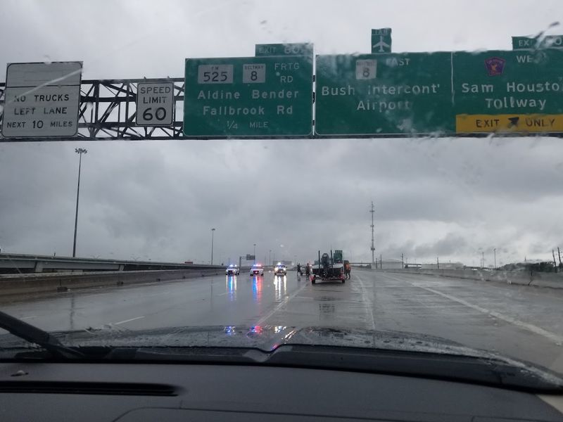
Texans have a saying: everything is bigger in Texas, and unfortunately that includes highway danger. I-45 connects Dallas to Galveston along about 285 miles of road that has earned a troubling reputation in crash studies.
Multiple transportation research groups have ranked it among the deadliest highways per mile traveled in the entire country, a distinction nobody wants.
High speeds are a major factor. Texas highways allow some of the fastest legal driving in the nation, and many drivers push well beyond even those generous limits.
Add in a heavy presence of commercial trucks hauling freight between major distribution hubs, and the size mismatch between passenger cars and big rigs creates serious collision risks.
Congestion around Houston is another pressure point. The metro area sits near the midpoint of I-45, and traffic through the city can be brutal during morning and evening rush hours.
Sudden slowdowns on a highway where everyone was just cruising at 75 miles per hour are a leading cause of rear-end collisions. Drivers are strongly encouraged to stay aware of brake lights ahead, keep a safe following distance, and never assume the car in front will maintain its current speed.
Texas highways reward alertness and punish complacency.
Interstate 10 (I-10)
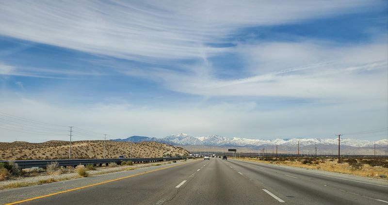
Crossing the entire southern tier of the United States from Jacksonville, Florida, to Santa Monica, California, I-10 is one of the longest interstates in the country at about 2,460 miles. That length alone means drivers encounter an extraordinary variety of road conditions, weather patterns, and hazards depending on exactly where they happen to be rolling.
Desert sections through Arizona and New Mexico are especially unforgiving. Summer temperatures regularly crack 110 degrees Fahrenheit, which can cause tire blowouts, engine overheating, and severe dehydration if a breakdown occurs far from the nearest exit.
The long, monotonous stretches of flat desert highway are also notorious for inducing highway hypnosis, where drivers zone out without realizing it.
Urban stretches through Houston, San Antonio, and Los Angeles bring an entirely different set of problems, mainly crushing congestion, aggressive lane changes, and complex interchange systems that confuse unfamiliar drivers. Truckers hauling goods across the country are a constant presence on I-10, and sharing lanes with vehicles weighing 80,000 pounds requires serious respect.
Fuel up frequently in remote sections, carry plenty of water, and never assume the next exit is just around the corner. Out here, preparation is not optional, it is essential.
Interstate 5 (I-5) – California
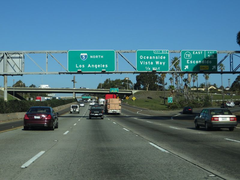
California drivers have a complicated relationship with I-5. On one hand, it is the fastest route through the state, running nearly 800 miles from the Mexican border near San Diego all the way to the Oregon state line.
On the other hand, it serves up some of the most infuriating, and sometimes terrifying, driving conditions anywhere on the West Coast.
The Grapevine section, climbing through the Tehachapi Mountains south of Bakersfield, deserves its own spotlight. Steep grades push trucks to their limits on the way up and test brakes on the way down.
During winter, this section can be hit with sudden snowfall and ice that catches drivers completely off guard, especially those traveling from warmer Southern California who may not have appropriate tires or chains.
Strong winds through mountain passes and the San Joaquin Valley can also be genuinely scary, especially for high-profile vehicles like RVs and box trucks that act like sails in a stiff gust. Southern California sections near Los Angeles feature some of the densest traffic on the planet, where five lanes of vehicles all seem to be changing positions simultaneously.
Check road conditions before heading over the Grapevine, especially between November and March. A few minutes of research can save hours of trouble.
U.S. Route 550 (Million Dollar Highway) – Colorado
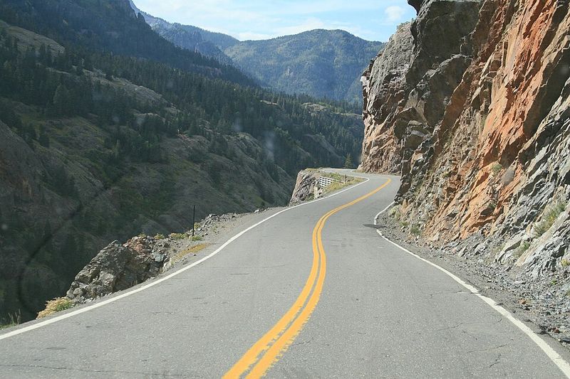
The name sounds glamorous, but drivers who have white-knuckled their way through the stretch between Ouray and Silverton know the Million Dollar Highway is more thriller than tourist brochure. This 25-mile section of U.S.
Route 550 winds through the San Juan Mountains at elevations that make your ears pop, and it does so with a casual disregard for modern safety features like guardrails.
Sheer drop-offs fall hundreds of feet straight down in several places along the route, with nothing between the road edge and the canyon below. The road is narrow enough that two large vehicles passing each other requires genuine skill and mutual cooperation.
Rockslides, avalanches, and sudden snowstorms can materialize without much warning, even in late spring and early fall.
Tourism is a double-edged sword here. The scenery is genuinely jaw-dropping, which means distracted drivers are everywhere, slowing down mid-curve to snap photos or drifting toward the center line while staring at a waterfall.
If you plan to drive this route, do it during daylight hours only. Night driving on the Million Dollar Highway is strongly discouraged even by locals who know it well.
Pull over at designated areas to enjoy the views rather than risking a catastrophic mistake on a blind curve.
Interstate 15 (I-15)
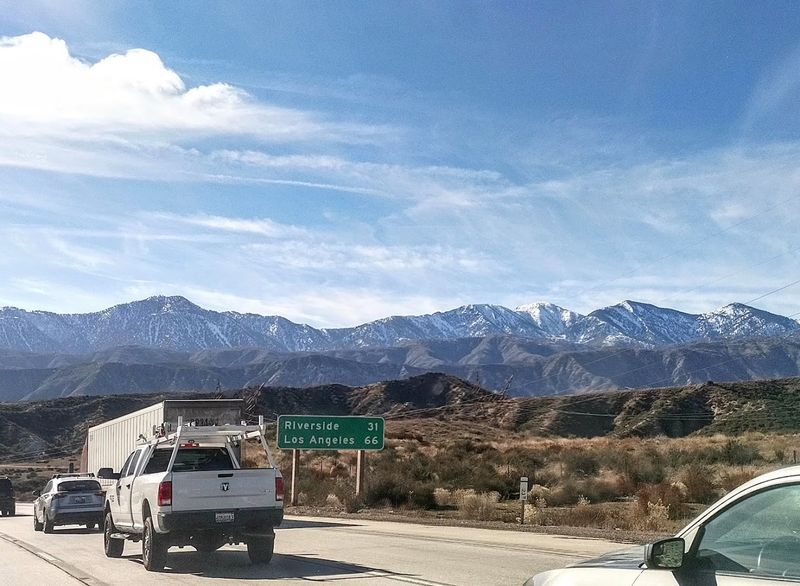
Every Friday afternoon, hundreds of thousands of people make the pilgrimage from Southern California toward Las Vegas on I-15, turning this desert highway into a slow-moving parking lot. The return trip on Sunday evenings is equally brutal.
But when traffic finally clears and drivers feel free to push the speed limit, that is precisely when things can go very wrong very fast.
The Mojave Desert setting creates its own category of hazards. Summer heat regularly exceeds 115 degrees Fahrenheit in the desert sections, and a vehicle breakdown here can escalate into a medical emergency within minutes.
Cell service is spotty in some stretches, meaning help may not come quickly if something goes wrong. Tire blowouts from heat-softened pavement are more common than many people realize.
Driver fatigue is another serious concern. The combination of long straight roads, featureless desert scenery, and the post-Vegas exhaustion that many return travelers are battling creates dangerous drowsiness behind the wheel.
Studies consistently show that fatigued driving can be just as impairing as drunk driving. If you feel sleepy on I-15, pull off immediately and rest.
The casinos will still be there next weekend, but getting home safely matters far more than shaving 20 minutes off your drive time.
Interstate 70 (I-70) – Colorado
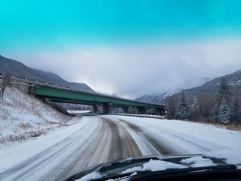
Skiers love I-70 on Friday evenings. Highway engineers probably lose sleep over it.
This stretch of interstate through the Colorado Rockies is one of the most technically demanding roads in the entire country, combining steep mountain grades, narrow canyon walls, heavy truck traffic, and weather conditions that can flip from clear to whiteout in under an hour.
The descent from the Eisenhower Tunnel toward Denver is particularly notorious for runaway truck incidents. Brake failures on steep grades have caused some genuinely catastrophic accidents over the years, which is why runaway truck ramps are positioned at strategic points along the descent.
These ramps are not decorative. Drivers of large vehicles must carefully manage speed and brake temperature on the way down.
Winter weekends create a perfect storm of danger. Ski resort traffic floods the highway with passenger vehicles that are not always equipped with proper snow tires or chains.
Chain laws are enforced during storms, but compliance is not always perfect. Closures due to avalanche control or accidents can trap drivers for hours in frigid conditions.
If you are heading into the mountains on I-70 during winter, check CDOT road conditions before you leave, pack an emergency kit, and never assume the weather report from Denver applies to the summit.
Interstate 80 (I-80) – Wyoming
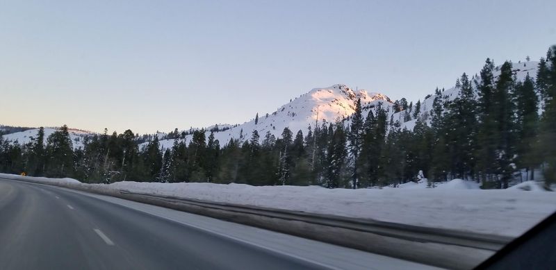
Wyoming does not mess around when it comes to winter weather, and neither does I-80. Crossing the southern part of the state at elevations above 8,000 feet in some sections, this highway is at the mercy of some of the most ferocious winter conditions in the lower 48 states.
Blizzards, black ice, and winds that can exceed 80 miles per hour are not exaggerations here, they are regular seasonal events.
The stretch between Laramie and Rawlins is especially infamous. Wind gusts strong enough to tip over semi-trucks have been recorded multiple times, and the Wyoming Department of Transportation closes this section of I-80 more frequently than almost any other interstate in the country.
When the signs say the road is closed, that is not a suggestion, it is a hard stop enforced by law enforcement.
Summer is considerably more forgiving, but even then, afternoon thunderstorms can roll in quickly and drop hail or reduce visibility to near zero in minutes. Wildlife crossings are also a concern, particularly at dawn and dusk when deer and pronghorn antelope are most active near the roadway.
If you are crossing Wyoming on I-80 between October and April, check road conditions obsessively, carry survival supplies, and build flexibility into your schedule for potential delays or detours.
Interstate 40 (I-40)
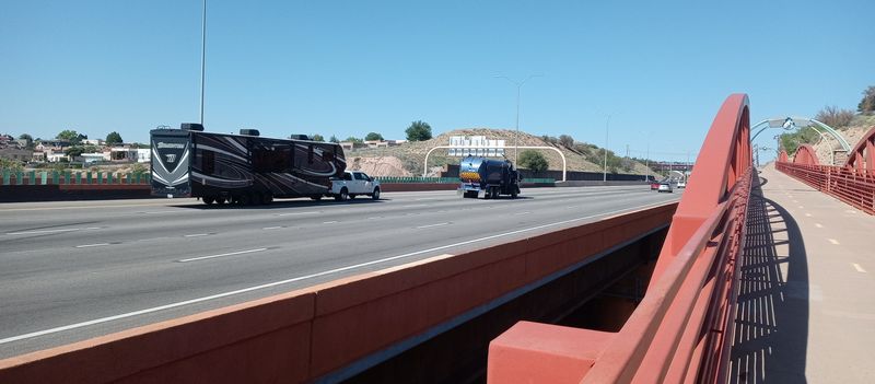
Running from Barstow, California, to Wilmington, North Carolina, I-40 stretches about 2,555 miles and serves as one of the country’s most important freight corridors. That means trucks.
Lots and lots of trucks. Sharing the road with commercial vehicles that stretch 70 feet long and weigh tens of thousands of pounds is something every I-40 driver becomes very familiar with very quickly.
Weather along this route changes dramatically depending on the region. In the desert Southwest, sudden dust storms called haboobs can reduce visibility to zero in seconds.
New Mexico and Arizona drivers are advised to pull completely off the road, turn off their lights, and wait out these storms rather than attempting to drive through them. The phrase pull aside, stay alive is actually a safety campaign used in Arizona for exactly this reason.
Mountain passes through New Mexico and Tennessee bring ice, snow, and fog during winter months, while the Great Plains sections in Oklahoma and Texas are vulnerable to severe thunderstorms and tornadoes during spring. The sheer variety of hazards across I-40’s length makes it impossible to prepare for just one type of danger.
Flexible planning, regular weather checks, and a well-maintained vehicle are the best tools for a safe crossing of this massive transcontinental route.
Overseas Highway (U.S. 1) – Florida Keys
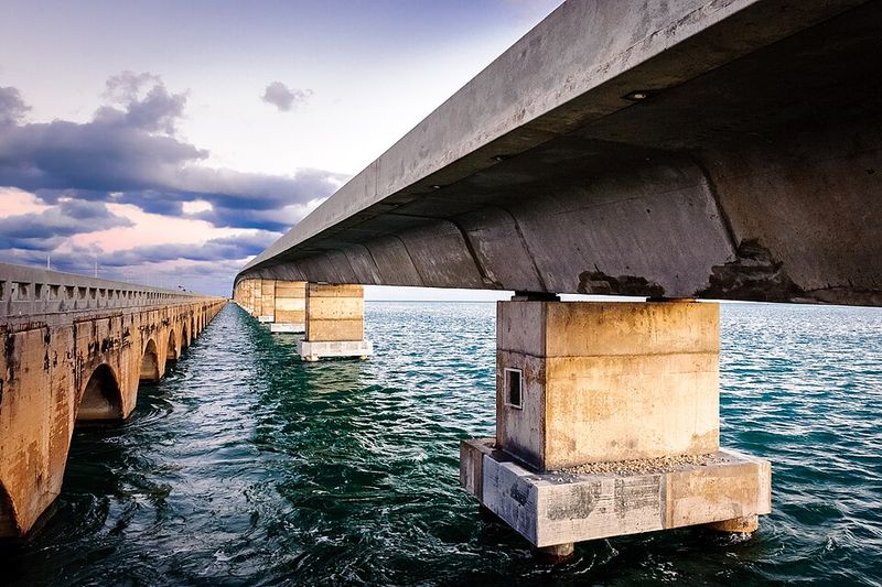
Driving the Overseas Highway feels like something out of a movie, a road that seems to float on top of the ocean as it hops between the Florida Keys on a series of bridges stretching 113 miles from the mainland to Key West. The Seven Mile Bridge section is particularly cinematic.
But the same features that make this drive unforgettable also make it genuinely risky in ways that are easy to underestimate.
Strong coastal winds are a constant companion, especially on exposed bridge sections where there is nothing to block the breeze coming off the Gulf of Mexico or Atlantic Ocean. Crosswinds can push smaller vehicles sideways unexpectedly, and the narrow bridge lanes leave very little room for error.
Motorcyclists and cyclists who use the highway face even greater wind exposure.
Tropical storm season runs from June through November and can bring sudden squalls that drench the highway in sheets of rain, dramatically reducing visibility and traction on bridges with no shoulders. There is essentially nowhere to go if conditions deteriorate mid-bridge.
Pulling over is not always possible, and turning around may not be practical. Before heading down the Keys during storm season, check the National Hurricane Center and local weather forecasts.
This road is one of the most beautiful in the country, but it requires a clear head and a weather eye at all times.
Interstate 35 (I-35) – Texas
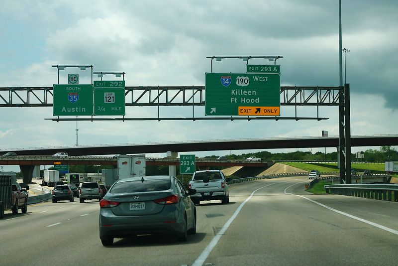
Ask any Texan which highway they dread most, and a significant number will say I-35 without hesitation. Running from Laredo at the Mexican border all the way to Gainesville near Oklahoma, this highway passes through San Antonio, Austin, Waco, and the Dallas-Fort Worth metroplex, making it one of the most heavily traveled corridors in the entire southern United States.
Construction on I-35 is practically a permanent state of being. Lane closures, shifted traffic patterns, reduced speed zones, and confusing detours seem to follow drivers for hundreds of miles.
The Austin section has been under various stages of expansion and reconstruction for years, and drivers who have not been through recently can find themselves in a very different road configuration than they expected.
Freight traffic is enormous on I-35 because it serves as a major trade route connected to the U.S.-Mexico border. Trucks carrying everything from electronics to agricultural products move through this corridor constantly, and the sheer mass of commercial vehicles in the traffic mix raises the stakes for every passenger car sharing the lanes.
Rush hour in Austin or San Antonio can stretch for two hours or more in each direction. Keeping calm, staying in your lane, and giving trucks plenty of space are not just good manners here, they are genuine safety strategies on this relentless Texas corridor.
Interstate 90 (I-90)
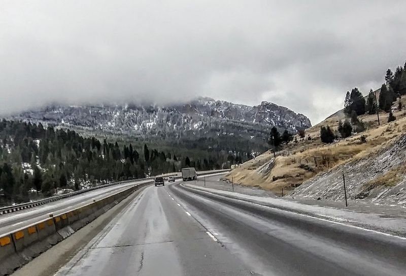
At approximately 3,020 miles long, I-90 holds the title of America’s longest interstate, stretching from Seattle, Washington, all the way to Boston, Massachusetts. That extraordinary length means it passes through an almost absurd variety of landscapes and weather systems, from Pacific Northwest rain and mountain passes to frozen Great Plains winters to the lake-effect snow zones of upstate New York.
The Snoqualmie Pass section in Washington is one of the most frequently hazardous segments, where heavy snowfall, avalanche risk, and icy conditions can close the road or require chains from October through April. Drivers heading east from Seattle need to check road conditions before committing to the pass, especially during overnight travel when temperatures drop and ice forms quickly on the pavement.
South Dakota and Montana sections introduce a different kind of challenge: extreme isolation. Services can be separated by 50 miles or more, and cell coverage disappears in long stretches across the plains and mountains.
A breakdown in these remote sections during a winter storm is a genuinely serious situation. Crossing I-90 in winter requires preparation that goes beyond just topping off the fuel tank.
Emergency blankets, water, food, a flashlight, and a battery pack for your phone should all be considered standard equipment for anyone tackling this iconic but demanding cross-country route.
Share this story