Some of the best views in America aren’t behind a paywall or at the top of a mountain. They’re right along the river, just a short stroll from the parking lot.
I’ve done my fair share of these walks, and I can tell you that nothing beats rounding a bend and suddenly going “wow” out loud like a total tourist. These 14 easy river walks across the USA deliver stunning scenery without asking much from your legs.
Zion Riverside Walk, Utah
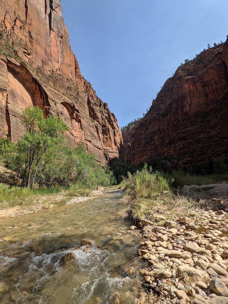
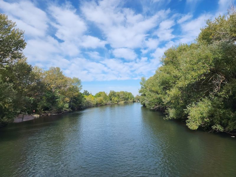
Red walls so tall they block out half the sky. That’s your welcome sign on the Zion Riverside Walk, a paved one-mile trail that runs alongside the Virgin River at the bottom of Zion Canyon.
The walk is genuinely flat and fully paved, making it one of the most accessible trails in any national park. Strollers, wheelchairs, and sandal-wearers are all welcome here.
I once spotted a family of deer just casually grazing next to the path like they owned the place.
The canyon walls tower over 2,000 feet above you. Every few steps, the light shifts and the red rock glows a different shade of orange or pink.
Bring water, wear sunscreen, and go early in the morning before the crowds arrive. The trail ends where the pavement does, but the views start the moment you step out of the shuttle.
San Antonio River Walk, Texas
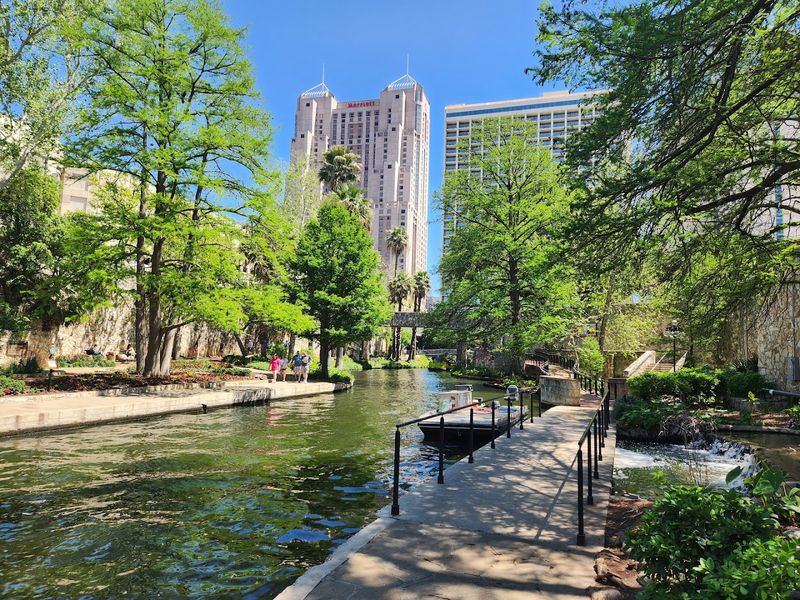
Nobody does a river walk quite like San Antonio. Built below street level, this 15-mile network of paths winds through the heart of the city along the San Antonio River, surrounded by cypress trees, stone bridges, and outdoor restaurants at every turn.
The River Walk has been around since the 1940s, but it keeps reinventing itself. New sections now stretch from the historic downtown area all the way to the famous missions.
You can walk for hours and never run out of things to see.
Grab a churro from a vendor, watch a riverboat float by, and then wander past a mural you didn’t know existed. The whole place feels like a secret garden tucked underneath a busy city.
Evening is the best time to visit when the string lights come on and everything gets a little magical. Comfortable shoes are a must.
Chicago Riverwalk, Illinois
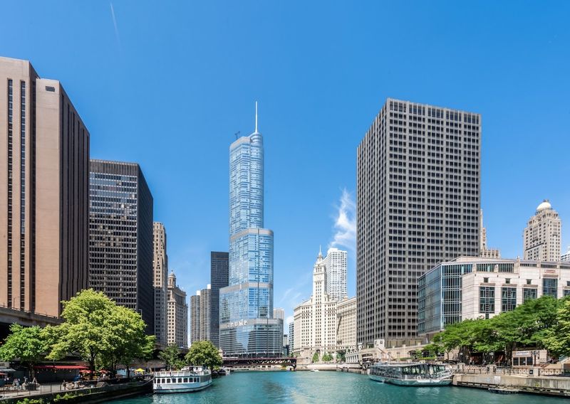
Skyscrapers reflected in green water, kayakers dodging tour boats, and the smell of deep-dish pizza drifting down from the street above. That’s the Chicago Riverwalk on a good Tuesday.
This 1.25-mile stretch along the main branch of the Chicago River is flat, wide, and packed with personality. The architecture alone is worth the trip.
Chicago’s skyline from river level is a completely different experience than looking at it from a rooftop.
The Riverwalk has designated zones for dining, recreation, and relaxation. There’s even a small urban garden and a water feature for kids.
I walked the whole thing in under an hour, but I stopped so many times for photos that it took three. Go on a weekday to avoid the biggest crowds.
The western end near Lake Street is especially photogenic in the morning light when the city is just waking up.
Boise River Greenbelt, Idaho
Boise doesn’t get nearly enough credit as an outdoor city, and the Greenbelt is the proof. This 25-mile paved path follows the Boise River through parks, nature reserves, and neighborhoods, all with the Rocky Mountain foothills as a backdrop.
The trail is flat and well-maintained, making it perfect for walking, jogging, or cycling. You’ll pass through Julia Davis Park, Ann Morrison Park, and several wildlife areas where herons and ospreys are basically permanent residents.
I once counted four great blue herons in a single mile.
The cottonwood trees along the river are spectacular in autumn when they turn bright gold. Summer brings tubers floating lazily down the river while walkers wave from the bank.
There are plenty of entry points throughout the city, so you can hop on and off easily. Grab a coffee from a nearby cafe and make a whole morning of it.
Tennessee Riverwalk, Chattanooga, Tennessee
Chattanooga quietly became one of America’s best outdoor cities, and the Tennessee Riverwalk is a big reason why. This 13-mile trail hugs the banks of the Tennessee River through downtown and beyond, offering stunning views of the river, bridges, and surrounding ridgelines.
The path is paved and mostly flat, with a few gentle slopes near the older sections. You’ll pass the famous Walnut Street Bridge, one of the longest pedestrian bridges in the world, which is absolutely worth crossing for the view from the middle.
Wildlife shows up regularly along this stretch. Ducks, turtles, and the occasional bald eagle have all been spotted here.
The trail connects to several parks and the Tennessee Aquarium, so it’s easy to turn a walk into a full day out. Early mornings are peaceful and quiet.
Weekend afternoons bring out families, cyclists, and food truck enthusiasts in equal numbers.
Detroit RiverWalk, Michigan
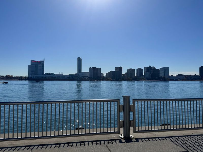
You can literally wave at Canada from this trail. The Detroit RiverWalk runs 5.5 miles along the Detroit River waterfront, and Windsor, Ontario sits right across the water the whole time you walk.
This is one of the most underrated urban waterfront trails in the country. The path is wide, smooth, and beautifully landscaped with pavilions, gardens, and public art installations at regular intervals.
The views of the river, the Ambassador Bridge, and the Canadian shoreline are genuinely dramatic.
The RiverWalk connects several riverfront parks and passes by historic buildings that tell the story of Detroit’s industrial past. Rivard Plaza and Milliken State Park are great stopping points along the way.
Detroit has poured serious effort into this waterfront, and it shows. Go on a summer evening when the river catches the sunset light and the whole city glows.
It’s a side of Detroit most visitors never expect to find.
Ohio River Greenway, Indiana
The Ohio River is one of America’s great waterways, and the Indiana side gives you a front-row seat. The Ohio River Greenway runs along the northern bank of the river near New Albany and Jeffersonville, offering wide-open river views and a genuine sense of scale.
The trail is paved, flat, and easy to walk in any season. On clear days, the Kentucky hills roll gently across the water like a postcard that nobody sent you.
The Big Four Bridge connects the trail to Louisville, Kentucky, making a cross-state river crossing entirely possible on foot.
This is a trail that rewards slow walkers. Sit on one of the benches along the bank and watch barge traffic move upstream.
The industrial river history here is fascinating. Locals use this trail daily for exercise, but visitors often have long stretches entirely to themselves.
Parking is easy and free at multiple access points along the route.
Schuylkill River Trail Boardwalk, Philadelphia, Pennsylvania
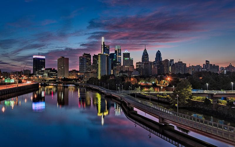
Philadelphia’s rowing culture is legendary, and the best place to watch it unfold is from the Schuylkill River Trail Boardwalk. This elevated wooden walkway extends over the river near Boathouse Row, putting you right above the water with a skyline view that belongs on a postcard.
The boardwalk section is short but spectacular. It connects to a longer trail that stretches for miles in both directions along the Schuylkill River.
Early mornings are particularly special when sculls glide silently across the flat water and the city skyline reflects below them.
The full trail runs from Philadelphia all the way to Valley Forge, but even a short walk near the Art Museum area delivers serious scenery. The famous Rocky steps are just a short detour away if you feel like recreating that iconic movie moment.
Bring a camera, comfortable shoes, and maybe a soft pretzel from a nearby vendor.
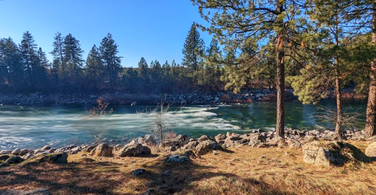
Spokane River Centennial Trail, Washington
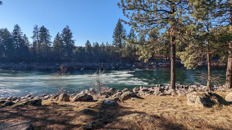
The Spokane River does not do calm. It charges through downtown Spokane over basalt rocks and small falls, and the Centennial Trail runs right alongside it for 37 miles from the Idaho border to Nine Mile Falls.
The stretch through Riverfront Park in downtown Spokane is the most dramatic section. The river roars through rocky channels while the trail passes gardens, bridges, and public art.
The falls in the middle of the city are completely unexpected and genuinely impressive.
This trail is flat and paved through most of the urban sections, making it easy for all fitness levels. The park setting means restrooms, water fountains, and places to sit are never far away.
Fall is a stunning time to visit when the trees along the bank turn gold and orange. The trail also passes the site of the 1974 World’s Fair, which gives the whole area an interesting layer of history most visitors don’t know about.
Anacostia Riverwalk Trail, Washington, D.C.
Most visitors to D.C. spend their time on the National Mall and never discover the Anacostia Riverwalk Trail, which means they’re missing out on 20 miles of waterfront path that’s far less crowded than anything near the monuments.
The trail runs along both sides of the Anacostia River through Southeast D.C. and into Prince George’s County, Maryland. It passes through historic Anacostia, the Navy Yard neighborhood, and several parks that rarely appear in travel guides.
The river views are wide and peaceful.
The path has improved dramatically over the past decade. New boardwalk sections, better lighting, and increased amenities have transformed it into a genuine destination.
The Yards Park section near the Navy Yard Metro is especially well-developed with waterfront seating and weekend events. This trail tells a different story about Washington than the typical tourist route, and that story is well worth hearing.
Arkansas River Trail, Little Rock, Arkansas
Little Rock punches well above its weight when it comes to outdoor infrastructure, and the Arkansas River Trail is the headline act. This 15-mile loop crosses the river twice using two different bridges, meaning you get both banks and two completely different perspectives on the same body of water.
The Big Dam Bridge is the longest pedestrian and cycling bridge in North America built specifically for that purpose. Walking across it gives you sweeping views of the river and the surrounding hills that feel almost too grand for a Tuesday morning stroll.
The trail is paved and flat throughout, passing through parks, wetland areas, and both downtowns of Little Rock and North Little Rock. Wildlife is a regular feature here.
Pelicans, herons, and eagles all use the river corridor regularly. The trail connects to the Clinton Presidential Library, which makes for a genuinely interesting detour.
Pack snacks and plan for at least a few hours.
Ohio & Erie Canal Towpath Trail, Cuyahoga Valley, Ohio
History nerds and nature lovers found their shared happy place, and it’s called the Towpath Trail. Running 101 miles through Cuyahoga Valley National Park and beyond, this trail follows the route of the original Ohio and Erie Canal, which was completed in 1832 and once connected Cleveland to the Ohio River.
The surface is crushed limestone and hard-packed gravel, making it easy to walk at any pace. The canal still holds water in many sections, and the reflections of the trees on still mornings are remarkable.
Lock 29 and Lock 38 are fascinating stops where you can see the original stone structures up close.
The national park section between Peninsula and Akron is the most scenic stretch. You might spot a great blue heron standing motionless in the canal, which is somehow both majestic and deeply relatable.
The Cuyahoga Valley Scenic Railroad runs parallel to part of the trail, so you can even take a train one way and walk back.
Manhattan Waterfront Greenway, New York, New York
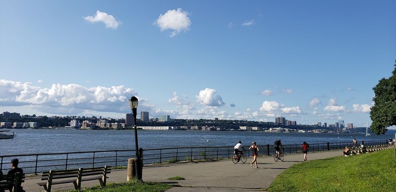
Walking the perimeter of Manhattan sounds like a workout, but the Hudson River section of the Manhattan Waterfront Greenway is so flat and scenic that it barely feels like exercise. The path runs for miles along the western edge of the island with the Hudson River on one side and the city on the other.
The views of the New Jersey Palisades across the water are surprisingly dramatic. The George Washington Bridge looms into view from the north, and the Statue of Liberty appears in the south.
Few cities in the world offer a waterfront walk with this much going on.
Hudson River Park stretches along much of this route, with piers converted into sports facilities, gardens, and dog runs. The section near the High Line and Chelsea Piers is especially lively.
Go on a weekend morning and you’ll share the path with serious cyclists, casual strollers, tourists, and locals walking dogs of every possible size.
South Waterfront Greenway, Portland, Oregon
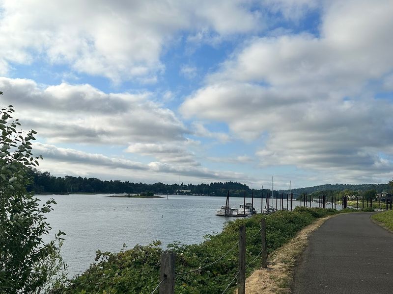
On a clear day in Portland, you can see Mount Hood from the South Waterfront Greenway, which means the backdrop for your casual stroll includes a 11,249-foot volcano. Not bad for a flat paved path.
This trail runs along the west bank of the Willamette River through the South Waterfront neighborhood, one of Portland’s newer and more architecturally interesting districts. The path is smooth, wide, and connects to the Steel Bridge and the Eastbank Esplanade, making longer loops possible.
The aerial tram connects the waterfront to Oregon Health and Science University on the hill above, and watching it glide overhead is oddly entertaining. The greenway is quiet on weekday mornings but gets lively on weekends with runners, cyclists, and families.
Portland’s food cart culture means great snacks are never far away. This trail feels local and unhurried, which is exactly what a river walk should feel like.


