America’s wilderness offers some of the most breathtaking hiking experiences on the planet. From towering granite peaks in the Sierra Nevada to misty waterfalls in Yosemite and rugged coastal trails in Maine, these paths showcase the country’s incredible natural diversity.
Whether you’re an experienced backpacker or just starting your outdoor adventures, these 15 trails promise unforgettable views, thrilling challenges, and memories that will last a lifetime.
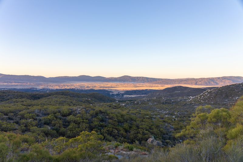
Half Dome — Yosemite National Park, California
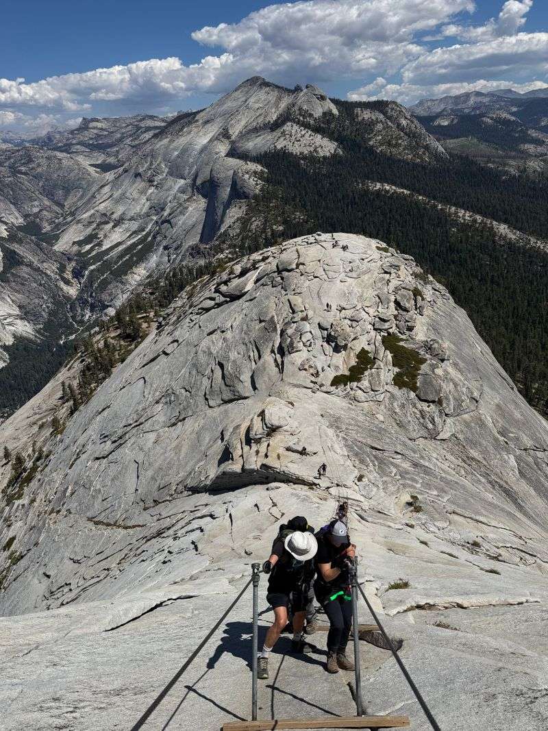
Standing at the base of Half Dome’s famous cables, you’ll feel your heart race with anticipation. This isn’t just any hike—it’s a full-body challenge that tests your endurance, courage, and determination as you pull yourself up the steep granite face using metal cables bolted into the rock.
The 14 to 16-mile round trip journey starts in Yosemite Valley and climbs through forests, past waterfalls, and up the Sub Dome before reaching the iconic cable section. Most hikers start before dawn to avoid afternoon thunderstorms and secure their spot on the cables, which can get crowded during peak season.
You’ll need a permit for the cable portion, which are distributed through a lottery system.
At the summit, 8,842 feet above sea level, the views are absolutely mind-blowing. You can see Yosemite Valley stretched out below, Vernal and Nevada Falls cascading down granite walls, and endless peaks marching toward the horizon.
The flat summit offers plenty of space to rest, eat lunch, and soak in the accomplishment.
Preparation is crucial for this adventure. Bring plenty of water, snacks, gloves for gripping the cables, and sturdy hiking boots.
Check weather conditions before you go, as the cables become extremely dangerous when wet.
Angels Landing — Zion National Park, Utah
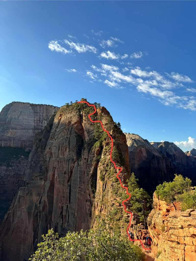
Gripping the chain anchored into the rock, you’ll inch along a narrow spine of sandstone with 1,000-foot drops on both sides. Angels Landing earned its heavenly name because early settlers believed only angels could reach the summit—and once you’re on that final ridge, you’ll understand why.
The five-mile round trip hike begins at the Grotto Trailhead and climbs through Walter’s Wiggles, a series of 21 tight switchbacks carved into the cliff face. After reaching Scout Lookout, the trail transforms into an adrenaline-pumping scramble along a knife-edge ridge.
The chains provide handholds, but you’ll need steady nerves and good balance.
From the summit, Zion Canyon spreads out in all its glory. The Virgin River snakes through the valley floor 1,488 feet below, while massive sandstone walls glow in shades of cream, pink, and crimson.
It’s one of those views that makes you forget how scared you were moments earlier.
Due to popularity and safety concerns, Zion now requires permits for Angels Landing, issued through a seasonal lottery and day-before lottery. Come prepared with appropriate footwear, avoid the trail in wet or icy conditions, and don’t attempt it if you have a fear of heights.
Appalachian Trail (Select Sections)
Imagine walking in the footsteps of thousands of adventurers who’ve tackled America’s most legendary long-distance trail. The Appalachian Trail stretches from Springer Mountain in Georgia all the way to Mount Katahdin in Maine, passing through 14 states and offering endless opportunities for both day hikes and extended backpacking trips.
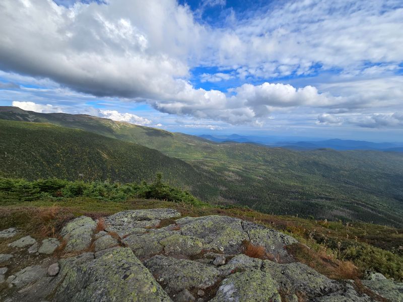
You don’t need to quit your job and hike for five months to experience the AT’s magic. Popular sections like Virginia’s McAfee Knob provide stunning views after just a few hours of hiking, while New Hampshire’s Presidential Range offers alpine challenges and weather that can rival mountain ranges out West.
The Smoky Mountains section showcases misty ridgelines and diverse wildlife, and the rocky terrain of Pennsylvania tests your ankle strength.
What makes the AT special isn’t just the scenery—it’s the culture. Trail shelters bring hikers together each evening, creating impromptu communities where stories and trail snacks are shared freely.
White blazes painted on trees guide your way, and trail towns offer warm meals and resupply opportunities.
Spring through fall offers the best hiking conditions, though each season brings its own character. Wildflowers bloom in April and May, summer brings lush green canopies, and autumn transforms the trail into a corridor of blazing color.
Pacific Crest Trail (Sections) — West Coast USA
Stretching from the Mexican border to Canada, the Pacific Crest Trail represents the ultimate West Coast wilderness experience. This 2,650-mile ribbon of trail traverses desert valleys, volcanic peaks, alpine meadows, and ancient forests, showcasing the incredible diversity of California, Oregon, and Washington.
Section hiking the PCT allows you to sample its greatest hits without committing to a five-month thru-hike. The Sierra Nevada sections through Yosemite and Kings Canyon deliver jaw-dropping granite scenery and crystal-clear alpine lakes.
Oregon’s Cascade sections wind through volcanic landscapes past Mount Hood and Crater Lake. Washington’s North Cascades offer rugged mountain terrain with glaciers, jagged peaks, and abundant wildlife.
Each region presents unique challenges and rewards. Southern California’s desert sections test your water-carrying abilities and heat tolerance, while the High Sierra demands snow navigation skills early in the season.
The northern sections bring lush forests, frequent rain, and the satisfaction of approaching the Canadian border.
Planning a PCT section hike requires careful consideration of permits, water sources, resupply points, and seasonal conditions. Snow lingers in the Sierra well into July, while Washington’s passes can be snowy through June.
Most section hikers target late July through September for optimal conditions and accessible high-elevation terrain.
John Muir Trail — Sierra Nevada, California
Named after America’s most famous naturalist, the John Muir Trail lives up to its legendary reputation with every single mile. This 211-mile route through the Sierra Nevada connects Yosemite Valley to Mount Whitney, passing through some of the most spectacular high-country terrain in the United States.
The JMT crosses eleven mountain passes, all above 10,000 feet, and travels through three national parks: Yosemite, Kings Canyon, and Sequoia. You’ll hike past hundreds of alpine lakes, each more beautiful than the last, with water so clear you can see trout swimming twenty feet below the surface.
Granite domes and spires surround you constantly, their surfaces polished by ancient glaciers.
Most hikers complete the JMT in about three weeks, though faster backpackers can finish in two weeks and leisurely hikers might take a month. The trail’s high elevation means you’ll need time to acclimatize, and the physical demands of carrying a heavy pack over mountain passes shouldn’t be underestimated.
Resupply options include mailing food packages to remote ranger stations or the Muir Trail Ranch.
Permits are notoriously difficult to obtain, requiring advance planning and often some lottery luck. The hiking season runs from July through September, with August offering the most stable weather and warmest temperatures for high-elevation camping.
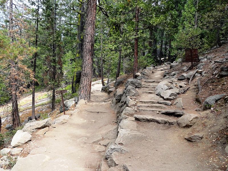
Mist Trail — Yosemite National Park, California
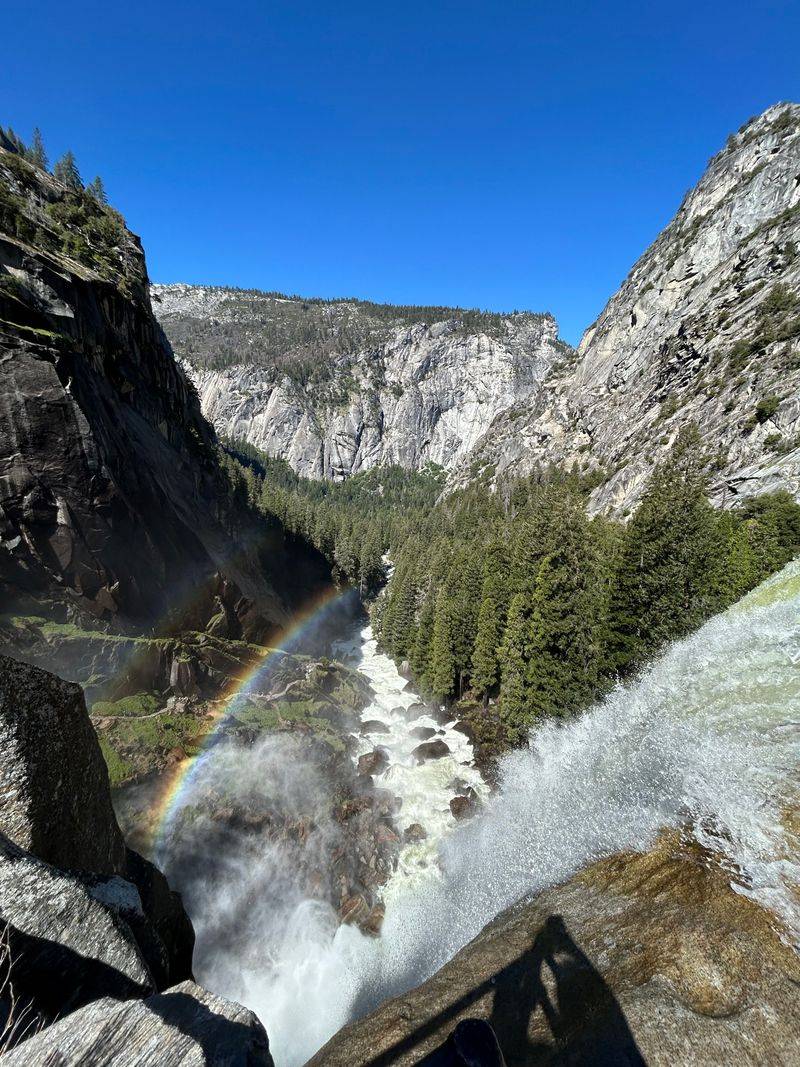
Water thunders down the granite cliff face, sending up clouds of mist that soak hikers climbing the stone steps. The Mist Trail delivers exactly what its name promises—a refreshing, wet, and absolutely spectacular journey past two of Yosemite’s most impressive waterfalls.
Starting from Happy Isles in Yosemite Valley, the trail climbs alongside the Merced River toward Vernal Fall. As you approach, the mist intensifies until you’re essentially walking through a rain shower created by thousands of gallons of water plummeting 317 feet.
Granite steps cut directly into the cliff take you right next to the waterfall’s edge, where the roar is deafening and rainbows dance in the spray.
Many hikers turn around at Vernal Fall, but continuing to Nevada Fall adds another stunning waterfall and expands the round trip to about seven miles. The trail beyond Vernal becomes less crowded, and the views looking back down the canyon are phenomenal.
Nevada Fall drops 594 feet, and the trail brings you to both the top and bottom viewpoints.
Spring and early summer bring peak water flow, making the waterfalls most dramatic but also making the trail extremely slippery. The steps can be treacherous when wet, so wear shoes with good traction and take your time.
Bring rain gear if you want to stay dry, though many hikers embrace the mist as part of the experience.
Highline Trail — Glacier National Park, Montana
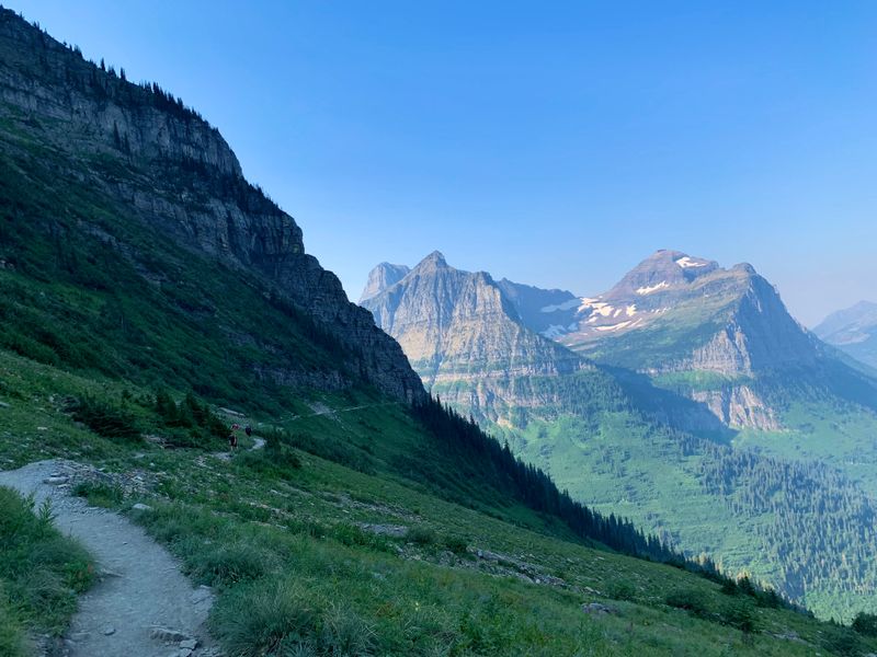
Carved into the side of the Continental Divide, the Highline Trail clings to cliffs and traverses open mountainsides where bighorn sheep graze and mountain goats scramble across impossible terrain. Starting from Logan Pass, one of the most scenic spots along Going-to-the-Sun Road, this trail immediately delivers the alpine grandeur that makes Glacier National Park legendary.
The first section hugs a cliff face where a cable handrail provides reassurance as you look down into the valley far below. Once past this brief exposed section, the trail opens onto flower-filled meadows with views that seem to stretch forever.
The Continental Divide rises on your right while valleys drop away on your left, creating a sense of walking along the rooftop of the Rockies.
Wildlife encounters are common on the Highline. You’ll likely spot ground squirrels, hoary marmots, and if you’re lucky, mountain goats posing on rocky outcrops.
Bears also frequent the area, so carrying bear spray and making noise on blind corners is essential. The trail can be hiked as an out-and-back or continued all the way to Granite Park Chalet for a longer adventure.
July through September offers the best conditions, with wildflowers peaking in mid-July. Snow lingers well into summer at this elevation, and afternoon thunderstorms are common, so start early and bring layers for changing weather conditions.
Delicate Arch Trail — Arches National Park, Utah
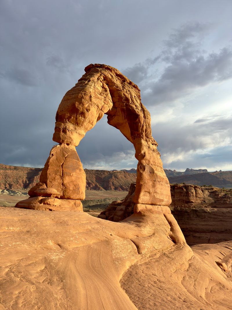
Utah’s most famous arch stands alone on a sandstone bowl, framing distant mountains like nature’s own picture window. Getting there requires hiking across slickrock under the desert sun, but watching that arch glow golden-red at sunset makes every step worthwhile.
The three-mile round trip trail starts at Wolfe Ranch and immediately begins climbing across bare sandstone. There’s minimal shade, so the exposed rock absorbs and radiates heat during summer months.
Cairns mark the route across the slickrock sections, and the trail includes some steep portions that require careful footing. As you round the final bend, Delicate Arch suddenly appears, and it’s always more impressive in person than in photographs.
The arch stands 46 feet tall and 32 feet wide, impossibly balanced on the edge of a sandstone bowl. Most hikers time their visit for sunrise or sunset when the arch glows in warm light and temperatures are cooler.
The area around the arch provides plenty of space to sit, though it gets crowded during peak season. Some visitors walk right up to the arch, while others prefer photographing it from the bowl’s edge.
Bring plenty of water—at least one liter per person—and sun protection including a hat and sunscreen. The trail offers no shade or water sources, and summer temperatures regularly exceed 100 degrees Fahrenheit.
Spring and fall provide the most comfortable hiking conditions.
Navajo Loop & Queens Garden — Bryce Canyon, Utah
Descending into Bryce Canyon’s amphitheater feels like entering another world where gravity forgot the rules and rock formations defy logic. The combined Navajo Loop and Queens Garden Trail creates a three-mile loop through forests of stone spires called hoodoos, each one carved by erosion into fantastical shapes.
Starting from Sunset Point, the Navajo Loop plunges into the canyon through a narrow slot called Wall Street, where towering hoodoos lean in from both sides and Douglas firs grow impossibly tall from the canyon floor. The trail switchbacks steeply downward, losing 550 feet of elevation as you enter the heart of the amphitheater.
Everywhere you look, orange, pink, and cream-colored spires rise like a petrified forest.
The Queens Garden section offers a gentler return route, winding through more open terrain where hoodoos stand individually or in clusters. One formation supposedly resembles Queen Victoria sitting on a throne—use your imagination.
The changing angles of sunlight create constantly shifting shadows and colors, making the landscape feel alive and dynamic.
Early morning or late afternoon provides the best light for photography and cooler temperatures for hiking. The high elevation (around 8,000 feet) means the air stays relatively cool even in summer, though thunderstorms can develop quickly.
The steep sections require good knees and sturdy footwear, especially when descending.
Emerald Lake Trail — Rocky Mountain National Park, Colorado
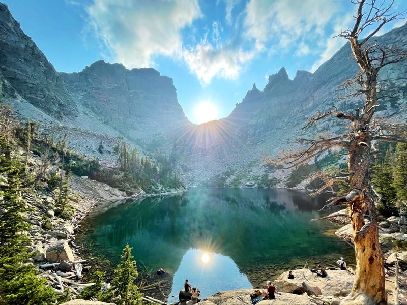
Three jewel-like lakes nestle in a glacially carved valley, each reflecting the surrounding peaks in water so clear you can count rocks on the bottom. The Emerald Lake Trail connects Nymph, Dream, and Emerald Lakes in a chain of ascending beauty that showcases Rocky Mountain National Park’s alpine splendor.
Beginning at Bear Lake, one of the park’s most popular trailheads, the relatively gentle trail climbs through subalpine forest and crosses streams fed by snowmelt. Nymph Lake appears first, surrounded by lily pads and offering views up the valley.
Dream Lake comes next, larger and more dramatic, with Hallett Peak rising directly above its far shore. The trail’s final push leads to Emerald Lake, the largest and most spectacular of the three.
Wildflowers explode across the meadows in July, painting the landscape in purples, yellows, and reds. Pikas chirp warnings from rockpiles, and you might spot marmots sunbathing on boulders.
The surrounding peaks—Hallett Peak, Flattop Mountain, and others—create an amphitheater of granite that holds snow well into summer.
The 3.6-mile round trip gains about 650 feet of elevation, making it accessible to most hikers while still providing an authentic alpine experience. Arrive early to secure parking at Bear Lake, as the lot fills by 7 AM during summer.
Afternoon thunderstorms are common, so plan to finish your hike by early afternoon.
Cascade Canyon Trail — Grand Teton National Park, Wyoming
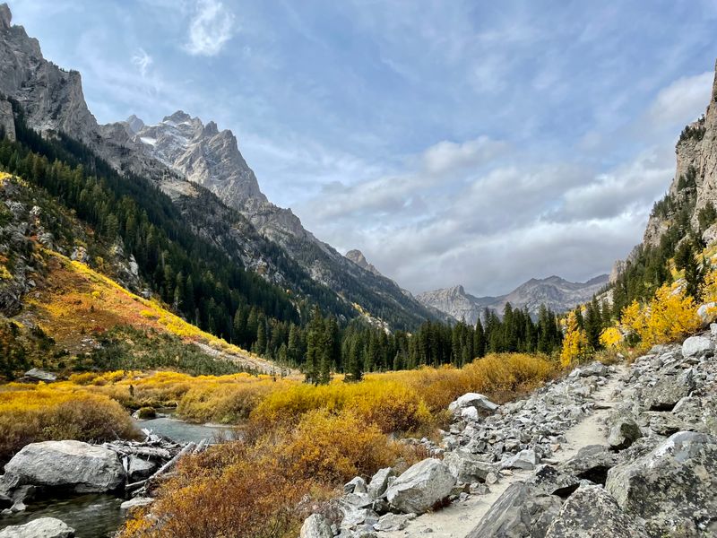
Walking into Cascade Canyon feels like entering a cathedral built by tectonic forces, with the Grand Tetons rising like spires on both sides. This trail penetrates deep into the heart of the range, following a creek through a glacier-carved valley where every turn reveals new perspectives on these iconic peaks.
Most hikers start by taking a boat shuttle across Jenny Lake, immediately saving two miles of hiking around the lake’s shore. From the boat dock, a short climb leads to Hidden Falls, where Cascade Creek tumbles over rocks in a series of cascades.
Beyond the falls, the trail enters Cascade Canyon proper, and the real magic begins.
The valley floor provides relatively gentle hiking as you penetrate deeper into the mountains. Moose browse in willow thickets along the creek, and black bears sometimes forage in meadows—keep your eyes open and your bear spray accessible.
The canyon walls rise thousands of feet on both sides, with the Cathedral Group peaks dominating the southern skyline. You can hike as far as you like, with the option to continue all the way to Lake Solitude for a longer adventure.
Summer brings wildflowers and comfortable temperatures, though afternoon thunderstorms can develop rapidly in the mountains. The boat shuttle operates from late May through September, making the trail accessible without the long lake approach.
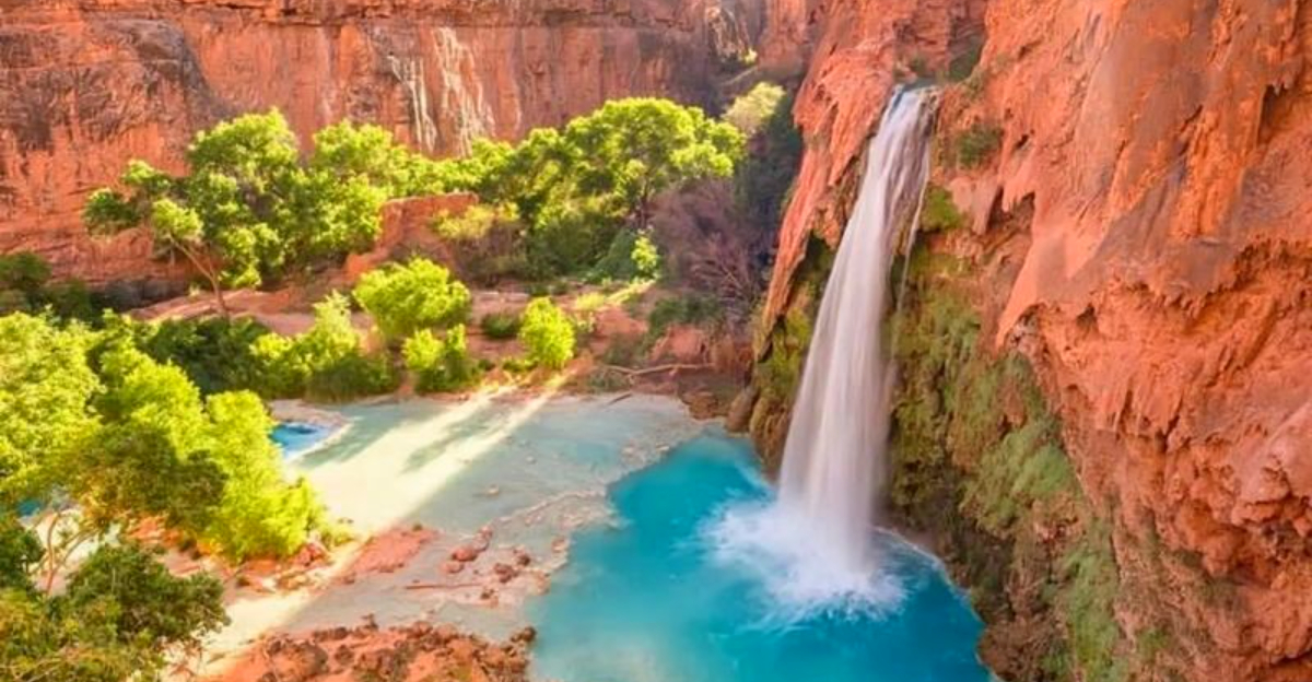
Havasu Falls Trail — Havasupai, Arizona
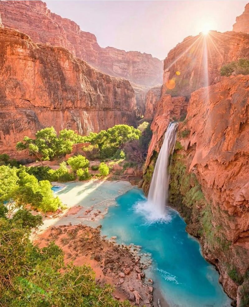
Turquoise water tumbles over red canyon walls into pools so blue they don’t look real—yet this desert oasis exists deep within the Grand Canyon on the Havasupai Indian Reservation. Reaching these stunning waterfalls requires advance planning, physical effort, and respect for the tribal lands you’re visiting, but the reward is one of the most photogenic and unique hiking destinations in America.
The ten-mile hike from Hualapai Hilltop to Supai village descends through desert terrain before reaching the creek that creates this paradise. From the village, it’s another two miles to the first major waterfall, Havasu Falls, which drops 100 feet into a large pool perfect for swimming.
The trail continues to Mooney Falls, even taller at 200 feet, which requires descending chains and tunnels to reach the base.
Reservations are extremely difficult to obtain and must be booked far in advance through the Havasupai Tribe’s reservation system. All visitors must pay fees and stay overnight—day hiking is not permitted.
Most people camp at the designated campground between Havasu and Mooney Falls, though limited lodge rooms are available in Supai village.
The best times to visit are spring and fall when temperatures are moderate. Summer brings extreme heat, and flash flood danger exists during monsoon season.
Pack out all trash and respect tribal regulations to help preserve this special place.
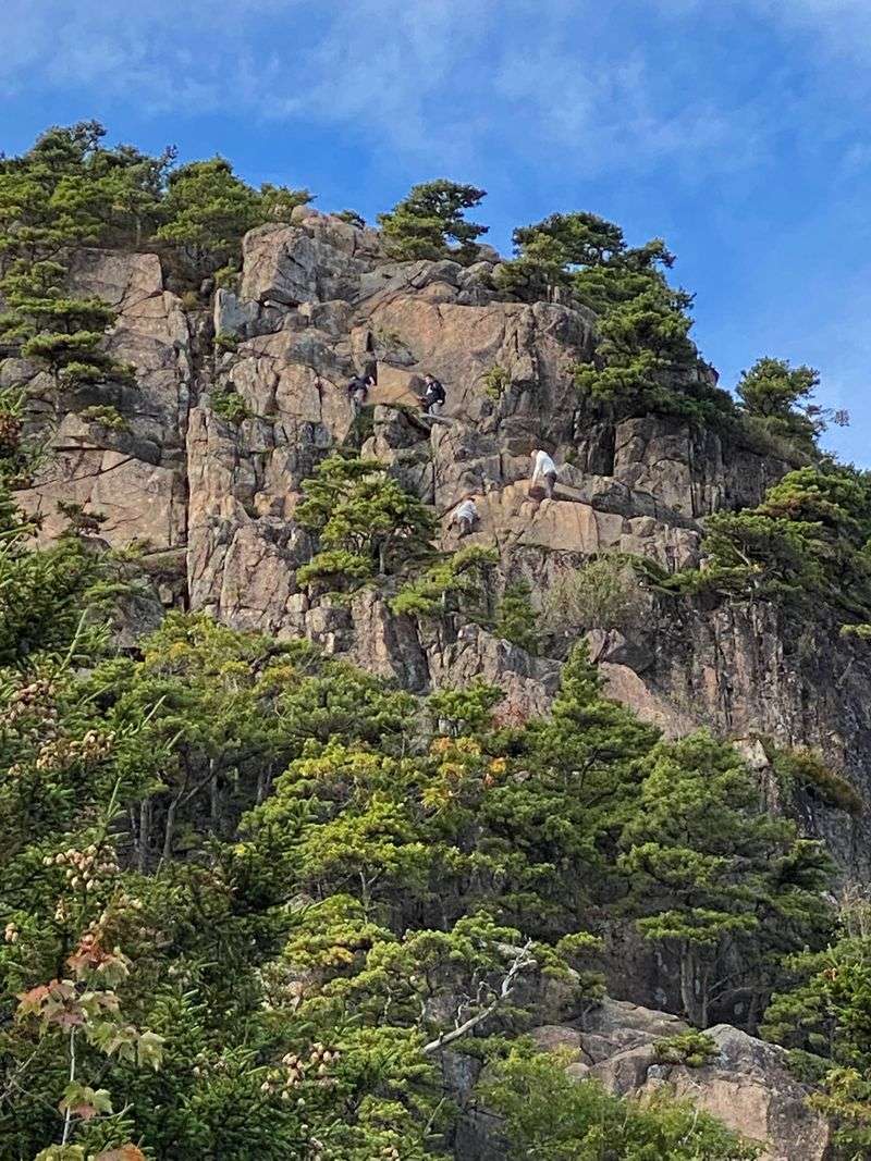
Old Rag Mountain — Shenandoah National Park, Virginia
Your hands grip granite as you pull yourself up through a narrow chimney between massive boulders. Old Rag Mountain offers the East Coast’s premier rock scrambling experience, combining technical climbing sections with panoramic Appalachian views that stretch across the Shenandoah Valley.
The nine-mile circuit hike begins innocuously enough, climbing through hardwood forest on a well-maintained trail. About three miles in, the real adventure starts as the trail transforms into a boulder scramble.
You’ll squeeze through rock crevices, climb up steep faces using hand and footholds, and navigate around house-sized boulders perched on the ridgeline. It’s challenging but not technical—no ropes or climbing gear needed, just confidence and good balance.
The summit rewards your efforts with 360-degree views of rolling forested mountains, the classic Appalachian landscape of peaks and valleys marching to the horizon. On clear days, you can see across multiple ridgelines.
The descent follows a different route, taking a longer but gentler fire road back to the trailhead, giving your scrambling muscles a break.
Fall brings spectacular foliage colors, making October weekends extremely crowded. Spring and early summer offer great hiking with fewer people.
The park recently implemented a fee and reservation system for Old Rag due to overcrowding, so plan ahead. Wear sturdy hiking boots with good ankle support and bring gloves to protect your hands during scrambles.
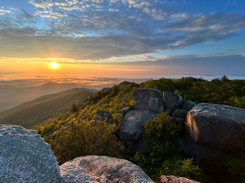
Beehive Loop — Acadia National Park, Maine
Clinging to iron rungs bolted into a near-vertical cliff face, you’re rewarded with ocean breezes and stunning views of Maine’s rugged coastline. The Beehive Loop in Acadia National Park packs serious thrills into a short but intense hike that’s become one of the park’s most popular adventures.
The trail starts innocently from the Park Loop Road, climbing gradually through forest before the character suddenly changes. Iron rungs, ladders, and narrow ledges appear as the trail ascends the exposed granite face of Beehive Mountain.
It’s steep, exposed, and definitely not for anyone afraid of heights, but the ocean views and sense of accomplishment are incredible. The summit, at just 520 feet, provides panoramic vistas of Sand Beach, the Atlantic Ocean, and surrounding mountains.
The loop descends via a gentler trail on the back side, making this a one-way thrill ride. Total distance is only about 1.4 miles, but the vertical gain and exposure make it feel much longer.
Most hikers complete the loop in about an hour, though you’ll want to linger at the top to soak in the coastal scenery.
Avoid this trail in wet conditions when the rock becomes slippery and dangerous. Strong winds can also make the exposed sections treacherous.
Summer brings the best weather, though crowds increase significantly. Early morning hikes offer cooler temperatures and fewer people on the rungs.
Hoh River Trail — Olympic National Park, Washington
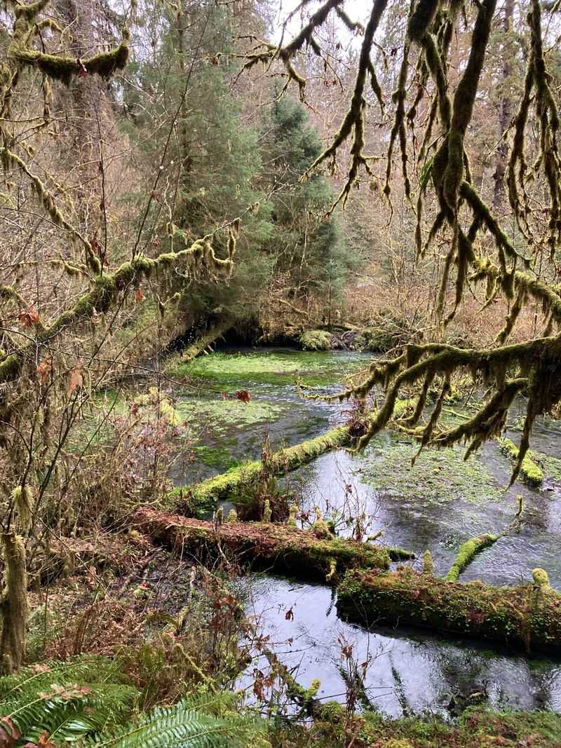
Moss drapes from every branch like nature’s own tapestry, and the air feels thick with moisture and life. The Hoh River Trail immerses you in one of America’s last temperate rainforests, a rare ecosystem where annual rainfall exceeds 140 inches and creates a jungle-like environment unlike anywhere else in the continental United States.
The trail follows the Hoh River into the heart of Olympic National Park, passing through groves of massive Sitka spruce and western hemlock trees, some reaching over 300 feet tall. Every surface—tree trunks, fallen logs, rocks—is covered in emerald moss and ferns.
The understory explodes with vegetation, creating multiple layers of green that filter the light into a soft glow. It feels primordial, like walking through a forest that time forgot.
You can hike as far as you like on this trail, with the first few miles offering the best rainforest immersion. Day hikers often turn around at Five Mile Island or Hall of Mosses spur trail, while backpackers continue deeper into the wilderness toward Blue Glacier on Mount Olympus.
Roosevelt elk frequently browse in riverside meadows, and the river’s turquoise water provides constant companionship.
The rainforest experience is best from late spring through early fall when trails are drier and river crossings are safer. Rain is likely any time of year, so bring waterproof gear and embrace the moisture—it’s what makes this ecosystem so magical.


