Rivers are the veins of our planet, carrying life, energy, and history across continents. Some rivers trickle quietly through meadows, but others move with a force so staggering they reshape entire landscapes.
The most powerful rivers on Earth are measured by their discharge, the sheer volume of water they push every single second. Get ready to meet the rivers that make the rest look like garden hoses.
Amazon River

No river on Earth even comes close to the Amazon. Flowing across South America and emptying into the Atlantic Ocean, it pumps out a jaw-dropping 209,000 cubic meters of water every single second.
That is more than the next seven most powerful rivers combined.
The Amazon basin stretches across Brazil, Peru, Colombia, and several other countries. It supports the largest tropical rainforest on the planet and an almost unbelievable variety of fish, birds, and wildlife.
I once read that the Amazon releases so much freshwater into the ocean that you can taste fresh water over 100 miles offshore.
During flood season, entire forests go underwater. Trees stand knee-deep in river water for months, and fish actually swim between the trunks eating fruit from branches.
The Amazon does not just flow through nature. It practically runs the whole show.
Congo River

Africa’s mightiest river does not mess around. The Congo River pushes about 41,400 cubic meters of water per second into the Atlantic Ocean, making it the second most powerful river on Earth and the undisputed king of African waterways.
What makes the Congo extra special is its depth. Parts of the river plunge over 220 meters deep, making it the deepest river ever recorded anywhere on the planet.
Its basin holds the Congo Rainforest, the second largest tropical rainforest after the Amazon.
Because the Congo straddles the equator, rain falls on different parts of its basin throughout the entire year. This means its flow stays strong no matter the season, unlike many rivers that peak and dip with weather changes.
The Congo is truly a river that never takes a day off.
Orinoco River

Third place on the world power rankings belongs to the Orinoco, a river that carries about 39,000 cubic meters of water per second through Venezuela and Colombia. That is enough water to fill over 15 Olympic swimming pools every single second.
The Orinoco is famous for its enormous floodplains, sprawling wetlands, and a delta so wide it fans out like a giant watery hand into the Atlantic. Its basin supports caimans, anacondas, capybaras, and hundreds of bird species that thrive in its wetlands and forests.
Here is a geographic fun fact that blew my mind: the Orinoco is actually connected to the Amazon basin through a natural waterway called the Casiquiare canal. Two of the world’s most powerful river systems, linked by nature itself.
South America really did go all out when it designed its plumbing.
Yangtze River

Asia’s most powerful river has been running China’s show for thousands of years. The Yangtze flows all the way from the Tibetan Plateau to the East China Sea, covering over 6,300 kilometers and carrying about 31,900 cubic meters of water per second on average.
The river has fed Chinese civilization since ancient times, supporting farming, trade, and culture along its banks. Today, it connects some of China’s largest and most economically powerful cities, including Chongqing, Wuhan, and Shanghai.
Hundreds of millions of people depend on it daily.
The Yangtze is also home to the Three Gorges Dam, the largest hydroelectric power station ever built. The dam generates an enormous amount of electricity but also created one of the biggest reservoirs on Earth.
The Yangtze is not just a river. It is a national powerhouse in every sense of the word.
Rio Negro

The Rio Negro earns its name honestly. Its water runs so dark it looks like strong black tea, stained by dissolved organic material from millions of acres of rainforest and wetlands.
This inky river is actually one of the most powerful on Earth, pushing about 30,641 cubic meters of water per second into the Amazon.
It flows through Colombia, Venezuela, and deep into Brazil before meeting the Amazon near Manaus. At that meeting point, something extraordinary happens.
The dark Rio Negro and the lighter-colored Solimoes River run side by side for several kilometers without mixing, like two rivers sharing a lane on a highway.
That phenomenon, called the Meeting of Waters, is one of the most photographed natural sights in all of South America. The Rio Negro is also a biodiversity hotspot, supporting hundreds of fish species and flooded forest ecosystems found nowhere else on Earth.
Madeira River

The Madeira River might not be a household name, but it is doing serious heavy lifting inside the Amazon system. Carrying about 30,173 cubic meters of water per second, it ranks as one of the most powerful rivers on Earth and the Amazon’s single largest tributary by volume.
It drains a massive chunk of the southwestern Amazon basin, pulling water down from the Andes mountains and across Bolivia and Brazil. Along the way, it picks up enormous amounts of sediment, which is why its water runs a muddy reddish-brown rather than the dark color of the Rio Negro.
The Madeira has historically been a crucial transportation route for remote communities in western Brazil and Bolivia. More recently, large hydroelectric dams have been built along its course.
Whether you are a fish, a farmer, or an engineer, the Madeira has something to offer.
Brahmaputra River

Few rivers on Earth have a biography as dramatic as the Brahmaputra. Born high in the Tibetan Himalayas, it carves through some of the world’s deepest gorges before bursting into the plains of India and Bangladesh, averaging about 22,182 cubic meters of water per second.
During monsoon season, this river transforms completely. It spreads across massive floodplains, swallowing farmland and entire villages in seasonal floods that are both destructive and strangely necessary.
Those floods deposit rich sediment that keeps the surrounding farmland among the most fertile on the planet.
The Brahmaputra also holds the title of one of the widest rivers in the world during peak flood season. In Assam, India, it can stretch over 10 kilometers across.
Locals who live beside it have a complicated relationship with this river. They fear it, depend on it, and deeply respect it all at once.
Mississippi River

Mark Twain wrote novels about it, blues musicians sang about it, and generations of American farmers built their lives beside it. The Mississippi River is North America’s heavyweight champion, discharging about 21,300 cubic meters of water per second into the Gulf of Mexico.
What gives the Mississippi its muscle is the enormous basin feeding it. Major rivers like the Missouri and Ohio pour into it, creating a drainage network that covers about 40 percent of the continental United States.
That is a lot of snowmelt and rainfall all funneling toward one exit.
The river has shaped American history in ways that go far beyond geography. It was a highway before highways existed, a border, a trade route, and a cultural symbol.
Its delta in Louisiana is one of the most ecologically rich and geographically unusual places in the entire country. The Mississippi runs deep in more ways than one.
Yenisei River

Siberia is not exactly famous for being warm and welcoming, but the Yenisei River makes up for the frost with sheer scale. Flowing north through Mongolia and Russia before emptying into the Arctic Ocean, it carries about 20,200 cubic meters of water per second and drains one of the largest river basins in Asia.
The Yenisei splits Siberia almost perfectly down the middle. West of it, the land is flat and swampy.
East of it, the terrain rises into highlands and mountains. The river acts like a natural boundary between two completely different Siberian worlds.
For much of the year, the Yenisei is locked under ice. When spring arrives, the thaw sends enormous pulses of water rushing north, sometimes causing dramatic ice jams and floods.
The river also powers several massive hydroelectric plants that supply electricity to a huge portion of Russia’s energy grid.
Paraná River

The Paraná River is South America’s second longest river and one of its most productive. Flowing through Brazil, Paraguay, and Argentina before joining the Rio de la Plata, it moves about 19,706 cubic meters of water per second and keeps entire national economies running.
Agriculture, shipping, fishing, and hydroelectric power all depend on the Paraná. The Itaipu Dam, built on the Paraná between Brazil and Paraguay, was once the largest hydroelectric power plant in the world by energy output.
That is a river earning its keep in a serious way.
Near Argentina, the river fans out into the Paraná Delta, a stunning labyrinth of islands, channels, and wetlands that stretches for kilometers. Locals navigate it by small boat the way others use roads.
The Paraná is not just a river flowing through South America. In many ways, it is the infrastructure that holds the region together.
Lena River

Russia has no shortage of enormous rivers, but the Lena stands out even among giants. Flowing north across Siberia into the Laptev Sea, it carries about 18,300 cubic meters of water per second and drains a territory larger than many entire countries.
The Lena delta is one of the largest river deltas in the world and one of the most pristine. Because it sits so far north and so far from major cities, it has remained largely untouched.
Millions of migratory birds stop here every year during their Arctic journeys.
Life along the Lena follows the rhythm of ice. The river freezes solid in winter, thick enough for trucks to drive on it.
In spring, massive ice floes break apart with a sound locals describe as thunderclaps echoing across the frozen landscape. The Lena is a reminder that nature still runs some places entirely on its own terms.
Japurá River

Not every powerful river gets the fame it deserves. The Japurá, known as the Caquetá in its upper reaches in Colombia, moves about 18,122 cubic meters of water per second through some of the most remote rainforest on Earth.
That puts it comfortably among the world’s most powerful rivers, even if most people have never heard of it.
The river flows through Colombia and into Brazil, where it pours into the Solimoes, the upper stretch of the Amazon system. Its contribution helps keep the Amazon’s legendary discharge numbers so astronomically high.
Because it runs through such isolated territory, the Japurá basin remains one of the least disturbed freshwater ecosystems anywhere on the planet. Indigenous communities along its banks have lived with and managed these waters for generations.
The Japurá may not have the global fame of its giant neighbor, but in the world of rivers, it is absolutely pulling its weight.
Marañón River

Before the Amazon becomes the Amazon, it has to start somewhere. The Marañón River is one of the main headwater rivers of the entire Amazon system, beginning high in the Peruvian Andes and charging through some of the deepest and most dramatic canyons in South America.
By the time it reaches the lowlands, the Marañón is already moving about 17,400 cubic meters of water per second. It carries mountain snowmelt, tropical rainfall, and a heavy load of sediment that eventually nourishes the Amazon floodplain thousands of kilometers downstream.
The upper Marañón cuts through gorges so steep and rugged that some sections were not fully explored until relatively recently. White-water rapids and sheer canyon walls make it one of the most visually dramatic rivers in the world.
Without the Marañón feeding into the system, the Amazon would be a noticeably less impressive river. Consider this its well-deserved moment of recognition.
Mekong River

Six countries share the Mekong River, and every single one of them depends on it heavily. Flowing from the Tibetan Plateau through China, Myanmar, Laos, Thailand, Cambodia, and Vietnam before reaching the South China Sea, the Mekong carries about 16,010 cubic meters of water per second.
The Mekong supports one of the world’s most productive inland fisheries. In Cambodia alone, the river and its connected lake, Tonle Sap, provide the majority of the protein eaten by the entire population.
That is not a small thing. That is a river feeding a nation.
Each year, the Mekong pulls off a remarkable trick. Seasonal floods actually reverse the flow of the Tonle Sap River, pushing water back into the lake and making it expand to several times its dry-season size.
The Mekong Delta in Vietnam is one of the most fertile rice-growing regions on Earth. This river feeds hundreds of millions of people every single day.
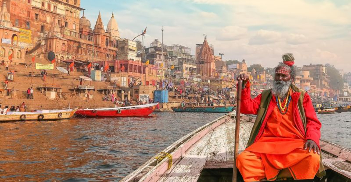
Ganges River

For over a billion people, the Ganges is not just a river. It is sacred ground in liquid form.
Flowing through northern India and Bangladesh into the Bay of Bengal, the Ganges carries about 15,646 cubic meters of water per second and supports one of the most densely populated river basins anywhere on Earth.
The Ganges feeds hundreds of millions of people through agriculture, provides drinking water for vast cities, and holds deep spiritual significance in Hinduism. Varanasi, one of the oldest continuously inhabited cities in the world, sits on its banks.
People have been coming to this river for thousands of years to pray, wash, and celebrate life’s biggest moments.
Its water comes from Himalayan glaciers, monsoon rains, and dozens of tributaries crossing the fertile Indo-Gangetic Plain. That plain is one of the most agriculturally productive regions on the planet.
The Ganges is powerful in ways that go far beyond cubic meters per second.


