New Mexico’s roads link high desert horizons with centuries of trading history, village plazas, and mountain passes. This guide highlights 15 drives where you can plan clear routes, find reliable stops, and see the state’s layered cultures.
You will get practical context for each byway, from road conditions to key pullouts and historic markers. Use it to map a focused day trip or build a longer circuit across the Land of Enchantment.
1. Turquoise Trail National Scenic Byway
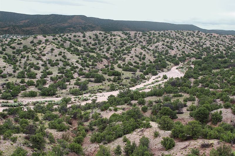
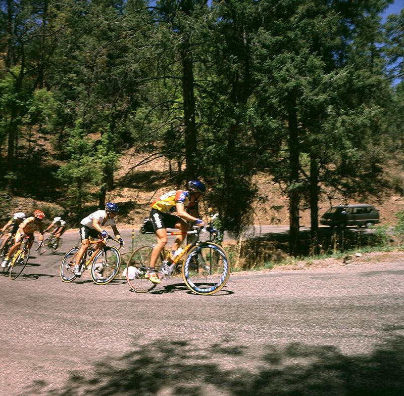
The Turquoise Trail connects Santa Fe and Albuquerque through rolling piñon hills and former mining towns. Madrid and Cerrillos feature galleries, low-slung false fronts, and weathered shafts that speak to boom-and-bust history.
Pullouts give big desert views, while side streets reveal cafes, folk art, and photo-worthy signage. Plan for slow speeds through town and limited shoulder parking near popular storefronts.
You can tour the Cerrillos Hills trails, browse artisan studios, and stop at the Mine Shaft Tavern for a classic roadhouse meal. Interpretive signs outline turquoise extraction and Spanish-era trade that flowed along these ridgelines.
Cell service is generally good near towns, but tap fuel in Tijeras or north of Golden to avoid gaps. Light is best mid-morning and late afternoon for warm color on adobe and rock.
Expect two-lane conditions, occasional cyclists, and cross-traffic. In winter, higher sections can see patchy ice, so check DOT updates.
Combine the drive with Sandia Crest via the scenic byway spur for cooler temperatures and long-range views. The route is short enough for a half day, yet packed with stops that link art, geology, and trade history.
2. El Camino Real National Scenic Byway
El Camino Real traces a trade route that predates the United States, paralleling the Rio Grande between Las Cruces and Española. You will pass cottonwoods, acequia-fed fields, and mission sites that marked supply lines for centuries.
Town plazas host modest museums where maps and artifacts place caravans and waystations in context. The terrain alternates between river valley green and open desert benchlands with wide horizons.
Start near Mesilla Plaza to ground the story in adobe architecture and continue through Socorro and Belen for quiet main streets and historic depots. Look for state historic markers that identify parajes camps and crossings.
Fuel and food are easy to find in larger towns, but stretches can feel remote between them. Plan water stops in warmer months and watch for agricultural traffic.
Traffic is mostly light on two-lane segments, with faster four-lane sections near cities. Morning drives reveal low-angle light on fields and church facades, while sunset brings alpenglow to distant ranges.
Museums in Las Cruces and Albuquerque deepen the historic thread with Spanish colonial and Indigenous perspectives. The byway rewards steady pacing and time to read the landscape’s layered timelines.
3. Abo Pass Trail Scenic Byway
Abo Pass leads into the Salinas Pueblo Missions region, where trade and faith intersected on arid mesas. The road threads low ridges and red sandstone outcrops toward the Abo ruins, with picnic areas and well-marked trails.
You will see mission walls standing against open sky, reminding travelers of exchange networks predating Spanish colonization. The drive feels remote, so fuel up in Mountainair and carry water.
Stop at the visitor center for maps and context on Pueblo and Spanish interactions. Trails are mostly level but can be hot midday, so start early.
Photography works well with side light to emphasize stone textures. Interpretive signs outline salt trade routes from nearby playas that supplied regional economies for centuries.
Road conditions are straightforward two-lane, with occasional livestock near fences. Expect limited cell service outside towns.
Combine Abo with the Quarai and Gran Quivira sites for a full loop of Salinas missions. This byway suits travelers interested in steady views, history-rich stops, and quiet walking paths where the desert’s soundscape carries.
4. High Road to Taos Scenic Byway
The High Road climbs from Santa Fe into the Sangre de Cristo foothills, connecting villages known for weaving, woodcarving, and historic churches. You will pass Chimayó’s Santuario, Truchas’s ridge-top views, and Las Trampas’s carved portals.
Expect curves, grade changes, and frequent reasons to pull over for galleries and photo stops. The route pairs cultural depth with alpine edges and open high desert light.
Shops often keep limited hours, so arrive mid-morning for the best chance to meet artisans. The road is paved but narrow in spots, with slow-moving local traffic.
Fall color brings aspen gold to the higher slopes, while spring showcases orchards and acequias. Pack snacks and water, then pause in Cordova or Ojo Sarco for quiet village scenes.
Taos-bound drivers can loop back via the faster Low Road along the Rio Grande. Winter weather can add snow and black ice near passes, so check forecasts.
Photography thrives at sunrise and late afternoon when adobe warms in the light. The High Road balances craft traditions with mountain scenery in a single, rewarding day.
5. Enchanted Circle Scenic Byway
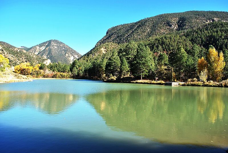
The Enchanted Circle forms an 85-mile loop around Wheeler Peak, linking Taos, Questa, Red River, and Eagle Nest. You will climb from high desert into cool forests, then descend into broad valleys with lakes and meadows.
Expect steady curves, passing lanes on grades, and regular pullouts for safe photo stops. In summer, traffic builds with anglers and hikers bound for alpine trailheads.
Red River’s main street offers food and fuel, while Eagle Nest Lake invites a shoreline pause. Questa anchors the north with access to the Rio Grande del Norte National Monument.
Afternoon storms are common, so keep a rain shell and watch for wet pavement. Fall colors sweep the aspen stands, rewarding patient drivers willing to time the loop.
Wildlife crossings increase at dawn and dusk, especially near forest edges. Tire pressure shifts with elevation, so monitor readings if you drive a packed vehicle.
The loop meshes mountain resort energy with quiet valleys and historic mining traces. It is a reliable introduction to northern New Mexico’s high country in a single day.
6. Jemez Mountain Trail National Scenic Byway
The Jemez Mountain Trail arcs from desert cliffs to cool forests, passing hot springs, historic sites, and volcanic landscapes. Start near San Ysidro’s red rocks, roll through Jemez Pueblo, and reach Jemez Springs for food, lodging, and walks.
Beyond, the road rises to Valles Caldera’s wide grasslands with elk viewing at dawn and dusk. Geologic layers are on display, from tuff walls to lava domes and river-carved canyons.
Pullouts mark trailheads for Soda Dam, Battleship Rock, and overlooks into the caldera. Parking fills on weekends, so arrive early for hikes and soaks.
Respect closures around cultural sites and watch speed limits through villages. Cell coverage varies, and snow can linger at high elevations into spring.
Photography benefits from angled light that brings out cliff color and meadow textures. Winter offers quiet roads but requires attention to packed snow and ice.
Combine the byway with Bandelier National Monument via adjacent routes for cliff dwellings and canyon walks. The Jemez drive rewards patient pacing and a mix of short hikes and roadside stops.
7. Geronimo Trail Scenic Byway
The Geronimo Trail spans quiet desert basins and low mountain passes near Truth or Consequences. Hillsboro’s main street offers Victorian-era facades and a simple cafe scene.
The route skirts Caballo Lake and Elephant Butte Reservoir, with marinas and shoreline overlooks. You will get long, uninterrupted stretches that make cruise control tempting but watch for wildlife and side winds.
Historic markers trace Apache homelands and cavalry routes, framing a frontier narrative. Services cluster in T or C, so plan fuel before you head west.
Temperatures swing widely, with hot afternoons and cool nights, especially in shoulder seasons. Dirt side roads tempt exploration, but check conditions and carry recovery gear if you leave pavement.
Traffic is light, and sunsets stretch across mountain silhouettes for vivid photography. Visit local museums for context on ranching, mining, and hydrotherapies linked to the hot springs.
Campgrounds near the lakes offer a base for a calm, two-day loop. The byway’s remote feel pairs well with careful planning and flexible timing.
8. Route 66 (New Mexico segment)
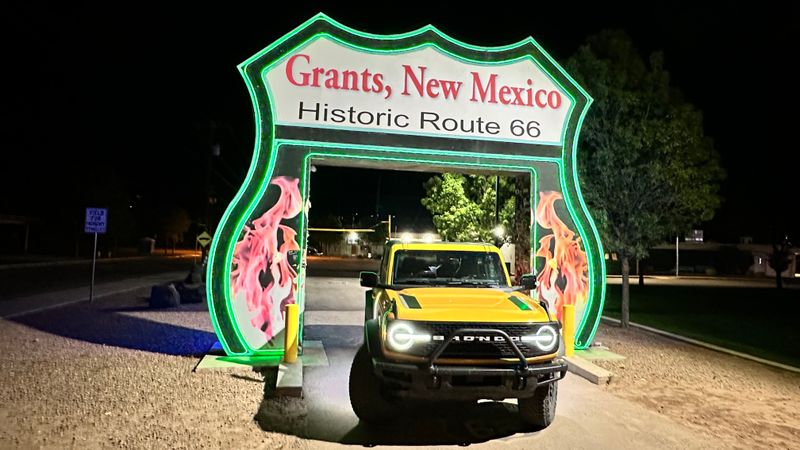
New Mexico’s Route 66 threads neon motel signs, mid-century diners, and main streets that grew beside the Mother Road. Start in Tucumcari for murals and restored neon, then continue to Santa Rosa’s car culture and Blue Hole detour.
Farther west, Gallup blends trading post heritage with railroad history and standout signage at dusk. You will find frequent photo ops, plus easy food and fuel access along frontage roads.
Historic segments alternate with I-40, so watch for clearly marked alignments to stay on the old road. Many towns maintain small museums and visitor centers with maps of bypassed loops.
Travel is straightforward, but traffic increases near interstate junctions. Aim for golden hour when neon comes alive and the sky still holds color.
Check business hours if you want interior photos or vintage lobby displays. Weeknights can be quieter for tripod work and street scenes.
The drive fits a day, yet you can stretch it with overnight stops in vintage motels. Route 66 delivers reliable nostalgia with real logistics baked in.
9. Trail of the Ancients Scenic Byway
The Trail of the Ancients highlights prehistoric sites and stark desert beauty across northwestern New Mexico. Chaco Culture anchors the route with planned great houses and roads that still align with the horizon.
Access includes paved stretches and graded dirt, so check conditions after rain. You will need extra water, a full tank, and time for slow travel to protect your suspension.
Stop at visitor centers for updated road advisories and cultural guidance. Respect site etiquette and remain on established paths to preserve fragile structures.
Photography benefits from side light that reveals masonry and stacked stone geometry. Night skies can be exceptional if you book a permitted stargazing program.
Services are limited, so carry snacks and plan for remote restrooms. Consider adding Aztec Ruins or Salmon Ruins for a broader regional picture.
Cell coverage is sparse, reinforcing the need for offline maps. The byway is best for travelers eager to read landscapes where engineering, ceremony, and trade converged.
10. Chain of Craters Back Country Byway
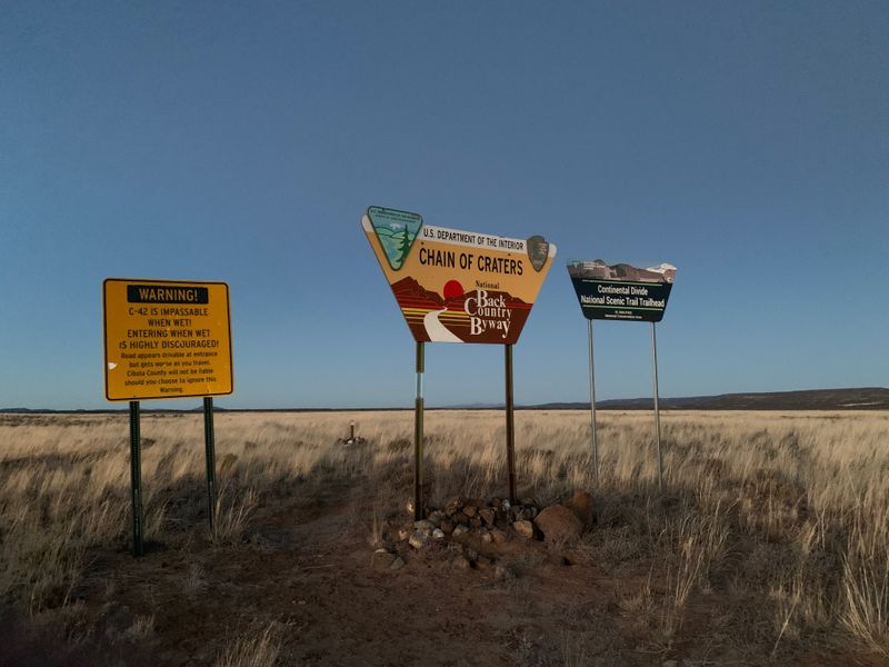
The Chain of Craters Back Country Byway crosses El Malpais’s lava fields and cinder cones on unpaved roads. Expect washboards, ruts, and sharp basalt edges that demand careful tire management.
The landscape is stark yet photogenic, with black rock ribbons cutting through tan grasslands. You will want high-clearance, a full-size spare, and plenty of water before committing.
Trailheads branch to lava tubes and sandstone bluffs, but access varies by season and weather. Check with the BLM or El Malpais visitor center for closures and updates.
Wayfinding can be tricky, so download maps and track mileage between junctions. Wildlife sightings include pronghorn on open flats and raptors riding thermals.
There are no services on the byway, and cell coverage is intermittent. Travel with a second vehicle if possible, or leave a detailed plan with someone.
The reward is silence, big skies, and geologic lessons underfoot at every stop. This is a route for slow, deliberate exploration and respect for fragile terrain.
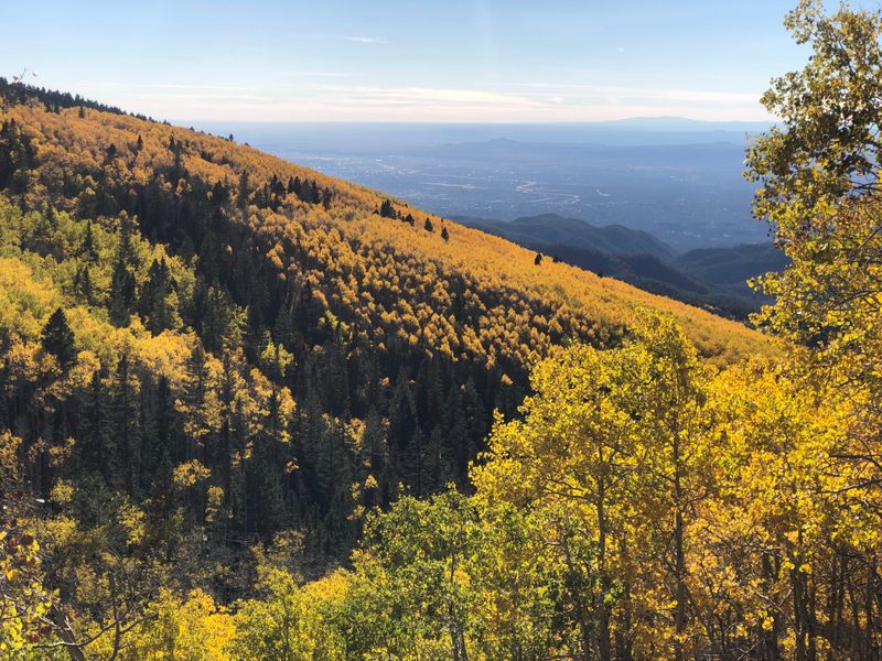
11. Santa Fe National Forest Scenic Byway
This short byway climbs from Santa Fe into cool forest air with consistent views back toward the city. You will pass aspen groves, rocky outcrops, and trailheads that start at high elevation.
Pullouts provide safe photography spots and places to recalibrate plans. The grade is steady, and summer brings cyclists, so share the road on curves.
Parking fills on weekends near popular trailheads. Start early for open spaces and softer light in the trees.
In fall, aspen leaves turn gold, drawing steady traffic in late September and early October. Winter narrows the route with plowed banks and patches of ice.
Fuel and food are easy in Santa Fe, but there are few services beyond. Cell coverage fades as you rise, so set offline maps.
The byway is ideal for a half-day outing that pairs a short hike with scenic overlooks. You get a clean snapshot of the city-to-mountains transition common across northern New Mexico.
12. Trail of the Mountain Spirits Scenic Byway
Centered on Silver City, the Trail of the Mountain Spirits loops through mining history, pine forests, and the Mimbres Valley. You will find steady curves, modest grades, and viewpoints across rugged ridges.
The byway links to Gila Cliff Dwellings access roads, though those segments take time and patience. Services concentrate in Silver City, so stock up before heading into quieter stretches.
Historic districts show off brick storefronts and galleries, while roadside markers outline Mimbres pottery traditions. Expect wildlife on the move at dawn and dusk.
Summer storms can drop hail and heavy rain that lift debris onto the roadway. Shoulder seasons are calmer, with comfortable temperatures for lunch stops and short walks.
Pullouts are frequent, enabling safe photo breaks and route adjustments. Cell service varies, and switchbacks require attentive driving.
Combine the loop with a soak or a night in town to slow the pace. The drive’s mix of culture, geology, and forest edges suits a full day of measured exploration.
13. Quebradas Back Country Byway
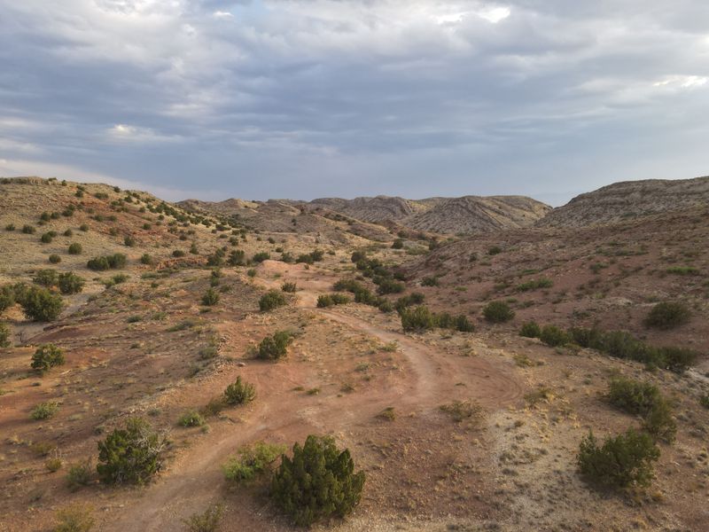
The Quebradas Back Country Byway runs east of Socorro across badlands carved by arroyos and time. The unpaved road threads multi-colored cliffs and hoodoo formations where erosion is on full display.
High-clearance is helpful after storms, and you will want a spare and air gauge. This is a quiet place to stop often and walk short distances for better compositions.
Rockhounds enjoy varied layers, but leave formations undisturbed. Services are in Socorro, so fuel and water up before departing.
Watch for flash flood potential during monsoon season, and avoid narrow washes in active weather. Morning and late afternoon create shadows that sculpt ridges and reveal texture.
Navigation is straightforward with a basic map, yet cell coverage can be spotty. Traffic is light, so travel prepared for self-sufficiency.
The byway rewards those comfortable with dirt driving and long views. Expect a patient, low-gear experience that showcases New Mexico’s colorful geology near the surface.
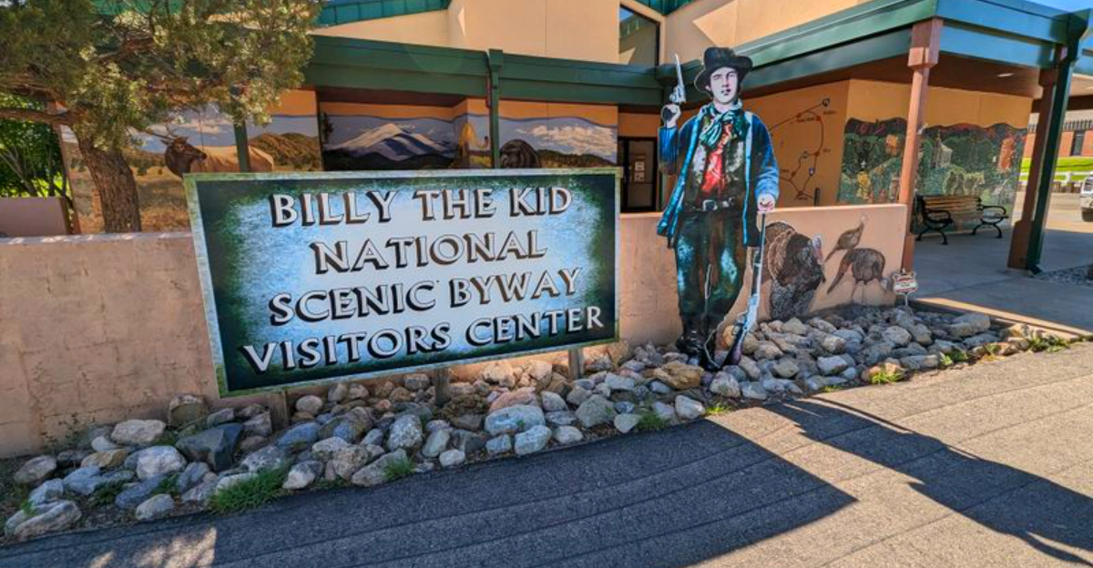
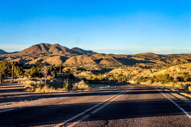
14. Billy the Kid Scenic Drive
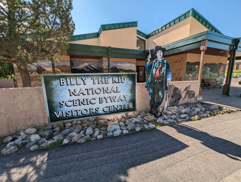
The Billy the Kid Scenic Drive loops through Lincoln County’s ranch country and the preserved main street of Lincoln. You will pass clapboard buildings, courthouse exhibits, and markers tied to the Lincoln County War.
Capitan provides services and a Smokey Bear museum that rounds out the region’s story. The road is gentle, with rolling hills and steady sightlines that make pacing easy.
Plan stops to read local signage and visit small museums that keep limited hours. Photography favors side streets and wood textures under soft light.
Summer brings heat, so bring water and aim for morning. Winter days can be crisp and quiet, with fewer visitors on the sidewalks.
Expect occasional livestock and farm equipment on the shoulders. Cell service is generally good along the main corridors.
Combine the drive with nearby Ruidoso for lodging and mountain air. This route suits travelers who enjoy history told at a walkable scale along calm, scenic pavement.
15. Rio Grande Gorge Loop
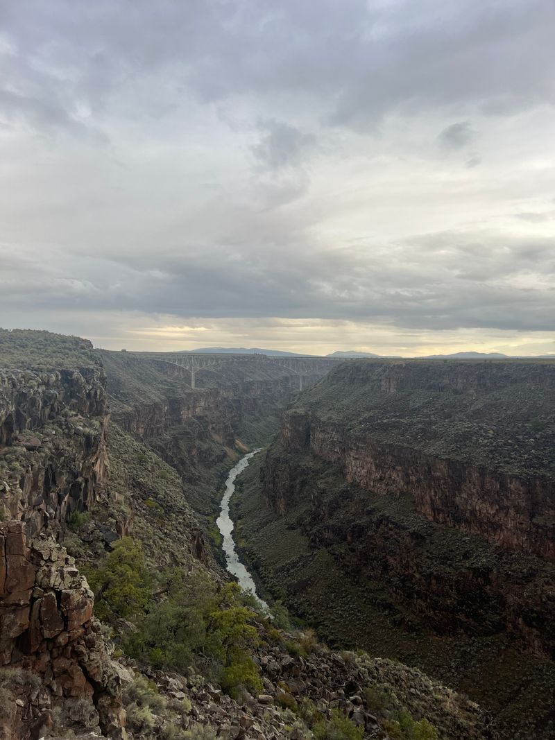
The Rio Grande Gorge Loop circles sage flats and basalt cliffs north of Taos, with repeated views into the deep canyon. The high bridge offers parking and walkways for safe lookouts.
You will drive two-lane roads with open sightlines and light traffic outside holidays. Winds can be strong on the mesa, so brace for gusts when exiting vehicles.
Trailheads lead to rim walks where lizards and ravens share the quiet. Dawn and dusk deliver the best shadows across the gorge’s stepped walls.
Services cluster in Taos, so carry snacks and water for the loop. The route pairs well with a quick detour to the earthship community for architecture fans.
In winter, black ice can form on shaded approaches to the bridge. Summer heat makes mid-day harsh, so plan early or late drives.
Photography favors mid-telephoto lenses to compress the canyon layers. The loop is short yet concentrated, with steady viewpoints and easy logistics.


