The United States is full of jaw-dropping landscapes, quirky borders, and geographic surprises that most people never learn about in school. From a state that exists in two time zones at once to a piece of land you can only reach by driving through another country, the geography of the U.S. is stranger than fiction.
These oddities aren’t just fun trivia – they reveal how rivers, tectonic plates, politics, and pure chance have shaped the country in unexpected ways. Get ready to look at the map in a whole new way.
1. Alaska is both the westernmost and easternmost state
Wrap your brain around this one: Alaska holds the title of both the westernmost AND easternmost state in the U.S. at the same time. That sounds impossible, but it’s completely true.
The Aleutian Islands, a long chain of volcanic islands that stretches far into the Pacific Ocean, crosses the 180th meridian – the line that separates the Eastern and Western hemispheres.
Once those islands cross that line, they technically enter the Eastern Hemisphere, making Alaska the easternmost state by definition. No other state comes close to pulling off that geographic trick.
Cartographers have argued for years about how to handle this on maps.
Most maps just cut Alaska off to keep things tidy, which is exactly why so few people know about it. Alaska is basically playing by its own rules, and honestly, that feels very on-brand for the largest state in the country.
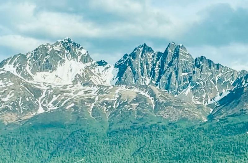
2. Alaska is closer to Russia than to the U.S. mainland
Just 2.4 miles of icy cold water separates the U.S. from Russia at the narrowest point of the Bering Strait. Standing on Little Diomede Island in Alaska, you can literally see Russian soil on Big Diomede Island on a clear day.
That’s closer than some people’s morning commute.
Meanwhile, the nearest point of the contiguous U.S. mainland is thousands of miles away. Alaska sits so far west that it’s geographically much more neighborly with Russia than with the Lower 48 states.
The two islands are so close that locals once crossed between them regularly before Cold War tensions turned the strait into a hard border.
Today, the invisible line between the islands is sometimes called the “Ice Curtain.” It’s a reminder that political borders don’t always follow the logic of geography – and that the world is a lot smaller than it looks on a map.
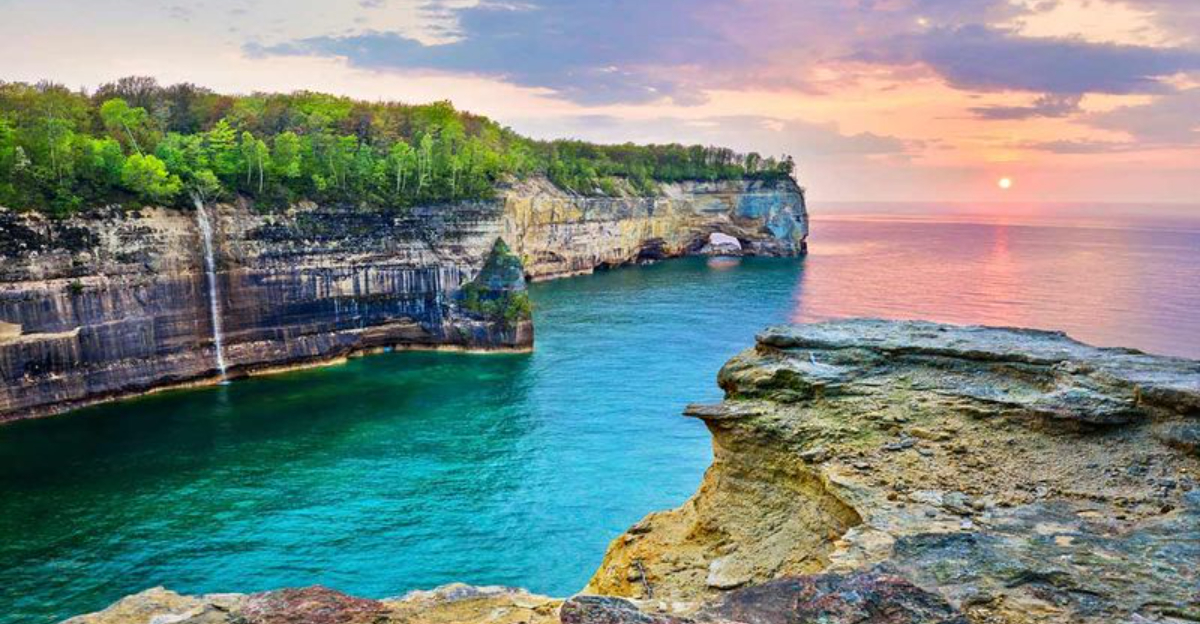
3. Michigan is split into two peninsulas
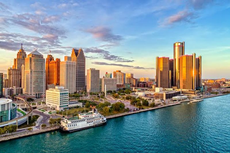
Michigan is the only state in the U.S. made up of two large, separate peninsulas – and they’re not even touching. The Lower Peninsula, shaped famously like a mitten, is home to most of Michigan’s population and cities like Detroit.
The Upper Peninsula sits above it, separated by the Straits of Mackinac, a waterway connecting Lake Huron and Lake Michigan.
Before the Mackinac Bridge opened in 1957, getting from one peninsula to the other meant taking a ferry. The bridge, now one of the longest suspension bridges in the Western Hemisphere, finally stitched the two halves together.
Residents of the Upper Peninsula are affectionately called “Yoopers” – a nod to “U.P.” – while Lower Peninsula folks are sometimes called “Trolls” because they live “under the bridge.”
The rivalry between Yoopers and Trolls is real, playful, and deeply Michigan. It’s geographic identity turned into a whole personality.
4. Kentucky has a bend surrounded by Tennessee
Somewhere along the Mississippi River, there’s a tiny patch of Kentucky that looks like it got lost. Kentucky Bend – also called New Madrid Bend or Bessie Bend – is a small piece of Kentucky land almost completely surrounded by Tennessee on three sides, with the Mississippi River curving around it like a lasso.
Because of the way the river curves, this chunk of Kentucky is geographically cut off from the rest of the state. To reach it from Kentucky by land, you’d actually have to drive through Tennessee first.
It’s one of the most unusual border quirks in the entire country, and it came about because state lines were drawn using the river’s position – which, as rivers do, eventually shifted.
Only a handful of people live there, making it one of the least populated areas in the state. It’s the kind of place that makes geography teachers smile and everyone else say, “Wait, seriously?”
5. Arizona doesn’t observe daylight saving time
Twice a year, most Americans scramble to change their clocks. Arizona?
It just sits back and watches. The state officially opted out of daylight saving time back in 1968, meaning it stays on Mountain Standard Time year-round.
The reasoning was pretty simple: when you already have blazing hot summers, adding an extra hour of evening sunlight sounds less like a gift and more like punishment.
Here’s where it gets delightfully complicated – the Navajo Nation, which covers a large portion of northeastern Arizona, DOES observe daylight saving time. And inside the Navajo Nation sits the Hopi Reservation, which does NOT.
So driving through that region can feel like a time zone obstacle course.
For the rest of Arizona, life without clock-changing is refreshingly straightforward. No groggy Monday mornings after springing forward.
No confused pets. Just consistent, predictable sunshine – and plenty of it.
Arizona makes its own rules, and the clocks agree.
6. Colorado’s borders are almost perfect straight lines
Pull up a map of Colorado and you’ll notice something almost suspicious – it’s basically a rectangle. Colorado is one of only three U.S. states (along with Wyoming and Utah) whose borders are defined almost entirely by lines of latitude and longitude rather than natural features like rivers or mountain ridges.
The result is a state that looks like someone just drew a box on the map.
“Almost” perfect is the key word here. Surveyors in the 1800s didn’t have GPS, and measuring long straight lines across rugged terrain was incredibly hard.
As a result, Colorado’s borders have tiny wobbles and errors – some spots are off by hundreds of feet from where they should theoretically be.
Despite that, Colorado comes remarkably close to being a true geometric rectangle. It spans exactly 4 degrees of latitude and 7 degrees of longitude.
It’s the kind of border that feels planned, clean, and just a little too neat for the wild American frontier.
7. The Mississippi River has changed state borders
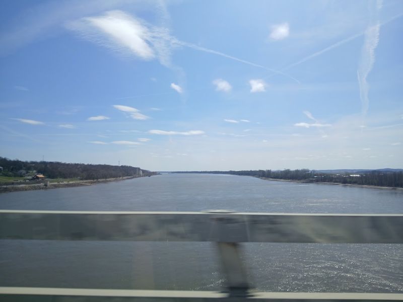
Rivers don’t stay still, and the Mississippi River is proof of that in the most dramatic way possible. Over centuries, the river has shifted its course, looped, and cut new paths – and when it did, it left some very confused state borders behind.
State lines in that region were originally drawn using the river as a boundary, which made sense at the time.
The problem? Nobody told the river to stop moving.
When the Mississippi changed course, some towns and parcels of land ended up on the “wrong” side of the border. A piece of land might legally belong to Missouri but sit physically on the Tennessee side of the river, or vice versa.
One famous case is Kaskaskia, Illinois – a town the river literally cut off from the rest of Illinois, leaving it accessible only from Missouri. It’s a real-life geography puzzle with no clean answer, and it happens more often along that river than most people realize.
8. There’s a desert below sea level in California
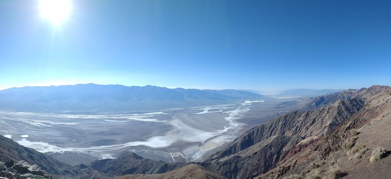
Death Valley sounds like a place someone invented to scare people, but it’s very real – and very extreme. Located in southeastern California, Death Valley is the lowest point in all of North America, sitting at a whopping 282 feet below sea level.
That means you’re standing lower than the surface of the ocean while surrounded by scorching desert heat.
It also holds the record for the highest reliably recorded air temperature on Earth: 134 degrees Fahrenheit (56.7°C), measured back in 1913. The landscape looks almost otherworldly – vast salt flats, colorful rock formations, and sand dunes that stretch on forever.
Yet people visit it every year, drawn by its eerie, alien beauty.
What makes it even more mind-bending is that it sits right next to some of the tallest mountains in the contiguous U.S. The elevation swings in that region are staggering.
Death Valley is proof that California contains more geographic extremes than most entire countries.
9. Hawaii grows farther from the mainland every year
Every single year, Hawaii drifts a little farther from the U.S. mainland – and there’s nothing anyone can do about it. The Hawaiian Islands sit on the Pacific Plate, which is slowly but steadily moving toward the northwest at roughly 2 to 3 inches per year.
That might sound tiny, but over millions of years, it adds up to massive distances.
This same tectonic movement is also responsible for how the Hawaiian island chain formed in the first place. A volcanic hotspot in the Earth’s mantle stays in one place while the plate moves over it, creating a new island every few million years.
The Big Island of Hawaii is currently sitting over that hotspot, which is why it’s still volcanically active and technically still growing.
Meanwhile, the older islands to the northwest are slowly sinking and eroding. Hawaii is both growing and moving at the same time – a geological process that never really stops.
10. Maine is the only state with just one neighbor
Every U.S. state shares a border with at least two other states – except Maine. Tucked up in the northeastern corner of the country, Maine borders only one other U.S. state: New Hampshire.
To the north and east, it’s flanked by Canadian provinces, and to the south, the Atlantic Ocean takes over. That makes Maine geographically unique in a way no other state can claim.
This isolation has shaped Maine’s culture and identity in interesting ways. The state has always had a fiercely independent spirit – famously stubborn, self-sufficient, and proud of it.
With just one American neighbor, Maine has historically felt a little set apart from the rest of the country, almost like its own quiet corner of the world.
Locals seem to like it that way. Maine’s motto is “Dirigo,” meaning “I lead” – which feels fitting for a state that confidently stands alone at the edge of the map, doing things its own way.
11. Point Roberts, Washington is cut off from the U.S.
Imagine living in the United States but having to drive through a foreign country just to get to the nearest American grocery store. That’s everyday life in Point Roberts, Washington.
This tiny peninsula dips just below the 49th parallel – the straight-line border between the U.S. and Canada – which means it’s technically American soil completely cut off from the rest of the U.S. by land.
To reach Point Roberts from the rest of Washington State by road, you must drive through British Columbia, Canada, cross a border checkpoint, and then re-enter the U.S. It’s about 25 miles of driving through another country just to get home.
During the COVID-19 pandemic, when the Canadian border closed, residents faced a genuine crisis reaching basic services.
Around 1,300 people live there permanently, and many are dual citizens or Canadian residents who chose the area for its charm and lower U.S. property taxes. It’s a geographic oddity that creates real, daily challenges for the people who call it home.
12. Four states meet at one exact point
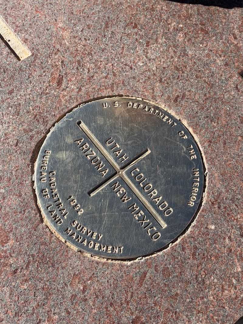
Four Corners is the only place in the entire United States where four states meet at a single point. Stand in the right spot and you can be in Arizona, Utah, Colorado, and New Mexico all at the same time.
People travel from all over just to crouch down, stretch their limbs in four directions, and snap a photo as a four-state resident for about thirty seconds.
The monument marking the spot is a flat bronze disk set into the ground, surrounded by the state seals of all four states. It’s managed by the Navajo Nation, since the area sits within tribal land.
Vendors sell traditional crafts and food right at the border, making it a surprisingly lively spot in the middle of the desert.
Fun fact: the original survey placing the marker was slightly off, meaning the monument isn’t at the mathematically perfect intersection – but the Supreme Court ruled the marker legally valid anyway. Close enough, apparently, is good enough.
13. Florida is the flattest state in the U.S.
Florida might be famous for theme parks and beaches, but its most underrated feature is how remarkably, almost comically flat it is. The highest natural point in Florida is Britton Hill in the Panhandle, standing at just 345 feet above sea level.
To put that in perspective, that’s shorter than many office buildings in downtown Miami.
No other state in the country has a lower high point. Florida’s landscape is so flat that even gentle rainstorms can cause flooding because there’s almost no slope for water to run off.
The Everglades, a massive wetland ecosystem in the south, exists partly because the land is so level that water just spreads out in every direction.
Geologically, Florida sits on a platform of limestone that was once completely underwater. The flatness isn’t an accident – it’s a reminder that this entire state was once the floor of a shallow sea.
Florida is basically a very large, very sunny sandbar with great real estate marketing.
14. Lake Superior is the largest freshwater lake by surface area
Lake Superior isn’t just big – it’s staggeringly, almost incomprehensibly large. Covering about 31,700 square miles, it holds roughly 10% of the world’s surface freshwater supply.
The entire country of South Korea could fit inside it with room to spare. It’s the largest freshwater lake on Earth by surface area, and it doesn’t come close to losing that title.
The lake sits along the border between the U.S. and Canada and is part of the Great Lakes system, which together hold about 21% of the world’s surface freshwater. Superior alone is so vast that it creates its own weather patterns.
Storms that form over the lake can be as powerful as small ocean systems.
Sailors have long respected – and feared – Lake Superior. The famous 1975 sinking of the Edmund Fitzgerald happened right on its waters.
The lake has claimed over 350 shipwrecks throughout history. Beautiful, massive, and occasionally terrifying, Superior earns its name in every sense.
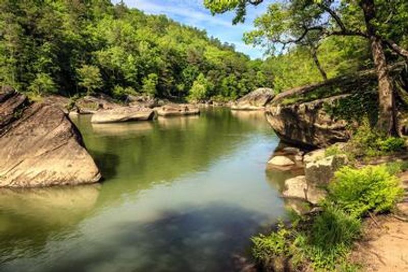
15. There’s a rainforest in the continental U.S.
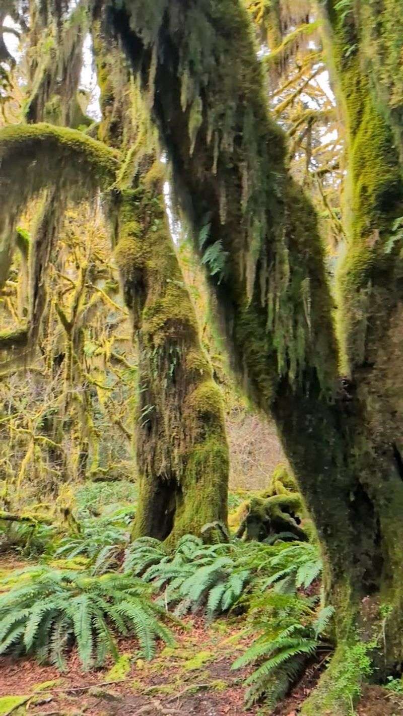
Most people picture tropical islands or South America when they hear the word rainforest. But the continental United States has one – and it’s spectacular.
The Hoh Rainforest in Olympic National Park, Washington, receives between 12 and 14 feet of rainfall per year, making it one of the wettest places in the entire country. It’s a temperate rainforest, different from tropical ones, but just as lush and awe-inspiring.
Walking through the Hoh feels like stepping into a fairy tale. Ancient Sitka spruce and Douglas fir trees tower overhead, their trunks draped in thick green moss.
The forest floor is carpeted with ferns, and mist drifts between the trees in a way that makes everything feel quietly magical. Elk roam freely through the undergrowth.
The Hoh exists because of its unique location – trapped between the Pacific Ocean and the Olympic Mountains, which force moisture-laden air to rise and release enormous amounts of rain. It’s a geographic accident that produced one of the most beautiful places in America.


