America’s border towns hold secrets that rarely make headlines. While most people think of borders as simple lines on a map, these communities live a more complex reality shaped by wars, treaties, unique geography, and cross-border partnerships that have unfolded over centuries. From libraries split down the middle to towns bombed by accident, these sixteen places reveal the surprising, often forgotten stories that define life on the edge of the United States.
1. Point Roberts, Washington
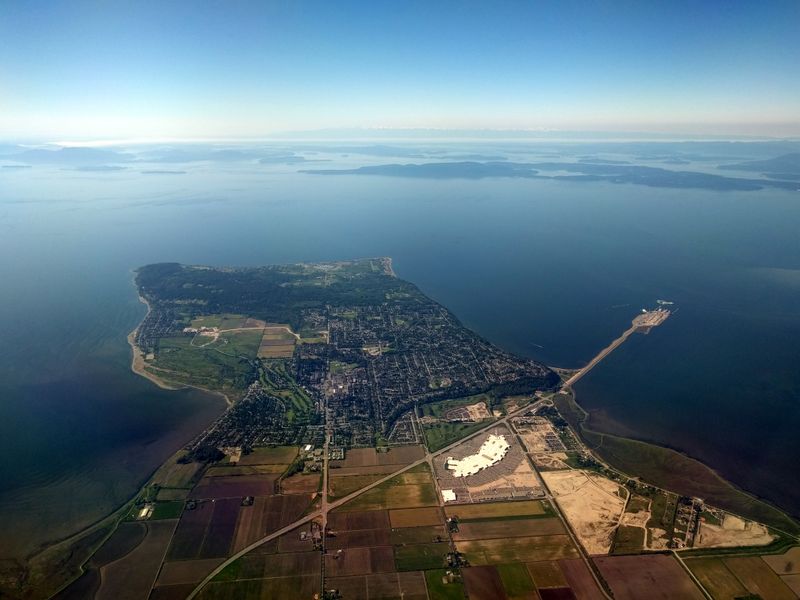
Geography played a strange trick on Point Roberts. When diplomats drew the U.S.–Canada border along the 49th parallel, they created an American exclave that you can only reach by land through Canada. This tiny peninsula became cut off from the rest of Washington State by an international boundary.
Residents here build their entire routines around border crossings. Grocery shopping, doctor visits, even attending school in mainland Washington means passing through Canadian and U.S. checkpoints twice each trip. During the COVID-19 pandemic, when the border closed to non-essential travel, Point Roberts faced a crisis as supplies and services became nearly unreachable.
Life in this five-square-mile community means navigating two countries’ laws daily. Kids might go to school in Blaine, workers commute to Vancouver, and every errand becomes an international journey. Point Roberts proves that borders drawn on maps don’t always match the reality of how people actually live their lives.
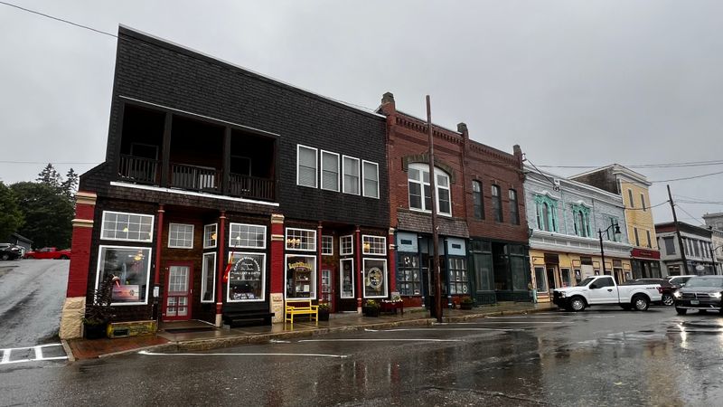
2. Derby Line, Vermont
A thick black line runs across the floor of the Haskell Free Library and Opera House, marking where the United States ends and Canada begins. Built deliberately on the international boundary in 1904, this unique building lets patrons enter from either country. The stage sits in Canada while most seats face it from American soil.
For over a century, this arrangement worked smoothly. Locals crossed freely to attend performances or borrow books, treating the border as little more than a curiosity. But in 2025, new access rules created tension when authorities began enforcing stricter entry requirements, threatening the building’s historic binational purpose.
Derby Line residents have family, friends, and daily routines that ignore the border. The library controversy highlighted how modern security concerns clash with communities that existed long before today’s checkpoint culture. What was once a symbol of cross-border cooperation became a flashpoint, reminding everyone that even the most peaceful boundaries can suddenly complicate ordinary life.
3. Blaine, Washington
Standing between two nations, the Peace Arch tells a story of reconciliation. Dedicated in September 1921, this monument was built to symbolize lasting friendship between the United States and Canada after the War of 1812 finally faded from living memory. The structure literally straddles the boundary, with one foot in each country.
Inscriptions on the arch read “Children Of A Common Mother” on the American side and “Brethren Dwelling Together In Unity” facing Canada. The surrounding park allows people to walk freely between nations within its grounds, a rare exception to normal border rules. Families gather here for picnics that technically happen in two countries at once.
Blaine residents see the arch as more than a tourist attraction. It represents their daily reality of living alongside neighbors who happen to be citizens of another country. The monument reminds visitors that borders can celebrate connection rather than just marking division, especially between nations that share the world’s longest undefended boundary.
4. Eastport, Maine
Most people forget that British forces captured American territory during the War of 1812, but Eastport remembers. In July 1814, British troops seized Moose Island and occupied this tiny border community for years. The occupation didn’t end until 1818, well after the war itself concluded, making Eastport one of the last pieces of American soil returned.
Today, Eastport holds the title of the easternmost city in the United States. Its location made it strategically valuable during early conflicts over where exactly the U.S.–Canada border should run. The British occupation left lasting marks on local identity and architecture that visitors can still spot.
Fishing boats now fill the harbor where military vessels once anchored. Eastport’s dramatic history gets overshadowed by bigger battlefields, but for a community of fewer than 1,500 people, playing a significant role in defining international boundaries is no small legacy. The town proves that border history isn’t always about lines on paper but about real places caught between competing nations.
5. Sault Ste. Marie, Michigan
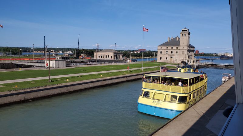
When the Soo Locks opened in 1855, they transformed not just a border town but the entire Great Lakes economy. These engineering marvels allow ships to navigate the 21-foot drop between Lake Superior and the lower Great Lakes, turning Sault Ste. Marie into a critical shipping gateway. Without them, iron ore from Minnesota’s mines couldn’t reach steel mills in the east.
The locks sit right at the U.S.–Canada border, with the Canadian city of Sault Ste. Marie, Ontario, just across the river. Both communities share a name and Indigenous Ojibwe heritage but developed different economies around the same waterway. The American side focused on locks and shipping, creating jobs and infrastructure that still define the town.
Locals call it simply “the Soo,” and they know their small city punches above its weight. More than 80 million tons of cargo pass through annually, making this border community essential to American industry. The Soo Locks prove that strategic location and smart engineering can make even remote border towns nationally important.
6. International Falls, Minnesota
Corporate interests, not government planners, built International Falls into a border hub. A U.S. port of entry opened here in 1895, but the real growth came after a dam on the Rainy River in 1905 provided power for paper mills. When the international bridge was completed in 1912, a paper company funded the construction to move goods across the border more efficiently.
This industrial origin story shaped everything about the town. Workers commuted across the border, logs floated down from Canadian forests, and the local economy depended on binational cooperation long before modern trade agreements. The bridge wasn’t about tourism or diplomacy but about moving raw materials and finished products between two countries.
International Falls earned fame as one of America’s coldest cities, but its border location matters more than its weather. The town demonstrates how private industry often drove border development, building infrastructure that governments later adopted. Cross-border business relationships here predate most federal border policies, giving locals a practical, no-nonsense view of what international boundaries actually mean in daily commerce.
7. San Ysidro, California
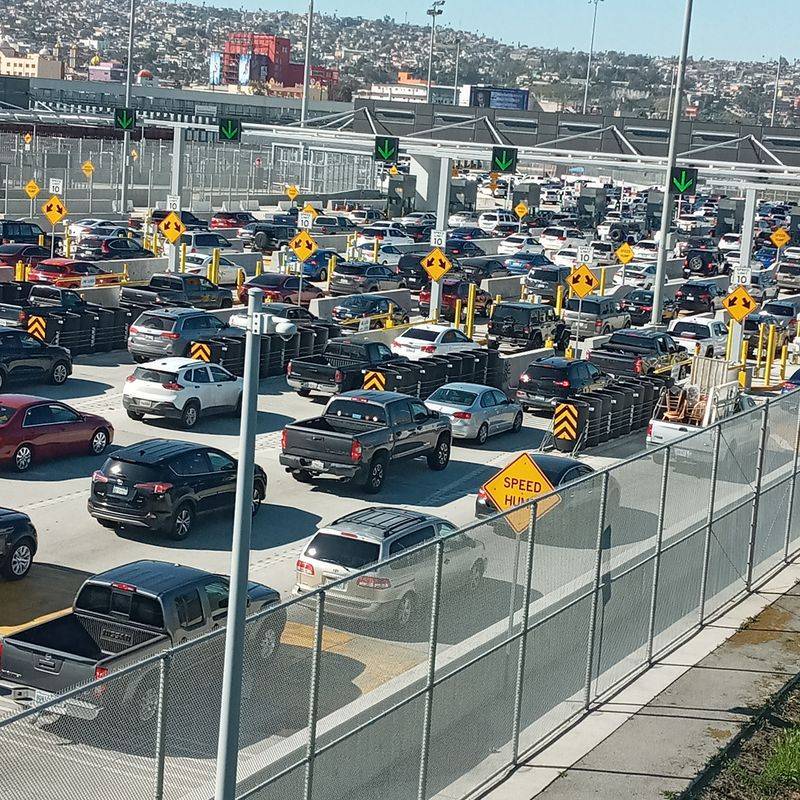
Every day, roughly 70,000 northbound vehicles and 20,000 pedestrians pass through San Ysidro, making it the busiest land border crossing in the Western Hemisphere. The port of entry opened in 1906 when cross-border traffic was a trickle compared to today’s massive flow. What started as a simple checkpoint has grown into a complex of lanes, inspection facilities, and infrastructure that never stops moving.
San Ysidro’s economy revolves entirely around the border. Thousands of people live in Tijuana but work, shop, or study in San Diego, creating a daily commuter culture that defines both cities. Businesses on the American side depend on Mexican customers, while workers on both sides navigate wait times that can stretch for hours during peak crossings.
The community exists in a unique space where two countries blur together. Spanish and English mix in every conversation, families span both sides of the line, and local identity refuses to fit neatly into one nation’s box. San Ysidro shows how borders create not just divisions but entirely new kinds of communities shaped by constant crossing.
8. Calexico, California
The name says it all: California plus Mexico equals Calexico. Founded in 1900, this city was literally designed as the American half of a binational pair with Mexicali right across the fence. Town founders knew from day one that their success depended on cross-border connections, so they chose a name that announced that relationship to the world.
Walk through Calexico and you’ll see a community where the border is both everywhere and nowhere. Families have relatives on both sides, businesses serve customers from both countries, and daily life requires constantly thinking about which side of the line you’re on. The border fence cuts through the heart of what locals see as essentially one metropolitan area.
Calexico’s twin-city identity means prosperity and problems flow both ways. Economic booms in Mexicali bring shoppers north, while downturns hit Calexico hard. Immigration policies affect not just strangers but neighbors, classmates, and coworkers. The city embodies the reality that border communities don’t just sit next to other countries; they’re woven together in ways that outsiders rarely understand or acknowledge.
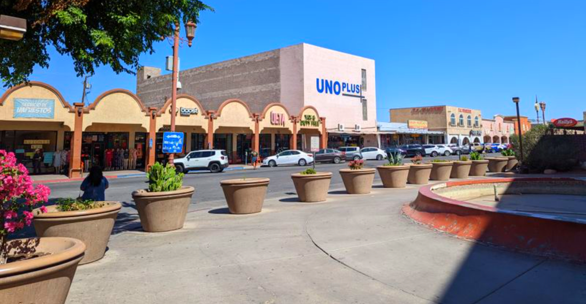
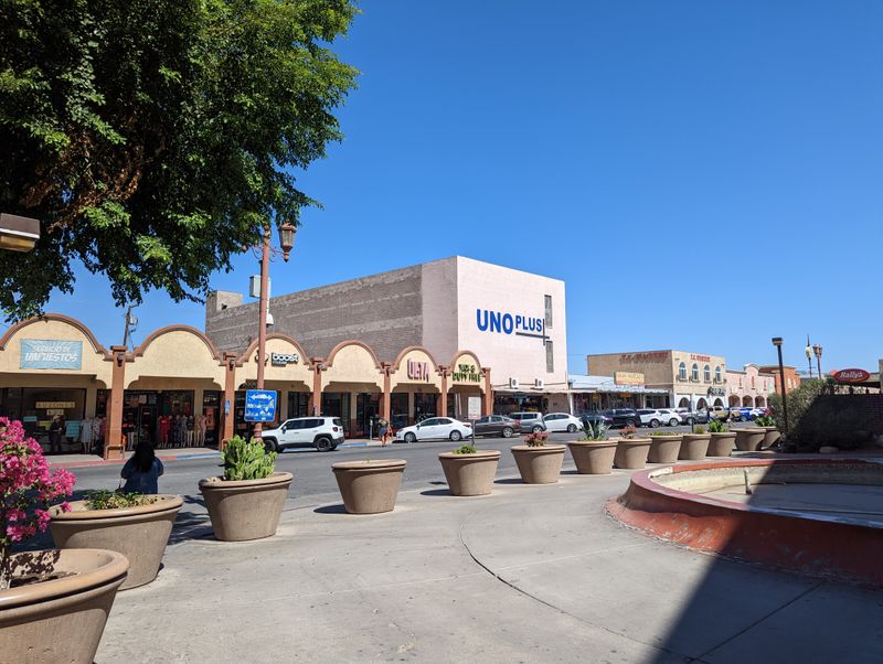
9. Nogales, Arizona
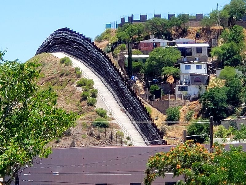
Gunfire erupted across the border on August 27, 1918, in what became known as the Battle of Ambos Nogales. Fighting started over a misunderstanding at the border crossing and quickly escalated into a full firefight between American forces and Mexican soldiers and civilians. When the smoke cleared, dozens were dead or wounded on both sides, and the two cities that shared a name had violently collided.
The battle’s aftermath changed Nogales permanently. Authorities pushed for a permanent barrier dividing the two cities, replacing the simple boundary markers that had existed before. What had been a relatively open border became increasingly fortified, setting a pattern that would repeat itself over the following century.
Today, a tall fence dominates downtown Nogales, separating neighborhoods that were once continuous. Residents remember when families could easily visit across the line for dinner or shopping. The 1918 battle didn’t just claim immediate casualties; it helped establish the militarized border infrastructure that now defines life here, turning a single day of violence into a lasting division.
10. Naco, Arizona
In one of history’s stranger border incidents, bombs fell on American soil in Naco during 1929. Fighting had broken out in Naco, Sonora, during the Mexican Revolution’s aftermath, and one side hired a mercenary pilot to drop bombs on their enemies. His aim proved terrible, and several bombs landed across the border in Naco, Arizona, damaging buildings and terrifying residents.
Nobody died in the bombing, but the incident created an international crisis. American forces scrambled to respond to what technically constituted a foreign attack on U.S. territory, even though it was clearly accidental. The pilot, an Irish mercenary named Patrick Murphy, became briefly infamous for his incompetence rather than his aggression.
Naco residents still tell stories about the bombing, one of the few times aerial weapons hit the continental United States from a foreign source. The tiny town of a few hundred people found itself at the center of diplomatic negotiations and newspaper headlines worldwide. Naco’s experience proves that even small border communities can suddenly become international incident sites when conflicts spill across the line.
11. Columbus, New Mexico
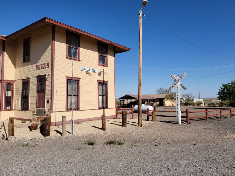
Before dawn on March 9, 1916, Pancho Villa’s forces attacked Columbus, killing American civilians and soldiers in one of the most famous border raids in U.S. history. Villa’s motivations remain debated—revenge, desperation, or political calculation—but the raid’s impact was immediate and dramatic. The United States launched a massive military expedition into Mexico in response, nearly triggering a full-scale war.
Columbus was a small, quiet border town until that morning transformed it into a battlefield. Residents fought back against the raiders, and the violence left buildings burned and the community traumatized. The raid fundamentally changed how Americans viewed border security and Mexico’s internal conflicts.
Today, Columbus maintains museums and memorials dedicated to the raid, keeping the memory alive for the few hundred people who still live there. The attack shaped U.S.–Mexico relations for years afterward and demonstrated that border towns could become targets in foreign conflicts. Columbus learned the hard way that living on an international boundary means your community can suddenly become entangled in events far beyond local control.
12. El Paso, Texas
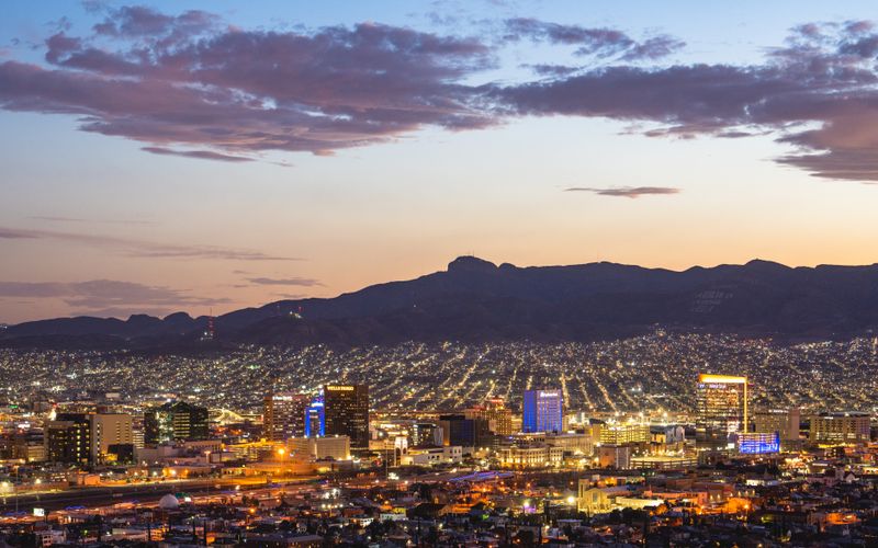
For over a century, El Paso and Ciudad Juárez argued over where exactly the border ran. The Rio Grande kept changing course, shifting land from one side to the other and creating the Chamizal dispute. What started as a minor boundary question grew into a major diplomatic headache affecting hundreds of acres and thousands of residents who weren’t sure which country they actually lived in.
The Chamizal Convention of 1963 finally settled the dispute through negotiation rather than force. The agreement transferred land, relocated the Rio Grande’s channel into a concrete bed, and redrew El Paso’s map. Families and businesses had to relocate, and the river’s path was permanently fixed to prevent future confusion.
El Paso’s experience shows how rivers make terrible borders when they refuse to stay put. The Chamizal settlement required both countries to compromise, moving beyond nationalist pride to find a practical solution. Today’s concrete channel and clear boundary seem obvious, but they represent decades of diplomatic work to resolve a problem caused by geography’s refusal to cooperate with political boundaries.
13. Del Rio, Texas
Just upstream from Del Rio sits Amistad Dam, a massive structure that represents binational cooperation on water management. Built between 1963 and 1969 under the 1944 Water Treaty between the United States and Mexico, the dam creates a reservoir shared by both countries. It’s not just about controlling floods or generating power; it’s about two nations jointly managing a resource that neither can control alone.
Del Rio’s border story differs from towns focused on immigration or trade. Here, the Rio Grande is primarily a water source that both countries depend on for agriculture, drinking water, and recreation. The International Boundary and Water Commission, not border patrol agents, shapes daily life through decisions about reservoir levels and water allocation.
Residents understand that border cooperation isn’t always about security or commerce. Sometimes it’s about recognizing that rivers don’t respect political boundaries and that sharing water requires trust and compromise. Amistad Dam stands as physical proof that even in tense times, neighbors can work together on essential projects that benefit everyone living along the border.
14. Eagle Pass, Texas
Just south of Eagle Pass, the Kickapoo Traditional Tribe of Texas maintains a reservation along the Rio Grande, adding Indigenous sovereignty to an already complex border landscape. The Kickapoo people have their own unique history of migration and displacement, originally from the Great Lakes region before various relocations brought some tribal members to Texas and others to Mexico.
The Kickapoo cross the border regularly to visit relatives and maintain cultural connections that predate the United States and Mexico as nations. Their reservation status gives them certain rights that other border residents don’t have, creating yet another layer of jurisdiction and identity in Eagle Pass. Tribal members navigate not just two national governments but also their own sovereign nation.
Most Americans visiting Eagle Pass never learn about the Kickapoo presence or how Indigenous communities experience borders differently than settlers and their descendants. The reservation challenges simple narratives about border security and national identity, reminding everyone that these lands had complex histories and multiple peoples long before modern boundaries were drawn. Eagle Pass demonstrates that borders can’t erase Indigenous sovereignty or connections.
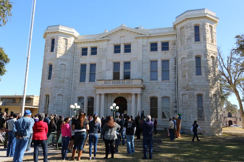
15. Laredo, Texas
In 1840, Laredo briefly became capital of the Republic of the Rio Grande, a separatist movement that rejected rule by Mexico City and tried to establish an independent nation spanning both sides of the river. The republic lasted less than a year before Mexican forces crushed the rebellion, but that short-lived moment of independence still echoes in Laredo’s identity.
The Republic of the Rio Grande represented local frustration with distant governments making decisions that ignored border communities’ unique needs and cultures. Residents saw themselves as distinct from both central Mexico and the United States, connected more to each other across the river than to capitals hundreds of miles away. Though the republic failed, the sentiment behind it never completely disappeared.
Today, Laredo embraces its rebel history through museums and annual celebrations. The republic’s flag and story remind locals that border communities have sometimes tried to define themselves outside existing national frameworks. Laredo’s separatist past challenges assumptions about loyalty and identity, showing that people living on borders sometimes imagine political futures that don’t fit neatly into either neighboring nation.
16. Brownsville, Texas
On May 12-13, 1865, Union and Confederate forces fought the Battle of Palmito Ranch near Brownsville, widely recognized as the last land battle of the Civil War. The bizarre part? Major Confederate surrenders had already happened, and many soldiers didn’t even know the war was effectively over. They fought anyway, with Confederates actually winning this final, pointless engagement.
Brownsville’s location on the Mexican border made it strategically important during the Civil War for smuggling cotton past Union blockades. Confederate goods flowed into Mexico and then to European markets, keeping the southern economy alive longer than it otherwise could have survived. The border’s porousness worked in the Confederacy’s favor, at least temporarily.
The battle’s timing makes it tragically absurd but also revealing. Communication traveled slowly in 1865, and border regions often learned about national events last. Brownsville’s experience shows how borders can be both strategically vital and oddly disconnected from the centers of power. The soldiers who fought at Palmito Ranch risked their lives for a cause already lost, simply because news hadn’t reached the Rio Grande.


