River deltas around the world are facing a serious problem that many people do not realize. These low-lying areas where rivers meet the ocean are sinking into the ground faster than the sea is climbing up.
Millions of people live in these regions, relying on the land for farming, fishing, and homes, but the ground beneath them is disappearing at an alarming rate.
1. Nile Delta
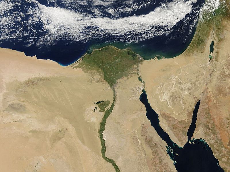
Egypt’s Nile Delta sits at the edge of Africa, where one of the longest rivers on Earth finally meets the Mediterranean Sea. Farmers have worked this fertile land for thousands of years, growing crops that feed millions of people across the region.
But now the ground is dropping faster than the water around it is rising. Dams upstream hold back sediment that used to rebuild the delta naturally.
Without that fresh soil arriving each year, the land compacts and sinks lower, putting coastal cities and farmland at risk of flooding.
2. Po Delta
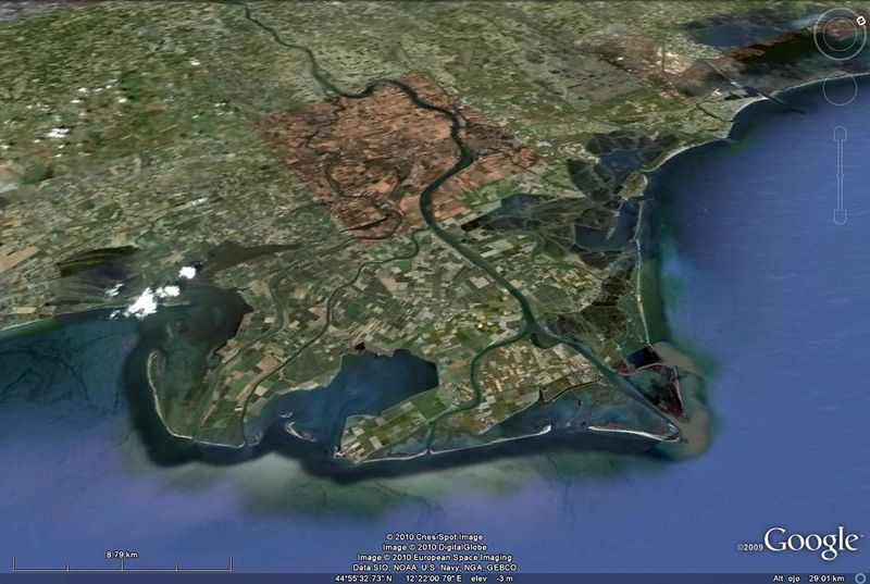
Northern Italy’s Po Delta stretches into the Adriatic Sea like fingers reaching into blue water. This marshy landscape provides habitat for countless bird species and supports local fishing communities that have lived here for generations.
Groundwater pumping and natural settling cause the delta to sink noticeably each year. The rate of sinking beats the speed at which nearby ocean levels climb.
Protective barriers and careful water management have become necessary to keep homes and businesses above the waterline in this historic region.
3. Vistula Delta
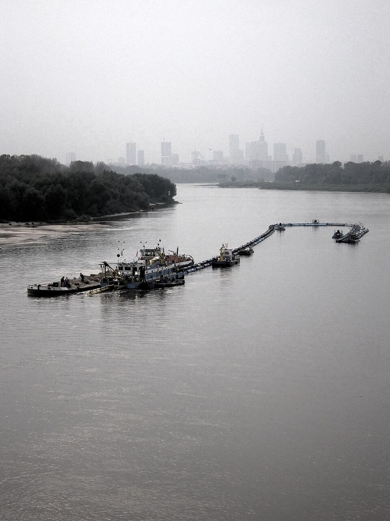
Poland’s Vistula Delta meets the Baltic Sea in a region known for its unique landscape of lagoons and lowlands. History runs deep here, with ancient trade routes and medieval settlements marking the area’s importance over centuries.
Natural compaction of sediments combined with human activities causes the land to drop steadily. The sinking happens faster than the Baltic waters rise in this particular spot.
Residents face increasing challenges as drainage systems struggle to keep pace, and some areas experience regular flooding during storms that once caused little concern.
4. Ceyhan Delta
Turkey’s Ceyhan Delta lies along the Mediterranean coast, where warm waters lap against a landscape shaped by centuries of river deposits. Cotton fields and citrus groves stretch across the flat terrain, supporting local agriculture and economy.
Measurements show the ground sinking at rates that surpass how quickly the Mediterranean rises nearby. Irrigation practices and natural settling both contribute to this downward movement.
Farmers and town planners must now consider this ongoing change when making decisions about crops, buildings, and infrastructure that will last for decades to come.
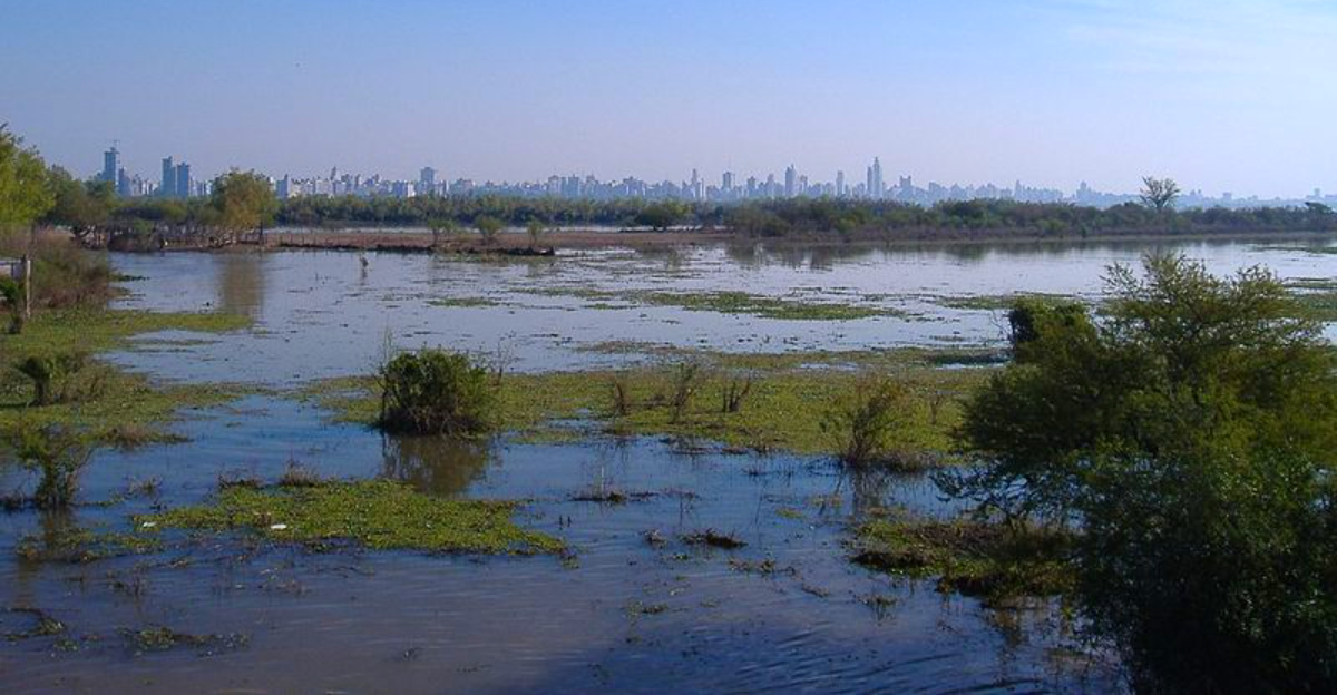
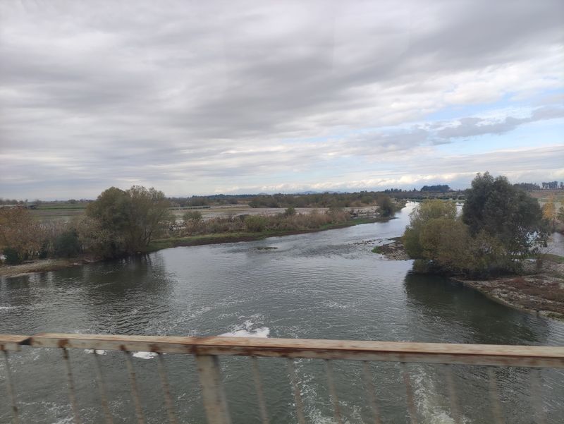
5. Rioni Delta
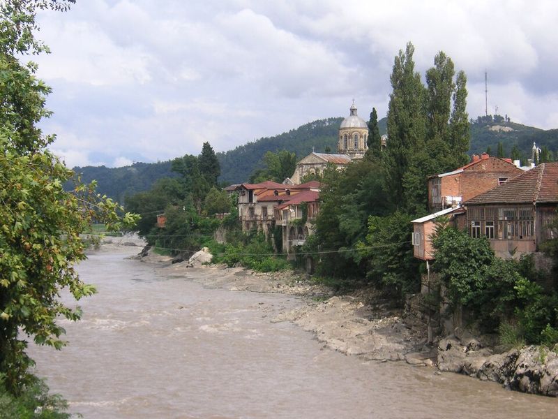
Georgia’s Rioni Delta opens into the Black Sea, creating a landscape of wetlands and channels that teem with wildlife. Ancient Greeks once explored these shores, and today the area remains important for both ecology and local communities.
Scientists tracking the land elevation here find it dropping faster than the Black Sea rises in this region. Natural processes combine with human influence to accelerate the sinking.
Coastal erosion increases as the land loses its battle with the water, threatening habitats and human settlements that depend on stable ground beneath them.
6. Brahmani Delta
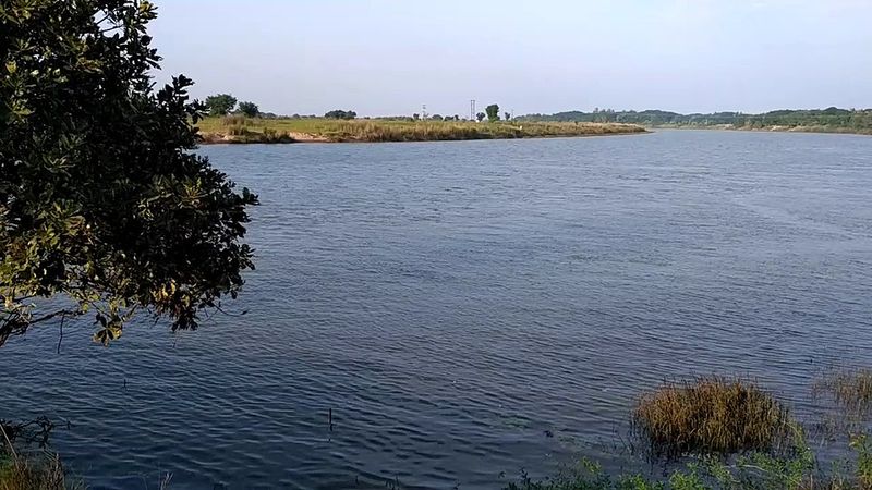
India’s Brahmani Delta sits along the Bay of Bengal, where tropical weather and monsoon rains shape daily life. Fishing villages dot the coastline, and rice paddies create a patchwork of green across the low-lying plains.
The average rate at which this delta sinks exceeds how fast the ocean climbs in the surrounding area. Groundwater extraction for agriculture speeds up the natural settling of river sediments.
Communities here face tough choices about where to build homes and how to protect their livelihoods as the reliable ground of past generations becomes less stable with each passing year.
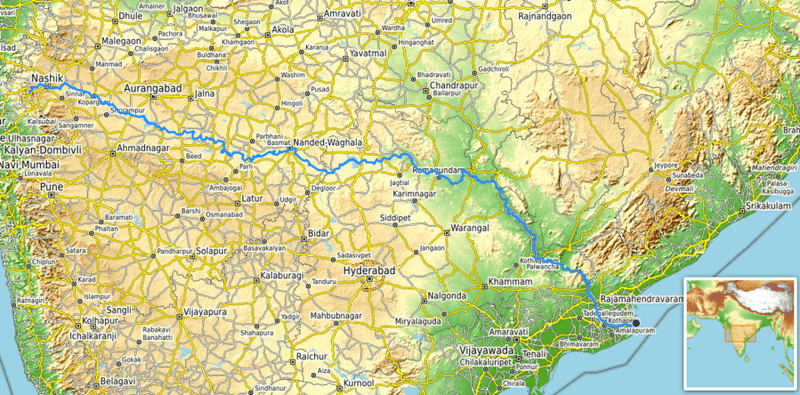
7. Mahanadi Delta
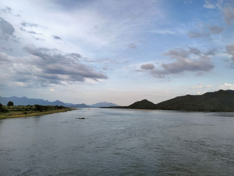
Another Indian delta along the Bay of Bengal, the Mahanadi region supports millions of people who depend on its fertile soil. Cyclones regularly sweep through this area, making the relationship between land and sea especially important for survival.
Studies reveal that sinking dominates the near-term changes in relative sea level here more than ocean rise itself. The ground drops as water gets pumped out and sediments compress naturally.
This creates a double threat when storms arrive, as lower land means water reaches farther inland, affecting more homes, schools, and farms than would flood if the ground stayed level.
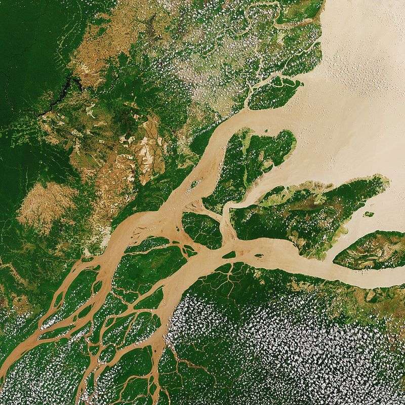
8. Ganges–Brahmaputra Delta
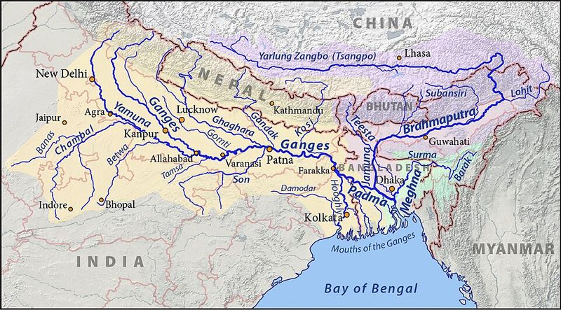
Stretching across Bangladesh and India, this massive delta forms the largest river delta system on Earth. Over 100 million people call this region home, making it one of the most densely populated deltas anywhere.
The land here drops faster than the Bay of Bengal rises nearby. Sediment starvation from upstream dams, groundwater pumping, and natural compaction all play roles in this sinking.
For families living just above sea level, even small changes in elevation can mean the difference between dry homes and devastating floods during monsoon season or tropical storms.
9. Godavari Delta
India’s Godavari Delta meets the Bay of Bengal along a coast known for its aquaculture and rice farming. Generations of families have worked this land, knowing exactly when to plant and harvest based on seasonal patterns.
Data shows average subsidence rates that beat regional sea-level rise figures. The ground settles as heavy sediments compress and water gets withdrawn for irrigation.
Coastal villages once protected by distance from the shore now find the ocean creeping closer year by year, forcing residents to adapt their traditional ways of life to a changing landscape.
10. Chao Phraya Delta
Thailand’s Chao Phraya Delta holds Bangkok, one of Southeast Asia’s largest cities, along with countless rice farms that make the country a major food exporter. The flat landscape here barely rises above sea level even in the best conditions.
Land subsidence races ahead of how quickly the Gulf of Thailand rises in this area. Massive groundwater pumping to support the growing population causes the ground to compact and sink dramatically.
Bangkok experiences this problem severely, with some neighborhoods dropping several centimeters annually, making flooding increasingly common and expensive to manage.
11. Mekong Delta
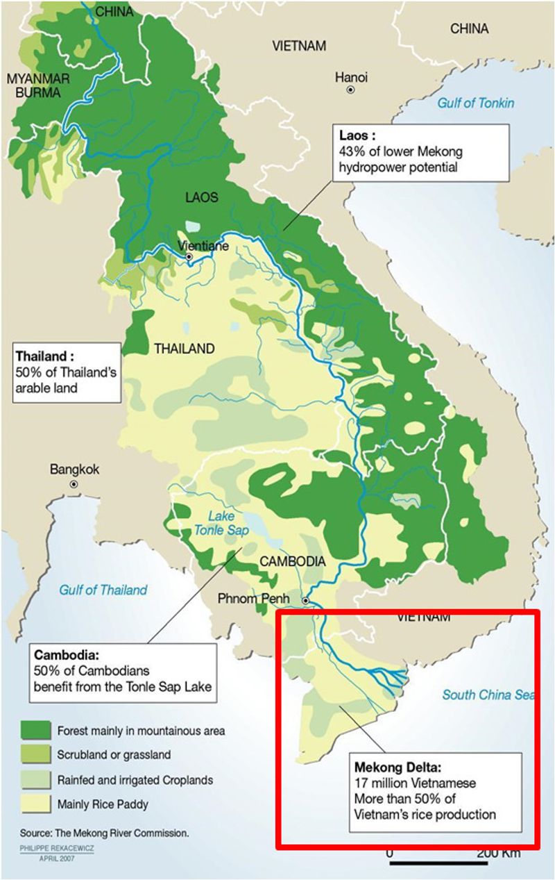
Vietnam’s Mekong Delta serves as the rice bowl of the nation, producing crops that feed the country and supply markets worldwide. Canals crisscross the region, creating a water-based transportation network that defines daily life here.
The delta sinks faster than the South China Sea rises along this coast. Groundwater extraction, sediment trapping by upstream dams, and natural settling all contribute to the problem.
Farmers worry about saltwater pushing farther inland as the land drops, contaminating the fresh water needed for rice cultivation and threatening the agricultural foundation of the entire region.
12. Red River Delta
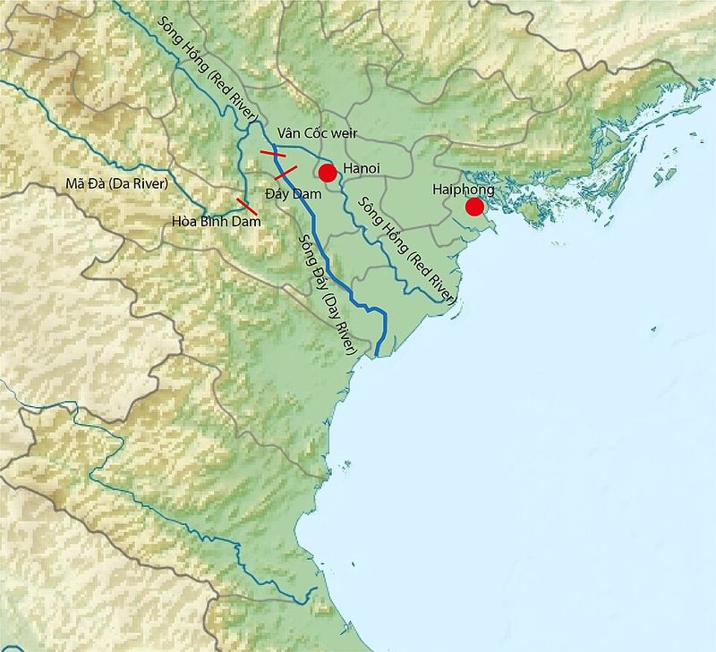
Vietnam’s Red River Delta cradles Hanoi and supports dense populations who have farmed this land for thousands of years. The region’s name comes from the reddish sediment the river once carried in abundance to rebuild the delta naturally.
Measurements confirm subsidence rates that exceed regional sea-level rise along the Gulf of Tonkin. Urban expansion and groundwater use accelerate the sinking beyond natural rates.
Ancient temples and modern buildings alike must contend with shifting foundations as the ground beneath them settles, creating engineering challenges for a region trying to preserve its past while building its future.
13. Ciliwung Delta
Indonesia’s Ciliwung Delta includes parts of Jakarta, a megacity home to millions of people living and working in one of the world’s fastest-sinking major cities. The river flows through the urban landscape before reaching the Java Sea.
Average sinking rates here surpass regional sea-level rise by remarkable margins. Excessive groundwater pumping causes the land to drop so quickly that some neighborhoods have sunk several meters in recent decades.
Buildings tilt, roads crack, and seawalls must constantly be raised to keep the ocean at bay, making this one of the most dramatic examples of delta subsidence anywhere on Earth.
14. Brantas Delta
Indonesia’s Brantas Delta in East Java combines urban centers with agricultural areas that produce crops for local and export markets. The delta meets the Java Sea along a coast shaped by volcanic soil and river deposits.
Subsidence here outpaces how quickly the nearby ocean rises. Industrial growth and water extraction for cities and farms cause the ground to compress and sink steadily.
Coastal communities face increasing flood risks during high tides and storms, while infrastructure like roads and bridges must be designed with the expectation that the ground beneath them will continue dropping in coming years.
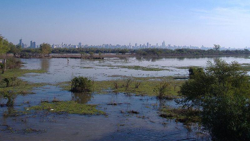
15. Amazon Delta
Brazil’s Amazon Delta represents where the world’s largest river by volume finally reaches the Atlantic Ocean. This massive system moves so much water and sediment that it influences ocean conditions far from shore.
Even here, average subsidence measurements exceed regional sea-level rise in parts of the delta. The weight of accumulated sediments causes natural compaction over time.
Island communities in the delta face changing shorelines and shifting channels as the land settles, affecting navigation routes and fishing grounds that people have relied upon for generations in this remote tropical region.
16. Paraná Delta
Argentina’s Paraná Delta spreads out before reaching the Río de la Plata, creating a unique landscape of islands and waterways near Buenos Aires. Residents travel by boat between communities, and weekend visitors come to enjoy the natural beauty.
Subsidence exceeds regional sea-level rise in this South American delta as well. The thick sediments deposited over millennia compress under their own weight.
Development pressure from nearby urban areas adds stress to the natural system, while changing water levels affect both wildlife habitats and human settlements scattered throughout the delta’s intricate network of channels and islands.
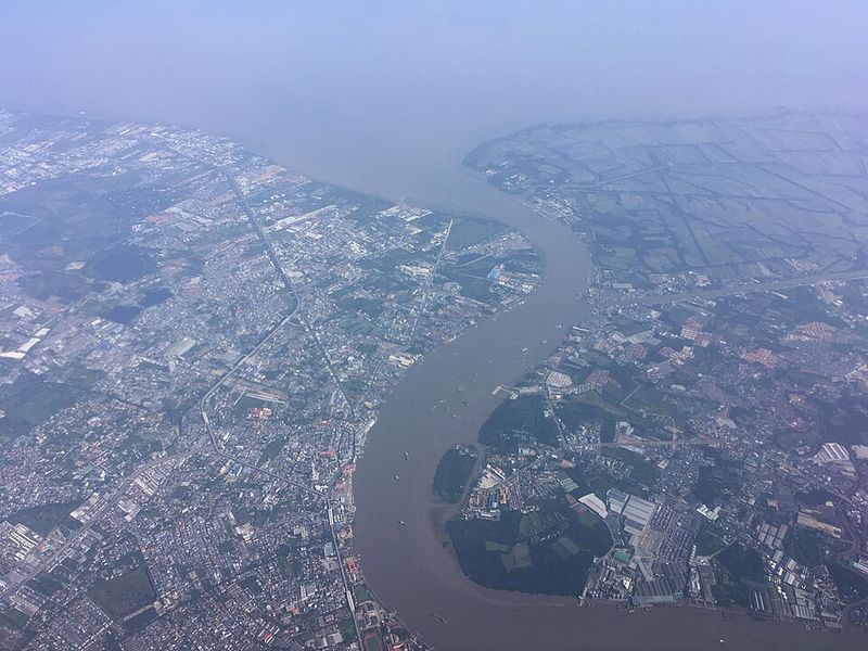
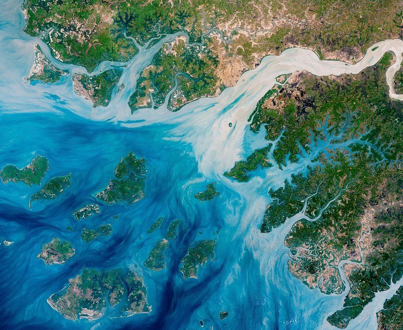
17. Pearl River Delta
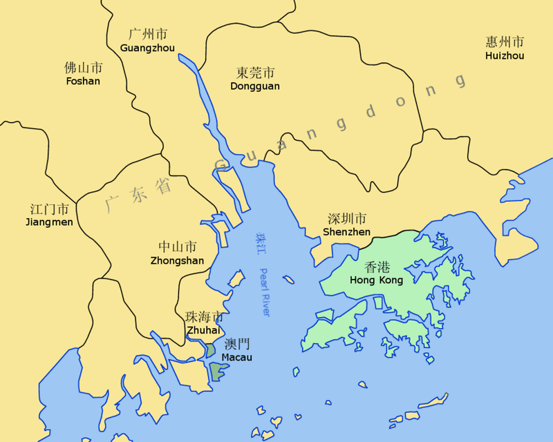
China’s Pearl River Delta contains some of the world’s fastest-growing cities, including Guangzhou, Shenzhen, and Hong Kong. This economic powerhouse drives much of southern China’s manufacturing and trade with global markets.
The land sinks faster than the South China Sea rises along this heavily developed coast. Massive construction projects, groundwater pumping, and the weight of buildings all contribute to subsidence.
Engineers must account for sinking ground when designing skyscrapers and infrastructure, while coastal defenses require constant upgrading to protect trillions of dollars worth of economic assets concentrated in this vital region.
18. Yellow River Delta
China’s Yellow River Delta gets its name from the massive amounts of yellow-brown sediment the river carries from inland plateaus. This delta grows and shifts more dynamically than many others, with the river sometimes changing course dramatically.
Average subsidence rates outpace regional sea-level rise even as new sediment arrives. The soft, recently deposited material compacts quickly under its own weight.
Oil extraction in the region also contributes to ground settling. Wetlands that provide habitat for migrating birds face pressure from both natural subsidence and human development, creating conservation challenges in this rapidly changing landscape.


