Maps tell you where to go, but old routes explain why people went in the first place. Follow the paths that moved ideas, faith, technology, and everyday goods across continents, from Roman paving stones to 20th century asphalt.
You will see how trade networks shaped cities, how pilgrimages built communities, and how engineering kept stretching horizons, decade after decade. If you want travel with context, these roads offer history you can actually stand on while deciding your next turn.
1. Route 66 (USA)
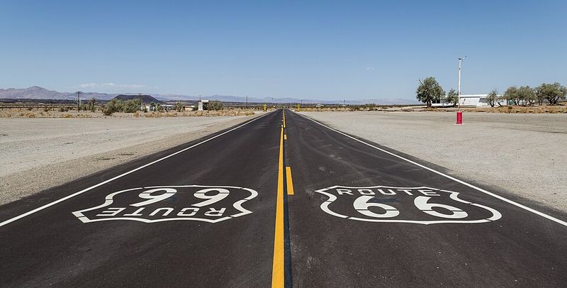
Before GPS rewrote our habits, this ribbon of pavement taught drivers how to cross a continent with confidence and curiosity. Commissioned in 1926, Route 66 linked Chicago to Santa Monica through small towns that promoted motor courts, trading posts, and garages, anchoring a roadside economy that fed midcentury mobility.
Federal decommissioning in 1985 did not end the story, because preservation groups, state byways, and museums kept its landmarks in circulation. You can still trace it through Illinois, Missouri, Oklahoma, Texas, New Mexico, Arizona, and California.
Travel today involves navigating frontage roads, signed historic segments, and downtown alignments bypassed by interstates. Classic stops include Chain of Rocks Bridge, Cadillac Ranch, Wigwam Motels, Blue Swallow Motel, and restored diners featuring regional menus and neon.
The route documents shifts in car culture, advertising, and racial travel guides, including stations listed in the Green Book. Drive slowly, collect stamps at visitor centers, and compare alignments from different decades.
2. The Silk Road (Asia)
Spices, silk, paper, and ideas traveled this web of corridors long before passports and customs lines. Rather than one road, the Silk Road was a cluster of routes linking China with Central Asia, Persia, and the Mediterranean, peaking under Han, Tang, and Mongol patronage.
Caravansaries offered security, taxation points, and marketplaces, knitting cultural exchange with commerce. Buddhism, Islam, and technologies like papermaking moved alongside textiles and ceramics.
Today you can ride trains to Kashgar, wander Samarkand’s Registan, visit Khiva’s city walls, and cross Kyrgyz highlands where nomadic traditions persist. Restored caravanserai sites in Uzbekistan and Azerbaijan show standardized courtyards built for pack animals and merchants.
Museums interpret Sogdian traders and diplomatic missions recorded by Chinese envoys. Border logistics require planning, but visas and e-visas are improving.
Traveling segments rather than the entire network helps you match seasons, avoid extreme passes, and appreciate regional craftsmanship.
3. The Camino de Santiago (Spain)
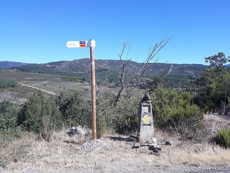
This path began as devotion and matured into one of Europe’s most organized long-distance experiences. Pilgrimage to the Cathedral of Santiago de Compostela dates to at least the 10th century, sponsored by monarchs and monasteries that built bridges, hostels, and hospitals.
Routes like the Francés, Portugués, Primitivo, and del Norte converge on Galicia, each with documented medieval stops. The scallop shell symbol guided travelers long before standardized signage.
Modern infrastructure includes albergues, stamped credencials, and a Compostela certificate for those who complete qualifying distances. You will pass Romanesque portals, waymarked forests, and towns that calibrate daily stages for steady walking.
Municipal, parochial, and private lodging demonstrate how civic and religious institutions continue to share responsibilities. Start early, carry light, and respect local customs shaped by centuries of hospitality.
The Camino shows how repetition across years can build continuity, memory, and practical care.
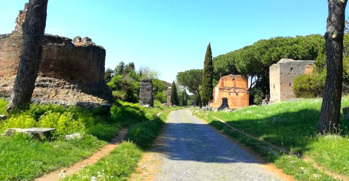
4. The Appian Way (Italy)
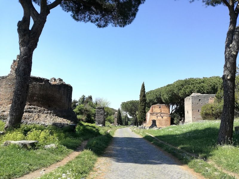
Political power once traveled on stones still visible under your shoes. Built in 312 BCE by Appius Claudius Caecus, the Appian Way connected Rome to Capua and later to Brundisium, standardizing distances, milestones, and road maintenance.
Engineering featured cambered surfaces, drainage ditches, and large basalt pavers that supported armies and merchants. Mausoleums and villas lined stretches, signaling status through architecture bordering critical infrastructure.
Today walkers and cyclists navigate preserved segments in Parco dell’Appia Antica, where traffic restrictions protect fragile paving. Museums interpret milestones, inscriptions, and road tools used by Roman surveyors.
You will notice straight alignments across gentle terrain, then deviations where later periods altered routes. Plan for uneven surfaces and carry shoes that handle polished stone.
The Appian Way clarifies how logistics and law allowed distant provinces to feel administratively close, explaining Rome’s durable administrative reach.
5. The Inca Trail (Peru)
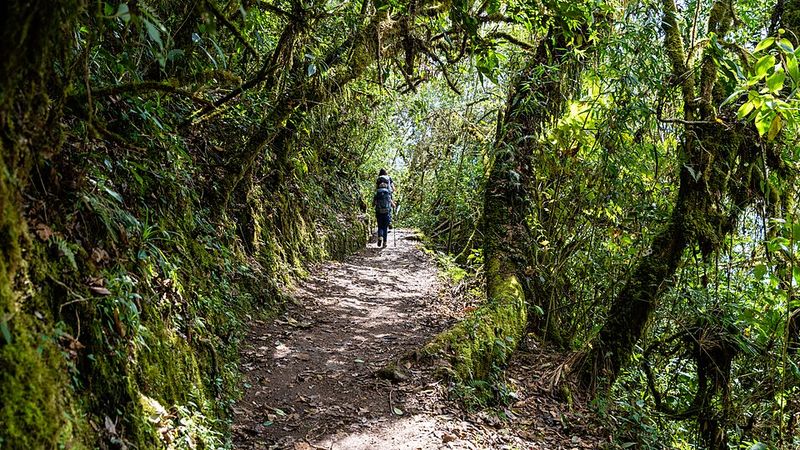
Long before switchbacks had guardrails, the Inca engineered gradients that still demand respect. The Qhapaq Ñan network reached thousands of kilometers, tying highlands and coast with tambos, rope bridges, and administrative checkpoints.
Today’s classic four-day Inca Trail is a curated segment ending at Inti Punku with entry to Machu Picchu, regulated by permits to reduce wear. Archaeological stops like Runkurakay and Wiñay Wayna reveal standardized masonry and agricultural experimentation.
Altitude planning, licensed guides, and staged campsites turn history into an organized challenge. You will learn how runners relayed messages on foot, how terraces stabilized slopes, and how imperial storage buffered climate risk.
Seasonal rains reshape schedules, so shoulder months help with trail conditions. Pack layers, respect carrying limits for porters, and preserve fragile steps by avoiding trekking poles without protectors.
This route shows infrastructure as governance, not just transportation.
6. The King’s Highway (Middle East)
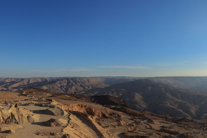
Merchants and pilgrims once measured time by wells along this plateau corridor. The King’s Highway predates Roman engineering and is mentioned in biblical narratives, later becoming a key Umayyad and Abbasid route.
The road threads Madaba’s mosaics, Kerak’s crusader castle, and Petra’s access points, with milestones and watchtowers documenting administrative control. Caravans moved incense and textiles while taxes funded policing and maintenance.
Driving today links preserved churches, early Islamic desert castles, and Nabataean facades without leaving the primary ridge for hours. You will watch geography govern politics as detours descend to Wadi Mujib or continue toward Aqaba and the Red Sea.
Visitor centers outline changing sovereignty, from Roman Provincia Arabia to Ottoman administration and modern Jordanian stewardship. Start early to balance distances and stops.
The King’s Highway proves how continuity can run through faith, commerce, and bureaucracy.
7. The Oregon Trail (USA)
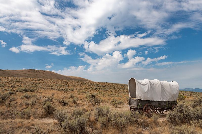
Settlers measured progress in oxen stamina and river crossings rather than mileage apps. During the 1840s to 1860s, an estimated hundreds of thousands moved west via the Oregon Trail toward the Willamette Valley, guided by forts, ferries, and waypoints like Chimney Rock.
Emigrant guides, land policies, and seasonal timing shaped outcomes, while supply lists displayed assumptions about diet and durability. Trails later overlapped railroads and highways, compressing months into hours.
Modern travelers can visit Independence, Fort Laramie, Scotts Bluff, and interpretive centers in Oregon and Idaho. Preserved wagon ruts near Guernsey show track depth from sustained traffic across soft stone.
Museums explain guidebooks, overland diaries, and trail economies surrounding blacksmithing and repair. Drive by car and hike short segments to match interpretive exhibits with terrain.
The trail’s material remains translate large demographic shifts into visible lines on the ground.
8. The Great Ocean Road (Australia)
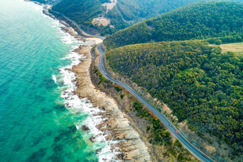
Engineers and returned servicemen turned employment into a monumental coastal project after World War I. Built from 1919 to 1932, the Great Ocean Road linked towns along Victoria’s shore while honoring those who served, blending scenic tourism with commemoration.
The alignment skirts cliffs, farmland, and surf beaches, with interpretive signs that explain blasting methods, early labor camps, and evolving safety standards. Tourism boards later codified photo stops, cementing a drive that balances industry with conservation.
Modern travelers pace the journey between Torquay and Allansford, visiting the heritage arch, Twelve Apostles overlooks, and rainforest detours in Great Otway. Traffic management protects sensitive areas while car parks and boardwalks concentrate footprints.
You will see how 20th century planning integrated memorial culture with public works funding. Travel outside peak periods for easier stops.
The road’s legacy sits in infrastructure that remembers while moving people along.
9. The Via Francigena (Europe)
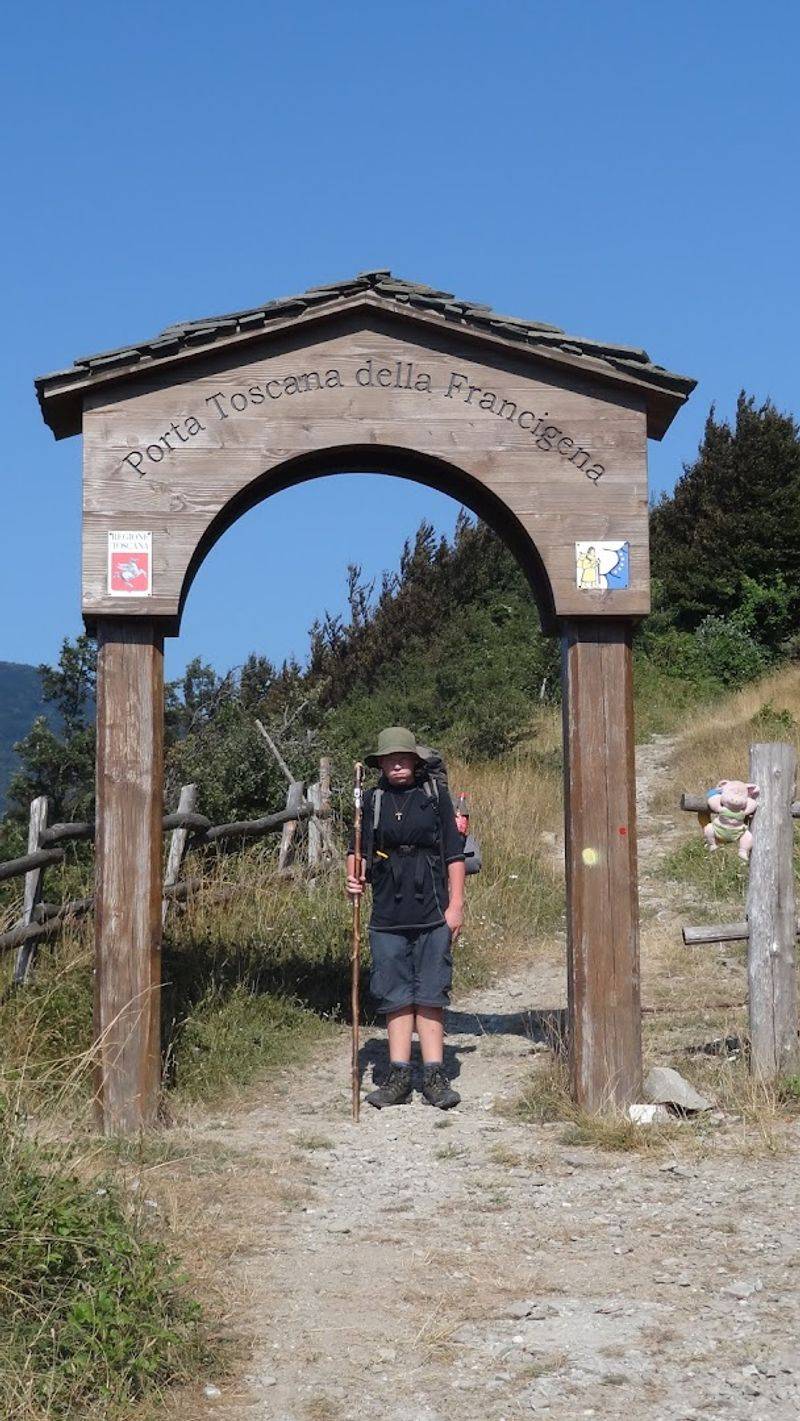
A medieval archbishop’s itinerary became a modern long-distance backbone. The Via Francigena traces Sigeric of Canterbury’s 10th century record to Rome, crossing England, France, Switzerland, and Italy through cathedrals, alpine passes, and Lombard plains.
Stages mirror parish networks that offered lodging, healthcare, and arbitration to travelers. Border crossings became easier with Schengen rules, though alpine weather still sets the calendar.
Today’s walkers collect stamps, sleep in parish houses, and study Romanesque capitals between bakery stops. Signage balances national standards with local markers, so maps help stitch continuity.
The route documents diplomacy, scribal culture, and administrative threads that tied northern Europe to papal authority. Plan for the Great St Bernard Pass snow window and consider alternate valley paths when necessary.
The Via Francigena rewards curiosity about small archives as much as grand basilicas.
10. The Pan-American Highway (Americas)
Cartographers dreamed of a single spine from Alaska to Patagonia, but the real achievement is collaborative patchwork. The Pan-American Highway spans roughly 30,000 kilometers across diverse standards, including the Darién Gap interruption between Panama and Colombia.
Agreements from the 1930s onward coordinated signage, bridges, and funding, while each country maintained sovereignty over design. Travelers experience policy differences through tolls, checkpoints, and fuel options.
Contemporary overlanders collect visas, vehicle permits, and insurance as carefully as spare hoses. Routing choices shape cultural exposure, whether hugging highlands or surfing Pacific stretches.
Border agencies publish updated procedures, and forums share ferry workarounds for the Gap. The project’s history demonstrates how regional integration can advance without uniform engineering.
Drive a section that fits your timeline and learn how the map reflects negotiation as much as asphalt.
11. The Ho Chi Minh Trail (Vietnam)
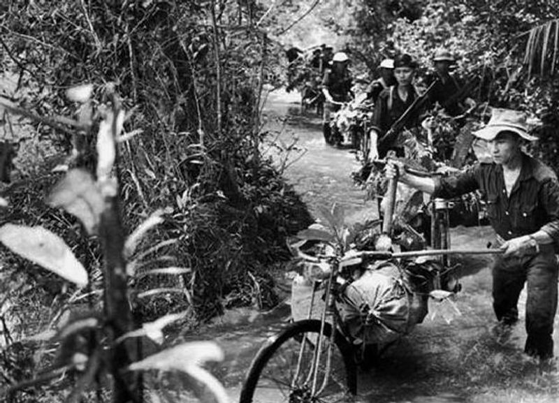
What began as tracks in difficult terrain became a coordinated supply network. The Ho Chi Minh Trail linked North Vietnam to forces in the south through Laos and Cambodia, using camouflage, waystations, and constant rerouting.
Engineering units built pipelines, corduroy roads, and bypasses that adapted under pressure. After the conflict, sections evolved into highways and heritage sites that frame logistics as a decisive capability.
Travelers can drive the Ho Chi Minh Highway, visit museums in Vinh and along the route, and see bridges where documentation explains repair cycles and supply tonnage. Guides describe staging areas, bicycle porters, and nighttime movement as coordinated systems rather than improvisation.
Respect modern borders and plan permits where needed. The journey highlights how infrastructure, when distributed, can resist disruption and later become civil transport.
12. The Grand Trunk Road (South Asia)
From caravans to cargo trucks, this corridor has scaled with each era’s technology. The Grand Trunk Road predates the Mauryas, expanded under Sher Shah Suri in the 16th century with milestones and sarais, and later modernized by the British.
It stretches from Bangladesh through India into Pakistan, linking historic cities like Kolkata, Varanasi, Kanpur, Lahore, and Peshawar. Its trees, bridges, and postal systems reveal how states made time predictable.
Contemporary travel meets dense traffic, but heritage milestones, caravanserais, and colonial bridges remain visible. Museums and archives interpret toll policies, revenue farming, and roadside services that shaped entrepreneurial cultures.
Plan segments that pair major cities with smaller market towns to see continuity in supply chains. Local cuisine at dhabas shows how logistics supports hospitality.
The road distills administrative ambition into physical markers you can still read.
13. The Old Salt Route (Germany)
Before refrigeration, salt decided which towns prospered. The Old Salt Route moved Lüneburg’s salt to Lübeck and the Baltic, underwriting Hanseatic power and distinctive brick Gothic architecture.
Carters tracked distances by axle counts, and toll posts enforced civic rules that funded maintenance. Warehouses, guildhalls, and cranes reveal organized logistics systematized long before rail.
Today cyclists follow signposted routes through forests, lakes, and canal towns, visiting salinas, salt museums, and medieval storehouses. You will see how infrastructure like the Stecknitz Canal shortened transport and changed market rhythms.
Regional passes bundle museum entries with transit discounts. Pace your ride to linger in marketplaces that still mirror trade geometry.
The route turns an everyday mineral into a lesson on urban finance.
14. The Dalton Highway (Alaska)
Truckers built the routine that tourists now borrow. The Dalton Highway, opened in 1974 to support the Trans Alaska Pipeline, runs from near Fairbanks to Deadhorse with minimal services and strict seasonal constraints.
The road’s design prioritizes heavy loads, wide turnouts, and rapid maintenance, explaining long gravel stretches and posted rules. Pipeline history markers describe construction camps, permafrost engineering, and environmental protocols.
Travel demands self-sufficiency, spare tires, and flexible pacing, but rewards include Arctic Circle markers and tundra interpretive panels. You can compare infrastructure eras by noting pipeline burials versus aboveground sections that manage heat.
Lodging and fuel are spaced far apart, so itineraries should reflect conservative margins. The Dalton shows how resource corridors become public adventures when policies open access responsibly.
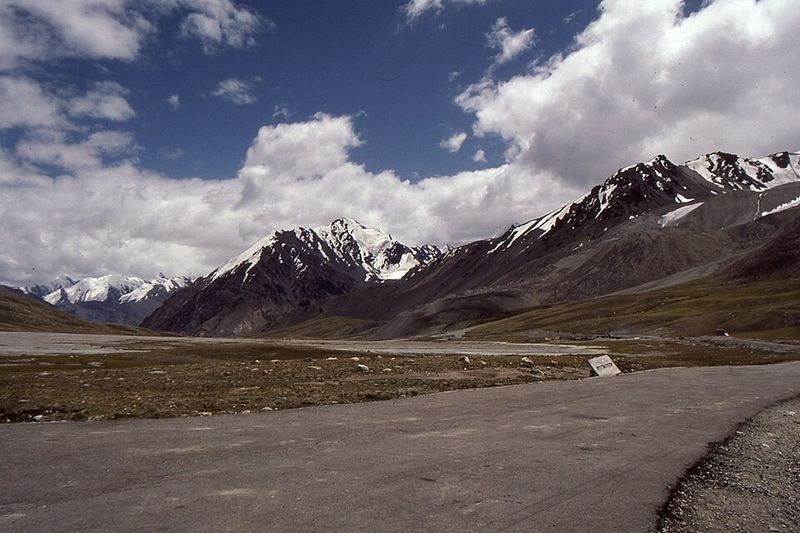
15. The Karakoram Highway (China–Pakistan)
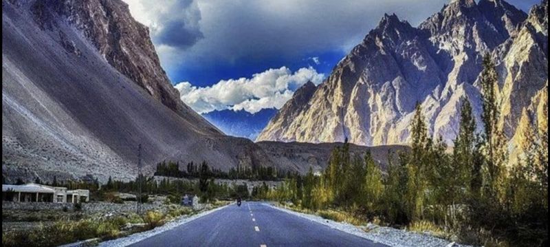
Geology wrote the problem set and crews answered with dynamite and persistence. The Karakoram Highway, completed in 1979 and later upgraded, follows ancient tracks along the Indus and Hunza valleys, stitching Pakistan and China across the Khunjerab Pass.
The route exposed fossils, petroglyphs, and archaeological sites while creating new markets in mountain towns. Landslide management and seasonal closures remain part of the operating manual.
Travelers combine viewpoints at Passu Cones, Attabad Lake detours, and border formalities at high elevation. You will see decorated trucks, restored stone towers, and signage that credits joint surveys and labor.
Weather, altitude, and construction zones require patience, but the payoff is a living classroom on tectonics and diplomacy. Carry identification and plan around checkpoint schedules.
The highway modernizes an old exchange corridor without erasing it.
16. Natchez Trace Parkway
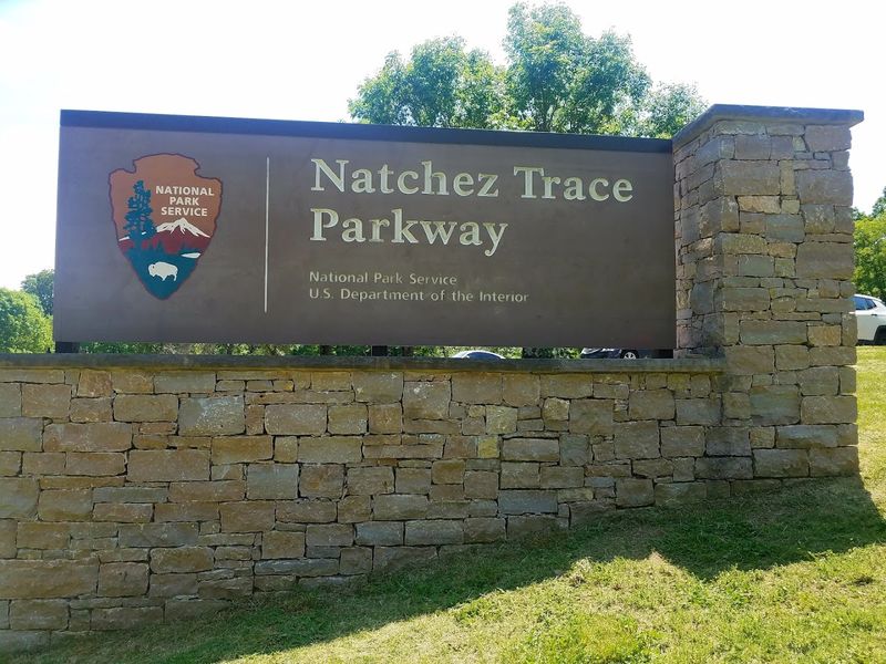
Postal riders, traders, and Native nations once chose this ridge for practical reasons you can still observe. The Natchez Trace links Nashville to Natchez along a 444-mile corridor that overlays a prehistoric path recorded in early American diaries.
Stands, or waystations, evolved into centers of trade and news, while treaties and roadworks formalized maintenance. The modern parkway protects viewsheds, bans commercial traffic, and adds milepost interpretation.
Driving the Trace guides you to Emerald Mound, Mount Locust, and Sunken Trace segments where soil erosion reveals repeated passage. Cyclists benefit from controlled speeds and widely spaced services.
Historical panels address Choctaw and Chickasaw homelands with growing attention to accurate representation. Reserve time for side trips into small towns shaped by the route’s economy.
The Trace translates layered mobility into a deliberately calm drive.
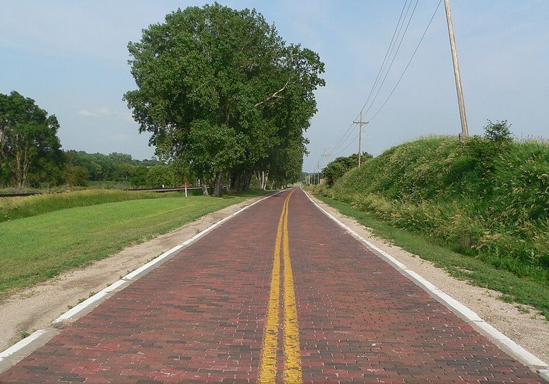
17. Lincoln Highway
Before federal numbering, a private association sold a bold idea with bold signs. Founded in 1913, the Lincoln Highway stitched existing roads into a transcontinental route from New York City to San Francisco, funding improvements through publicity and local buy-in.
Concrete markers, guidebooks, and seedling miles promoted standardization that later informed U.S. Highways.
Communities competed for alignment, proving branding could move asphalt.
Modern explorers target preserved brick segments in Ohio, interpretive centers in Nebraska, and Sierra grades that taught early motorists patience. You will spot stenciled L logos, restored garages, and diners that owe their siting to traffic forecasts.
The highway’s archives capture the moment when motorists demanded reliable surfaces and predictable signage. Plan segments that showcase original alignments rather than bypasses.
The journey explains how civic enthusiasm accelerated national connectivity.
18. Mojave Road
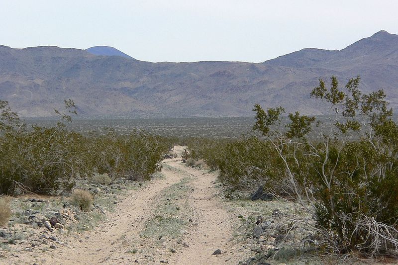
Water sources, not waypoints, determined success along this 147-mile desert corridor. The Mojave Road follows Native American paths later adopted by mail carriers, military scouts, and settlers who relied on reliable springs.
The modern trail, mostly unpaved within Mojave National Preserve, requires high-clearance vehicles and careful preparation. Historic markers identify Fort Piute, Government Holes, and crossings that concentrated decision making.
Travelers learn how logistics scale down in dry country where a shovel beats style points. Maps emphasize dry lakebeds, washouts, and detours that protect habitat.
Permits, tire repair kits, and convoy planning turn history into a competent weekend. Museums in Barstow and Baker interpret route evolution using diaries and quartermaster records.
The Mojave Road rewards those who treat navigation as respect for constraints.
19. Historic Route 20
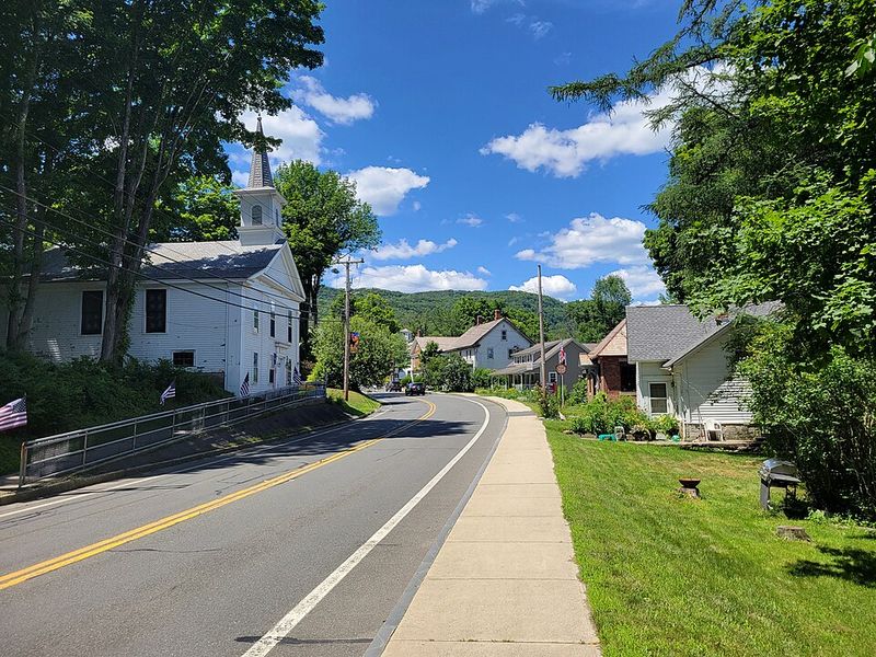
Stretching from Boston to Newport, Oregon, U.S. Route 20 is the nation’s longest road and a time capsule of evolving standards.
Established in 1926 and extended west in 1940s realignments, it predates many interstates and still connects courthouse squares, university towns, and national parks. Historic Route 20 groups now publish maps to highlight original alignments and roadside heritage.
Travelers can chain together New England mill towns, Midwest farm grids, and mountain passes without leaving the backbone. Interpretive efforts spotlight early concrete paving, steel truss bridges, and automotive services that shaped migration between decades.
Plan modest daily distances to appreciate courthouse murals and museum collections that highways bypass. The route shows continuity as a civic choice made town by town.


