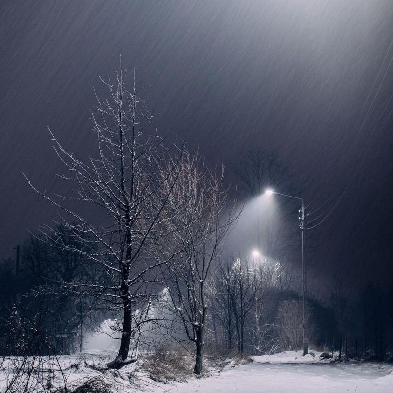
A powerful winter storm is sweeping across large sections of the United States, bringing heavy snowfall, icy conditions, and dangerous travel to millions of people. Communities from the Midwest through the Northeast are bracing for significant accumulations that could disrupt daily life for days. Understanding what to expect and how to stay safe during this weather event is essential for everyone in the storm’s path.
1. Big footprint: More than 50 million people are under winter storm advisories across the Midwest, Appalachians, and Northeast.
More than 50 million Americans woke up to winter storm advisories stretching across a massive swath of the country. From the plains of the Midwest to the rolling Appalachian Mountains and all the way to the coastal Northeast, families are preparing for a serious weather event.
Weather officials issued these advisories to warn residents about dangerous conditions ahead. The sheer size of this storm makes it one of the most significant winter weather events of the season so far.
When such a large population faces winter weather simultaneously, it creates challenges for emergency services, transportation networks, and everyday activities. Staying informed through local weather updates becomes crucial during events of this magnitude. Communities across multiple states are working together to keep roads clear and residents safe throughout the duration of this powerful winter system.
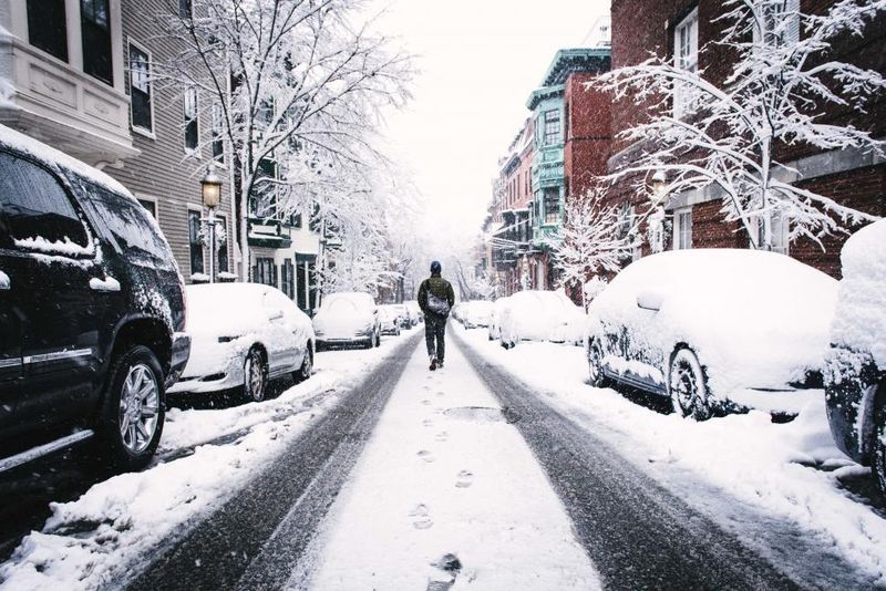
2. Hefty totals: Up to a foot of snow is forecast from the Ohio Valley through Pennsylvania, upstate New York, and into New England. Heaviest bands may drop ~1 inch/hour.
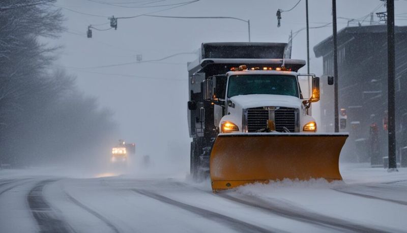
Snowfall totals could reach an impressive foot in many areas along the storm’s path. Regions stretching from the Ohio Valley eastward through Pennsylvania, upstate New York, and into New England should prepare for significant accumulations that will blanket roads, roofs, and yards.
The most intense snow bands are expected to drop snow at a rate of about one inch every hour. That kind of snowfall rate makes it nearly impossible for plows to keep up, even on major highways.
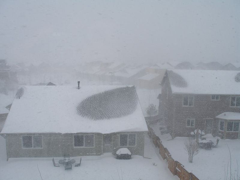
A foot of snow might not sound like much to seasoned winter veterans, but it’s enough to paralyze unprepared communities. Schools close, businesses shut down, and travel becomes treacherous. Residents in the forecast zone should stock up on supplies, charge devices, and avoid unnecessary trips outdoors while the heaviest snow falls.
3. What’s already fallen: By early Tuesday afternoon, 3–5 inches had been reported in parts of Indiana, Pennsylvania, central New York, and New England, with more through the day.
Snow began piling up quickly across several states by Tuesday afternoon. Reports from Indiana, Pennsylvania, central New York, and New England confirmed that 3 to 5 inches had already blanketed the ground, with no signs of letting up.
Residents ventured outside to shovel driveways and clear walkways, knowing more snow was on the way. Early accumulations like these set the stage for even more challenging conditions as the storm intensifies throughout the day.
Seeing several inches fall in just a few hours reminds everyone how quickly winter weather can transform a normal Tuesday into a snow day. Local weather stations tracked the snow’s progress minute by minute, helping communities prepare for additional accumulation. As the afternoon wore on, forecasters warned that totals would continue climbing well into the evening hours.
4. Schools impacted: Hundreds of districts from Cincinnati and western Pennsylvania to New Hampshire and Maine closed or delayed.
School administrators across hundreds of districts made the tough call to close or delay classes. From Cincinnati and western Pennsylvania all the way north to New Hampshire and Maine, students celebrated unexpected days off while parents scrambled to adjust work schedules.
Safety always comes first when winter weather threatens bus routes and walking paths. Icy roads and reduced visibility make it dangerous for children to travel to and from school, so closures become necessary.
For many families, snow days bring both joy and stress. Kids bundle up for sledding adventures while parents work from home or arrange childcare. Teachers pivot to remote learning when possible, trying to keep education on track despite Mother Nature’s interruption. These widespread closures highlight just how seriously communities take winter storm warnings when children’s safety is on the line.
5. I-95 corridor mostly wet: Areas east of I-95 (including Washington, Philadelphia, and New York City) are expected to see rain or freezing rain as temps hover above freezing; Boston may flip between snow and rain.
Geography plays a fascinating role in what type of precipitation falls during winter storms. Areas east of Interstate 95, including major cities like Washington, Philadelphia, and New York City, will likely see rain or freezing rain instead of snow because temperatures stay just above freezing.
That narrow temperature difference between snow and rain can mean vastly different conditions for neighboring communities. Boston sits right on the edge, where conditions could flip back and forth between snow and rain throughout the storm.
While rain might seem preferable to snow, freezing rain creates its own hazards. When raindrops hit cold surfaces, they instantly freeze, coating everything in a slick layer of ice. Drivers should exercise extreme caution, and pedestrians need to watch for slippery sidewalks. Coastal cities often experience these mixed precipitation events during winter storms.
6. Appalachian icing: Parts of the central and southern Appalachians face freezing rain and slick roads.
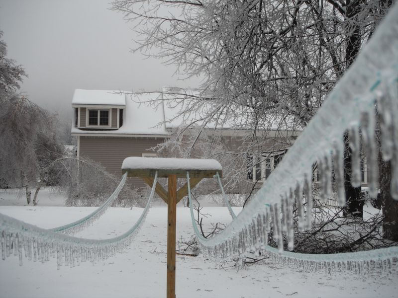
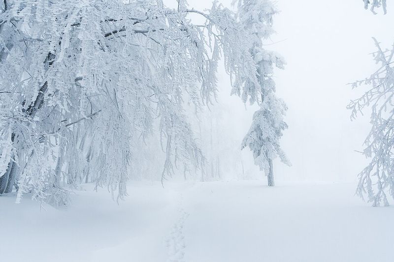
Mountain communities throughout the central and southern Appalachians face a particularly dangerous threat from this storm. Freezing rain is coating roads, trees, and power lines with thick ice, creating treacherous conditions on winding mountain highways.
Ice storms in mountainous terrain present unique challenges. Steep grades become nearly impossible to navigate safely, and emergency vehicles struggle to reach people who need help.
Power outages often follow ice accumulation when heavy ice weighs down tree branches and power lines until they snap. Residents in these areas know to prepare with flashlights, extra blankets, and battery-powered radios. The beauty of ice-coated forests comes with serious risks. Avoiding travel during ice storms saves lives, and those who must venture out should move slowly and carefully, understanding that conditions can change dramatically from one bend in the road to the next.
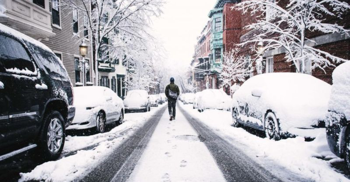
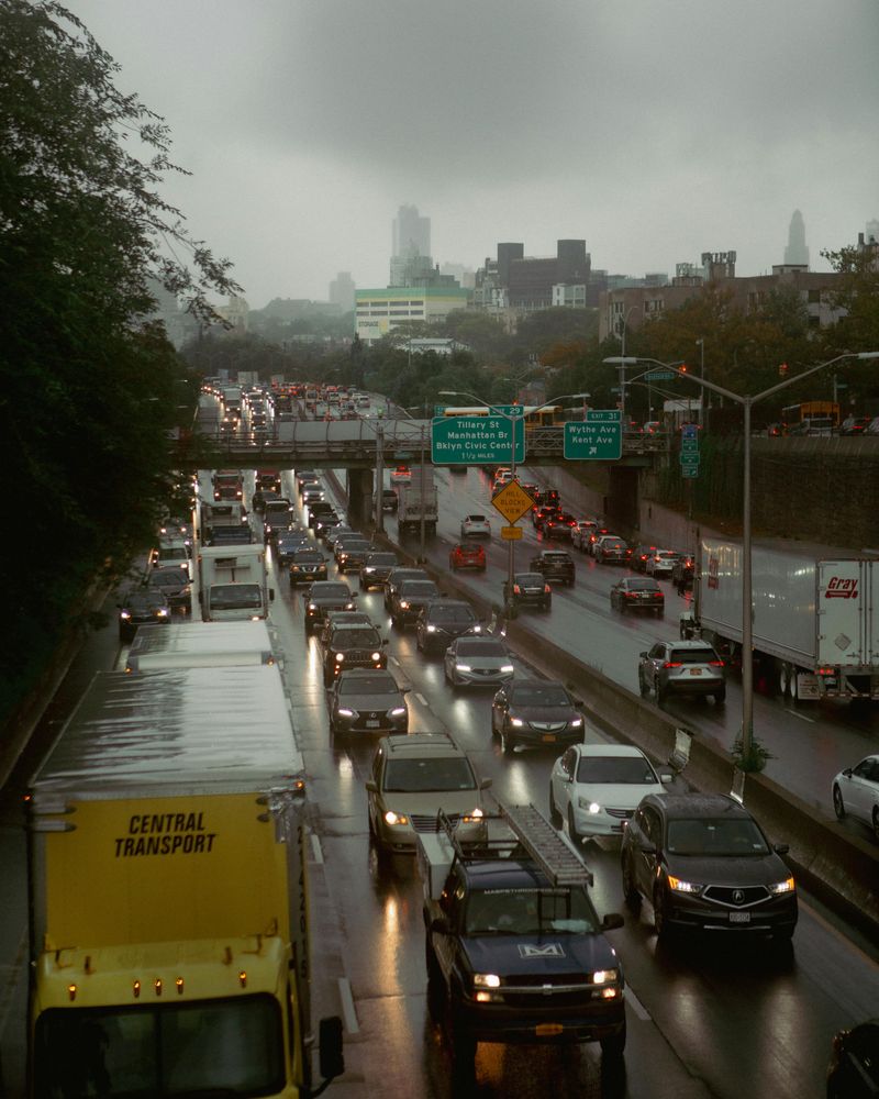
7. Travel advice: NWS forecasters urged: “If you don’t have to be on the roads today, stay home”—and leave extra time if you must travel.
National Weather Service forecasters issued a clear and direct message to everyone in the storm’s path. Their advice? Stay home if possible. When severe winter weather strikes, the safest place to be is indoors, away from dangerous road conditions.
Sometimes travel becomes unavoidable despite the warnings. Essential workers, medical emergencies, and other urgent situations require people to venture out even in terrible weather.
For those who absolutely must travel, forecasters stress the importance of allowing extra time. Trips that normally take 30 minutes might require an hour or more in snow and ice. Drivers should pack emergency supplies like blankets, water, snacks, and phone chargers in case they get stranded. Rushing in winter weather leads to accidents, so patience becomes as important as proper tires and careful driving techniques.
8. Timing: The storm intensifies through Tuesday with snow continuing during the day across interior sections.

Understanding a storm’s timing helps people plan their day and stay safe. This particular system intensifies throughout Tuesday, meaning conditions worsen as the day progresses rather than improving.
Interior sections away from the coast will see continuous snowfall during daylight hours. Morning flurries give way to heavier bands by afternoon, with the most intense snow likely during the evening commute.
Timing matters enormously for school closures, work schedules, and travel plans. Knowing that conditions deteriorate as Tuesday unfolds allows families to make smart decisions about staying put. Evening commutes could become especially challenging as snow accumulation reaches its peak and visibility drops. Meteorologists track these timing details carefully, using computer models and radar to predict when conditions will be worst. Paying attention to these hourly forecasts helps everyone stay one step ahead of dangerous weather.
9. Late-week pattern: An Arctic front is expected Thursday, likely bringing additional snow showers to parts of the Northeast and Mid-Atlantic (generally light accumulations).
Just when communities start digging out from Tuesday’s storm, another weather system arrives. An Arctic front is forecast to sweep through on Thursday, bringing a blast of frigid air and additional snow showers to parts of the Northeast and Mid-Atlantic.
Fortunately, this second round isn’t expected to produce the heavy accumulations seen earlier in the week. Light snow showers will dust the landscape but shouldn’t cause the same level of disruption.
Arctic fronts bring more than just snow; they usher in bone-chilling cold that makes any snow that has fallen stick around longer. Temperatures plummet, wind chills become dangerous, and heating systems work overtime. While the snow amounts might be lighter, the cold itself poses risks for people without adequate shelter or heat. Communities should remain vigilant throughout the week as winter refuses to loosen its grip on the region.
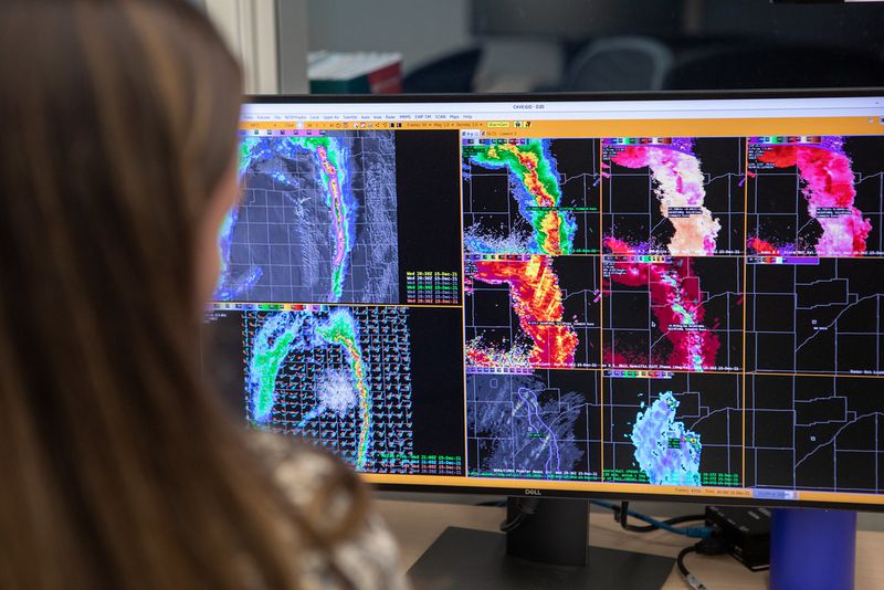
10. Stay tuned to official forecasts: The National Weather Service highlights a winter storm impacting the northern Mid-Atlantic and interior Northeast; check your local office for the latest warnings and totals.
Winter storms evolve quickly, and forecasts change as new data becomes available. The National Weather Service continuously monitors this system as it impacts the northern Mid-Atlantic and interior Northeast, updating warnings and snow total predictions throughout the event.
Your local National Weather Service office provides the most accurate and detailed information for your specific area. National forecasts give a broad overview, but local offices understand regional weather patterns and can pinpoint exactly what your community should expect.
Checking official forecasts regularly keeps you informed about changing conditions. Download weather apps, follow local meteorologists on social media, and sign up for emergency alerts through your county or town. Reliable information helps you make smart decisions about travel, school, work, and safety. Ignoring official warnings or relying on outdated information puts you at unnecessary risk during significant winter weather events like this one.


