
Finding public land boundaries can save you from accidentally trespassing and help you discover amazing outdoor adventures. Whether you’re planning a hiking trip, looking for camping spots, or just curious about what land is open to the public, knowing where boundaries lie is crucial. Fortunately, you don’t need expensive equipment or professional surveys to locate these boundaries.
1. Government Mapping Tools and Online Portals

Federal agencies offer powerful mapping resources that most people never know exist. The U.S. Geological Survey provides detailed topographic maps showing national forests, parks, and public land boundaries with incredible precision.
Bureau of Land Management maps excel for Western states, revealing vast public lands and access points. Many state and county governments run Geographic Information System portals where you can view property lines and ownership details.
These official sources provide the most accurate boundary information available, often updated regularly by surveyors and land management professionals.
2. Park Service and Forest Service Official Websites

National parks and forests maintain comprehensive boundary maps on their official websites, often overlooked by visitors. These maps highlight access points, trailheads, and restricted zones with remarkable detail.
State park websites frequently include downloadable boundary maps and seasonal closure information. Forest Service sites provide timber sale areas, wilderness boundaries, and special use permits that affect public access.
Park rangers update these digital resources regularly, making them more current than many third-party mapping services. Always check official sites before your trip for the latest boundary changes.
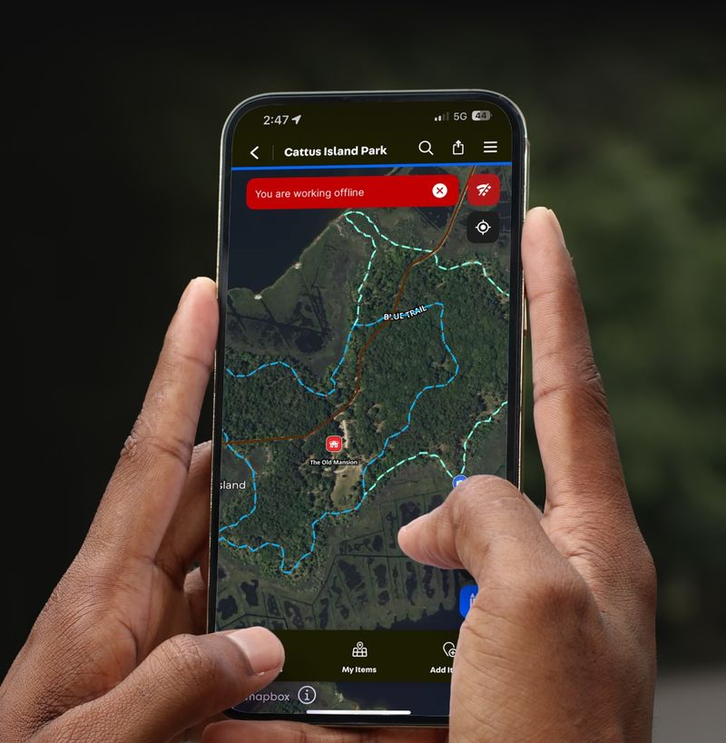
3. Free Mobile Apps with Land Overlay Features
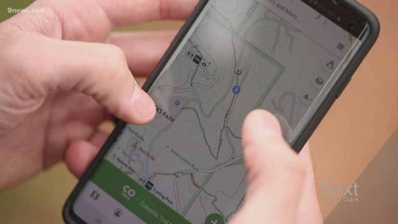
Modern smartphone apps bring professional-grade mapping tools to your pocket without subscription fees. Gaia GPS offers free map layers including trails and public land boundaries, perfect for backcountry navigation.
Avenza Maps allows downloading georeferenced maps provided directly by government agencies. Even premium apps like onX Hunt offer free trials or web versions showing detailed boundary information.
These apps work offline once downloaded, making them invaluable for remote areas where cell service disappears. GPS accuracy helps pinpoint your exact location relative to boundary lines.
4. County Assessor Records and Parcel Maps
County assessor websites contain treasure troves of property information, including detailed parcel maps with clear boundary lines. While not always labeled as public versus private, government agency ownership indicates public land.
Property tax records reveal ownership details, acreage, and legal descriptions of land parcels. Many counties provide interactive mapping tools showing adjacent properties and their boundaries.
These records undergo regular updates for taxation purposes, ensuring accuracy. Search by address, parcel number, or owner name to find specific boundary information for any area.
5. Ranger Stations and Visitor Center Resources
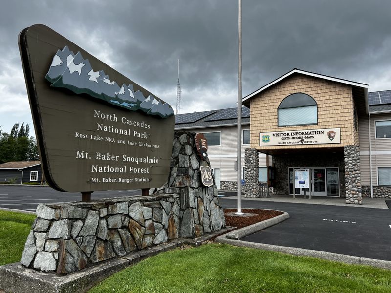
Local ranger stations serve as goldmines of boundary information, offering free printed maps and expert guidance. Staff members possess intimate knowledge of seasonal closures, restricted areas, and access point changes.
Visitor centers provide updated boundary maps reflecting recent acquisitions, easements, or policy changes. Rangers can explain complex boundary situations involving private inholdings within public lands.
Face-to-face conversations reveal insider tips about unmarked trails, seasonal restrictions, and local regulations. Many stations offer specialized maps unavailable online, including hunting unit boundaries and fire closure areas.
6. Protected Areas Database Research Tools
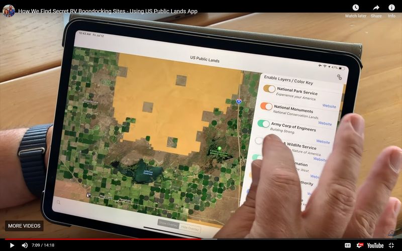
The U.S. Geological Survey maintains the Protected Areas Database, covering over three billion acres of public lands and marine areas. This comprehensive inventory includes federal, state, and local protected areas managed by thousands of agencies.
PAD-US provides detailed boundary data for parks, wilderness areas, wildlife refuges, and recreational lands. Interactive mapping tools allow searching by location, management agency, or protection status.
Regular updates ensure current information about land acquisitions, boundary adjustments, and management changes. Professional land managers rely on this database for official boundary determinations.
7. Physical Boundary Markers and Field Signs

Ground-level exploration reveals physical markers that digital maps sometimes miss, including boundary signs, fences, and survey posts. Public lands often feature clear signage at access points and major boundary crossings.
Wilderness area boundaries typically display distinctive markers and regulatory signs. Private property owners frequently post obvious boundary indicators like gates, fences, or warning signs.
Combining digital maps with physical markers provides the most reliable boundary identification. Survey monuments, when present, offer precise legal boundary points established by professional surveyors for definitive land demarcation.


