America has some of the most beautiful highways in the world, but not every road is safe for a casual Sunday drive. Some routes are so treacherous that people who live nearby think twice before traveling them. From icy mountain passes to lonely desert stretches where help is hours away, these roads demand respect, preparation, and sometimes a little bit of courage.
1. Dalton Highway (Alaska)
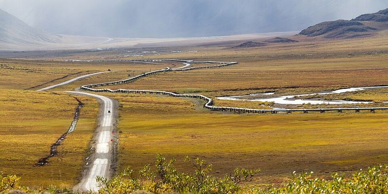
Stretching over 400 miles through the Alaskan wilderness, this mostly gravel route takes you deep into Arctic territory where cell service is a distant memory. Winters bring blizzards and temperatures that can freeze your car battery in minutes. Summers offer mud, dust, and swarms of bugs big enough to block your windshield.
Services are scarce, with only three tiny towns along the entire highway. If your vehicle breaks down, you could wait hours or even days for help. Wildlife like caribou and bears often wander onto the road, adding another layer of danger to an already nerve-wracking journey.
2. U.S. Highway 50 (Nevada segment)
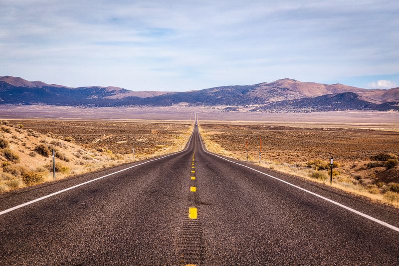
Known as “The Loneliest Road in America,” this Nevada stretch lives up to its nickname in the most unsettling way. You can drive for an hour without seeing another car, gas station, or even a tree. Summer temperatures soar past 100 degrees, and if your air conditioning quits, things get dangerous fast.
Breaking down here means you’re stranded in true isolation. Cell towers are almost nonexistent, so calling for help becomes impossible. Locals always tell visitors to pack extra water, food, and fuel before attempting this route, because the desert shows no mercy to the unprepared.
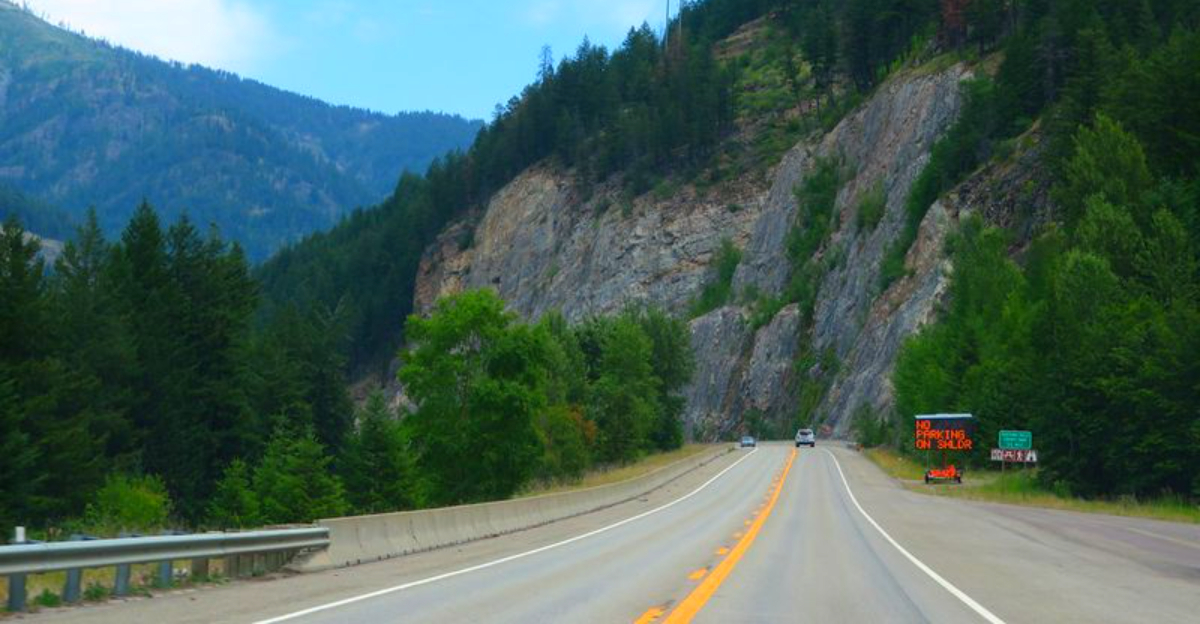
3. U.S. Route 285 (New Mexico)
Locals call this stretch between Vaughn and Roswell the “Death Highway,” and the nickname isn’t an exaggeration. Oil and gas trucks rumble along this two-lane road day and night, and impatient drivers often make deadly passing attempts. The isolation means emergency responders take longer to arrive after crashes.
Speed limits feel like suggestions to some truckers racing to meet deadlines. Head-on collisions happen with frightening regularity, especially at night when visibility drops. If you must travel this route, stay alert every single mile and resist any urge to speed past slow-moving vehicles.
4. U.S. Route 129 / Tail of the Dragon (Tennessee/North Carolina)
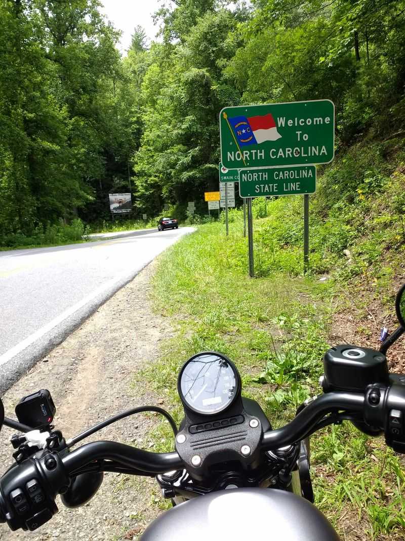
With 318 curves packed into just 11 miles, this mountain road is a magnet for thrill-seekers and a nightmare for cautious drivers. Motorcyclists flock here to test their skills, but many end up testing the local hospital staff instead. Parts of the route have zero guardrails, meaning one wrong move sends you tumbling down the mountainside.
The tight turns come so fast that even experienced drivers feel their hearts race. Crossing the center line happens easily when you’re focused on the curve ahead. Accident rates stay high year-round, with memorial markers along the roadside serving as sobering reminders.
5. Pikes Peak Highway (Colorado)
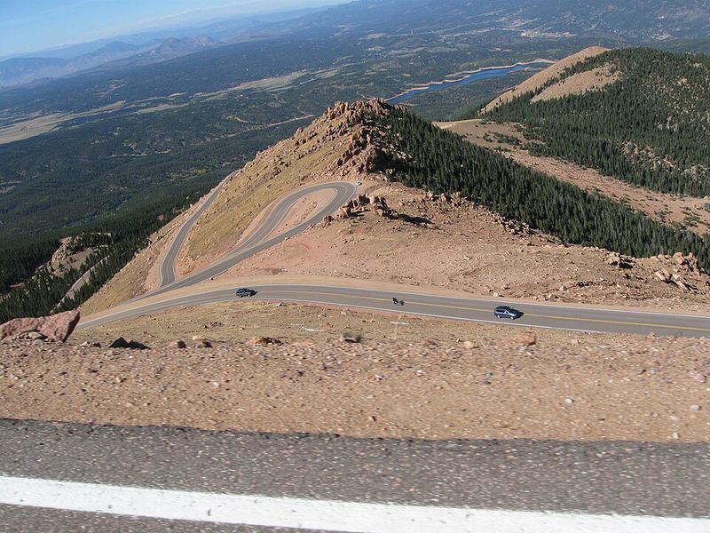
This 19-mile climb to over 14,000 feet elevation tests both your nerves and your vehicle’s brakes. Hairpin turns with steep drop-offs appear around every corner, and the thin air at the summit can make you dizzy before you even start descending. Weather changes happen in minutes, turning sunny skies into blinding snowstorms.
Your brakes work overtime on the way down, and overheating can cause total brake failure. Rangers recommend stopping frequently to let them cool, but some drivers ignore this advice and pay a terrifying price. Altitude sickness affects passengers too, making an already stressful drive even more uncomfortable.
6. Moki Dugway / Utah Highway 261
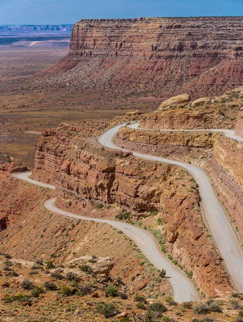
Carved into a cliff face, this three-mile gravel section drops over 1,000 feet through tight switchbacks that make your stomach flip. Grades reach 10 to 11 percent, and there are no guardrails to catch you if you drift too close to the edge. Large RVs and trailers should avoid this route entirely unless the driver enjoys pure terror.
Loose gravel reduces traction, especially during descent when gravity pulls your vehicle faster than you’d like. One-lane sections mean you might meet another vehicle coming the opposite direction with nowhere to go. The views are stunning, but you’ll be too focused on survival to enjoy them properly.
7. Blue Ridge Parkway (Virginia/North Carolina)
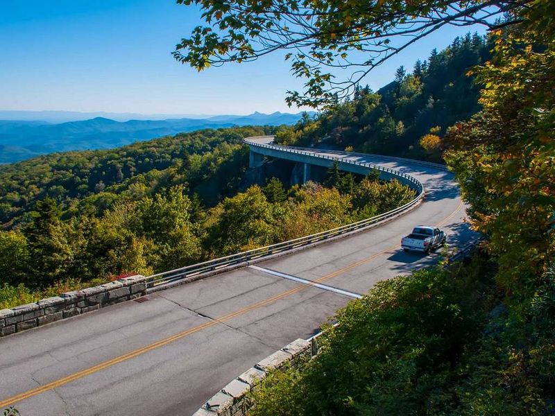
Beauty and danger share the same winding pavement along this famous scenic route. Fog rolls in without warning, cutting visibility to just a few feet and turning gentle curves into guessing games. Deer leap onto the road at dawn and dusk, causing hundreds of collisions each year.
The National Park Service reports around 200 vehicle accidents annually, many involving tourists unfamiliar with mountain driving. Steep drop-offs line sections of the parkway, and distracted drivers admiring the views sometimes drift into oncoming traffic. Winter ice and summer storms create additional hazards that catch visitors off guard, making this pretty drive more perilous than most expect.
8. Interstate 4 (Florida)
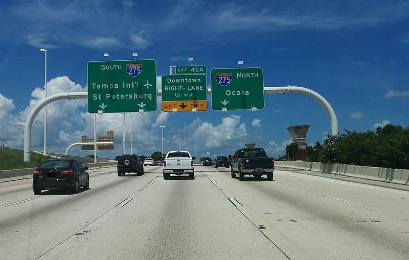
Running between Tampa and Daytona Beach, this highway has earned a reputation as one of America’s deadliest stretches of interstate. Tourists unfamiliar with the area mix with frustrated locals, creating a chaotic blend of aggressive driving and confused lane changes. Construction zones pop up constantly, narrowing lanes and forcing sudden merges.
Fatal crash rates per mile rank among the highest in the nation. The narrow lanes leave little room for error, and distracted drivers cause chain-reaction pileups during rush hour. Rain makes things worse, as Florida’s sudden downpours turn the pavement slick while drivers maintain highway speeds.
9. Interstate 95 (Eastern Seaboard)

Stretching from Maine to Florida, this major artery carries millions of vehicles through vastly different driving conditions and driver skill levels. Some sections see constant traffic jams while others tempt speeders with open lanes. The mix creates unpredictable situations where accidents happen daily.
Fatality rates per 100 miles place this interstate among the most dangerous in America. Weather varies wildly along the route, from ice storms in the north to tropical downpours in the south. Tired truckers sharing the road with vacationing families creates a recipe for disaster, especially during holiday weekends when traffic volume doubles.
10. Overseas Highway (U.S. 1 in Florida Keys)
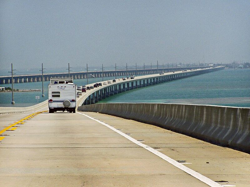
Connecting the Florida Keys through a series of bridges and causeways, this route leaves you exposed to whatever weather the ocean throws your way. Narrow lanes offer almost no shoulder, so any mistake could send you into the Atlantic. Hurricane season brings storm surges that can wash over the low-lying road completely.
Traffic backs up easily since there’s literally nowhere else to go, and impatient drivers make risky passing attempts. Strong crosswinds buffet high-profile vehicles like RVs and trucks. Rising sea levels threaten the highway’s future, but for now, it remains the only way to reach the Keys by car.
11. U.S. Route 17 (Southeast coastal roads)
Winding along the Southeast coast, this two-lane route sees far too many head-on collisions for comfort. Limited passing zones tempt impatient drivers to take dangerous chances, often with fatal results. The road carries both local traffic and tourists, creating speed mismatches that lead to rear-end crashes.
Many sections lack center barriers, meaning only a painted line separates you from oncoming vehicles. Distracted driving or a moment of drowsiness can drift you into the opposite lane. Emergency responders know this route well, unfortunately, because they’re called to serious accidents here regularly throughout the year.
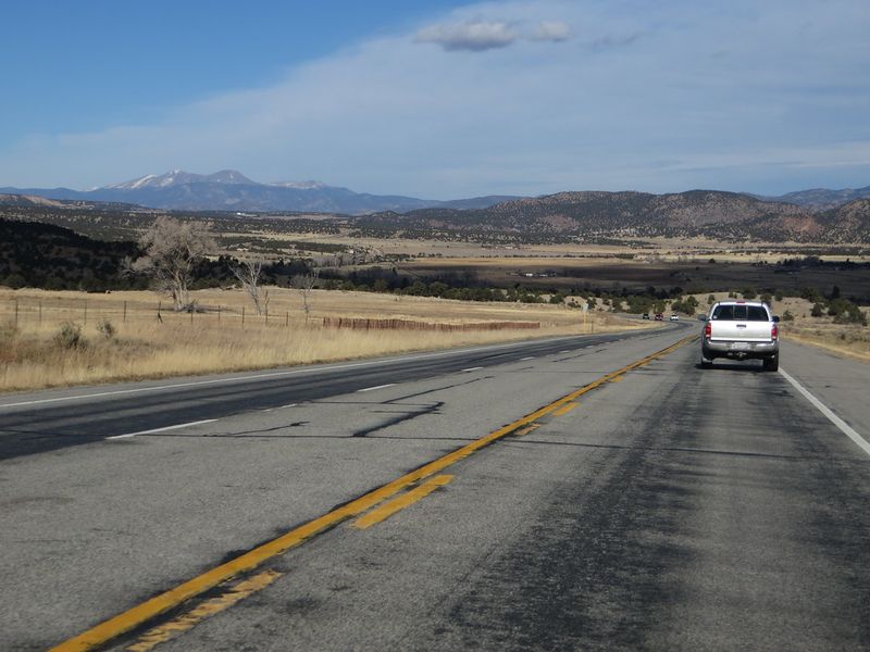
12. U.S. Route 2 (Northern Plains/Montana)
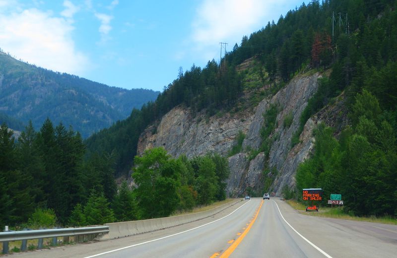
Crossing the northern plains and Montana’s wide-open spaces, this route takes you through some of the most isolated terrain in the lower 48 states. Towns are few and far between, meaning services like gas stations and hospitals can be 50 miles or more apart. Winter transforms the highway into an ice rink where black ice hides under innocent-looking pavement.
If you break down in winter, hypothermia becomes a real threat within hours. Cell service disappears for long stretches, cutting you off from help. Wildlife crossings add another hazard, as deer and elk appear suddenly, especially at dawn and dusk.
13. U.S. Highway 190 (Through Death Valley National Park, California)
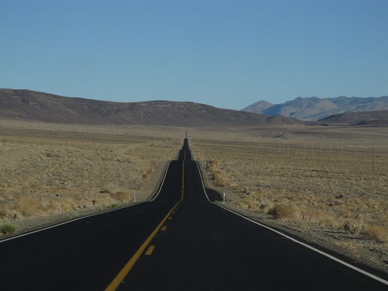
Crossing through Death Valley means driving through one of the hottest places on Earth, where summer temperatures regularly exceed 120 degrees Fahrenheit. Your car’s cooling system gets pushed to its absolute limit, and engine overheating can strand you in a landscape that earned its ominous name. Limited shade and water sources turn a breakdown into a life-threatening emergency.
Cell service is nonexistent in most areas, so calling for help isn’t an option. Park rangers warn visitors to carry extra water and stay with their vehicle if trouble strikes. The extreme heat has killed unprepared travelers who thought they could walk to safety.


