Beneath the Etruscan city of Veii lies a labyrinth that has evaded scholars for centuries—until now. A rover inspired by space exploration has mapped miles of underground passages, revealing a hidden world of engineering and ritual. The findings challenge long-held assumptions about Etruscan urban planning and technological sophistication. Dive into five essential insights that explain why this discovery is rewriting the story of pre-Roman Italy.
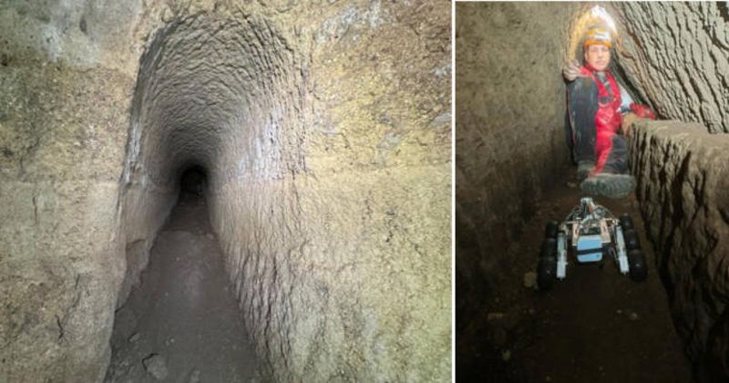
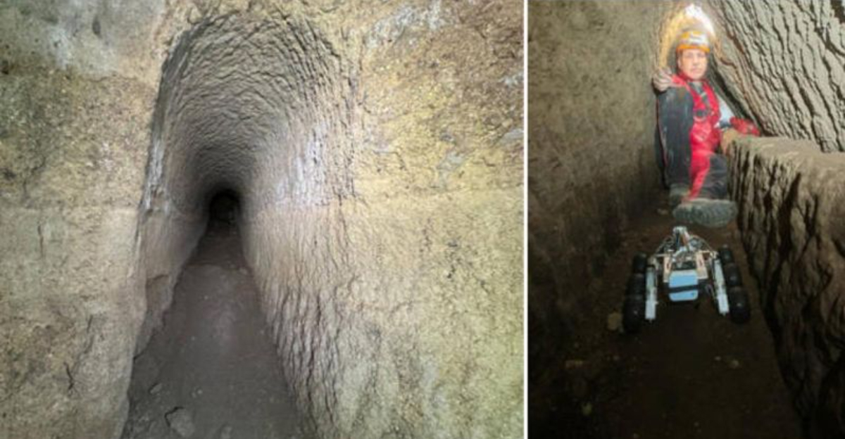
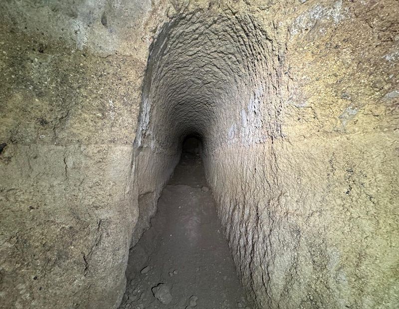
Archaeologists executed the first comprehensive mapping of Veii’s subterranean network using a rover-guided survey, revealing long-forgotten galleries, hydraulic channels, cisterns, and ritual basins tied to the Portonaccio sanctuary. Sources such as Arkeonews, Etruscan Times, and La Brújula Verde highlight how the tunnels stitch together sacred and civic spaces beneath the city. The project exposes a meticulously engineered underworld where water management systems and ritual infrastructure intersect. By correlating digital models with surface ruins, researchers now visualize how the hidden arteries sustained urban life and ceremonial practice. The mapping confirms that Etruscan planning extended vertically—above and below ground—challenging assumptions derived from fragmentary texts and partial excavations. This underground atlas reframes Veii as a city of layered complexity, where engineering, religion, and landscape design were orchestrated with remarkable foresight.
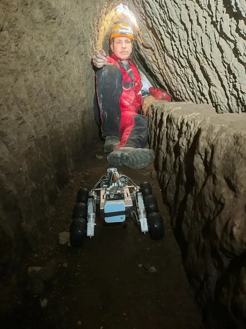
To navigate narrow, unstable, and inaccessible passages, researchers deployed a compact autonomous rover—dubbed “Magellano” in some reports—equipped with suspension and imaging systems inspired by Martian rover designs. Drawing on aerospace principles, it captured real-time visuals and telemetry from deep underground, feeding data into a digital reconstruction pipeline. Colombia One reported on the rover’s role enabling safe access where human entry was impractical. High-intensity LEDs, inertial sensors, and structured-light or LIDAR modules ensured accurate modeling, while remote operation minimized disturbance to fragile features. This integration of robotics, photogrammetry, and GIS produced a high-resolution map of the subterranean network. The result is a repeatable, non-invasive methodology that expands archaeological reach, validating rover-based exploration as a breakthrough for sites with hazardous voids and delicate stratigraphy.
The mapped system connects the Campetti plateau, sanctuary terrace, and Cannetaccio valley, revealing integrated tunnels, channels, cisterns, and ritual basins, including large installations adjacent to the Temple of Apollo at Portonaccio. Arkeonews notes how these spaces likely served dual roles: hydraulic regulation—capturing, channeling, and storing water—and ceremonial functions, such as processions and purification rites. This synthesis suggests Etruscan engineers embedded religion into city infrastructure, using water to shape urban experience. The discovery elevates Veii from a Rome-vanquished rival to a sophisticated center whose subterranean works rival later Roman systems. By aligning hydrology with sacred topography, the network demonstrates a holistic planning ethos uncommon for its time. Ultimately, it shifts scholarly focus from isolated monuments to the connective tissues that sustained civic and spiritual life.
Veii, once among the largest Etruscan cities north of Rome, fell in 396 BCE yet long remained enigmatic due to scarce textual records. New underground mapping offers a rare lens on Etruscan organization of sacred space, water systems, and urban design, as noted by Arkeonews. This evidence anchors debates previously driven by conjecture, furnishing material correlates for ritual practice and civic engineering. It nuances the cultural rivalry with early Rome by showing Veii’s technical parity and religious sophistication. For historians and archaeologists, the tunnels provide context for art, inscriptions, and temple remains, knitting disparate finds into a coherent urban narrative. The result is a recalibrated history of pre-Roman Italy that foregrounds Etruscan innovation rather than framing it as a prelude to Roman achievement.
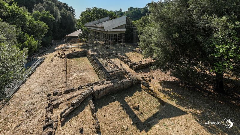
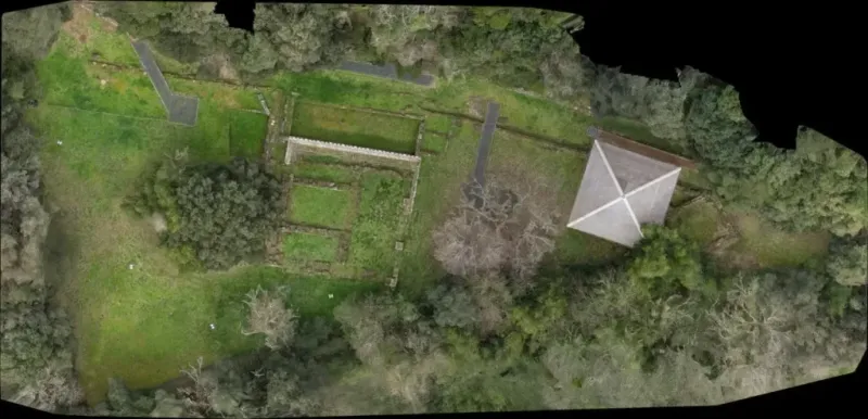
Though the tunnels are not yet open to the public, interest in the Archaeological Park of Veii—and especially the Portonaccio Sanctuary—is surging among visitors and scholars. Travel guides increasingly highlight new interpretive possibilities: digital reconstructions, AR tours, and above-ground trails synchronized with subsurface maps. For researchers, rover-enabled, aerospace-inspired methods establish a precedent for exploring fragile voids worldwide, from Mesoamerican caves to Mediterranean hypogea. The Veii model encourages cross-disciplinary teams blending robotics, conservation science, and landscape archaeology. It also underscores the need for careful stabilization, environmental monitoring, and ethical access policies. As datasets are shared, expect collaborative syntheses that refine urban models, enhance conservation strategies, and broaden public engagement without compromising the integrity of these extraordinary underground spaces.


