Most people picture national parks as timeless places that barely change. But in Alaska’s Wrangell St. Elias, the ground, ice, and coastlines are shifting at a pace you can actually measure year to year. You will see exposed valleys, rising shorelines, and advancing ice all in one epic landscape. Keep reading to discover the surprising science behind how this park is expanding faster than anyone expected.
1. It is already the largest park – and exposed land keeps increasing
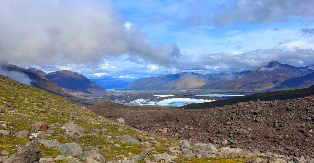
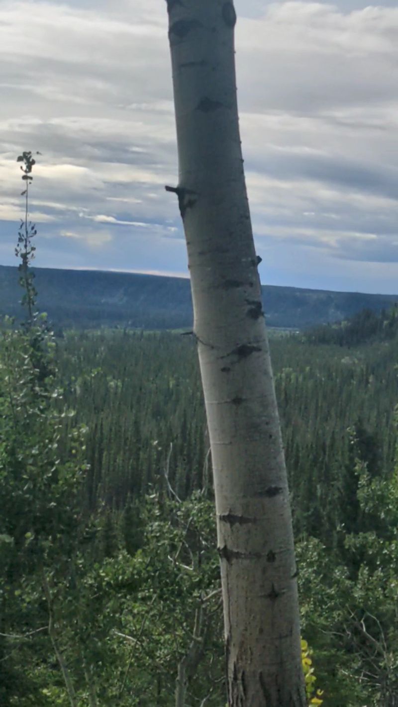
You might know Wrangell St. Elias as the largest U.S. national park by far. What you may not expect is that exposed land inside its fixed boundaries is growing as ice pulls back. Satellite images reveal fresh rock, sediment, and vegetation zones where white once dominated.
This does not mean the legal map is expanding. It means more of the surface within that map is now above ice or water and accessible. Hikers, pilots, and researchers increasingly spot new outcrops, gravel fans, and early successional plants.
2. Glacial retreat is revealing entire new landscapes

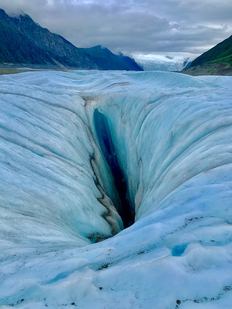
Retreating ice on Malaspina, Nabesna, and Kennicott is exposing valleys and ridges not seen for centuries. Zoom in on recent imagery and you will notice braided streams threading through freshly uncovered ground. Field teams keep finding ancient tree remains and preserved soils.
The pace shocks even seasoned scientists. Decadal comparisons show glacier fronts stepping back with dramatic clarity. You can practically trace newly formed channels and moraines that did not exist in photos from the 1970s.
3. The ground itself is rising up to 1.5 inches a year

Lose the ice weight and the crust rebounds. In Wrangell St. Elias, instruments record uplift approaching an inch or more per year in places. That vertical nudge subtly tilts rivers, reshapes shorelines, and lifts lowlands out of the splash zone.
For you, it means more dry ground where there was once marsh or intertidal. Over decades, small annual gains add up to new terraces and higher floodplains. It is one reason local relative sea level can fall even as global oceans rise.
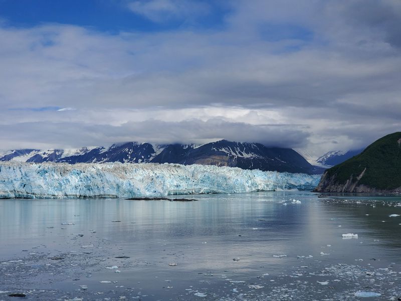
4. Hubbard Glacier is advancing while others retreat
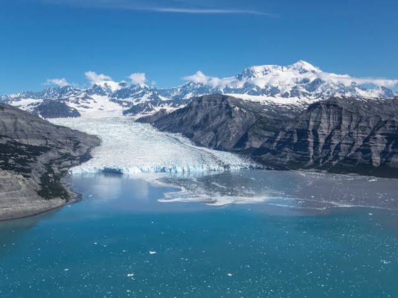
Here is a plot twist. The Hubbard Glacier is surging seaward, bulldozing sediment and occasionally choking off Russell Fjord. It advances tens of meters per year, fed by heavy snowfall high in the St. Elias.
Stand near its calving face and you sense the raw push of ice against ocean. Unlike retreating glaciers that reveal land by melting, Hubbard creates new seaward ground by ramming forward. It is a rare example of growth in a warming world.
5. New coastal areas are emerging as local sea levels fall
Along parts of the Gulf of Alaska, land is rising faster than the sea. Tide gauges document negative relative sea level trends, which means beaches and rocky benches are expanding. You can spot young vegetation lines marching seaward.
It is not uniform, but where uplift outpaces erosion the coastline grows. Old maps show narrower shore zones than you will find today. The result is more walkable ground and broader intertidal habitats taking shape.
6. A volcanic landscape evolving below the surface
Beneath the glaciers sits the Wrangell Volcanic Field. Mount Wrangell still vents heat and gases, a quiet reminder that magma shaped these peaks. Subtle geothermal flux can lubricate ice bases and influence glacier flow.
Add uplift and faulting, and you get a restless foundation. Over long spans, volcanic deposits and fractures steer valleys and ice tongues. Even without big eruptions, the subsurface is busy rewriting the surface.
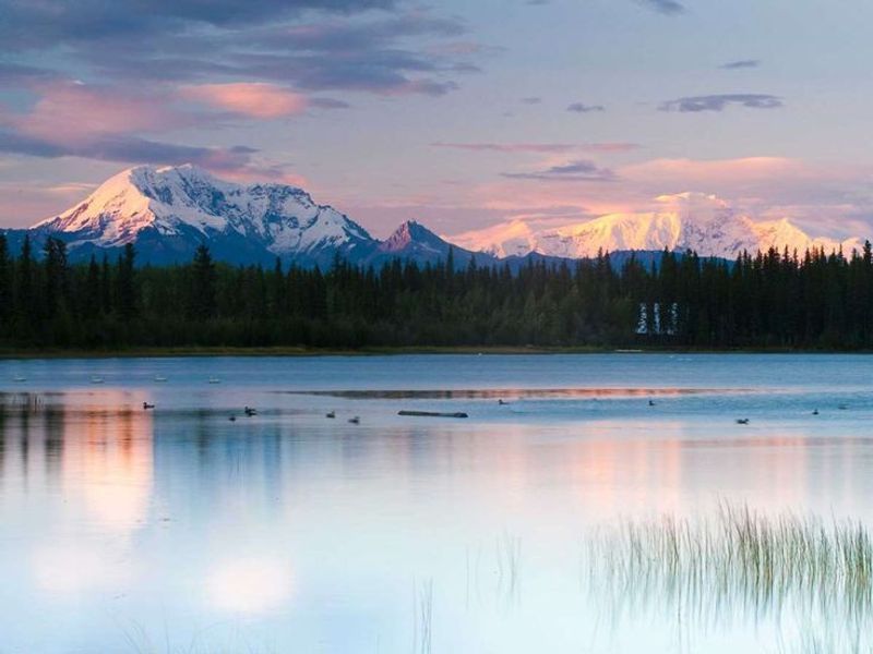
7. The St. Elias Mountains are rising at world class rates
Where plates collide, mountains rocket upward. The St. Elias are growing as the Pacific plate shoves under North America. Some uplift rates rival hotspots like the Himalayas.
Rising peaks feed aggressive erosion and ice formation. That push and pull carves deep troughs and knife ridges. The skyline you photograph today is literally a work in progress shaped by tectonics and ice.
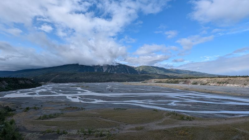
8. Rivers and drainage are shifting at unusual pace
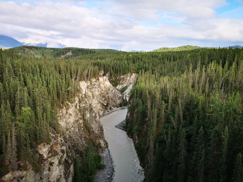
As ice thins, water and sediment budgets flip. Rivers abandon old channels and cut new ones across fresh outwash. From the air, you can see fans bright with silt where ice faces collapsed.
Uplift tilts the board just enough to send flow elsewhere. What looks stable on a map can reroute within years. Pack a flexible mindset if you navigate gravel bars and braids here.
9. Satellites confirm faster than projected change
ICESat 2 and Landsat track centimeter scale thinning and year to year front positions. Compare scenes from the 1990s to now and the acceleration jumps out. Analysts flag uplift and glacier retreat outpacing older models.
For planners and travelers, that data is gold. It reveals where trails, shorelines, and landing strips may shift next. The park is a living laboratory that updates in near real time.
10. Newly exposed land is being colonized fast

Where ice fades, life arrives. Grasses, fireweed, and alder creep across raw till, fixing nitrogen and trapping dust. Within a short window, insects and birds follow, then mammals nosing into fresh forage.
Walk through and you feel the hush of a young ecosystem waking up. Soil thickens, roots knit slopes, and the color palette shifts from gray to green. It is expansion you can see and smell on a summer breeze.
11. Ancient forests and sediments are emerging from ice
Retreating margins are revealing tree stumps and organic layers sealed for millennia. These time capsules let scientists reconstruct past climates and fire regimes. You are literally looking at forests that last saw sunlight before written history here.
As exposure grows, sampling expands too. Core by core, the region’s climate story gets sharper. It also sets a baseline to watch how modern plant communities build from bare ground.
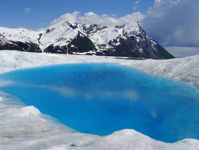
12. High elevation glaciers thicken while lowlands melt

Paradox alert. Upper accumulation zones keep packing on snow faster than it melts, so parts of high glaciers are thickening. Down lower, tongues are thinning and pulling back, revealing ground at record pace.
That split personality makes Wrangell St. Elias perfect for studying microclimates. Expect complex flowlines and crevasse patterns that change with altitude. It is a layered ice story rather than a single trend.
13. Local sea level trends make Alaska an outlier

Global seas rise, yet parts of Alaska register falling relative sea level. Land rebound overwhelms ocean gains, lifting coasts into the air by millimeters to centimeters each year. New marine terraces and salt marsh edges attest to the shift.
For you, that means expanding coastal real estate for plants, animals, and careful explorers. Managers weigh how archaeology, habitats, and access evolve as dry ground grows. It is a counterintuitive change with very real footprints.


