New research reveals something amazing happening deep beneath the Strait of Gibraltar. Scientists have found evidence of rare tectonic activity that could eventually change the Atlantic Ocean itself. While these changes will take millions of years, understanding them helps us see how our planet constantly reshapes itself over time.
1. A subduction zone lies beneath the Strait of Gibraltar
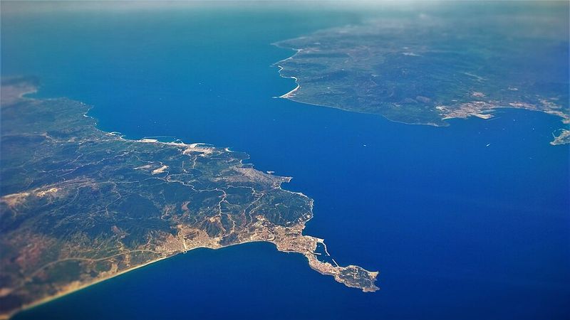
Deep under the narrow waters separating Europe from Africa, something remarkable exists. Recent geophysical studies confirm the presence of a small, complex subduction structure beneath Gibraltar. This represents one of the only such zones in the entire Atlantic region.
Subduction happens when one tectonic plate slides beneath another, diving into Earth’s mantle. Most subduction zones ring the Pacific Ocean, making Gibraltar’s location unusual.
Scientists use specialized equipment to detect this hidden feature. Seismic waves travel through rock at different speeds depending on temperature and composition. By analyzing these patterns, researchers mapped the descending plate material beneath the strait, confirming what geological models had predicted for years.
2. This subduction zone may be slowly migrating westward
Imagine a geological feature creeping across the ocean floor at an incredibly slow pace. Computer modeling suggests the Gibraltar subduction zone could be migrating westward, essentially invading the Atlantic basin. This movement happens at rates measured in millimeters per year, invisible to human observation.
Over tens of millions of years, this westward march could set the stage for significant tectonic shifts. The process resembles how a crack slowly spreads through glass under pressure.
Scientists created these models by combining data from earthquakes, GPS measurements, and deep imaging techniques. Their simulations run forward in time, predicting how plate boundaries might evolve as Africa and Eurasia continue their slow collision.
3. Gibraltar sits where the African and Eurasian plates converge

Standing at Gibraltar means standing at one of Earth’s major plate boundaries. The African and Eurasian plates push toward each other here, creating seismic activity and shaping the region’s unique geology. This collision zone stretches from the Azores through Gibraltar and into the Mediterranean.
These plates move at roughly the same speed your fingernails grow. Despite this slow pace, their relentless pressure builds mountains, triggers earthquakes, and reshapes coastlines.
The convergence began millions of years ago when the ancient Tethys Ocean closed. Today, the remaining compression continues to squeeze the Mediterranean region, creating the complex geology we observe around Gibraltar and throughout southern Europe.
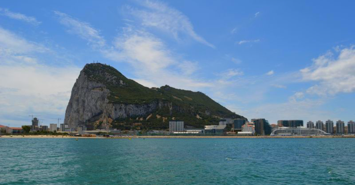
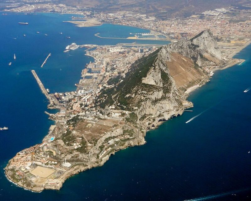
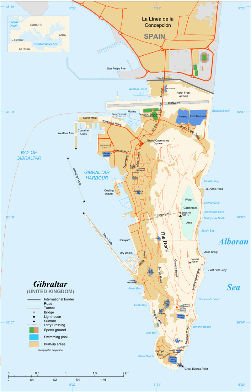
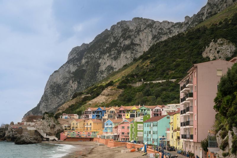
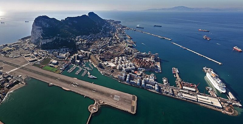
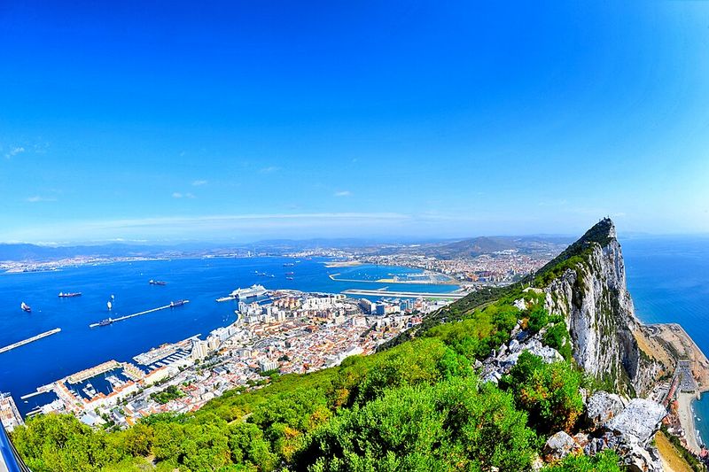
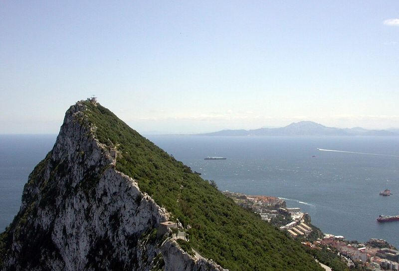
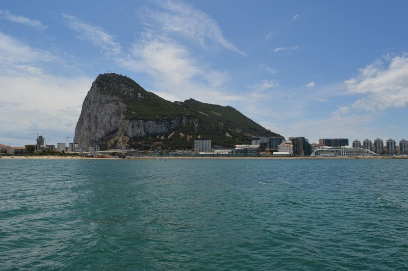
4. The Rock of Gibraltar itself is made of tough Jurassic limestone

Formed about 175 million years ago when dinosaurs roamed the Earth, the Rock of Gibraltar consists of incredibly durable Jurassic limestone. This rock type forms from compressed sea creature shells and calcium carbonate deposits in ancient ocean environments.
The limestone’s toughness means claims about Gibraltar crumbling are inaccurate. While surface weathering occurs naturally over centuries, the rock’s structural integrity remains solid. Small pieces may fall occasionally, but the main formation stands firm.
Geologists can read the rock layers like a history book. Each stratum tells stories about ancient sea levels, climate conditions, and marine life that existed when these sediments first accumulated on an ocean floor that no longer exists.
5. The Mediterranean Sea nearly dried up 5-6 million years ago
Picture the Mediterranean as a giant desert basin covered in salt flats. Between 5 and 6 million years ago, this actually happened during an event called the Messinian Salinity Crisis. Plate movements near Gibraltar restricted water flow from the Atlantic, causing the sea to evaporate.
Rivers continued flowing into the basin, but evaporation exceeded input. Water levels dropped dramatically, leaving behind thick salt deposits that geologists find buried today beneath the seafloor.
Some scientists estimate the Mediterranean dried almost completely, possibly multiple times. The basin may have resembled Death Valley on a massive scale, sitting more than a mile below sea level with scattered hypersaline lakes where the deepest parts remained.
6. The Mediterranean refilled catastrophically about 5.3 million years ago
What happened next ranks among Earth’s most spectacular geological events. About 5.3 million years ago, the Atlantic broke through the barrier at Gibraltar in a massive flood called the Zanclean Flood. Water poured into the dry Mediterranean basin at unimaginable rates.
Scientists estimate the flood may have lasted anywhere from months to a few thousand years. At peak flow, water cascaded through the strait with forces that would dwarf every modern waterfall combined, perhaps moving enough water to raise the basin by several feet daily.
This catastrophic refilling left geological evidence in sediment layers. The sudden transition from salt deposits to marine sediments marks this dramatic moment when the Mediterranean returned to life.
7. The region remains one of Earth’s most tectonically complex areas
Few places on Earth pack so much geological action into such a small area. The Gibraltar region combines African and Eurasian convergence, subduction remnants, multiple fault systems, and complex mantle flow patterns. All these factors interact in ways scientists still work to understand fully.
This complexity makes the area both fascinating and challenging to study. Earthquake patterns don’t follow simple predictions because multiple forces act simultaneously. GPS stations measure ground movement in directions that reveal the complicated dance of crustal blocks.
Researchers from many countries collaborate to unravel these mysteries. Each new study adds pieces to the puzzle, gradually revealing how this unique corner of the planet operates beneath our feet and under the waves.
8. The Atlantic Ocean is currently in a geological mature stage
Born when the supercontinent Pangaea split apart, the Atlantic Ocean has been widening for about 200 million years. Mid-ocean ridges continue adding new seafloor, pushing the Americas away from Europe and Africa at roughly an inch per year. This represents the mature stage of ocean basin development.
Eventually, this expansion will stop. All oceans follow a predictable life cycle, and the Atlantic has reached middle age in geological terms.
The ocean floor near the mid-Atlantic ridge is young and hot, while crust near the continents is old and cool. This age progression provides clear evidence of how seafloor spreading works. Scientists can date rocks from the ocean floor to track exactly when each section formed.
9. Gibraltar’s subduction zone may signal the beginning of Atlantic closure
Could Gibraltar’s small subduction zone represent the Atlantic’s first step toward eventual closure? Many geologists think so. Over tens of millions of years, subduction could slowly consume parts of the Atlantic Ocean from east to west, reversing the spreading that created it.
This process mirrors how other oceans have closed throughout Earth’s history. The ancient Tethys Ocean once separated Africa from Eurasia but disappeared as subduction zones consumed its seafloor, leaving only the Mediterranean as a remnant.
The Atlantic’s closure remains far in the future. Current models suggest the ocean might persist for another 200 million years before subduction significantly reduces its size. Our distant descendants might witness a very different world geography.
10. The Wilson Cycle governs the birth and death of oceans
Named after Canadian geologist J. Tuzo Wilson, the Wilson Cycle describes how oceans open and close over hundreds of millions of years. Oceans are born when continents split apart and die when subduction zones form around their edges, eventually consuming all the oceanic crust.
Gibraltar may represent the Atlantic’s first closing trigger point. While the mid-Atlantic ridge still creates new seafloor, subduction zones forming at the ocean’s edges could eventually outpace spreading, causing the basin to shrink.
This cycle has repeated throughout Earth’s history. Ancient oceans we’ll never see have opened and closed, their existence revealed only through mountain belts where continents collided after the intervening ocean disappeared completely.
11. The region can produce strong earthquakes
On November 1, 1755, one of Europe’s strongest recorded earthquakes struck near Lisbon, Portugal. The quake, estimated at magnitude 8.5 or higher, was related to tectonic stresses in the broader plate boundary zone near Gibraltar. It destroyed much of Lisbon and triggered tsunamis that reached across the Atlantic.
The earthquake occurred on All Saints’ Day when churches were full of candles, leading to widespread fires. Combined with the shaking and tsunami, the disaster killed tens of thousands and profoundly influenced European philosophy and science.
Modern seismic monitoring shows the region remains active. While earthquakes of 1755’s magnitude are rare, smaller quakes occur regularly as the African and Eurasian plates continue their relentless convergence.
12. Future tectonic activity could reshape the area but very slowly
Geological models predict significant changes for the Gibraltar region, but these unfold over millions, not hundreds, of years. Nothing imminent threatens Gibraltar’s stability or the surrounding areas. The rock will stand, and the strait will remain navigable for countless human generations.
Computer simulations project how plate movements might evolve. These models account for current motion rates, stress patterns, and material properties of rocks involved. Results show gradual changes that would be imperceptible within human lifespans.
Understanding these long-term processes helps scientists assess earthquake hazards and coastal changes. While dramatic transformations await the distant future, knowing the direction of change allows better planning for the hazards that might occur along the way.
13. Scientists use seismic tomography to see deep structures under Gibraltar

How do researchers see miles beneath Earth’s surface? Seismic tomography provides the answer. This imaging technique works somewhat like medical CT scans but uses earthquake waves instead of X-rays. By analyzing how seismic waves travel through rock at different speeds, scientists map structures deep underground.
Waves travel faster through cold, dense rock and slower through hot, less dense material. The descending slab beneath Gibraltar appears in these images as a faster region, indicating cooler rock sinking into the warmer mantle.
Creating these images requires data from many earthquakes recorded at numerous seismic stations. Computers process thousands of wave arrivals to build three-dimensional models showing what lies beneath the surface where no drill can reach.
14. Some models predict eventual mountain-building in the western Mediterranean

If subduction beneath Gibraltar fully develops and continues, the result could be spectacular. Some geological models predict eventual mountain-building in the western Mediterranean region. These mountains would form through the same processes that created the Alps, Himalayas, and other great ranges where continents collide.
The timeline for such changes stretches across tens of millions of years. No one alive today will see these mountains, nor will countless future generations. Yet the processes are already underway at microscopic rates.
Mountain-building occurs when compression forces rocks upward and folds layers like wrinkled fabric. The Mediterranean region already shows this process in action, with ranges in Spain, Italy, and Greece all products of African and Eurasian convergence.
15. The Atlantic Ocean is not dropping or disappearing anytime soon

Despite dramatic headlines, the Atlantic Ocean faces no imminent threat. Even if Gibraltar’s subduction zone grows and spreads westward, the ocean would take tens of millions of years to noticeably shrink. No near-term changes are expected that would affect sea levels, navigation, or marine ecosystems.
The mid-Atlantic ridge continues spreading, creating new oceanic crust faster than subduction currently consumes it. The ocean is still growing, not shrinking, and will likely continue expanding for many millions of years.
Understanding these long-term processes helps put geological changes in perspective. While fascinating to study, they unfold on timescales so vast that human civilization will look completely different long before the Atlantic shows significant size changes.


