Snow and wind are hammering West Virginia, and the worst may not be over yet. If you need to be out, you will want the latest on where conditions are deteriorating fastest and why visibility can vanish in seconds. This guide breaks down what is happening, what it means for the next few days, and how to stay safe when roads turn risky. Keep reading so you can plan smart and avoid preventable dangers.
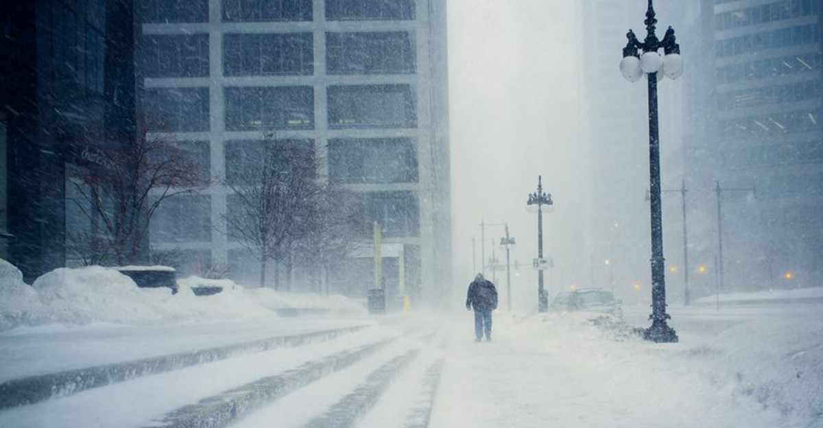
Parts of West Virginia remain under a Blizzard Warning from the National Weather Service as heavy snow and strong winds sweep across higher elevations. The warning targets northern and eastern mountain zones, where snowfall of 4 to 8 inches will pair with gusts capable of generating whiteouts. When wind lifts snow into the air, visibility can collapse quickly, turning familiar routes into disorienting, snow washed corridors.
Through 10 a.m. Thursday, the combination of continuous snow, frequent gusts near or above 35 mph, and sub quarter mile visibility could persist for hours. That blend meets blizzard criteria and dramatically increases the risk of crashes, spinouts, and stalled vehicles on steep grades. Even plowed stretches can ice over rapidly as powder drifts back across lanes and refreezes.
Travel is expected to be extremely hazardous or impossible at times wherever the warning is in place. You should postpone trips if you can, and prepare as if you might get stuck if you cannot. Check weather.gov and local alerts for updates as cells pivot over the mountains, and remember that conditions may worsen fastest along ridgetops, exposed passes, and open valleys funneling wind.
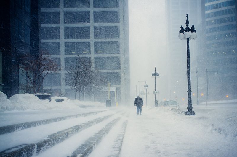
Under a Blizzard Warning, falling and blowing snow can slash visibility below a quarter mile, making roads feel like tunnels of moving white. Northwest Pocahontas, southeast Randolph, and southeast Webster counties have already measured several inches, while gusts roar down slopes. Whiteouts erase landmarks, and even centerlines vanish, so it becomes easy to drift off course without realizing.
Officials urge travel only for emergencies and advise motorists to carry winter survival kits and stay with their vehicles if stranded. Keep a charged phone, blankets, water, snacks, a shovel, traction aids, and a flashlight. Let someone know your route and ETA, then slow down radically, increase following distance, and avoid sudden braking that can lead to a slide.
NWS blizzard criteria exist to highlight the dangerous pairing of snow and wind lasting several hours. Even modest accumulation with strong gusts can mean zero reference points and drifting that buries previously cleared lanes. If you must go, watch for downed limbs, slick bridges, and plows working with limited sight lines, and expect closures or chain controls on steep grades.
This blizzard is only one chapter in a broader, active winter pattern gripping the Appalachians and Mid Atlantic. Multiple waves have already dragged snow, cold air, and gusty winds through the region, and the atmosphere is primed for repeats. Meteorologists expect several more systems to ripple east, keeping chill and periodic snow showers in play well into the weekend.
A second disturbance is slated for Friday with additional light to moderate accumulation, especially higher terrain. Another system late Saturday into Sunday could reinforce hazards, stacking drifts and prolonging icy travel even after the current warning ends. That layering effect means secondary roads and shaded corridors may not fully recover between events.
Plan for staggered impacts rather than one and done. You will want to restock essentials, monitor school and event changes, and keep salt, windshield fluid, and fuel topped off. Check weather.gov frequently for timing adjustments, because small track shifts can move heavier bands into different valleys and ridges, altering snowfall totals and wind exposure overnight.

Preparation matters when wind and snow team up across West Virginia. Delay trips if possible, and if you must drive, pack a survival kit with blankets, water, snacks, a shovel, kitty litter or traction mats, a scraper, and a flashlight with spare batteries. Keep your phone charged, share your route, and top off gas to run heat intermittently if you become stuck.
At home, expect power flickers where heavy snow weighs on trees and lines. Charge devices, secure a battery radio, and stage flashlights where you can grab them fast. Avoid generator use indoors, keep it outside and away from windows, and stock shelf stable food plus medications for several days as repeated waves complicate deliveries.
Dress in layers, cover exposed skin, and limit time outdoors when wind chills bite. Clear vents, hydrants, and porch steps, and give plows plenty of room to work narrow mountain roads. For updates, rely on weather.gov, local emergency management, and DOT feeds so you can adjust plans quickly as conditions shift valley by valley and ridge by ridge.


