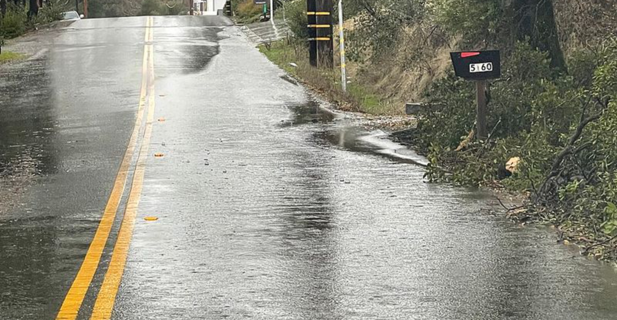
A powerful atmospheric river is slamming Southern California just as millions hit the roads and skies for Christmas. Flash flood warnings now blanket Los Angeles, and the risk of fast-moving water and debris flows is rising by the hour. If you are traveling or simply heading out for last-minute errands, conditions may change faster than you expect. Here is what you need to know to stay safe and make smart decisions through the holiday rush.
Flash Flood Warnings Issued as Dangerous Storm Hits Southern California
Flash flood warnings lit up phones across Southern California as rain pounded the region with little pause. You could see gutters boiling and intersections turning into churning streams in minutes. With an atmospheric river overhead, rainfall rates surged fast enough to overwhelm storm drains and trap vehicles before drivers realized what was happening.
Meteorologists warned this was not a typical winter drizzle. Saturated soils, steep terrain, and sensitive burn scars combined to funnel water and debris downhill with dangerous force. Even a shallow sheet of water can hide potholes and manhole covers, and that is where many travelers get caught.
Officials urged residents to avoid flooded intersections and never attempt to cross swift water, even if it looks passable. Stay put if you can, reschedule errands, and lean on real-time alerts for your neighborhood. If you must drive, turn around at any water crossing and keep emergency supplies in the car.
The timing could not be worse, arriving during peak Christmas travel. Urban flooding expanded quickly from low-lying streets to underpasses and freeway ramps. This is a fast-evolving situation, so protecting yourself starts with slowing down and staying off the roads when warnings hit.
Los Angeles Placed Under Rare High-Risk Flood Outlook
Los Angeles landed under a rare high-risk flood outlook, the kind reserved for the most dangerous rain events. If you live near canyons or recent burn scars, this designation is your cue to leave early and stay out of drainage paths. Rainfall rates near or above one inch per hour can unleash sudden debris flows that move like speeding concrete.
These flows often arrive with little warning and do not care if the rain eases for a moment. Charred soil repels water, shoots it downhill, and takes rocks, trees, and cars along for the ride. Drainage systems simply cannot keep up when hillsides shed water this quickly.
Emergency managers say the safest move is to evacuate before conditions deteriorate. If you wait until mud starts moving, escape routes can vanish in minutes. Keep gas tanks at least half full, pack essential documents, and set phone alerts to loud.
This high-risk label appears only on a small fraction of days, yet it correlates with a large share of flood damage and deaths. Take it seriously. Your best strategy is to act early, follow local orders, and stay clear of canyons, creeks, and burn scar channels.
Christmas Travel Disrupted by Flooding, Road Closures and Hazardous Conditions
Christmas travel collided with a dangerous storm, and the result has been a maze of closures, detours, and long delays. Freeways slowed to a crawl where water pooled across lanes, while canyon roads shut down after mud and rocks spilled onto the pavement. Even experienced drivers found visibility and traction changing from block to block.
Airports felt it too, with ground stops, wind gusts, and low ceilings forcing schedule shuffles. If you are flying, check your airline app constantly and arrive early, because security lines swell when flights stack up. Keep power banks charged and carry medication, snacks, and water in case you get stuck.
Authorities repeated a hard truth: most flood deaths happen in vehicles. Turn around, do not drown, and never drive around a barricade. If water is moving over the road, back out and reroute.
Public transit can be a safer bet, but even trains and buses face delays when tracks flood or trees fall. Factor in extra time, let someone know your route, and consider postponing nonessential trips. The key is flexibility, patience, and a plan B that keeps you out of flood zones.
More Rain Possible as Officials Urge Caution Through the Holiday
Even as the heaviest rain begins to ease, forecasters say more showers could keep risks elevated through Christmas. Saturated ground means runoff will stay brisk, with creeks, small rivers, and debris channels remaining dangerous. You might see water recede on your street while hazards persist around the corner.
Cleanup is tricky when hillsides are unstable and roadbeds are undermined. Expect secondary closures, scattered power outages, and downed trees as crews assess damage. If you live near slopes, keep an eye on cracks, leaning fences, and new water seepage.
Stay tuned to local alerts, and do not move barricades to get through. Avoid unnecessary travel until agencies declare routes clear. Keep flashlights, batteries, and a go bag ready in case conditions deteriorate again.
Meteorologists note that wildfire scars and dense development amplify flood impacts even in otherwise dry winters. That makes preparation your best defense. Through the holiday, give yourself extra time, help neighbors who may need assistance, and keep clear of storm drains and waterways that can surge without warning.


