If you are eyeing fresh powder in central Idaho, now is the moment to pause and pay attention. The Sawtooth Avalanche Center has issued a high-risk warning, and conditions are changing quickly with every new flake and gust. You will find clear, actionable facts here to guide your choices and keep you and your partners safe. Read on before you click into skis, fire up the sled, or follow a tempting skin track into steep terrain.

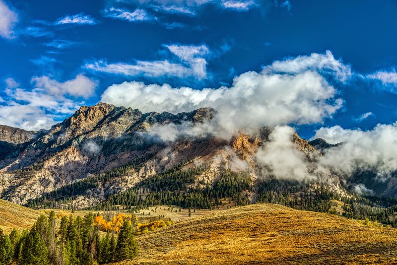
High avalanche danger is impacting central Idaho’s high mountains right now, including large sections of Sawtooth National Forest. If you plan to tour, sled, or snowshoe, you need to recognize that slopes you rode last week may not behave the same today. The problem is widespread, not isolated, and it is catching experienced travelers off guard.
You should treat all steep terrain as suspect, especially classic objectives that lure people after storms. Even mellow approaches can cross runouts from bigger slopes above. Choose low-angle trees, avoid overhead hazard, and set strict turnaround times.
Travel with a partner, carry a beacon, shovel, and probe, and practice companion rescue before leaving the trailhead. Decision discipline matters more than ambition right now. If uncertainty creeps in, that is your cue to back down and live to ride another cycle.
On Christmas Day, the Sawtooth Avalanche Center issued a high-risk avalanche warning, highlighting extremely unstable conditions. This was not routine language. Forecasters rarely use high unless they are seeing red flags across multiple drainages and elevations.
When you read high, interpret it as very likely to trigger avalanches and possible natural releases. This rating is a call to dramatically change plans, not just tweak a route. You should reduce exposure to avalanche terrain to zero.
Check the latest forecast before leaving home, because ratings can shift fast. The center’s website updates daily and often includes videos and field photos that show real slopes failing. Share this warning with partners so everyone aligns on a conservative plan.
Forecasters say backcountry users are very likely to trigger avalanches. That means human-triggered slides should be expected on many steep slopes, not just thin, rocky pockets. Even small wind slabs can sweep you through trees or over cliffs.
You can test for this by noticing cracking, collapsing, and whoomphing sounds. These are strong, obvious clues that the snowpack is primed to fail. Do not put weight on steep convexities or terrain that funnels into gullies.
Plan travel so one person moves at a time, watch partners closely, and communicate constantly. Keep your slope angles under 30 degrees and avoid runouts beneath steeper features. If you feel uneasy, listen to that discomfort and turn around.
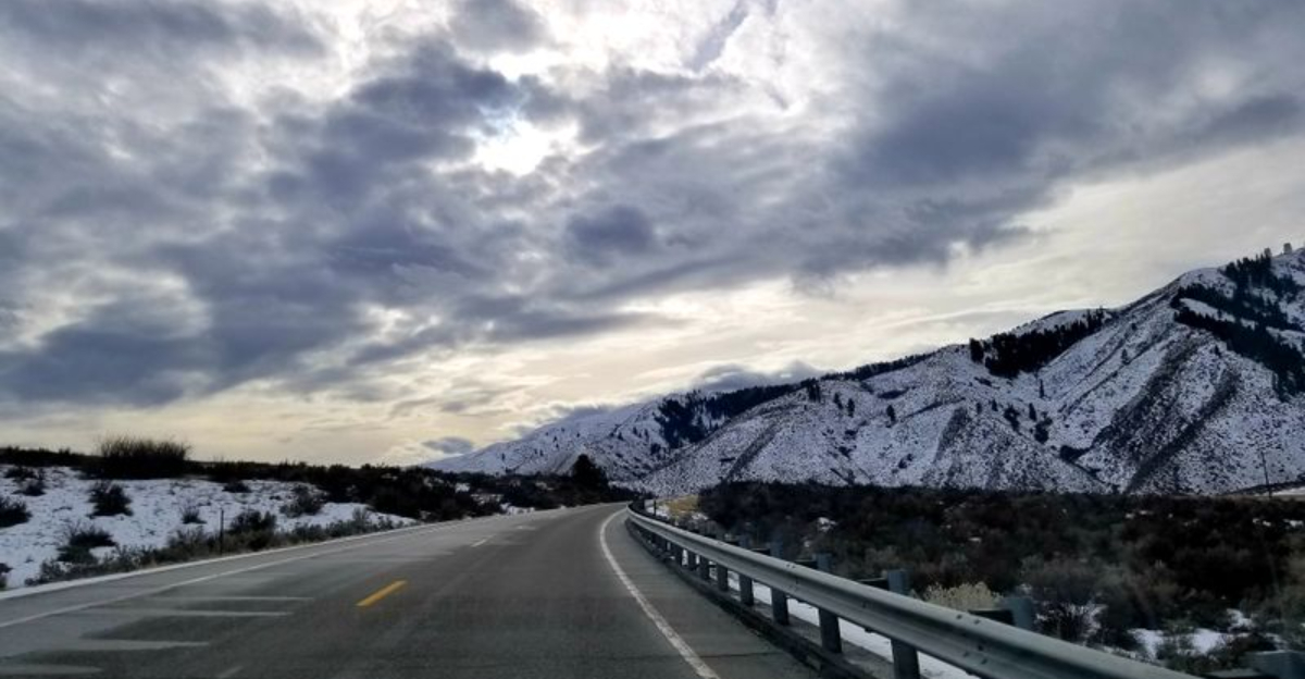
The current warning zone tracks along Idaho Highway 75, covering the Sawtooth Mountains, Western Smoky Mountains, Galena Summit, and Eastern Mountains. Popular trailheads and classic lines sit right in this corridor. Visibility of danger may be low during storms, adding to the risk of bad decisions.
Route planning should start with a map and the daily forecast. Identify overhead paths that can reach the road or your approach. If a slope looms above your skintrack, consider finding an alternate route.
Expect plow crews and temporary closures when conditions spike. Do not stop in known runouts to gear up or chat. Keep vehicles parked well away from avalanche paths and move quickly through exposed sections.
Banner Summit along Idaho Highway 21 is under an avalanche advisory at considerable risk. Considerable is not a free pass. Many accidents occur at this level because slopes still lure people while instability persists.
Expect both natural and human-triggered avalanches, especially on wind-loaded aspects and terrain over 30 degrees. Avoid corniced ridgelines and watch for hollow, drum-like sounds. Snowpack tests may propagate easily and give clear feedback.
Pick conservative terrain with clean escape options. Keep eyes on neighboring slopes that can send debris into your line. If winds are transporting snow, step back another notch and stick to protected meadows and dense low-angle timber.
Recent weather layered heavy, dense snowfall on top of older surfaces, then added rain and unusual warmth. That cocktail rapidly overloaded weak layers and created poor bonding between slabs. Warmth can also saturate near-surface layers, greasing bed surfaces for slides.
Think of it as stacking bricks on a shaky shelf. You might get away with one more brick, until it finally collapses. The timing of loading matters, and this load came fast.
Track precipitation type, snowfall rates, and temperature swings in the forecast discussion. If rain-on-snow shows up or temperatures spike, instability tends to rise sharply. When weather stacks the deck, you should dial back objectives and emphasize margins.

Forecasters report thick, unstable slabs across most middle and upper elevations. These slabs can fracture wide and run far, pulling out above you or from adjacent features. A single step onto a connected piece of terrain could set off a whole slope.
Slab thickness makes rescue harder because burial depths increase quickly. Even if you carry gear, time is brutally short under heavy debris. Avoid terrain traps like creek beds, road cuts, and narrow gullies.
Angle awareness is your friend. Keep it under 30 degrees and give a wide berth to steep rollovers. Remember that low-angle benches beneath steep bowls can still lie inside the runout, so stay outside the splash zone.
Strong winds at Banner Summit have been moving snow aggressively, building sensitive wind slabs and drifted pillows. Leeward features, cross-loaded gullies, and subridges are especially touchy. Cornices are growing and can break farther back than expected.
Blowing snow is a real-time red flag. If spindrift banners fly from ridges, you can assume slabs are forming downwind. Audible wind and textured snow surfaces should push you toward sheltered trees and meadows.
Keep travel spacing wide, avoid ridgeline overhangs, and enter slopes from the flanks if you must test something tiny. Better yet, skip tests on steep terrain entirely during active loading. Choose calm, protected zones where a small slide cannot stack debris deeply.
Some avalanches could be large enough to bury people deeply and snap trees. Debris in these canyons stacks high and sets like concrete. Even a short ride can be unsurvivable if it carries you into timber or over terrain traps.
Treat runouts as active danger zones, not resting places. If you hear natural activity or see fresh crowns, step far back. Natural cycles often precede or accompany human-triggered slides.
Carry full rescue gear, add a radio for partner comms, and discuss emergency plans before you move. If you do not have practice with your beacon under stress, do drills today in a safe field. The best strategy remains avoidance through conservative terrain choices.
The Sawtooth Avalanche Center advises avoiding steep slopes entirely and postponing backcountry skiing, snowboarding, and snowmobiling. This is short-term pain for long-term gain. Good snow will still be there after the cycle calms down.
Swap to low-angle tours, Nordic laps, or rest days. If cabin fever hits, study maps and pick future objectives with safer approaches. Skills refreshers like beacon drills and strategic shoveling practice pay off later.
When in doubt, trust the forecast and keep things boring. Boring choices save lives during high danger. You will be glad you waited when safer windows open and the mountains stop throwing curveballs.
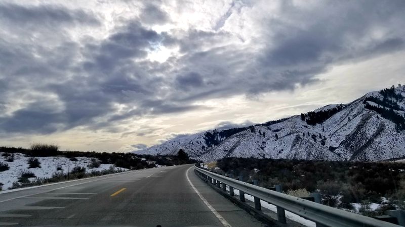
The stretch of Idaho 21 near Banner Summit is nicknamed Avalanche Alley for good reason. Steep terrain funnels numerous paths across the roadway, and winter storms can shut it down quickly. Do not linger in signed paths or pullouts under steep banks.
Plan travel windows around closures and check the road report before leaving. Keep gear accessible in case you need to move fast or wait out control work. Park well clear of runouts and follow instructions from road crews.
Remember that slopes above the road can release naturally even when skies clear. Bluebird breaks after storms are notoriously dangerous. If the forecast remains elevated, consider alternate routes or delay travel entirely.
Idaho Highway 21 ranks in the highest-risk category of the Avalanche Hazard Index, one of only three highways in the U.S. with that distinction. This underscores how serious the exposure is for drivers and crews. Slides can cross lanes, bury vehicles, and damage infrastructure.
Respect closures and pilot car operations during control missions. Waiting a little saves lives. Do not drive past barricades or stop to take photos in runouts.
If you must travel, carry winter kits, keep fuel high, and monitor updates from ITD and the Sawtooth Avalanche Center. Consider flexible itineraries to avoid peak hazard windows. Your patience supports crews working under difficult, hazardous conditions.


