Get ready for a winter shaped by the Pacific. NOAA says La Niña is expected to influence the 2025–2026 season, tilting the odds toward more snow in the north and drier conditions in the south. That does not mean every week will match the map, but it does give you a planning edge. If you want fewer surprises when the first big storm rolls in, this outlook is your early heads up.
NOAA confirms La Niña is expected to influence the 2025-2026 winter, nudging where snow, rain, and cold are most likely. La Niña forms when cooler than average sea surface temperatures develop in the central and eastern Pacific, altering jet streams and storm tracks. You are not getting a lock on daily weather, but a powerful set of odds that guide expectations.
Forecasters say this La Niña looks weak to moderate, and even modest events can reshape North American winter. Historically, the Pacific Northwest trends cooler and wetter, the southern tier turns drier, and the northern tier often sees more snow risk. Think of it as a pattern that loads the dice rather than a promise of constant cold.
More frequent northern storm tracks and fewer Deep South systems are favored, but storm-to-storm variation still matters. Local bursts of cold, surprise thaws, and impactful ice events can pop up when the atmosphere aligns. Use this outlook as a planning framework for travel, supplies, and heating, then lean on short-range forecasts to time your moves.
Across the northern United States, La Niña often ups snowfall odds and invites sharper cold shots. NOAA highlights the Pacific Northwest, northern Rockies, Upper Midwest, and parts of the Northeast for above average precipitation, much of it as snow. Expect busier storm tracks that clip Montana to Michigan, then sweep toward interior New England.
Arctic air intrusions are more likely east of the Rockies, triggering lake effect snow and hazardous travel windows. Rapid temperature swings can turn slush to ice and back to powder in days. Mountain snowpack in the Cascades and northern Rockies typically benefits, supporting spring water supplies and hydropower planning.
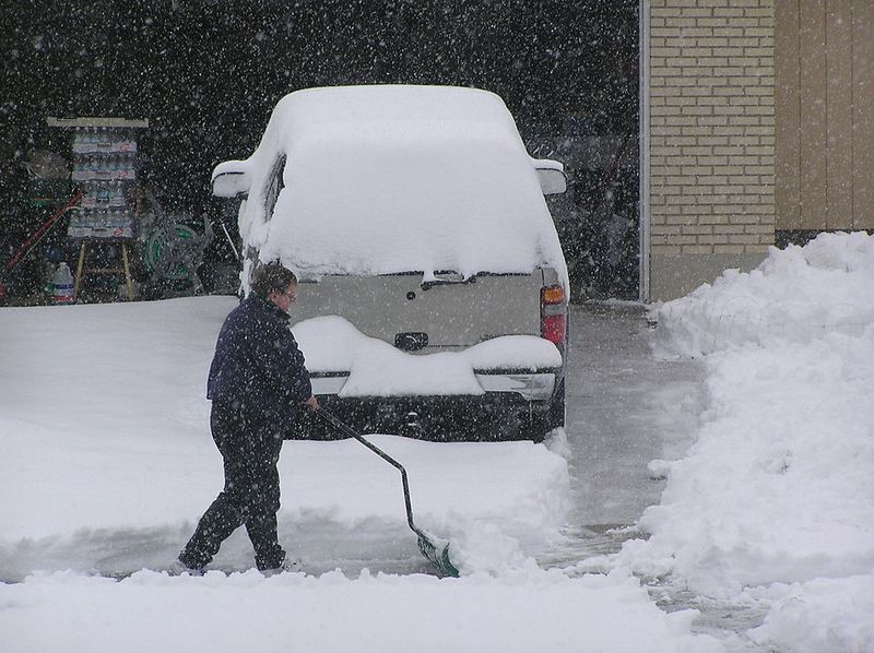
Still, totals will vary wildly by storm track, timing, and lake temperatures. You might see a blockbuster week followed by an oddly calm stretch, then a sharp reload. Keep a flexible plan for commutes, school schedules, and backup heat, and watch mesoscale forecasts that refine snow bands and wind chills within 24 to 48 hours.
For the southern tier, La Niña typically tilts the season drier and warmer. NOAA expects below average precipitation to be more likely across Southern California, the Southwest, the Gulf Coast, and parts of the Southeast. That means fewer strong Pacific storms reaching Southern California and fewer widespread cold fronts sweeping the Southeast.
Rain and snow can still occur, but the odds lean toward prolonged dry stretches punctuated by brief, fast movers. If dryness persists into spring, drought risk can escalate, nudging up wildfire concerns and pressuring water supplies. You will want to track reservoir levels, soil moisture, and any early red flag warnings.
Warm anomalies also reduce the frequency of wintry precipitation outside higher terrain. Still, a timely cold snap can deliver a rare ice or snow event, even in a La Niña pattern. Use this season to sharpen water conservation habits, schedule vegetation management, and coordinate with local advisories for burn restrictions and air quality.
La Niña sets broad trends, but big storms can still hit anywhere when ingredients align. A stronger northern jet often speeds storms and sharpens temperature contrasts, which can drive snow squalls, rapid icing, and disruptive wind. Even drier favored regions can see one high impact event that defines a season.
For northern states, plan for frequent plow operations, variable visibility, and stacked commutes. Utilities should stage crews for wind driven outages and cold related stress on equipment. In the south, emphasize water conservation, vegetation clearing, and coordination on wildfire readiness as spring approaches.
Build a flexible checklist now: updated tires, insulation checks, backup heat, and travel kits with chargers, snacks, and blankets. Then lean on 7 to 10 day outlooks to frame windows of risk, and day ahead forecasts for exact timing. NOAA will update guidance as winter nears, so keep notifications on and adjust plans with each forecast cycle.


