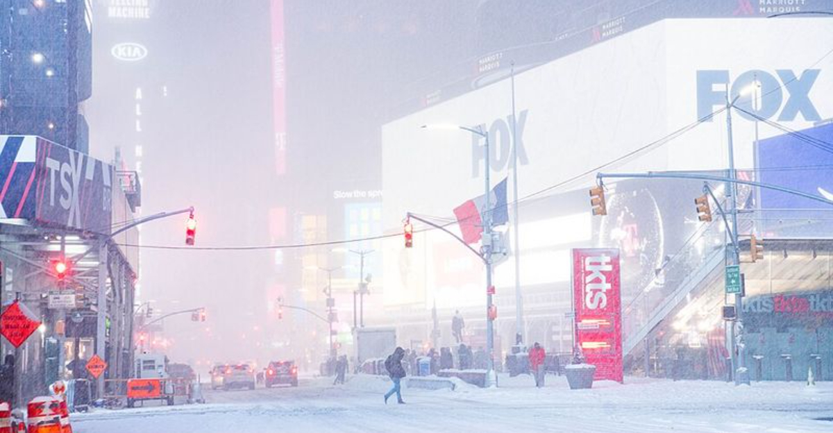
A powerful burst of Arctic air is crossing the Great Lakes, priming the atmosphere for a monster lake-effect snowstorm. Feet of snow are possible in narrow, relentless bands that could hammer the same towns for days. Travel may grind to a halt as visibility collapses and roads drift shut faster than crews can clear them. If you live downwind of the lakes, now is the time to prepare and stay weather aware.
A surge of frigid Arctic air is sweeping over the relatively warm waters of the Great Lakes, igniting classic lake-effect snow. As moisture and heat rise from the lakes, clouds mushroom and dump intense, localized snowfall that can vary wildly from one mile to the next. You could see calm skies at home, then drive ten minutes and hit a wall of white with instant whiteout.
Forecasters with Fox Weather highlight that this event may persist for several days, allowing snow bands to train over the same communities. That repeat targeting is what turns inches into feet and overwhelms plows. Snowfall rates may spike to 2 to 4 inches per hour, quickly burying cars, driveways, and roads even after crews pass.
The prolonged nature of this storm raises risks beyond slick travel. Blowing and drifting can rapidly reduce visibility again minutes after clearing, prolonging closures and delays. Stock up on essentials, check generators and heaters, and plan for limited mobility, especially if you live in a typical snowbelt.
Unlike big synoptic storms, lake-effect is surgical and unforgiving. A slight wind shift can move the bullseye. Stay flexible, monitor alerts, and be ready to hunker down longer than expected.
The traditional snowbelts are lighting up, especially east and southeast of Lakes Erie and Ontario, with persistent winds locking bands in place. Communities near Buffalo and Watertown sit in prime corridors where long lake fetch fuels towering clouds and extreme snowfall rates. In Michigan, the Upper Peninsula and the western Lower Peninsula downwind of Lake Michigan also face intense, prolonged bursts.
What makes this round so dangerous is duration. Bands can redevelop over the same neighborhoods for days, steadily stacking totals into multiple feet. Cross one town line, and you might jump from manageable accumulations to a buried main street.
Small wind shifts will shuffle the deck, so the exact jackpot zone can pivot by a few miles. That means your friend across town might dig out from three feet while you watch flurries. Stay tuned to local radar, mesoscale discussions, and school or work alerts to adapt plans.
If you live in a known corridor, move your car, flag hydrants, and clear drainage paths now. Keep exits accessible for first responders. Conditions can escalate quickly when a band parks, so advance prep will save time and reduce risk.
As the strongest bands intensify, visibility can drop to near zero within minutes. Even if official blizzard criteria are not met everywhere, the effect will feel blizzard-like with gusty winds, drifting, and rapid road coverage. Highways near the lakes are especially vulnerable as crosswinds lift and redeposit snow across open stretches.
Plows may clear lanes only to see them vanish under fresh squalls. Vehicles can become stranded quickly, and rescue operations might be delayed for safety. If you must travel, carry a fully stocked winter kit, extra warm layers, phone chargers, and sand or traction aids.
Air travel is at risk too, particularly at regional airports where bands park over runways. Expect delays and cancellations while crews struggle to keep surfaces operational. Build extra buffer time, rebook proactively, and monitor airline apps for rolling changes.
The safest choice is to avoid unnecessary trips until conditions stabilize. Park off street if possible to help plows, and keep tailpipes clear to prevent carbon monoxide buildup. Share your plans with someone, and if you hit a whiteout, slow down, increase distance, and never stop in travel lanes.
Because lake-effect events can linger far longer than typical storms, preparation needs to be marathon minded. Officials stress stocking several days of food, water, medications, and pet supplies. Heavy snow can weigh down trees and lines, so be ready for power outages and keep flashlights, batteries, and a charged backup battery on hand.
Safety matters most during cleanup. Shoveling wet, heavy snow can strain your heart, so take breaks, push rather than lift, and know the warning signs. Run generators outdoors, at least 20 feet from doors and windows, to avoid carbon monoxide poisoning.
Heat safely with approved devices and clear vents to prevent dangerous buildup. Mark hydrants and check on neighbors who may need help, especially older adults. Keep communication devices charged and enable emergency alerts for fast updates.
Meteorologists note that while lake-effect is a familiar winter threat, storms of this magnitude are rare and require extra caution. Plan for isolation if a band parks overhead. By preparing early and staying informed, you can ride out prolonged impacts and recover faster when the sky finally clears.


