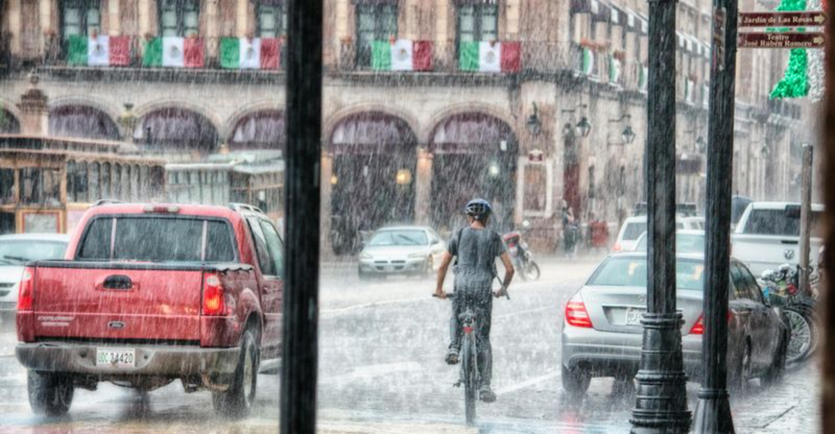
Evacuation warnings are pulsing across Greater Los Angeles as a conveyor belt of Pacific storms drenches hillsides and low lying neighborhoods. If you live near recent burn scars or canyon roads, now is the moment to plan your exit route and pack essentials. Forecast models point to intense rain bursts that can turn streets into rivers and slopes into sliding earth within minutes. Stay weather aware so you are ready to move before conditions escalate.
Forecasters say La Niña is taking a breather, and that pause matters for Southern California right now. With the classic La Niña setup weakening, different storm tracks have room to steer moisture toward Los Angeles. You can feel it in the rhythm of the rain, with bursts that arrive faster than drainage systems can handle.
Jet stream kinks are overpowering the usual pattern, sending atmospheric rivers and stacked lows toward the coast. That shift raises flash flood and mudslide risks, especially below burn scars in the San Gabriel and Santa Monica Mountains. If you live near a canyon or debris basin, consider pre packing, mapping alternative routes, and keeping a battery radio ready.
This does not mean La Niña has vanished. It means probabilities shifted, and January is seizing the opening with warmer air and frequent precipitation. Stay nimble, check local alerts, and treat watches and warnings as actionable guidance.

Warmer than average air sounds comforting, but in Los Angeles it can supercharge rain rates by holding more moisture. Instead of deep cold, you get robust, juicy storms that wring out over foothills and urban corridors. That is when low spots flood and unstable slopes let go.
Forecasters expect fewer lengthy cold snaps and more spring like intrusions, especially east of the Rockies. Out West, mild spells still mingle with mountain winter, while our basin sees rain over snow. You should avoid driving through ponding on freeways and know which intersections routinely flood.
Short cold shots can still slip in, briefly lowering snow levels and complicating mountain passes. Yet the overall warmth argues for rain dominated events across LA County. Plan for slick commutes, possible power outages, and slower drainage as storm pulses repeat.
January is trending wetter, and that carries consequences for Greater Los Angeles. Repeated storms saturate soils until hillsides behave like sponges at their limit. When the next downpour hits, runoff accelerates into channels, streets, and debris basins.
Meteorologists highlight a storm track aimed at the South, Midwest, and East, but the West Coast still receives periodic hits. Here, snow levels wobble, so mountain snow can switch to rain that rushes downhill. If your neighborhood sits below a burn scar, keep gutters clear, move cars off steep streets, and know evacuation zones.
Urban flooding is a top concern when cells train over the same corridor. It does not take a blockbuster storm to overwhelm storm drains after several wet days. Monitor river gauges, heed flash flood warnings, and avoid canyons during active rain.
A soggy January does not close the book on winter. La Niña still lingers in the Pacific and could flex again later, reshaping cold and snow chances. For Los Angeles, that means staying adaptable as patterns pivot and new storm windows open.
Expect variability, not a straight line. A later jet shift could pull Arctic air south, alter snow levels, and change storm intensity. Keep your go bag stocked, maintain half a tank of fuel, and subscribe to local alerts so you are not scrambling.
Right now, rain is the headline, with flooding and mudslides the practical threat. February could look different, but preparation you do today pays off in any scenario. Treat January as a transition, and make safety steps routine rather than last minute.


