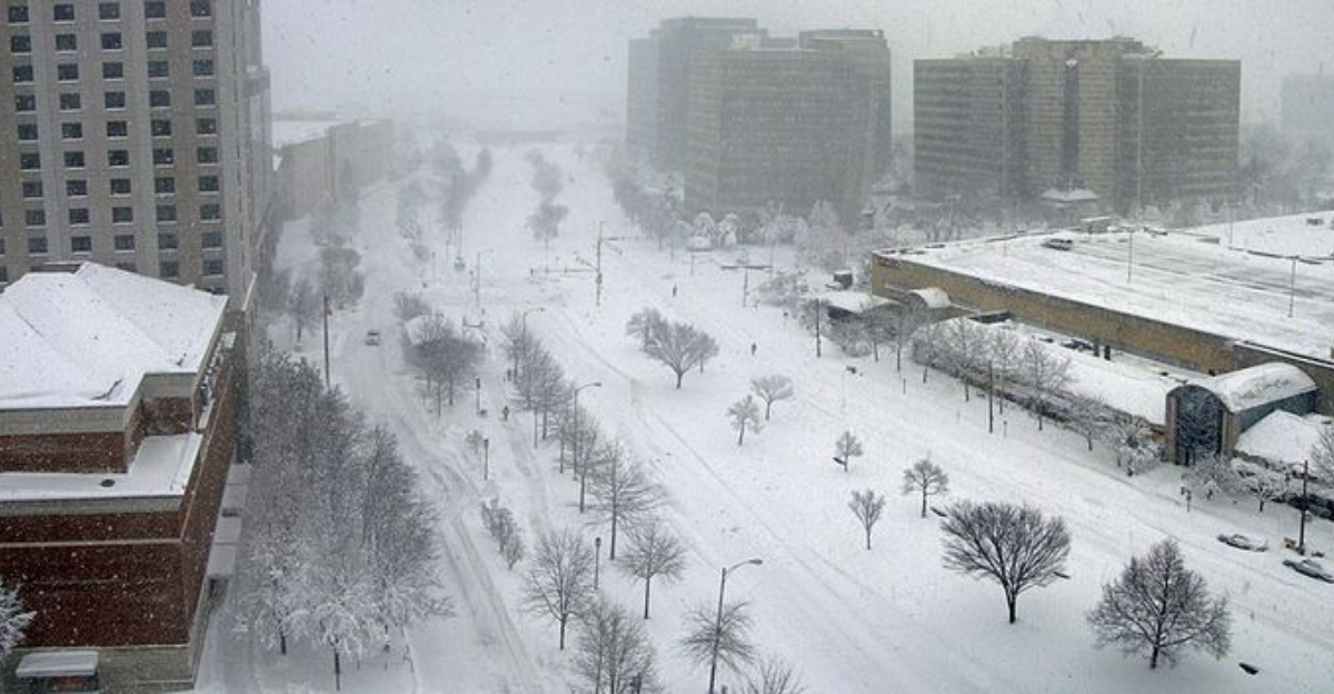
A rare winter storm is taking aim at the far South, and the setup looks primed for more snow than most of us are used to seeing. Cold air is dropping south while Gulf moisture surges in, a combo that can flip typical rain into accumulating snow. If you live in Tennessee or the Carolinas, you could wake up to slick roads, power hiccups and altered plans.
Stay with this guide so you can prepare confidently and avoid last minute surprises.
Unusual Winter Storm Threatens Heavy Snow in the Far South
A winter storm is aiming at parts of the far South, and it is the kind that makes you pause. Cold air is settling in just as Gulf moisture arrives, flipping what would usually be rain into snow. That combination is rare this far south, which is why even a few inches can cause outsized issues on roads, bridges and overpasses.
Forecasters say timing and temperatures will be critical to how much piles up. A small wobble in the storm track can shift heavy bands and leave one town fine while the next struggles. You should plan for school delays, slick commutes and power blips if wet snow clings to trees and lines.
Because crews and equipment are limited compared to northern cities, treatment may lag and refreeze can sneak in overnight. Keep travel flexible, charge devices and gather basics like batteries, snacks and meds. Follow local alerts closely because watches can turn into warnings with little notice.
Confidence is growing that parts of Tennessee and the Carolinas will see impactful snow. If the cold deepens, totals rise quickly. Prepare now so you can stay put when flakes start flying.
Tennessee Faces Elevated Risk of Accumulating Snow
Tennessee sits in a prime zone for accumulating snow as this storm matures. Cold air is already in place across central and eastern counties, letting flakes stick instead of melt. If you have weekend travel or a late commute, plan around heavier bursts that can quickly drop visibility.
Transportation officials typically ask drivers to stay off roads during the worst hours. Black ice forms fastest on bridges and ramps, so even confident drivers can get caught off guard. Fewer plows and treatment rigs mean roads may remain slick longer than you expect.
Power outages become more likely when wet snow clings to branches across the Cumberland Plateau and foothills. Keep your phone charged, top off gas and know an alternate route if a hill becomes impassable. If you must drive, slow down, increase following distance and avoid sudden braking.
Check county advisories for school or event changes. Even three inches can close routes in hollows and ridge lines. Prepare a small kit with water, snacks and blankets so you are comfortable if delays stack up.
Carolinas Could See Snow and Wintry Mix
The Carolinas are watching a tricky forecast where small temperature shifts make big differences. Inland North Carolina looks favored for snow, while parts of South Carolina may see a snow sleet mix or freezing rain. That ice risk is the wild card, coating roads, trees and lines with a slick glaze.
Higher elevations stand to collect the most, with the foothills and mountains turning white first. Coastal zones likely trend warmer with rain, yet a deeper push of cold could reach farther south than first expected. Keep a close eye on updates because precipitation type can flip within an hour.
If you hear pellets on the window, that is sleet, which makes traction poor but limits ice accretion. Freezing rain is quieter and far more dangerous, building weight on limbs that can snap. Park away from large branches, and avoid driving over shaded bridges that hide thin glaze.
Have flashlights handy, charge devices and plan for possible spotty outages. Short trips can take much longer when untreated intersections freeze. Monitoring alerts will help you time errands before the worst arrives.
Travel and Power Disruptions a Major Concern
Travel and power impacts are top concerns as this storm slides across areas unaccustomed to winter weather. Airports may face deicing delays and cascading cancellations, while interstates slow behind plows and minor fender benders. Rail schedules can slip too, especially where switches freeze and crews must work in bursts.
Power outages become more likely when heavy, wet snow or glaze loads up on trees and lines. Utilities will stage crews early, but restoration takes time if damage is widespread. You can help by charging phones and battery packs, securing loose outdoor items, and moving cars off street where plows need space.
Once precipitation begins, limit nonessential trips. Black ice can look like wet pavement and turn a normal stop into a slide. Keep extra washer fluid, a scraper, warm layers and a blanket in the car in case traffic stalls for hours.
Prepare meals that do not need cooking, fill prescriptions, and check on neighbors who may need assistance. Staying informed through local alerts will help you pivot quickly. A little caution now can prevent injuries and keep you comfortable until the storm exits.


