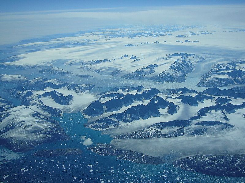
Glaciers and ice sheets aren’t breaking apart in sudden, dramatic collapses like you might see in movies. Instead, they’re slowly creeping toward the ocean every single day, carrying enormous amounts of ice that eventually melts into the sea.
Scientists using satellites have spent the last ten years watching this silent migration, and what they’ve discovered is changing how we understand rising sea levels and the future of our coastlines.
1. Polar Ice Sheets Don’t Collapse Suddenly
Forget the Hollywood version of ice sheets exploding into the ocean overnight. Reality moves much slower but just as powerfully.
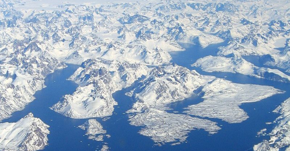
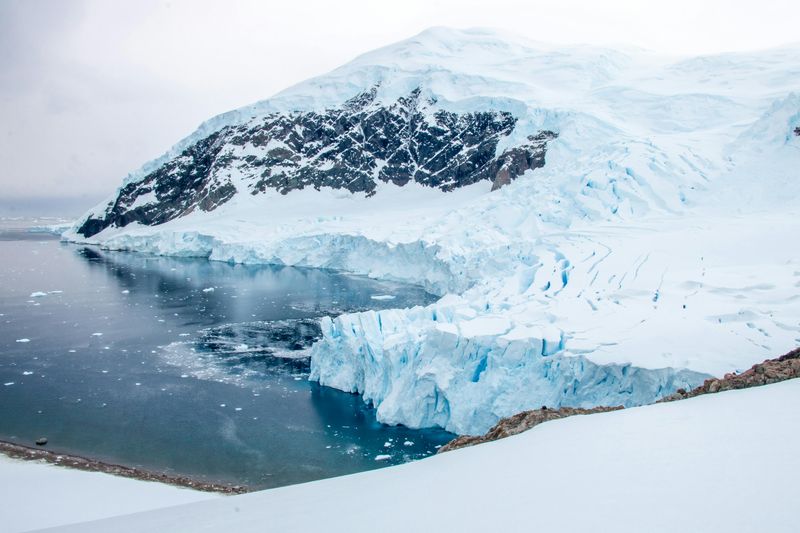
Giant ice masses in Greenland and Antarctica shift gradually, like rivers made of frozen water flowing in super slow motion.
These massive ice rivers don’t crack apart all at once. Instead, they creep forward continuously, day after day, year after year.
Scientists now understand that this steady movement, not sudden breaks, accounts for most ice loss from polar regions.
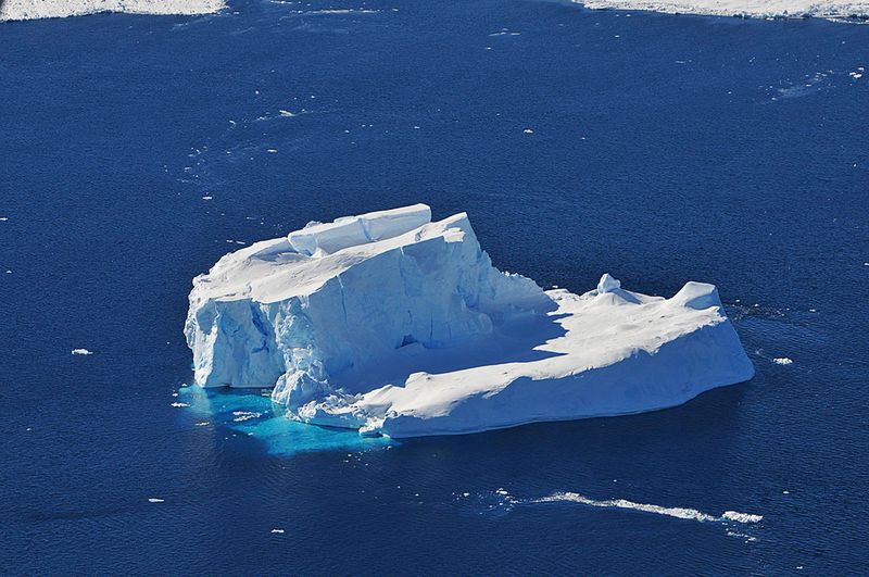
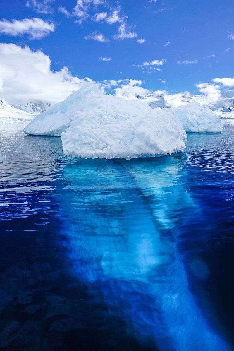
The dramatic images of ice shelves calving into the sea make headlines, but they represent only a fraction of the story. Most ice reaches the ocean through relentless, patient migration that happens whether cameras are watching or not.
This quiet process has been reshaping our planet’s ice for thousands of years, and it continues today at rates that concern climate researchers worldwide.
2. Ice Flow Controls Sea-Level Rise
How quickly ice travels from land to ocean determines our future coastlines. When ice sits on land, it doesn’t affect sea levels at all.
But once that same ice flows into the ocean and melts, it adds volume to the world’s seas, pushing water levels higher along every shore.
Scientists track ice velocity because it tells them exactly how much land-based ice is becoming ocean water. Faster flow means more ice entering the sea, which translates directly to faster sea-level rise.
This connection makes ice speed one of the most critical measurements in climate science.
Researchers use these flow rates to build computer models predicting future flooding in coastal cities. Even small changes in ice velocity can mean big differences for communities from Miami to Mumbai.
Understanding this relationship helps governments plan for everything from building seawalls to relocating neighborhoods threatened by rising tides.
3. Daily Ice Movement Is Constant
Every single day, without pause or rest, colossal volumes of ice migrate from the frozen hearts of Greenland and Antarctica toward their edges. Think of it like a conveyor belt that never stops, constantly delivering ice from the interior toward coastal regions where glaciers meet the sea.
This daily movement happens whether it’s summer or winter, stormy or calm. The ice doesn’t take breaks or slow down for weekends.
Gravity pulls it downhill along paths carved over millennia, and the sheer weight of ice piled miles thick keeps the flow going.
The amounts involved are staggering. In just 24 hours, some glaciers transport enough ice to fill thousands of Olympic swimming pools.
Over a year, this adds up to ice volumes measured in cubic kilometers, all marching steadily toward the ocean where it will eventually contribute to sea-level rise affecting billions of people worldwide.
4. Long-Term Monitoring Was Once Nearly Impossible
Imagine trying to watch something happen in the most hostile environment on Earth. For decades, scientists struggled to keep continuous eyes on polar ice because the conditions fought them at every turn.
Blizzards could last for days, burying equipment and making visibility zero.
Winter darkness stretches for months near the poles, making traditional cameras useless. Temperatures plunge to levels that freeze fuel and crack metal.
The remoteness means that if equipment breaks, repairs might take months or be impossible until the next summer season.
Ground-based monitoring stations could only cover tiny areas, like watching a single tree in a vast forest. Aircraft surveys were expensive and weather-dependent, often providing just snapshots separated by months or years.
Scientists knew ice was changing, but getting the full picture remained frustratingly out of reach until technology finally caught up with the challenge of polar observation.
5. A 10-Year Satellite Record Changed Everything
Between 2014 and 2024, something remarkable happened in polar science. Satellites circling overhead provided uninterrupted observations of ice sheets every single week and compiled them into yearly records.
For the first time ever, scientists could watch ice flow continuously across entire continents of frozen water.
This decade of data transformed understanding from scattered snapshots into a continuous movie. Researchers could finally see patterns, track changes over seasons, and spot accelerations that shorter studies would have missed completely.
The consistency meant they could trust the trends they were seeing.
Before this breakthrough, gaps in data left scientists guessing about what happened during unobserved periods. Now they have a complete record showing exactly how Greenland and Antarctica’s ice behaved through warm years and cold ones, through all seasons and weather conditions.
This information is revolutionizing predictions about future sea-level rise and giving policymakers the solid evidence they need to plan ahead.
6. Radar Satellites See Through Darkness and Clouds
Regular cameras need light and clear skies, but polar regions offer neither for much of the year. That’s where radar technology becomes a game-changer.
These instruments send out radio waves that bounce off ice surfaces and return to the satellite, creating detailed images regardless of lighting or weather.
Clouds that would blind optical cameras are completely invisible to radar. The months of polar night that plunge the Arctic and Antarctic into 24-hour darkness don’t matter either.
Radar works exactly the same way at noon or midnight, in sunshine or snowstorm.
This capability means winter observations are just as reliable and detailed as summer ones. Scientists no longer have to wait for good weather or daylight to gather data.
They can track ice movement continuously through every condition the poles throw at them, building a complete picture of how ice behaves throughout the entire year, not just during the brief summer observation windows that limited earlier research efforts.
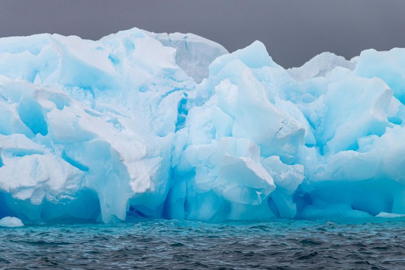
7. Ice Moves at Dramatically Different Speeds
Not all ice crawls at the same pace. In some regions, particularly the thick, stable interiors of ice sheets, ice barely budges.
It might move less than 90 centimeters per day, taking centuries to travel even a few kilometers. You could literally watch paint dry faster than this ice flows.
But near the coast, where ice funnels into outlet glaciers, speeds increase dramatically. Some fast-flowing glaciers race forward at up to 15 meters per day.
That’s roughly the length of a school bus moving every 24 hours, which sounds slow until you remember it’s solid ice weighing billions of tons.
This variation matters enormously for predicting sea-level rise. Slow-moving ice takes a long time to reach the ocean, while fast glaciers deliver ice to the sea much more quickly.
Scientists map these speed differences across entire ice sheets to understand where ice loss is happening fastest and which regions pose the greatest threat to coastal communities in coming decades.
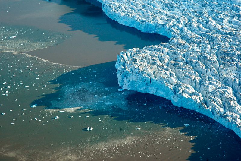
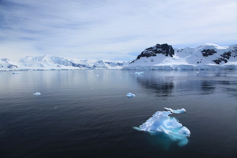
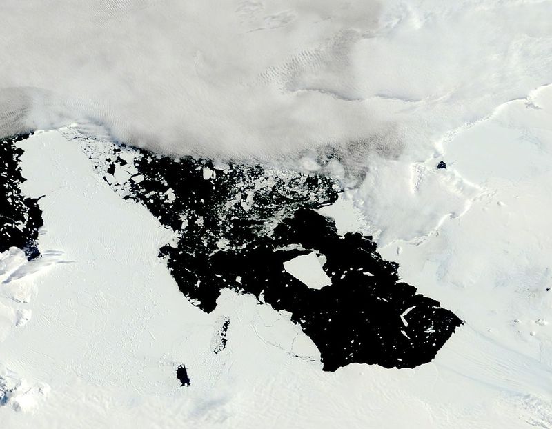
8. Antarctica’s Coastline Reveals Hidden Changes
Along Antarctica’s vast coastline, satellites measured ice movement every 6 to 12 days throughout the decade-long study. This frequent monitoring exposed subtle speed increases that earlier, less frequent observations had completely missed.
Changes that seemed invisible in annual snapshots became obvious when watched continuously.
These hidden accelerations are critically important because coastal regions are where ice transitions from grounded sheets to floating shelves, and eventually to the ocean. Small speed increases here can signal big changes happening beneath the surface, like warming water melting ice from below.
Scientists discovered that many coastal glaciers weren’t flowing at steady rates as previously assumed. Instead, they showed complex patterns of speeding up and slowing down tied to seasons, ocean temperatures, and other factors.
Understanding these patterns helps researchers predict which parts of Antarctica are most vulnerable to rapid change and which coastal areas worldwide should prepare for the most significant sea-level impacts in coming years.
9. Pine Island Glacier Is Accelerating
West Antarctica’s Pine Island Glacier has scientists particularly worried. Over the ten-year study period, this massive ice river showed a steady and continuous speed increase right at the critical point where grounded ice begins to float.
Measurements showed velocity rising from 34.8 feet per day to 41.7 feet per day.
That might not sound dramatic, but for a glacier containing enough ice to raise global sea levels by several feet, any acceleration is concerning. The speed increase means more ice is flowing into the ocean faster than before, contributing more quickly to sea-level rise.
Pine Island Glacier is considered one of Antarctica’s most unstable ice masses. Its grounding line, where ice lifts off the bedrock and starts floating, has been retreating inland.
This retreat removes support that helps slow the glacier down, allowing it to accelerate further. Scientists watch this glacier closely because its behavior might preview what could happen to other Antarctic glaciers if warming continues, potentially triggering much faster sea-level rise than current predictions suggest.
10. Ocean Warming Is Driving Antarctic Changes
Antarctica’s ice doesn’t just melt from warm air above. Much of the action happens underwater, where warming ocean currents reach beneath floating ice shelves and melt them from below.
This hidden melting is thinning ice shelves that normally act like brakes, slowing down glaciers behind them.
As ice shelves thin, they provide less resistance to the glaciers feeding them. This allows those glaciers to speed up, sending more ice toward the ocean.
Scientists have traced acceleration patterns back to specific ocean warming events, creating a clear cause-and-effect connection.
The grounding line, where ice transitions from resting on bedrock to floating on water, is also retreating inland in many locations. Warmer water melts ice at this boundary, causing it to lift off the seafloor earlier.
Once ice starts floating, it flows faster and eventually breaks apart or melts completely. This process is particularly concerning because much of West Antarctica’s ice sits on bedrock below sea level, making it especially vulnerable to ocean warming that could accelerate dramatically.
11. Greenland Hosts Some of Earth’s Fastest Glaciers
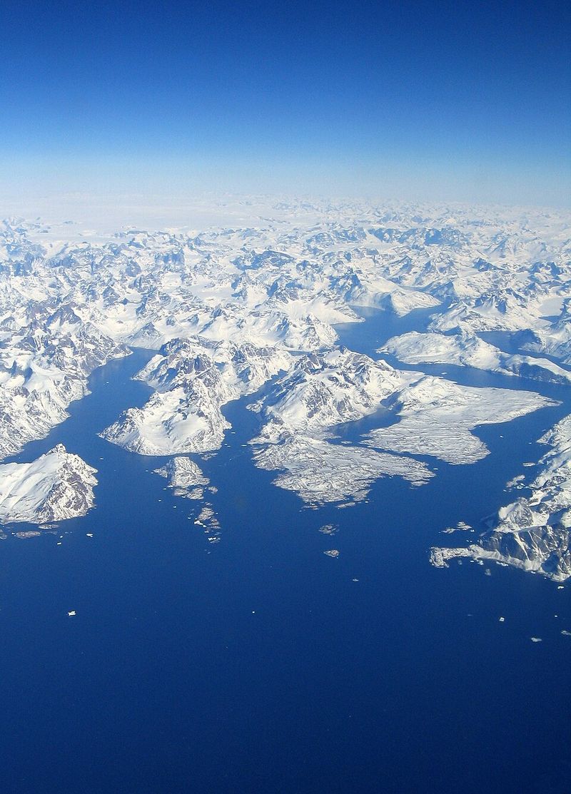
While Antarctica gets much attention, Greenland’s glaciers move at truly astonishing speeds. Several outlet glaciers racing toward the coast travel up to 15 meters per day regularly.
That’s nearly 50 feet of ice advancing every single day, making them among the fastest-flowing ice masses anywhere on the planet.
Sermeq Kujalleq, also known as Jakobshavn Glacier, occasionally reaches speeds of 50 meters per day during peak flow periods. At that rate, ice moves more than 160 feet daily.
You could actually see the ice surface shift if you watched carefully enough over several hours.
These extreme speeds occur because Greenland’s glaciers flow through steep valleys carved by ice over millions of years. Gravity pulls powerfully on ice descending from the high interior plateau toward sea level.
Combined with meltwater that lubricates the glacier base, this creates conditions for remarkably rapid flow. The speed means Greenland contributes significantly to sea-level rise despite being smaller than Antarctica, delivering massive ice volumes to the ocean year after year.
12. Ice Speed Is a Direct Warning Signal
When glaciers accelerate, they’re sending us a message we need to hear. Ice flow rates directly reveal how much land-based ice is entering the ocean right now and hint at what’s coming.
Faster flow means more ice loss, which translates immediately into higher sea levels affecting coastlines everywhere.
Greenland and Antarctica together hold enough frozen water to raise global sea levels by tens of feet if all of it melted. That won’t happen overnight, but even today’s relatively modest losses are already causing serious problems.
Coastal flooding happens more frequently, erosion eats away beaches and cliffs, and storm surges reach farther inland than before.
Communities worldwide are experiencing these changes firsthand. High-tide flooding now regularly swamps streets in Miami, Charleston, and other coastal cities during events that wouldn’t have caused problems decades ago.
Island nations face existential threats as their land disappears beneath rising waters. By monitoring ice speed, scientists can warn us how quickly these problems will worsen, giving communities precious time to adapt, protect, or relocate before the water arrives.


