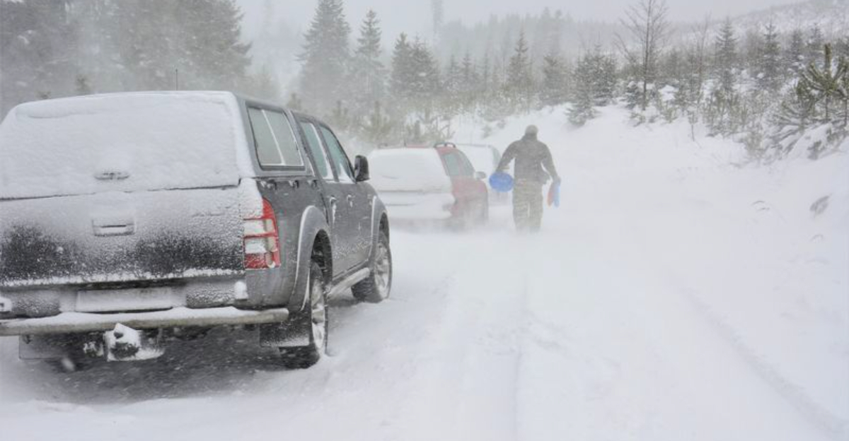
Just as shovels are finally scraping down to pavement, another potent winter system is lining up for the Northeast. Forecast models hint at a coastal low that could intensify fast, feeding on arctic air and a sharp jet stream dip.
Travel, power, and school plans may be on the line again if snow bands and gusty winds lock onto the I-95 corridor. Stay close to updates now because timing and track will decide who sees disruptive totals and who escapes with flurries.
You just dug out, and now the next storm signal is flashing. Forecasters are tracking a fresh low-pressure system that could consolidate near the East Coast and intensify over the weekend.
With arctic air already entrenched, even a moderate track could deliver impactful snow and biting wind.
This setup features a deep jet stream trough guiding moisture into cold air, the classic recipe for a coastal nor’easter. If the low tucks close to shore, heavy snow bands and coastal gusts could develop from the Mid-Atlantic into New England.
If it tracks farther offshore, impacts would ease, but slick roads and lingering chill still threaten.
Cities like New York and Boston, hit hard days ago, face renewed travel risks, from flight delays to hazardous commutes. Side streets and sidewalks remain icy where sun and salt have not done enough, so any fresh coating will worsen conditions.
Stay alert to National Weather Service advisories, and prepare for fluctuating snowfall projections.
Confidence in exact totals is low now, but odds favor some snow, plus wind-whipped periods that reduce visibility. Power crews may contend with blowing snow and sporadic outages if gusts ramp up.
Check supplies early, refuel vehicles, and reconsider weekend plans if guidance trends stronger.
The ingredients are textbook. A stout arctic air mass blankets the Northeast, while the jet stream carves a sharp trough over the eastern U.S.
That upper support can ventilate a developing coastal disturbance, allowing pressure to fall and snowfall rates to surge if banding locks in.
Model spread remains meaningful, with some runs tucking the low near the benchmark and others sliding offshore. The difference is everything for snowfall gradients along I-95.
Stronger coastal coupling would favor heavy snow and gusts, while a weaker solution brings lighter accumulations and more coastal mixing.
Antecedent conditions matter too. Refreezing has glazed roads and sidewalks since the historic storm, so fresh bursts will quickly bond to cold surfaces.
Even a modest clipper crossing the Great Lakes could prime lake-effect belts, stacking localized totals before the main event.
Watch for signals like a consolidated low, tightening isobars, and robust frontogenesis pivoting inland. Those cues point to mesoscale bands capable of two inch per hour bursts.
Until guidance converges, plan for disruptive snow and blowing wind, then scale preparations up or down as confidence shifts.
Daily routines may wobble again if this storm matures. Airport operations could see deicing queues, runway slowdowns, and rolling cancellations during heavier bursts.
Rail and bus networks often run reduced schedules when visibility drops and switches freeze, so expect knock-on delays.
Road travel will hinge on timing. Overnight snow can outpace plows and treatment, especially where salt supplies were drawn down by the last storm.
Black ice remains a stealth hazard on shaded ramps, bridges, and neighborhood hills.
Get ahead of it. Top off prescriptions, charge devices, and stage an emergency kit with water, snacks, flashlights, and warm layers.
If you must drive, keep a scraper, shovel, traction aids, and a half tank minimum.
Work and school plans may pivot to remote options if rates spike. Power interruptions are possible where gusts slap tree limbs onto lines, though dry snow limits weight risks.
Track official alerts, adjust itineraries early, and consider moving trips outside the storm window.
Preparation works best when timed to the forecast. Two to three days out, verify alerts on your phone, review insurance contacts, and refill fuel for generators or snowblowers.
Restock rock salt, pet-safe ice melt, and windshield fluid rated for deep cold.
A day before, charge power banks, do a grocery run for shelf-stable staples, and stage shovels by entries. Park vehicles off-street where possible to help plows clear curb lanes.
Pre-treat high-traffic steps and walkways to reduce refreeze.
On storm day, bundle tasks during lulls and clear snow in layers rather than waiting for a heavy slab. Dress in moisture-wicking layers, protect fingers and face, and take breaks to prevent overexertion.
Keep pets brief outside, and wipe paws free of salt.
Timing signals to watch include deepening coastal pressure, a jog toward the benchmark, and collapsing visibility in regional radar bands. Those cues favor heavier totals and gusty conditions.
If models trend weaker or offshore, impacts ease, but do not drop your guard until the back edge passes.


