Arctic air has settled in across the Northeast, and it is not leaving quietly. Another storm signal is emerging along the coast, raising the risk for fresh snow where piles from the last blizzard still line streets.
Forecast models disagree on the track, but the ingredients are on the table and timing is narrowing. If you live or travel along I-95, you will want to follow updates closely over the next 48 hours.
Another coastal storm threat is gathering as entrenched Arctic air lingers over the Northeast. Forecast guidance highlights a developing low off the Mid Atlantic that could lift north along the Eastern Seaboard, tapping cold air to produce snow.
Confidence in exact track and intensity remains moderate at best, but the signal for accumulating snow is notable.
Major cities like New York, Philadelphia, and Boston still face crusted snow, narrowed lanes, and slick sidewalks. With temperatures well below freezing, even light new snow will bond to existing ice, worsening traction and visibility.
Expect flight schedules to wobble again, and plan for slower commutes and extended plow operations.
While this does not guarantee a blockbuster, a coastal low tracking close to shore can intensify quickly. A jog west means heavier snow bands and stronger gusts.
A farther offshore route favors lighter totals but still hazardous travel, especially overnight when road salt loses effectiveness and black ice hides under fresh powder.
Monitor advisories and model trends through Friday for timing and totals. If snowfall rates spike during peak travel, impacts may outrun accumulation.
Prepare now so you are not scrambling once bands begin to fill in.
The setup hinges on a pronounced jet stream trough digging into the East while Arctic air stays locked at the surface. That cold dome supports snow if a coastal low forms near the Carolinas and rides north along the thermal gradient.
Baroclinic contrast between cold land and milder shelf waters can fuel rapid deepening.
Model spread remains meaningful, with some runs tucking the low closer to the benchmark and others slipping it offshore. A closer pass enhances frontogenesis and mesoscale banding, raising snowfall rates.
Farther east favors lighter, fluffier totals with biting wind and blowing snow.
Even without a classic nor’easter, the cold means modest QPF translates efficiently into accumulation. A clipper diving from Canada could pre condition the region with fresh coatings and lake effect snow for western New York.
That pre existing snowpack maintains high albedo and surface chill, reinforcing subfreezing boundary layers.
Watch for coastal front placement, which can locally boost lift and snowfall. Small jogs at 700 mb can pivot bands over the same corridor.
If high pressure to the north wedges stronger than modeled, a colder, snowier solution along I-95 becomes more likely.
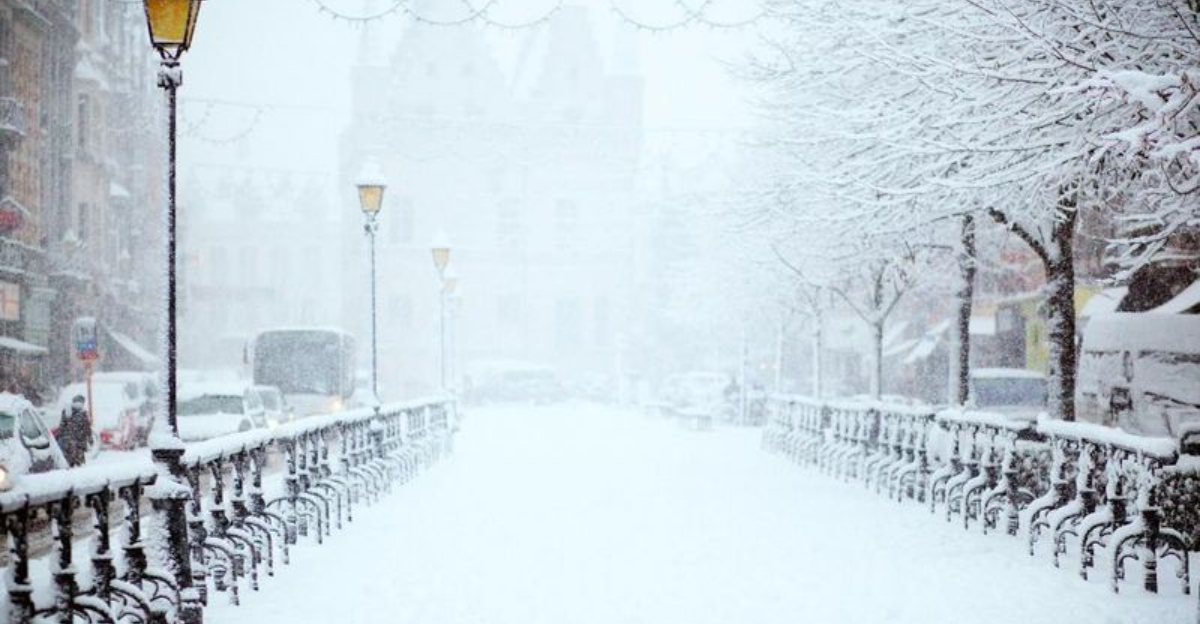
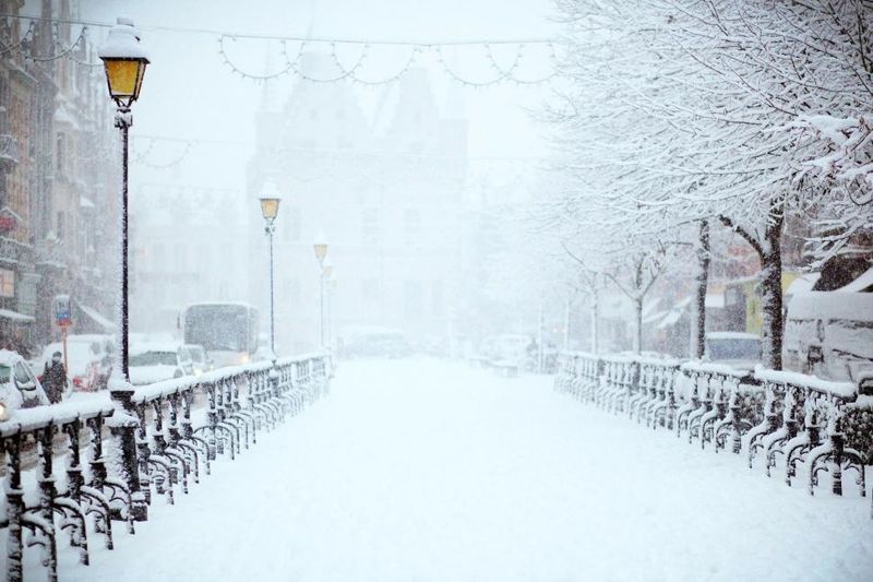
The region is still digging out from a historic storm that delivered one to two feet for many and higher drifts where winds piled snow. Crews have cleared primary routes, but secondary streets and sidewalks remain rutted with refreeze.
Storm drains are iced over, and parking remains tight under towering snowbanks.
Cold air locked in behind the system has preserved snowpack and kept road salt less effective. That means any additional snowfall will quickly adhere and glaze, even at modest rates.
Utility crews continue to address scattered outages, and flight operations are recovering unevenly as deicing demand persists.
Municipal resources are stretched, with overtime mounting and salt inventories shrinking. Another round, even minor, risks extending cleanup timelines and complicating school and business schedules.
Emergency managers urge patience with plow sequencing and caution at intersections where sightlines are blocked by banks.
Expect transit delays, restricted curb space for deliveries, and slower fire hydrant access until shoveling expands. Pedestrian hazards linger in shaded corridors and curb cuts.
Add time for every trip, and log pothole reports as freeze thaw cycles begin to fracture pavement under the remaining snow.
Stay ahead of shifting guidance by checking the National Weather Service, the FOX Forecast Center, and local emergency alerts twice daily. Enable push notifications and set location based warnings for your commute.
Track timing windows so you can adjust departures, deliveries, or appointments.
For travel, build buffer time and consider earlier flights or flexible fares. Keep the gas tank at least half full, top off washer fluid, and stash an emergency kit with blankets, snacks, and a scraper.
For homes, clear storm drains, widen driveway aprons, and mark hydrants to speed access.
Apply ice melt before the first flakes to improve traction, then reapply between bands. Move vehicles to one side during plow passes to avoid being walled in.
If forecasts trend snowier, postpone nonessential trips and coordinate remote options to reduce roadway volume.
Expect slick spots at night and on bridges where cold sinks. Wear traction aids if sidewalks are polished.
A little preparation now pays off later, helping you stay mobile and safe if the coastal low tightens and snowfall rates spike during the weekend window.


