Spring break only comes once a year, so why waste it sitting on a couch? The open road is calling, and the US has some seriously stunning routes that hit their peak right around this time of year.
From cherry blossoms in Washington, D.C. to wildflower explosions in Death Valley, there is a road trip here for every kind of traveler. Pack your snacks, charge your playlist, and get ready to roll.
Washington, D.C. Blossom Loop: Catch Peak Bloom Before It Vanishes
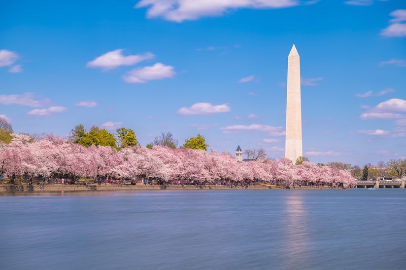
Every spring, Washington D.C. pulls off one of nature’s greatest limited-time offers. The cherry blossoms around the Tidal Basin and National Mall burst into bloom, and the whole city basically turns pink.
The National Park Service tracks peak bloom closely, and it typically lands between late March and early April.
The catch? Peak bloom lasts only about a week, sometimes less.
Timing your road trip around it feels like chasing a comet, but when you nail it, the payoff is unreal. I once drove in just as the blossoms hit their prime, and I genuinely forgot I was in a city for a moment.
Parking near the Mall can be rough, so consider arriving early or using the Metro for the Tidal Basin portion. Drive the loop around Hains Point for a quieter blossom experience away from the crowds.
Go on a weekday morning for the best light and the fewest selfie sticks in your face.
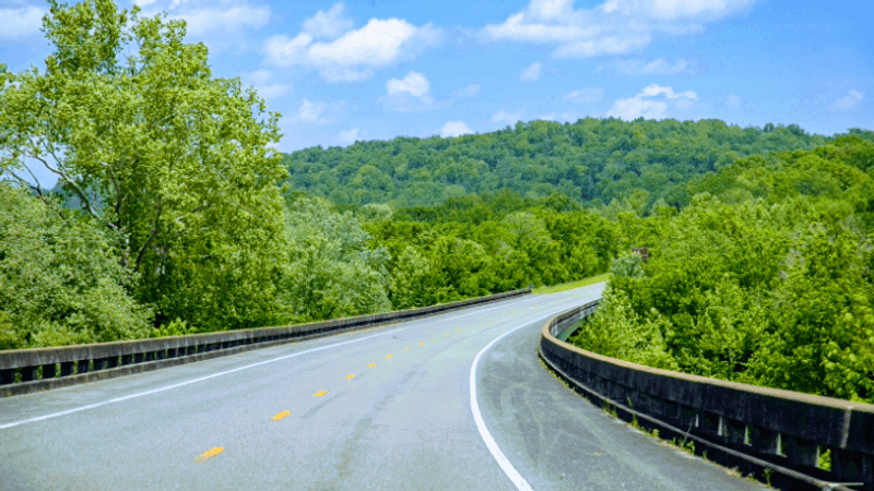
Shenandoah Skyline Drive: Mountaintop Overlooks on Repeat
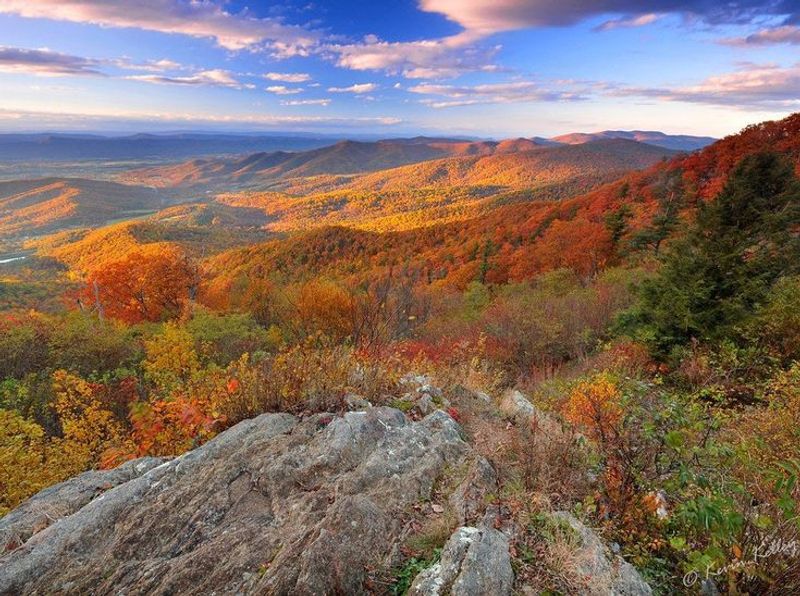
Skyline Drive is 105 miles of pure overlook addiction. Running the entire length of Shenandoah National Park in Virginia, this road sits right on the spine of the Blue Ridge Mountains.
Every few miles, another pullout appears with a view that makes you question why you ever live anywhere else.
Spring turns the forest a dozen shades of green, and wildflowers start popping up along the trails by mid-April. White-tailed deer are practically everywhere, treating the road shoulders like their personal neighborhood sidewalk.
Speed limits top out at 35 mph, which sounds slow until you realize every curve deserves that speed anyway.
Pick your entry point based on what you want to prioritize. The northern entrance near Front Royal drops you close to Dickey Ridge Visitor Center.
Luray Caverns sits just off the park and makes a solid detour if underground rock formations are your thing. Bring layers because mountain temps swing fast.
Blue Ridge Parkway: America’s Slowest Wow Road
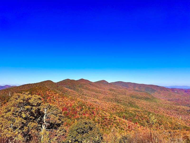
At 469 miles, the Blue Ridge Parkway connects Shenandoah National Park all the way to Great Smoky Mountains National Park. It has zero traffic lights, zero commercial trucks, and zero billboards.
The whole road feels like someone pressed mute on the modern world.
Spring on the Parkway is genuinely special because wildflower timing shifts with elevation. Lower sections bloom earlier while higher stretches are still waking up, which means you can literally chase spring as you drive south.
Trillium, bloodroot, and wild azalea put on a serious show.
The road has no gas stations, so fill up in towns before getting on. Asheville, North Carolina makes an excellent midpoint stop for food, coffee, and a little urban reset before heading back into the trees.
Some sections near the higher elevations can still have frost in early spring, so always check road conditions before you commit to a long stretch.
Natchez Trace Parkway: No Billboards. No Semis. Just Scenery.
The Natchez Trace Parkway runs 444 miles from Natchez, Mississippi all the way up to the Nashville, Tennessee area. No commercial trucks are allowed.
No billboards clutter the view. It is one of the most genuinely peaceful drives in the entire country, and most people have never even heard of it.
The road follows an ancient path used for centuries by Native Americans, settlers, and traders. Historic markers pop up regularly, turning the drive into an accidental history lesson.
Spring floods the roadside with dogwood blossoms and wildflowers that make every mile feel like a nature documentary.
Milepost markers run from 0 to 444, making navigation refreshingly simple. Stop at the Emerald Mound near Natchez, one of the largest pre-Columbian earthworks in North America.
The town of Natchez itself is worth an overnight stay for its stunning antebellum architecture. Nashville end of the drive puts you perfectly positioned for some post-road-trip live music.
Great River Road: Ten States. One Legendary River.
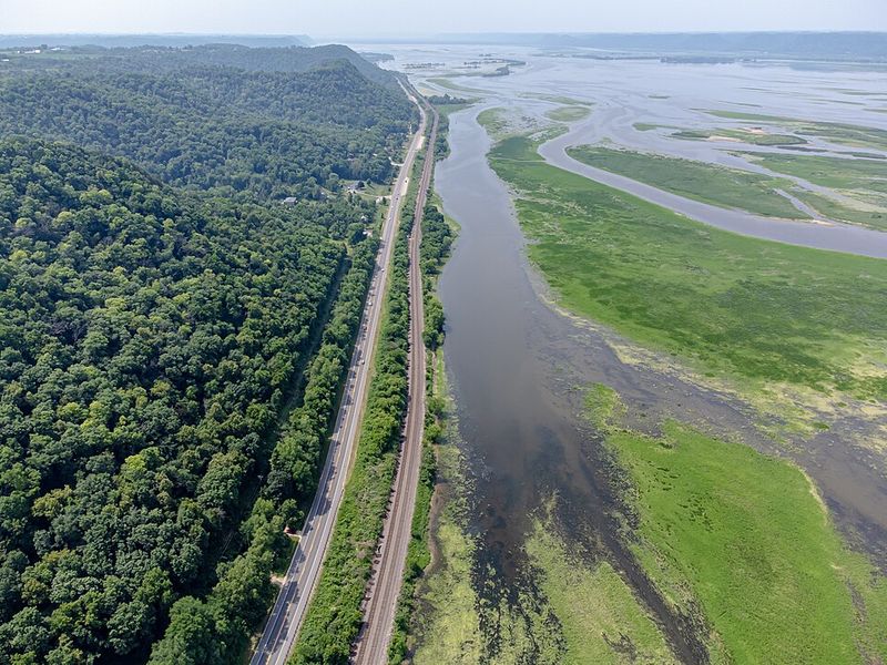
Nearly 3,000 miles long and touching ten states, the Great River Road follows the Mississippi River from Minnesota all the way to the Gulf of Mexico. You do not need to drive all of it.
Pick a spring-break-sized chunk and own it completely.
The Minnesota and Wisconsin sections offer dramatic bluff scenery and charming river towns like La Crosse and Winona. The Iowa stretch has a quieter, wide-open feel that is surprisingly underrated.
Further south, Missouri and Illinois deliver historic towns with riverboat history baked right into the architecture.
Green-and-white signs with a pilot’s wheel mark the official route, so navigation stays easy. The road passes through dozens of small towns where local diners serve breakfast that absolutely destroys anything from a chain restaurant.
Spring migration brings massive flocks of birds to the river corridor, making this a genuinely great pick for anyone who owns a pair of binoculars and is not embarrassed about it.
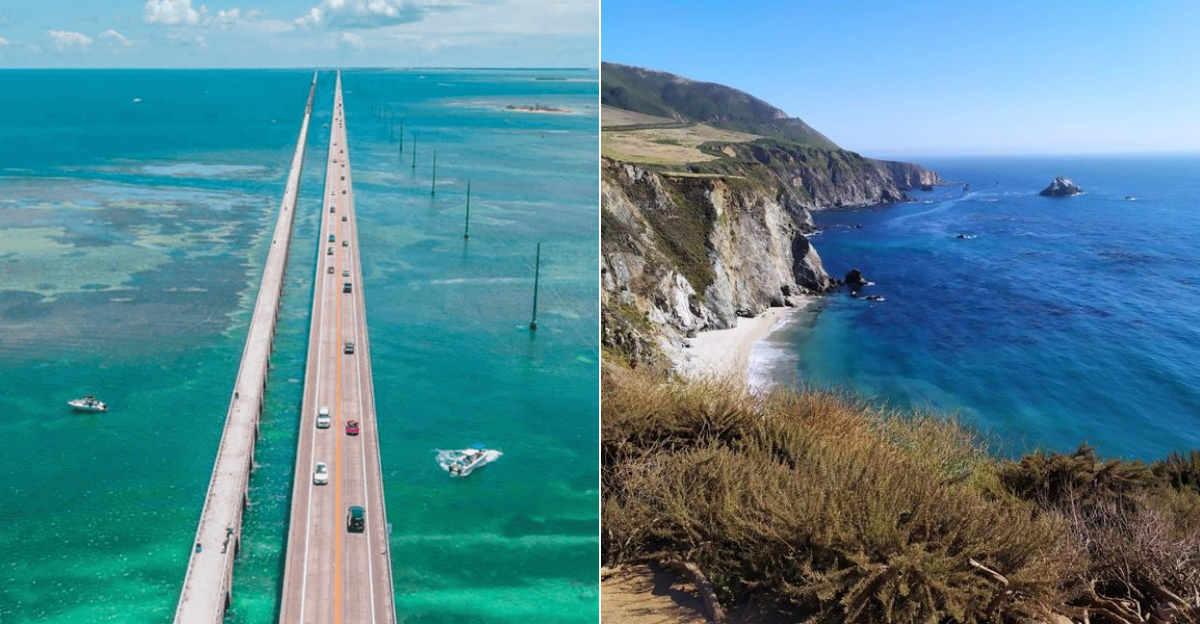
Florida Keys Overseas Highway: Drive the Highway That Feels Like a Beach Day

The Overseas Highway does something most roads cannot: it drives directly over the ocean. Stretching about 113 miles from mainland Florida down to Key West, this route hops across 42 bridges and dozens of tiny islands.
The water on both sides shifts between colors that look photoshopped but are completely real.
Spring break timing is smart here because the brutal Florida summer heat has not fully arrived yet. Temperatures hover in the low 80s, the water is warm enough to swim, and the tourist crush of peak winter season has thinned out.
Key Largo, Islamorada, and Marathon all make excellent stops along the way.
Seven Mile Bridge is the showstopper, giving you a straight shot across open water that feels genuinely dramatic. Stop at Bahia Honda State Park for one of the best beaches in Florida, and do not skip a slice of authentic Key lime pie in Key West.
It should be yellow, not green. That matters.
California Highway 1 Big Sur Stretch: Cliffs, Ocean, and Nonstop Pull-Offs
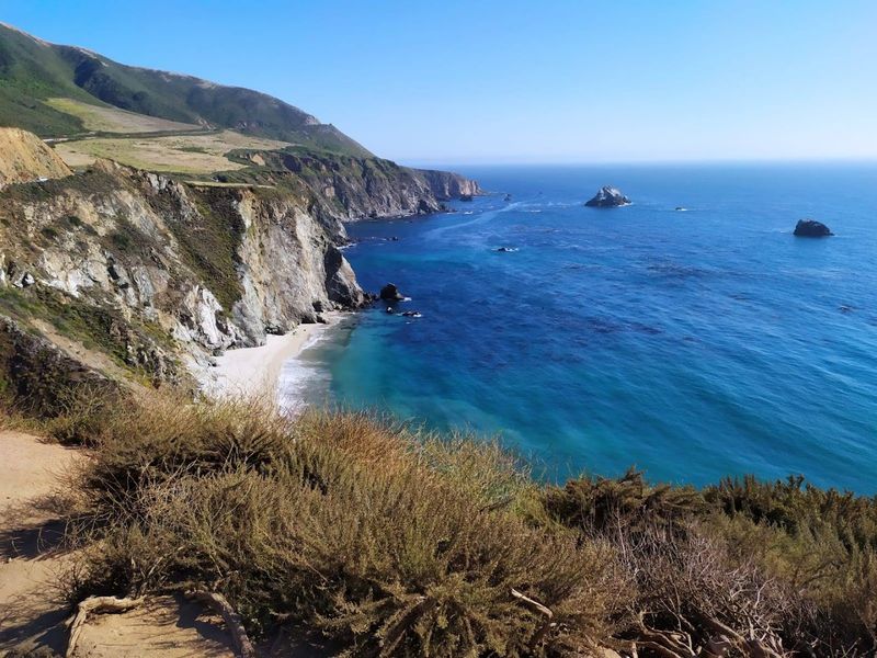
Big Sur is the stretch of California’s Highway 1 that makes people pull over every five minutes whether they plan to or not. Running from the Monterey and Carmel area south toward San Simeon, this section of road hugs cliffs that drop straight into the Pacific.
It is objectively one of the most dramatic coastal drives on the planet.
Spring brings green hillsides that make the contrast with the blue ocean almost cartoonishly beautiful. Bixby Creek Bridge is the most photographed spot on the route and absolutely earns the attention.
Julia Pfeiffer Burns State Park offers a waterfall that falls directly onto a beach, which is exactly as cool as it sounds.
Always check Caltrans for road closures before driving Big Sur. Sections get washed out or repaired regularly, and finding a detour on a cliff road is nobody’s idea of a good time.
Fill your gas tank in Carmel or Cambria because options along the route are very limited.
Columbia River Gorge Waterfall Drive: Waterfalls Everywhere, Seriously
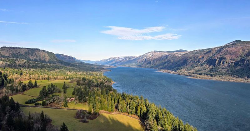
The Columbia River Gorge in Oregon has over 90 waterfalls, which is a number that sounds made up until you actually drive the Historic Columbia River Highway and start counting. Spring runoff from snowmelt turns every waterfall up to full volume, and the surrounding forest goes an almost aggressive shade of green.
Multnomah Falls is the headliner at 620 feet, but honestly the supporting cast is just as good. Latourell, Bridal Veil, and Wahkeena Falls are all within easy reach and far less crowded.
The drive from Portland takes less than an hour, making this a very doable day trip or an easy first night of a longer Pacific Northwest road trip.
Parking at popular falls requires a timed permit during peak season, so book ahead through Recreation.gov. Crown Point Vista House sits on a cliff above the gorge and offers a sweeping view of the whole Columbia River valley.
Bring a rain jacket. This is Oregon in spring, and the weather has opinions.
Sedona to Oak Creek Canyon to Flagstaff: Red Rocks to Pine Trees in One Drive
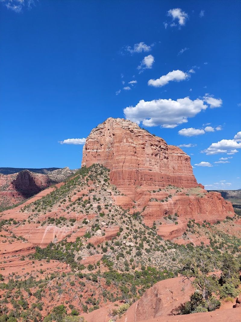
This 15-mile stretch of State Route 89A between Sedona and Flagstaff is one of the most underrated drives in the American Southwest. You start surrounded by Sedona’s famous red rock formations and end up in a completely different world of tall ponderosa pines in Flagstaff.
The transition happens faster than you expect.
Oak Creek Canyon is the star of the middle section. The road follows the creek through steep canyon walls, passing swimming holes and small campgrounds tucked into the rocks.
Slide Rock State Park sits right along the route and is basically a natural water slide carved into the creek bed.
Spring temperatures in Sedona are ideal, sitting comfortably in the 70s while Flagstaff can still be cool in the 50s. Stop at Tlaquepaque Arts and Shopping Village in Sedona before heading up the canyon.
Flagstaff has a great downtown food scene and sits at the base of the San Francisco Peaks for anyone who wants to add a short hike at elevation.
Sedona to Grand Canyon: Turn the Drive Into the Main Event
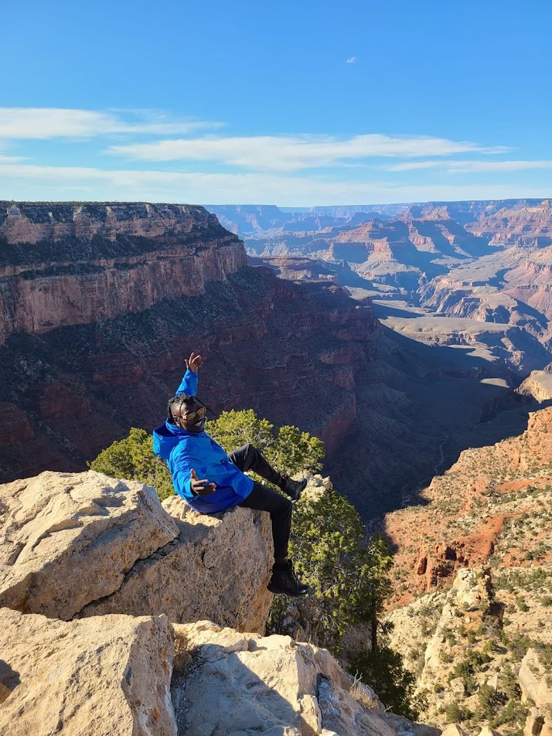
About 109 miles separates Sedona from the Grand Canyon’s South Rim, and the drive is far more interesting than just connecting two famous spots. The route climbs through Flagstaff, passes through ponderosa pine forest, and delivers you to one of the most jaw-dropping views on Earth.
The South Rim sits at about 7,000 feet, so spring temperatures there are cool and crisp.
Spring is a genuinely good time to visit the Grand Canyon. Summer brings brutal heat and massive crowds.
Spring gives you manageable temperatures for rim walks and lighter traffic on the popular Bright Angel Trail. Condors are frequently spotted riding thermals above the canyon in April and May.
Mather Point near the main visitor center is the classic first stop and worth every cliche. The Rim Trail stretches 13 miles along the edge and is flat enough for casual walkers.
Book lodging inside the park months in advance because Grand Canyon fills up fast regardless of the season.
Utah’s Mighty 5 National Parks Loop: Five Parks. One Unforgettable Week.
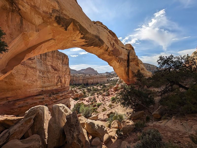
Utah stacked five world-class national parks close enough together that one road trip can cover all of them. Arches, Canyonlands, Capitol Reef, Bryce Canyon, and Zion form the legendary Mighty 5 loop, and spring is the sweet spot before summer heat and summer crowds turn the whole experience into a slow shuffle.
Zion’s Narrows hike is one of the most unique walks in the country, taking you directly through a slot canyon river. Bryce Canyon’s hoodoos glow orange-pink at sunrise in a way that makes every early alarm worth it.
Arches has over 2,000 natural stone arches, which is a number that still seems impossible.
Plan at least five to seven days to do this loop justice. Book campgrounds and popular permits like the Zion Narrows months ahead because they sell out fast.
The towns of Moab and Springdale work well as base camps. Cell service is spotty throughout, so download offline maps before leaving civilization behind.
Joshua Tree Wildflower and Desert Drive: Catch Desert Blooms While They’re Here
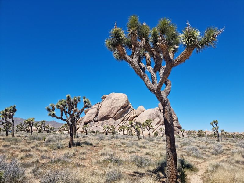
Joshua Tree National Park looks like it was designed by a very creative alien. The twisted trees, boulder piles the size of buildings, and wide-open desert sky create a landscape that feels completely unlike anywhere else in the US.
Add a wildflower bloom and the whole place transforms into something genuinely spectacular.
The NPS classifies many of the showiest desert wildflowers here as annual ephemerals, meaning they show up only when winter rain hits the right amounts. Timing is never guaranteed, but early spring is your best window.
Check the NPS wildflower report before driving out to avoid a trip built on hope alone.
The park has two distinct ecosystems divided by elevation. The higher Mojave section hosts the Joshua trees while the lower Colorado Desert section blooms earlier and with different species.
Cholla Cactus Garden at sunset is worth stopping for even without any flowers. The nearest towns for food and gas are Joshua Tree and Twentynine Palms.
Death Valley Wildflower Chase: A Once-in-a-While Spring Spectacle
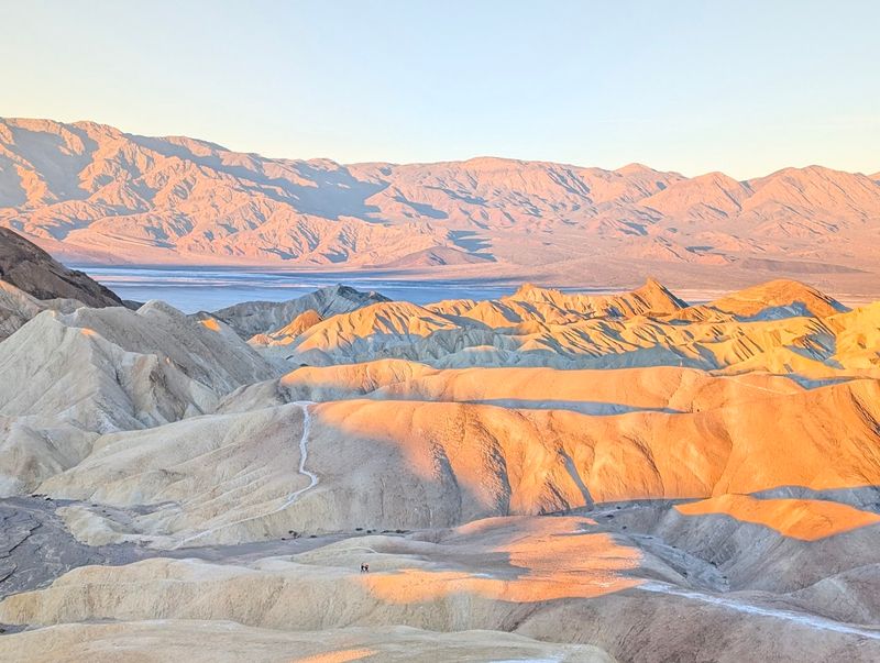
Death Valley does not mess around when it decides to bloom. After the right winter rains, the floor of the hottest, driest national park in the US explodes with wildflowers in a rare event that draws visitors from across the country.
Multiple outlets are reporting a major bloom event for early spring 2026, with low elevations peaking in March.
Badwater Basin and Zabriskie Point are the classic viewpoints, and both deliver completely different visual experiences. Badwater sits at 282 feet below sea level, the lowest point in North America, while Zabriskie offers sweeping views of eroded golden badlands.
Spring temperatures at low elevations are manageable, usually in the 80s, before the park turns into a furnace by May.
Cell service inside Death Valley is extremely limited, so download maps and check NPS updates before entering. Bring far more water than you think you need.
Fuel up in Beatty, Nevada or Pahrump before entering because gas inside the park is significantly more expensive than anywhere else on Earth.


