There is a country so spread across the Pacific Ocean that it touches all four hemispheres at once, a geographic feat no other nation on Earth can claim. That country is Kiribati, a remote island republic made up of 33 atolls and coral islands scattered across a vast stretch of the central Pacific.
Most people have never heard of it, and fewer still can pronounce it correctly (hint: it sounds like “Kiribas”). From its unique position on the globe to its rich island culture and fragile environment, Kiribati is one of the most fascinating places you can read about, and once you start learning about it, it is very hard to stop.
A Nation Spread Across Four Hemispheres
No other country on Earth can say what Kiribati can: its territory spans the Northern Hemisphere, Southern Hemisphere, Eastern Hemisphere, and Western Hemisphere all at once.
This happens because Kiribati’s 33 islands and atolls are scattered across both sides of the equator and both sides of the International Date Line.
The equator divides the world into north and south, while the 180th meridian (the Date Line) divides it into east and west. Kiribati straddles both of these invisible lines.
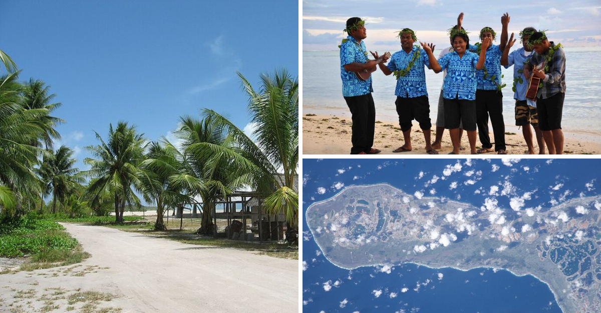
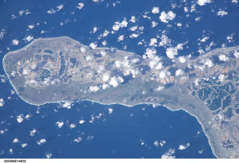
Most of its land sits in the central Pacific Ocean, spread across roughly 3.5 million square kilometers of sea. That is an area larger than the entire continent of Europe, yet the actual land area is only about 811 square kilometers.
This extraordinary geographic quirk makes Kiribati a one-of-a-kind country that geography teachers love to talk about in classrooms around the world.
Where Exactly Kiribati Is Located
Officially known as the Republic of Kiribati, this island nation sits in the Micronesia sub-region of Oceania, right in the heart of the central Pacific Ocean.
Its islands are grouped into three main chains: the Gilbert Islands, the Phoenix Islands, and the Line Islands. The capital, South Tarawa, is found in the Gilbert Islands and is home to more than half of the country’s population.
The country’s coordinates place its geographic center near 1.44 degrees North latitude and 172.98 degrees East longitude, putting it very close to the equator.
Kiribati shares the Pacific with neighbors like Nauru, Tuvalu, and the Marshall Islands, though none of its land masses are connected. Each island or atoll stands alone in the open ocean.
Getting there typically requires flying through Fiji or Hawaii, making it one of the more remote destinations on the planet.
The Story Behind the Name
Here is a fun fact that surprises almost everyone: “Kiribati” is not pronounced the way it looks. The name comes from the Gilbertese language, where the letters “ti” are pronounced as “s.”
So “Kiribati” is actually said as “Kiribas,” which is the Gilbertese way of writing “Gilberts,” referring to the Gilbert Islands that form the country’s core.
The country was formerly called the Gilbert Islands when it was a British colony. It gained independence on July 12, 1979, and adopted the name Kiribati to represent all its island groups, not just the Gilberts.
The people of Kiribati call themselves I-Kiribati (pronounced “ee-Kiribas”), and their language is also called Gilbertese or Kiribati.
This quirky pronunciation catches travelers and geography students off guard every single time, making it one of those delightful little language puzzles the world quietly keeps tucked away.
The International Date Line Connection
One of the most unusual things about Kiribati is its relationship with the International Date Line. Before 1995, the Date Line ran right through the middle of the country, meaning some Kiribati islands were a full day behind others.
That created serious problems. People living on different islands within the same country were technically living on different calendar days.
Business, communication, and government operations were complicated by this odd split.
In 1995, Kiribati made the bold decision to shift the Date Line eastward around its territory so that the entire country would share the same calendar day. This move pushed the Date Line into a dramatic zigzag shape that you can still see on modern world maps.
As a result, the Line Islands, particularly Caroline Island (now called Millennium Island), became the first place on Earth to greet each new day, including the year 2000.
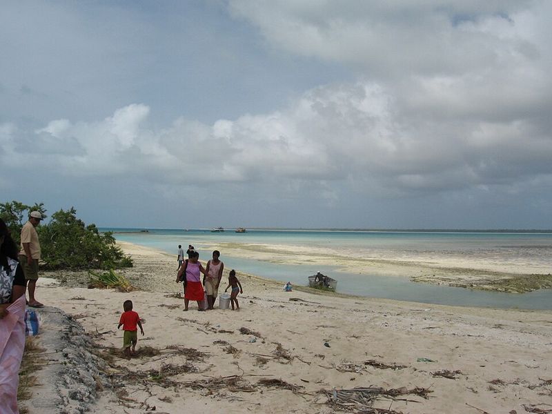
The Fragile Atolls and Rising Seas
Kiribati sits at an average elevation of just two meters above sea level, making it one of the most vulnerable countries in the world to rising oceans caused by climate change.
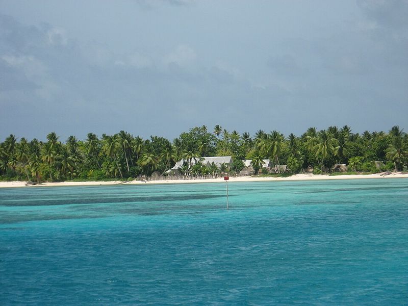
Most of its islands are coral atolls, which are ring-shaped reefs that barely peek above the water’s surface. As global temperatures rise and polar ice melts, the sea creeps higher, threatening to swallow these islands entirely.
Scientists and government officials have warned that without major global action, much of Kiribati could become uninhabitable within this century. The soil is already experiencing saltwater intrusion, which damages freshwater supplies and makes farming harder.
The Kiribati government has taken proactive steps, including purchasing land in Fiji as a possible future home for its people. Their situation has made Kiribati a powerful symbol in international conversations about climate responsibility and the real human cost of environmental inaction.
The People and Their Rich Culture
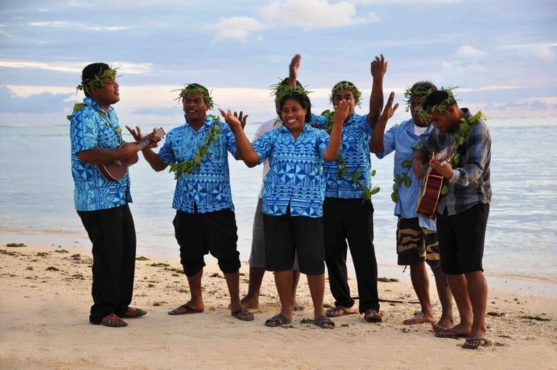
With a population of around 120,000 people, Kiribati has a tight-knit society deeply rooted in Pacific Island traditions. The I-Kiribati people are known for their strong community bonds, warm hospitality, and vibrant cultural expressions.
Traditional dance, called “te kaimatoa” and “te bino,” plays a central role in community life. These dances are performed at celebrations, ceremonies, and festivals, with elaborate costumes made from natural materials like pandanus leaves and shells.
Fishing has always been the backbone of daily life. The ocean provides food, income, and cultural identity for most families across the islands.
The maneaba, a traditional open-sided meeting house, serves as the social and political heart of each village. Important decisions, disputes, and community gatherings all take place there.
Family and community come before individual needs in I-Kiribati culture, creating a social fabric that holds these scattered islands together across hundreds of miles of open sea.
Wildlife and Natural Wonders
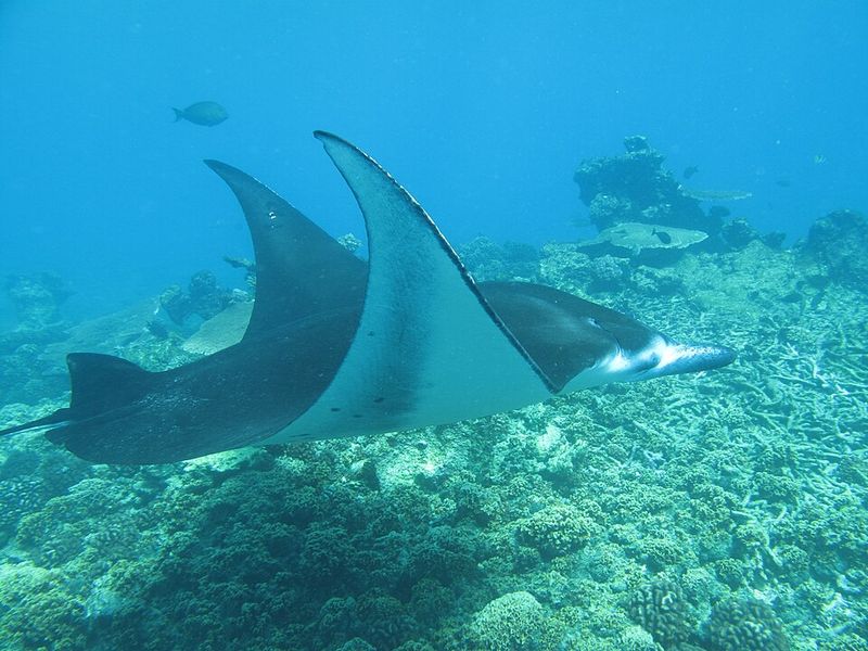
For nature lovers, Kiribati offers some of the most pristine and untouched marine environments left on the planet. The Phoenix Islands Protected Area, a UNESCO World Heritage Site, is one of the largest marine protected areas in the world.
Its coral reefs are home to hundreds of fish species, sea turtles, sharks, and rays. Because the islands are so remote and tourism is limited, the underwater ecosystems remain largely undisturbed by human activity.
Above water, the islands host nesting seabirds in enormous numbers. Species like frigatebirds, boobies, and shearwaters use the remote atolls as safe breeding grounds far from predators.
The Phoenix Islands also feature some of the deepest underwater seamounts in the Pacific, creating rich upwellings that support abundant marine life from the surface all the way to the ocean floor.
For divers and marine biologists, Kiribati is nothing short of a living laboratory filled with wonders that most of the world has never seen.
World War II History in the Gilbert Islands
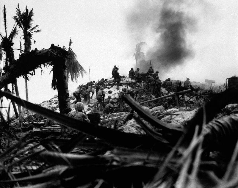
The Gilbert Islands, now part of Kiribati, were the site of one of the most intense battles of World War II. The Battle of Tarawa took place in November 1943, when American forces fought to recapture the atoll of Betio from Japanese troops.
The battle lasted just 76 hours but resulted in thousands of casualties on both sides. It was one of the bloodiest battles per square mile in American military history.
Today, Betio still holds visible reminders of that conflict. Rusted Japanese bunkers, artillery pieces, and war relics are scattered across the island, drawing visitors interested in military history.
Several memorials honor the soldiers who fought and those who did not return. The battle also marked a turning point in the Pacific campaign, teaching Allied forces critical lessons about amphibious assault tactics.
Walking through Betio today is a quiet and sobering reminder that even the most remote corners of the world have been touched by history’s largest events.
The Economy and Daily Life
Kiribati is one of the least developed countries in the world by economic standards, yet its people maintain a resilient and resourceful way of life. The economy relies heavily on fishing license fees paid by foreign nations that fish in Kiribati’s vast ocean territory.
Copra, the dried meat of coconuts, has historically been the main agricultural export. However, the economy remains fragile and heavily dependent on foreign aid from countries like Australia, New Zealand, and Japan.
Remittances sent home by I-Kiribati workers living abroad, especially those trained as merchant seafarers, also make up a significant portion of household income across the islands.
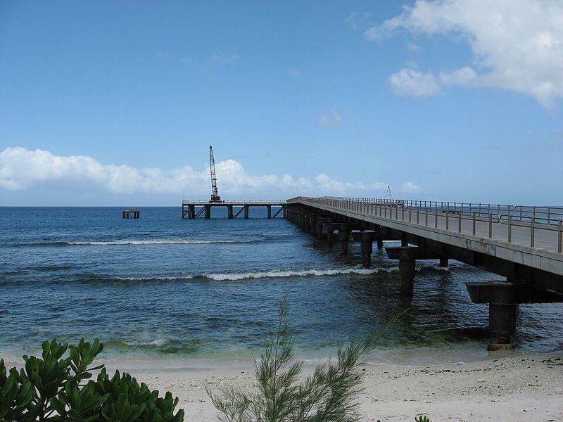
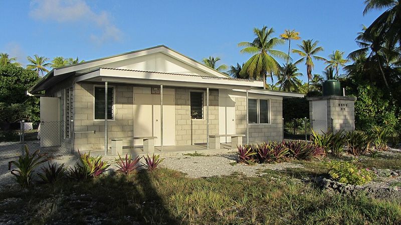
Access to goods and services is limited outside of South Tarawa, the capital. Many outer islands rely on occasional supply ships for basic necessities.
Despite these challenges, communities remain self-sufficient in many ways, growing local food, fishing daily, and supporting one another through strong traditional networks that money simply cannot replace.
Visiting Kiribati: What Travelers Should Know
Kiribati is not your typical tourist destination, and that is precisely what makes it so appealing to adventurous travelers who want something genuinely off the beaten path.
The most common entry point is Tarawa’s Bonriki International Airport, with connections available through Fiji and the Marshall Islands. A valid passport and onward ticket are required for entry, and visitors can usually stay up to 30 days without a visa.
Accommodation is basic but welcoming. South Tarawa has guesthouses and small hotels, while outer islands offer simple homestays where you truly live as the locals do.
The best activities include snorkeling, fishing, exploring World War II sites, and learning about traditional I-Kiribati culture firsthand. The dry season from March to October is the most comfortable time to visit.
Respect for local customs, including modest dress and asking permission before photographing people, goes a long way in this small and deeply community-oriented nation.


