Nearly one million acres of public land make this one of Michigan’s largest and most accessible outdoor destinations. The Huron-Manistee National Forest offers everything from multi-day hiking routes and backcountry camping to paddling stretches of the Au Sable River.
What sets it apart is how much you can actually do in one place. You can hike, fish, canoe, and camp without needing to travel between locations, which is why it draws repeat visitors from across the Midwest.
It also changes depending on when you go. Summer brings river trips and long trail days, while fall and winter shift the focus to hunting, snowshoeing, and quiet off-season exploration.
Where the Forest Begins: Location and First Impressions
The headquarters for Huron-Manistee National Forests sits at 1755 S Mitchell St, Cadillac, MI 49601, and that address is a good starting point for anyone planning their first trip.
The forests themselves spread across the northern half of Michigan’s Lower Peninsula, tucked between the shores of Lake Michigan to the west and Lake Huron to the east. That geography alone tells you something important: this is not a small patch of trees on the edge of a highway.
This is a massive, living landscape that takes real time to explore.
The ranger station in Cadillac is open Monday through Friday from 9 AM to 4 PM, and the staff there are genuinely helpful when it comes to maps, trail conditions, and permit questions. You can also reach them at +1 231-775-2421 before your trip.
Arriving with even a rough plan makes the experience so much richer, because the forest rewards those who come prepared.
Nearly a Million Acres: The Scale That Changes Everything
Most people underestimate what nearly one million acres actually looks like until they are standing in the middle of it with no cell signal and nothing but trees in every direction.
The Huron-Manistee National Forests cover a combined total of roughly 970,000 acres, making them one of the largest national forest systems in the eastern United States. The two units, the Huron on the eastern side and the Manistee on the western side, are managed together by the U.S.
Forest Service but each carries its own distinct character and terrain.
The sheer size means you could visit a dozen times and still discover trails, river bends, and quiet clearings you have never seen before. I have driven two-track roads through sections of this forest that felt completely untouched, even on a busy summer weekend.
That sense of genuine solitude is increasingly rare, and this forest protects it well. The scale is the whole point.
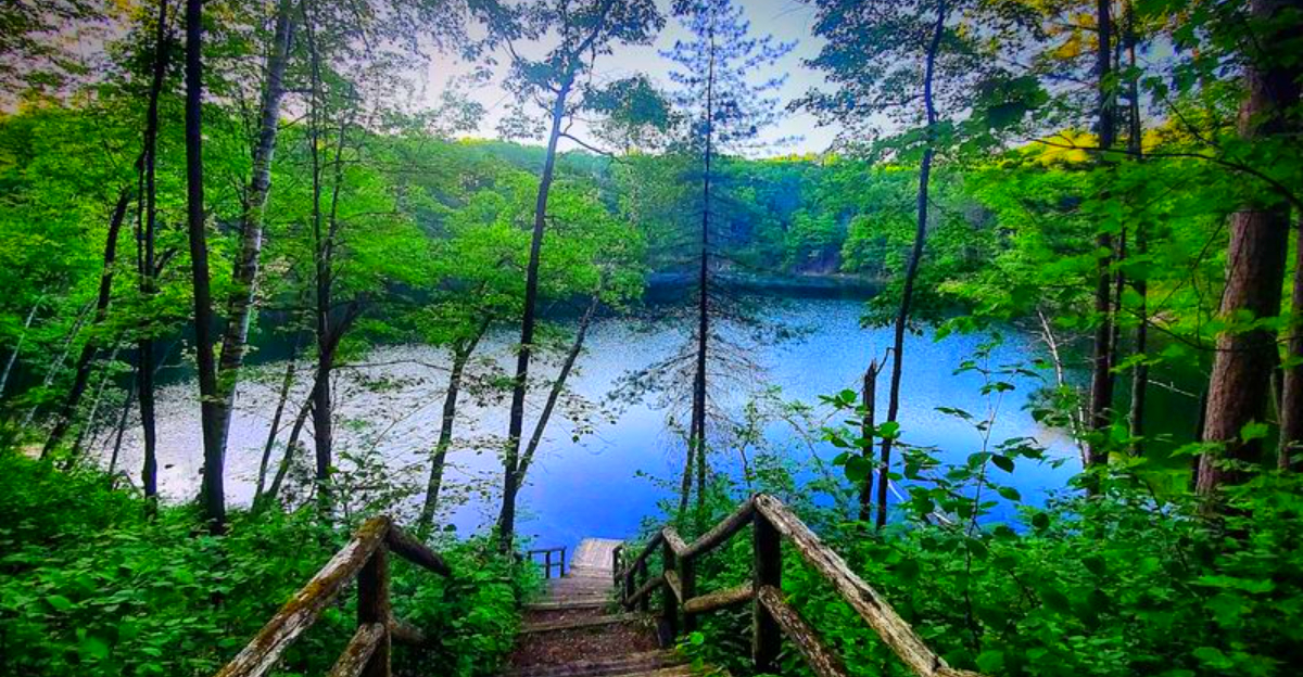
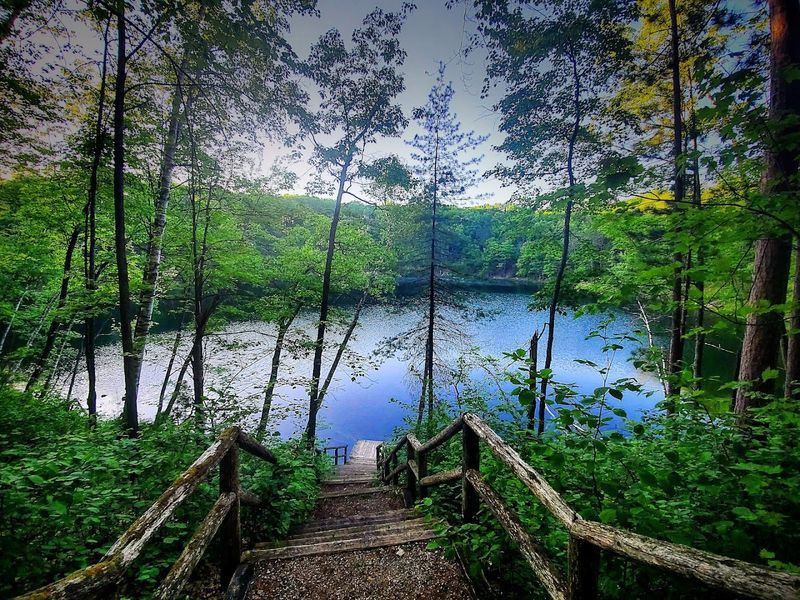
Rivers That Deserve Their Own Fan Club
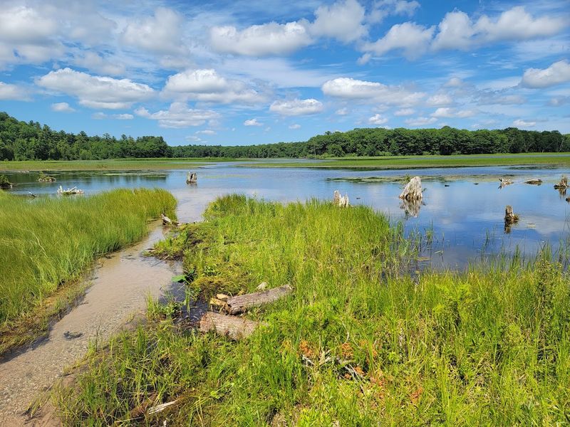
Eight major river basins run through these forests, and each one has a personality worth getting to know personally.
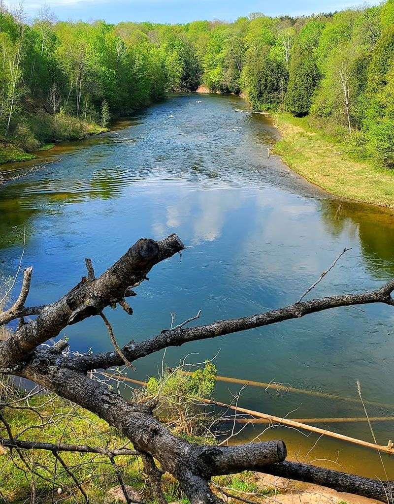
The Pere Marquette River holds a nationally designated Wild and Scenic status, which means it is federally protected for its outstanding natural and recreational value. The Au Sable River, flowing through the Huron unit, is one of Michigan’s most celebrated fishing rivers, known for its cold, clear water and healthy trout populations.
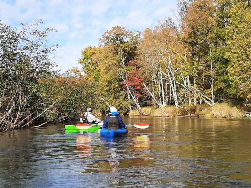
Paddling either river feels like moving through a nature documentary, with herons lifting off the banks and the water shifting from glassy calm to gentle riffles.
The Pine River is another standout, drawing paddlers who want something with a little more challenge. I once spent two nights camping along the Pine River after paddling about 40 miles over two days, and it remains one of the most satisfying outdoor experiences I have had in Michigan.
The rivers here are not a side feature; they are the main event for many visitors.
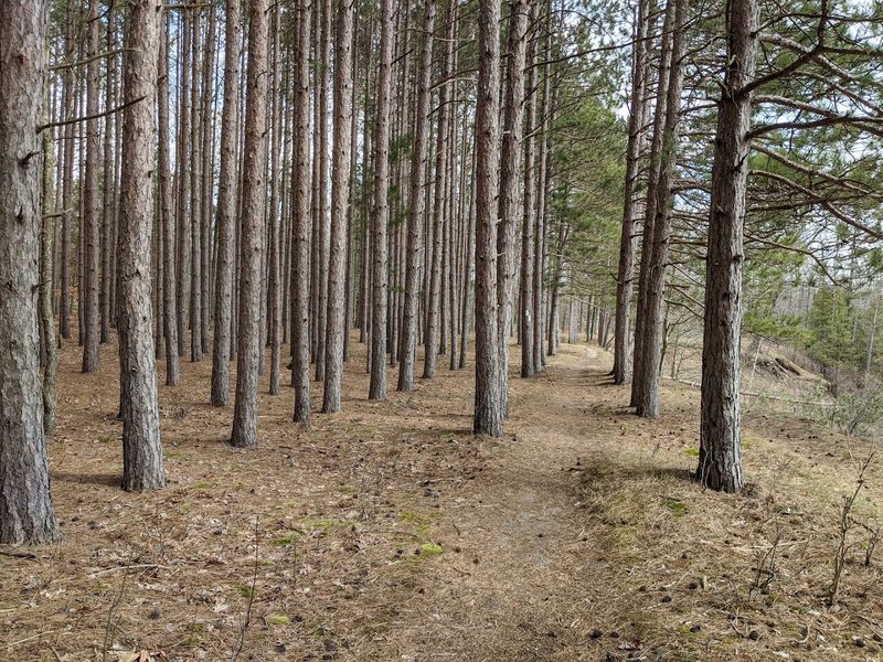
The Trees Themselves Tell a Quiet Story
White pine, red pine, sugar maple, yellow birch, and dozens of other species make up the forest’s layered canopy, and the mix changes noticeably as you move from one part of the forest to another.
The white pines in particular carry a certain weight of history. Michigan was once blanketed in old-growth white pine before heavy logging in the late 1800s stripped much of it away.
The forests here represent a long, steady recovery, and some sections now feel genuinely mature and full again. Walking beneath a stand of tall pines with the light cutting through in long, narrow shafts is one of those experiences that slows your breathing without you even noticing.
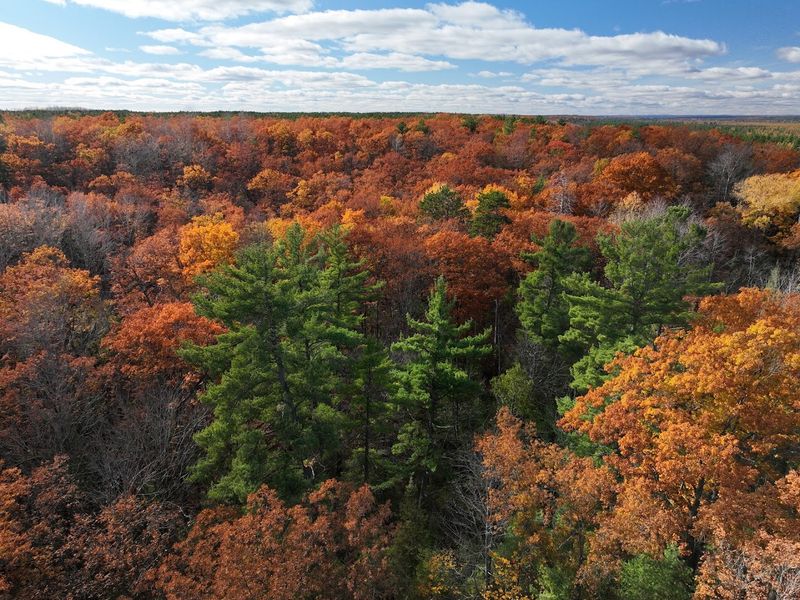
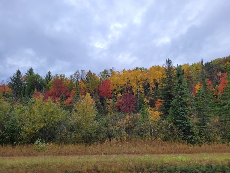
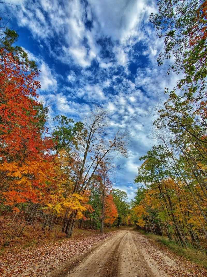
Fall is when the hardwoods take over the visual show entirely. Sugar maples turn a deep, burning orange, while birches go bright yellow, and the contrast against the dark green conifers is the kind of color combination that makes people stop their cars on the side of the road.
September and October are worth planning around.
Wildlife You Did Not Expect to See This Close
White-tailed deer are practically a given here, appearing at the edges of clearings and along two-track roads at dawn and dusk with a calm confidence that suggests they know exactly whose forest this really is.
Black bears also live within these forests, and while most visitors never see one up close, the signs of their presence, turned-over logs, claw marks on tree bark, are easy to spot on backcountry trails. Wolves have been documented in the region as well, adding a layer of wildness that feels significant in a state where large predators were nearly gone for decades.
Birdwatchers have strong reasons to visit too. Bald eagles, ospreys, sandhill cranes, and a wide variety of warblers and waterfowl use the forest’s rivers and wetlands as key habitat.
I once watched a bald eagle drop from a dead tree branch and pull a fish from the Au Sable River in one smooth motion, which is the kind of moment that no photograph ever fully captures. Keep your eyes open here.
Trails for Every Type of Hiker
The Manistee River Trail is probably the most talked-about hiking route in the forest, and the reputation is well earned.
The trail runs along the Manistee River for roughly 10 miles, with a connecting loop option via the North Country Trail that turns it into a multi-day backpacking route. The terrain along the river section is mostly moderate, with some elevation changes near the Red Bridge end that give more experienced hikers a genuine workout.
The trail is well-defined in most sections, though a map or navigation app is still a smart thing to carry.
Beyond the Manistee River Trail, the forest contains hundreds of miles of additional hiking and backpacking routes ranging from flat, easy walks through pine plantations to more demanding ridge trails with long views. The variety means families with young kids and solo thru-hikers can both find something that fits their pace and energy.
Slowing down on any of these trails is always the right call, because the details reward patience.
Camping Options That Range From Cozy to Completely Wild
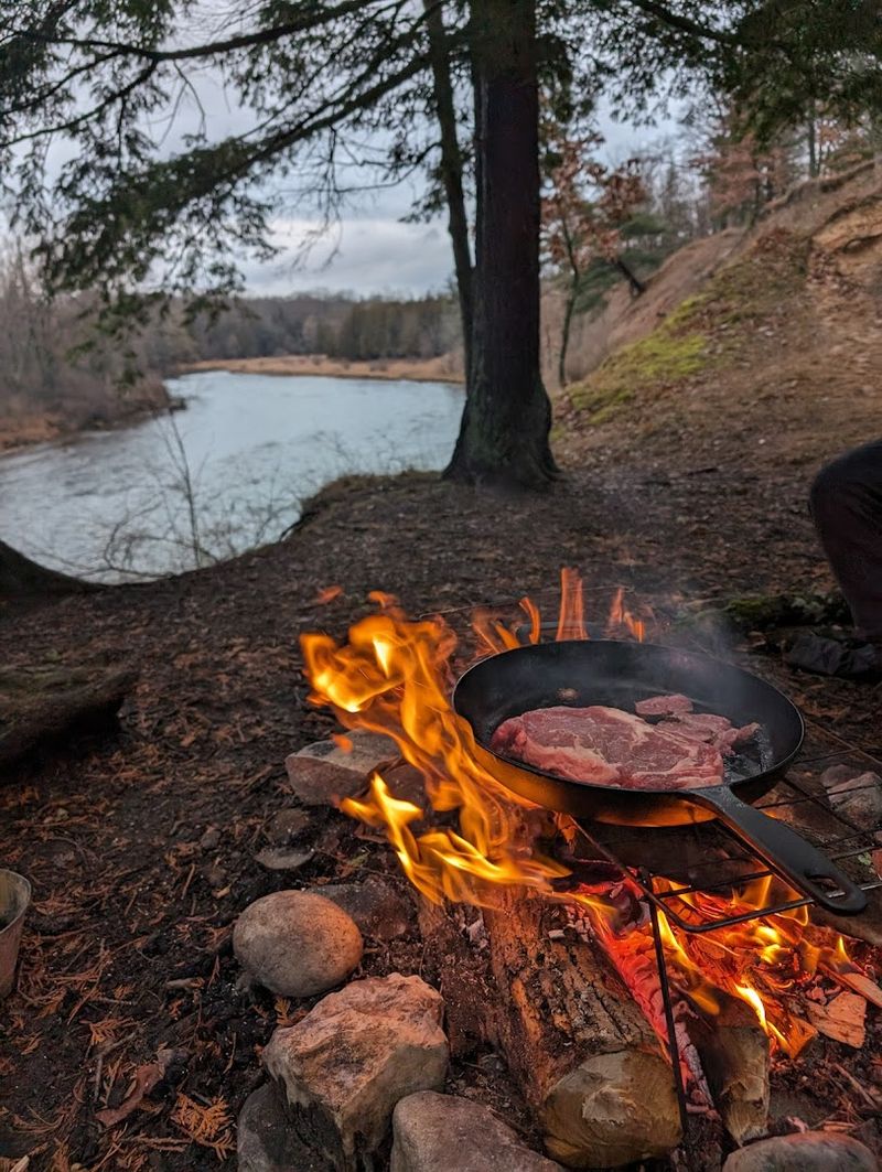
Few things match the experience of dispersed camping along the Lake Michigan shoreline within the Manistee unit, where flat, private sites sit just steps from the beach and the sunsets run long and vivid every clear evening.
Developed campgrounds are available throughout both forest units, offering vault toilets, fire rings, and varying levels of privacy. Many operate on a first-come, first-served basis outside of the Memorial Day to Labor Day window, which makes shoulder-season camping both easier to plan and noticeably quieter.
The campgrounds are generally well-maintained, and the hosts at staffed sites tend to be friendly and knowledgeable about local conditions.
For those who prefer a more rugged setup, dispersed camping on national forest land is permitted in most areas without a fee, as long as you follow Leave No Trace principles and stay away from designated recreation areas. Bringing your own water and being prepared to pack out everything you bring in is non-negotiable in those backcountry spots.
The reward is a level of solitude that developed campgrounds simply cannot match.
Off-Road and Motorized Adventures on Two Tracks
Not every visitor comes to Huron-Manistee on foot or by paddle, and the forest accommodates that reality with an extensive network of two-track roads and designated off-road vehicle trails.
The sandy, two-track forest roads are a signature feature of the Manistee unit in particular, where the soil composition makes for surprisingly drivable paths even in a low-clearance vehicle during dry conditions. ORV trails are clearly designated and offer miles of motorized adventure through pine stands, over sandy ridges, and alongside wetland edges.
Snowmobilers also have a strong presence here in winter, with groomed trail systems connecting large sections of the forest.
What I appreciate about the motorized recreation culture here is that most users genuinely respect the land. The trails I have explored by vehicle have generally been clean, and the sense of stewardship among regular visitors is noticeable.
That said, sticking to designated routes matters enormously for protecting the forest floor and keeping those trails open for future visitors. The two-tracks here have a character all their own.
Fishing Culture Runs Deep in These Waters
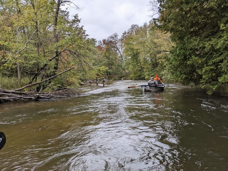
The Au Sable River has been a destination for serious fly fishers for well over a century, and the tradition of wading its cold, clear water in pursuit of brown and rainbow trout is woven into the cultural identity of this part of Michigan.
Chinook salmon runs also draw significant attention in the fall, particularly on rivers connected to Lake Michigan like the Manistee and the Pere Marquette. Watching salmon push upstream through shallow water is one of those spectacles that feels almost prehistoric in its intensity.
The fishery at the Manistee River area is an educational stop worth making, where you can learn about salmon life cycles and the ongoing work to manage sea lamprey populations in the Great Lakes.
Even casual anglers who show up with a simple spinning rod and a container of worms tend to have good days here. The rivers, lakes, and streams within the forest hold bass, pike, panfish, and walleye in addition to the more celebrated trout.
Fishing licenses are required and readily available online or at local bait shops near the forest boundaries.
Planning Your Visit: Practical Tips That Actually Help
A visit to a forest this large benefits from at least some advance planning, and the U.S. Forest Service website at fs.usda.gov/main/hmnf/about-forest is the most reliable source for current trail conditions, campground availability, and any seasonal closures.
The forest is accessible year-round, but the experience shifts dramatically by season. Summer brings the most activity, with campgrounds filling quickly on holiday weekends.
Spring offers excellent fishing and wildflower displays but also muddy trails. Fall is widely considered the best overall season for hiking and leaf-peeping, with comfortable temperatures and far fewer crowds.
Winter opens up snowmobiling, cross-country skiing, and a quiet version of the forest that most visitors never experience.
Cell service is unreliable in large portions of both forest units, so downloading offline maps before arrival is a genuinely useful step. Bringing enough water, wearing layers, and telling someone your planned route are all basic habits that make a real difference out here.
The forest is generous with its rewards, but it does ask visitors to come in ready.


