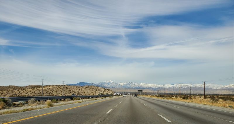
Driving is one of the most common ways to travel across the United States, but it also comes with serious risks. Each year, tens of thousands of people lose their lives on American roads, often on highways that millions use daily without a second thought.
Some routes stand out for their high number of fatal crashes due to heavy traffic, design challenges, speeding, or unpredictable conditions. From massive interstates cutting across multiple states to congested urban corridors, these highways reveal patterns that go far beyond simple bad luck.
Here are 15 of the deadliest highways in the U.S. and what makes them so dangerous.
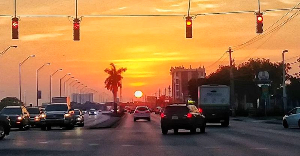
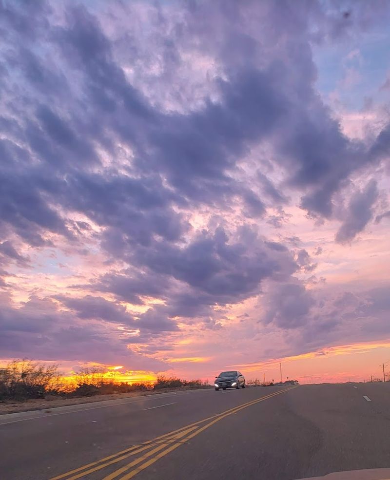
Interstate 4 (Florida)
Nicknamed “Death Highway” by locals, Interstate 4 holds the grim title of most dangerous highway in the U.S. when measured by fatalities per mile. Stretching just over 130 miles between Tampa and Daytona Beach, it slices right through Orlando’s tourism-heavy corridor.
Year-round visitors unfamiliar with the road mix with fast-moving local traffic, creating a recipe for disaster. Frequent lane changes, distracted driving, and sky-high speeds push accident numbers up consistently.
The road logs dozens of fatal crashes every single year.
Complex interchanges near downtown Orlando are especially brutal. Multiple ramps converge in quick succession, leaving little room for error.
Even experienced drivers can find themselves confused by the rapid decisions required.
Tourists on their way to theme parks often underestimate how aggressive Florida highway driving can be. Rental cars and unfamiliar navigation add more chaos to an already volatile situation.
Safety advocates have pushed for redesigns for years, with mixed results.
If you ever drive I-4, stay alert, avoid peak hours when possible, and keep a safe following distance. This stretch of asphalt has claimed far too many lives to take lightly.
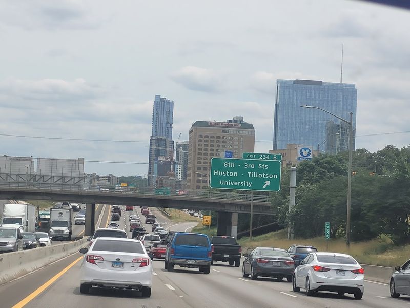
Interstate 45 (Texas)
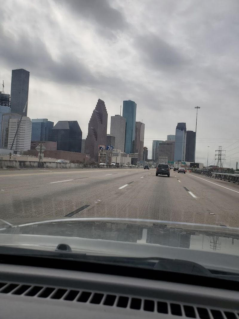
Pull up any list of America’s most dangerous urban highways, and Interstate 45 through Houston will almost always appear near the top. This road handles a staggering volume of daily traffic, blending commuters, eighteen-wheelers, and long-distance travelers into one high-speed pressure cooker.
The design itself does not help matters. Multiple entry and exit ramps appear within short distances of each other, forcing drivers into constant split-second decisions.
That kind of cognitive overload is a major contributor to serious collisions.
Aggressive driving culture in Houston amplifies the risk even further. Tailgating, sudden lane changes, and excessive speed are common sights on this corridor.
Studies have repeatedly flagged specific segments of I-45 as among the deadliest in the nation.
Freight trucks add a brutal dimension to the danger. When a fully loaded semi collides with a passenger vehicle at highway speeds, the outcome is rarely good.
Commercial traffic on I-45 is heavy around the clock.
Houston has invested in improvements, but the sheer growth of the metro area keeps pace with any upgrades. Drivers should treat every mile of this highway with full attention and zero overconfidence.
Speed kills here more than almost anywhere else.
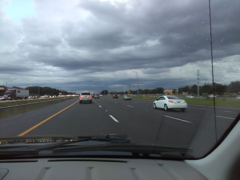
Interstate 95 (Multiple States)
Stretching from Florida to Maine, Interstate 95 is essentially the spine of the entire East Coast, and it carries an enormous price in human lives. No other single highway in the U.S. covers as much densely populated territory, and that scale drives up fatal crash totals in a serious way.
Florida alone accounts for a significant chunk of the fatalities recorded on this highway each year. The Sunshine State segment combines high speeds, tourist traffic, and aggressive local drivers into a particularly dangerous blend.
Construction zones along this stretch make things even worse.
In major metro areas like Miami, Washington D.C., and Philadelphia, constant merging creates unpredictable traffic patterns. Heavy truck traffic rolls through day and night, adding weight and momentum to potential crash scenarios.
One moment of inattention can spiral into a multi-vehicle pileup.
Long-distance drivers are especially vulnerable to fatigue on I-95. The road seems to go on forever, and monotony can dull reaction times faster than most people realize.
Rest stops exist for a reason, and skipping them is a gamble not worth taking.
Despite ongoing safety improvements, I-95 continues to rank among highways with the most total fatalities nationwide. Awareness and caution remain the best tools any driver can bring to this road.
Interstate 10 (Multiple States)
Crossing eight states from California to Florida, Interstate 10 is one of the longest highways in America, and its sheer length contributes directly to its deadly reputation. The variety of terrain and driving conditions it covers makes it especially unpredictable for travelers.
Desert stretches in Arizona and New Mexico are particularly treacherous. The monotony of flat, featureless landscape lulls drivers into a dangerous sense of comfort, and fatigue sets in fast.
Add blazing heat to the mix, and mechanical failures become a real threat too.
Urban segments through Los Angeles, Phoenix, and San Antonio bring an entirely different set of dangers. Sudden congestion, aggressive merging, and construction zones create stop-and-go chaos at freeway speeds.
Rear-end collisions are especially common in these sections.
Long-haul truckers dominate large portions of I-10, particularly through Texas. When fatigue-impaired truck drivers share the road with speeding passenger vehicles, the results can be catastrophic.
The size and weight of commercial trucks turn ordinary crashes into fatal ones.
Severe weather adds another unpredictable layer. Gulf Coast sections can experience sudden heavy rain and fog that reduce visibility to near zero.
Drivers on I-10 need to stay sharp across every single mile, no matter how routine the road may feel.
Interstate 5 (California)
California’s main north-south artery, Interstate 5, is a study in contrasts that makes it genuinely difficult to drive safely. One hour you are crawling through Los Angeles gridlock, and the next you are flying down an open stretch of Central Valley highway at 80 miles per hour.
That shift in pace is where many accidents happen. Drivers who finally escape city congestion tend to overcorrect by speeding excessively on open stretches.
High speeds reduce reaction time dramatically, and rural I-5 has very little margin for error.
Heavy truck traffic is a constant presence on this route. The Central Valley relies heavily on freight movement, so commercial vehicles are everywhere, day and night.
Trucks and speeding passenger cars are a dangerous combination on any road.
Tule fog is a seasonal hazard that makes California’s inland I-5 particularly notorious. This dense, low-lying fog can reduce visibility to near zero in seconds, and multi-car pileups involving dozens of vehicles have occurred because of it.
It is a weather phenomenon most visitors never anticipate.
Around San Diego and Los Angeles, distracted driving and aggressive lane changes keep accident rates high regardless of weather. Staying focused, matching traffic speeds, and keeping safe distances are non-negotiable survival strategies on I-5.
Interstate 40 (Multiple States)
Forget Route 66 nostalgia for a moment, because the highway that largely replaced it, Interstate 40, has a much darker story to tell. Running from Barstow, California, all the way to Wilmington, North Carolina, this cross-country corridor sees a relentless flow of freight and passenger traffic.
Rural sections are where fatalities tend to pile up. Long stretches through New Mexico, Oklahoma, and Tennessee can feel endless, and driver fatigue becomes a genuine killer.
There are fewer exits, less lighting, and minimal emergency response infrastructure in these zones.
Mountainous terrain in North Carolina and Tennessee adds serious weather-related risk. Ice, snow, and fog turn mountain grades into deadly obstacles for unprepared drivers.
Trucks lose braking ability on steep descents, and accidents in these areas are often severe.
Construction zones are a persistent hazard on I-40. Major sections have been under repair for years, creating narrow lanes, abrupt speed changes, and confused traffic patterns.
Workers and drivers both face elevated risks inside these zones.
Urban segments through Albuquerque and Memphis bring their own brand of danger, with congestion and aggressive driving taking center stage. The combination of so many different road environments packed into one highway makes I-40 consistently deadly across multiple states every single year.
Interstate 75 (Multiple States)
Running nearly 1,800 miles from the Florida Keys to the Canadian border in Michigan, Interstate 75 is one of the most heavily traveled north-south corridors in the entire country. It connects snowbirds, truckers, commuters, and vacationers in one long, uninterrupted stream of traffic.
Atlanta is arguably the most dangerous section of I-75. The city’s infamous spaghetti junction is one of the most complex highway interchanges in America, and navigating it without a serious lapse in concentration requires genuine skill.
Accidents there back up traffic for miles.
Tourist traffic creates an unusual hazard on the Florida portion of the highway. Seasonal travelers unfamiliar with the road, often older drivers making long trips, mix with locals who know every inch and drive accordingly fast.
That mismatch in driving styles causes real problems.
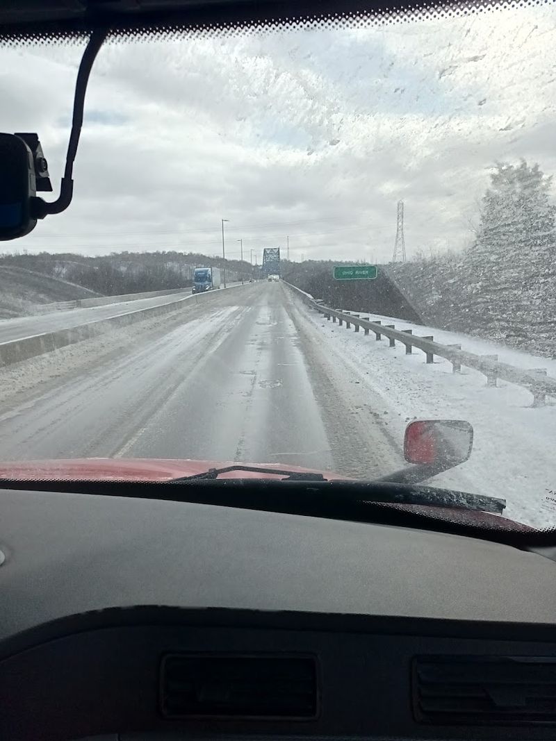
In Michigan, winter weather transforms I-75 into a genuinely treacherous stretch. Ice storms, heavy snow, and whiteout conditions hit without much warning.
Drivers who underestimate winter road conditions here often pay a severe price.
Despite improvements to some sections, I-75 continues to see significant annual fatalities. The sheer number of vehicles and the variety of driver types make it nearly impossible to eliminate risk entirely.
Patience and vigilance are the best co-pilots on this highway.
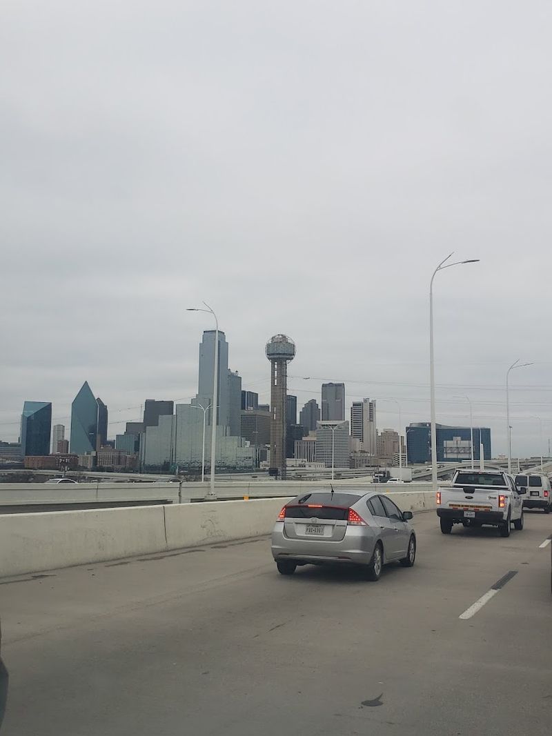
Interstate 35 (Texas and Midwest)
Ask any Dallas or Austin resident about their daily commute, and the mention of Interstate 35 will likely produce a groan. This highway has earned a reputation for relentless congestion, confusing layouts, and a crash rate that keeps traffic reporters busy every single day.
Population booms in Texas cities have overwhelmed I-35’s capacity. Roads designed decades ago now handle traffic volumes they were never built for, creating bottlenecks that stretch for miles.
Construction crews are almost always present somewhere along the route, narrowing lanes and confusing drivers.
The stretch between Dallas and San Antonio is particularly brutal. Heavy commercial truck traffic mixes with fast-moving passenger vehicles on a road that has too many on-ramps, too many off-ramps, and not nearly enough space between them.
Split-second merging decisions are a constant demand.
Northward through Oklahoma and Kansas, I-35 opens up into long rural stretches that bring fatigue into the equation. Drivers who survive the urban chaos sometimes let their guard down on the open road, and that is when single-vehicle crashes spike.
Severe weather in the Midwest, including tornadoes, ice storms, and heavy rain, adds further unpredictability to this already challenging route. I-35 demands full attention from its first mile to its last, no exceptions.
Interstate 30 (Texas)
Sandwiched between two of Texas’s biggest cities, Interstate 30 connects Dallas and Fort Worth in a dense, high-pressure driving corridor that has seen its share of tragedy. The road is essential to the region’s economy, but its aging design has not kept pace with explosive growth.
Rear-end collisions are practically a signature feature of this highway. Traffic speeds shift suddenly and without warning, especially near construction zones that seem to multiply every few years.
Drivers who follow too closely pay for that mistake quickly and painfully.
Complex interchanges near downtown Dallas demand sharp navigation skills. Multiple highways converge and split within short distances, creating a maze that even regular commuters can find stressful.
First-time visitors to the area often find themselves in the wrong lane at exactly the wrong moment.
Rush hour on I-30 is its own kind of chaos. Morning and evening commutes pack the road wall to wall, and the combination of stress, impatience, and fatigue makes aggressive driving behaviors skyrocket.
Tempers flare, and dangerous maneuvers follow.
The Dallas-Fort Worth metro area has invested in infrastructure improvements, but demand consistently outpaces progress. Until a comprehensive redesign addresses the root problems, I-30 will continue to be one of the more hazardous highways in the Lone Star State.
Interstate 635 (Texas)
Welcome to the LBJ Freeway, where lanes multiply, merge unexpectedly, and somehow manage to confuse even drivers who use it every single day. Interstate 635 loops around Dallas and handles a volume of traffic that would stress any road design, let alone one this complicated.
The highway features multiple elevated levels, collector-distributor roads, and interchanges that require precise planning several hundred feet in advance. Miss your exit, and you may find yourself on an entirely different highway before you can correct course.
That kind of pressure breeds dangerous snap decisions.
Commercial trucks are everywhere on I-635. The freeway serves as a key freight corridor connecting major distribution hubs in the Dallas area.
When trucks and passenger vehicles compete for the same tight merge lanes, the size difference alone makes outcomes grimly predictable.
High speeds combined with sudden slowdowns create a rear-end collision environment that keeps emergency responders on constant alert. One stalled vehicle can trigger a chain reaction of crashes that backs up traffic for hours.
It happens with alarming regularity.
Improvements through the North Texas Tollway Authority have helped in some sections, but the core design remains a challenge. Drivers on I-635 need to plan their route in advance, stay in their lane, and resist the temptation to weave through traffic.
The road punishes impatience severely.
U.S. Route 1 (East Coast)
Unlike the controlled-access interstates that dominate most highway safety discussions, U.S. Route 1 plays by entirely different rules.
Running from Fort Kent, Maine, all the way to Key West, Florida, this historic road passes through towns, cities, and suburban strips where intersections and traffic lights are the norm, not the exception.
Those at-grade intersections are where the danger concentrates. Every traffic light is an opportunity for a T-bone collision, a pedestrian strike, or a rear-end crash triggered by a yellow-light gamble.
The more intersections a road has, the more chances something can go wrong.
Pedestrian activity along Route 1 is a serious concern in urban and suburban zones. Shoppers, workers, and residents cross the road constantly, often at unmarked locations.
Drivers distracted by storefronts and navigation apps are a lethal combination in these environments.
Speed variation along Route 1 is another hazard. Limits drop and rise repeatedly as the road moves through different jurisdictions, and drivers who do not adjust quickly create conflict with local traffic.
That inconsistency catches people off guard regularly.
In Florida, the southernmost sections near the Keys attract tourists who are sightseeing rather than focusing on driving. The scenery is stunning, but the road demands attention.
Route 1 rewards careful, patient drivers and punishes the distracted ones without mercy.
U.S. Route 83 (Texas and Midwest)
Out on U.S. Route 83, the road just keeps going and going, and that relentlessness is precisely what makes it so deadly.
Cutting a long north-south path from Canada down to the Texas-Mexico border, this highway earns its grim reputation one rural mile at a time.
In Texas, Route 83 has been flagged repeatedly for high fatality rates relative to its traffic volume. The numbers are especially alarming because the road does not carry nearly the volume of a major interstate.
Fewer cars, more deaths per mile, is a pattern that demands serious attention.
Nighttime driving on this route is particularly treacherous. Rural stretches have minimal lighting, and deer crossings are common in certain regions.
A driver who hits a large animal at highway speed faces a genuinely life-threatening situation, especially on a road where help may be miles away.
Long-haul truckers share this highway with local farmers, ranch vehicles, and occasional long-distance travelers. The speed difference between a loaded semi and a slow-moving agricultural vehicle can be startling and dangerous when passing opportunities are limited.
Emergency response times in rural areas along Route 83 are significantly longer than in cities. A crash that might be survivable with quick medical attention can turn fatal when help is 30 minutes away.
That reality alone should make every driver on this road think twice about speeding.
State Road 826 (Florida)
Miami traffic has a reputation all its own, and State Road 826, better known as the Palmetto Expressway, is ground zero for that reputation. This urban highway moves through one of the most densely populated and culturally diverse metro areas in the country, and it shows in every chaotic mile.
Bottlenecks form constantly along the Palmetto. Multiple entry points from residential neighborhoods and commercial districts feed traffic onto the expressway in rapid bursts, creating unpredictable surges that catch drivers off guard.
One slow driver in a fast-moving lane is all it takes to start a chain reaction.
Tourists visiting Miami’s beaches and attractions frequently find themselves on this highway with zero familiarity of its layout. Rental cars with confused drivers hesitating at merge points are a recipe for aggressive responses from locals who know exactly where they are going and want to get there fast.
Despite its relatively short length, the Palmetto records a striking number of accidents annually. The combination of high speeds, dense traffic, and frequent aggressive maneuvers creates conditions where even minor mistakes escalate quickly.
Fender benders here rarely stay minor for long.
Driving the Palmetto requires confidence and preparation. Knowing your exit in advance, avoiding peak hours when possible, and keeping a safe buffer from surrounding vehicles can genuinely reduce your risk on one of Florida’s most unforgiving urban roads.
Interstate 20 (Southern U.S.)
Freight is the lifeblood of the American economy, and Interstate 20 is one of its main arteries. Running from Kent County, Texas, all the way to Florence, South Carolina, this highway carries an enormous volume of commercial trucking traffic, and that freight-heavy character shapes its danger profile significantly.
Rural sections between Texas and Alabama are where fatigue-related crashes concentrate. Long stretches of open road with few services or distractions lull long-haul drivers into a dangerous drowsiness.
When a fully loaded truck drifts lanes at 70 miles per hour, the consequences are catastrophic.
Weather is a persistent threat along the I-20 corridor. Southern storms roll in fast, dropping heavy rain and thick fog with very little warning.
Visibility can drop to near zero in minutes, and drivers who do not immediately reduce speed are taking an enormous gamble.
Urban sections through Dallas and Birmingham introduce congestion, construction, and the stop-and-go frustration that leads to rear-end collisions. The shift from open highway to city driving happens faster than many drivers anticipate, catching them unprepared for the sudden change in pace.
I-20 does not have the fame of some other deadly highways, but its consistent fatality numbers deserve serious recognition. Truck drivers, commuters, and road-trippers alike should approach every mile of this southern corridor with full alertness and zero complacency.
U.S. Route 41 (Multiple States)
Stretching from Copper Harbor, Michigan, all the way down to Miami, Florida, U.S. Route 41 is one of America’s longest non-interstate highways, and its mixed character makes it consistently dangerous from top to bottom.
This is not a controlled freeway, and that distinction matters enormously for safety.
Direct access points from businesses, neighborhoods, and side streets appear regularly along Route 41. Every driveway and intersection is a potential collision point, and the volume of these access points in suburban sections is staggering.
Drivers must stay alert for vehicles pulling in and out constantly.
Speed limits shift frequently as Route 41 passes through different communities. A driver cruising at 55 mph outside a town must quickly adjust to 35 mph through a commercial strip, and not everyone makes that adjustment on time.
Speed-related crashes in transition zones are a recurring problem.
In Florida, particularly around Naples and Fort Myers, heavy retiree populations share the road with younger, faster-moving traffic. That generational mix of driving styles creates friction and unpredictability that raises accident rates in those segments noticeably.
Through Chicago and other Midwest urban areas, pedestrian activity near Route 41 adds another layer of vulnerability. Walkers, cyclists, and transit riders share space with vehicles moving at varied speeds.
U.S. Route 41 demands the kind of constant, active awareness that no amount of highway driving experience can replace.


