Every day, millions of Americans hop in their cars and merge onto highways that are already packed wall to wall with vehicles. The busiest highways in the United States are measured using Annual Average Daily Traffic (AADT), a metric that counts how many vehicles travel a road segment on an average day.
These roads are economic lifelines, connecting major cities, ports, and suburbs, but they also come with a side of serious congestion and long commute times. Here are 12 of the busiest highways in the U.S. based on real traffic volume data.
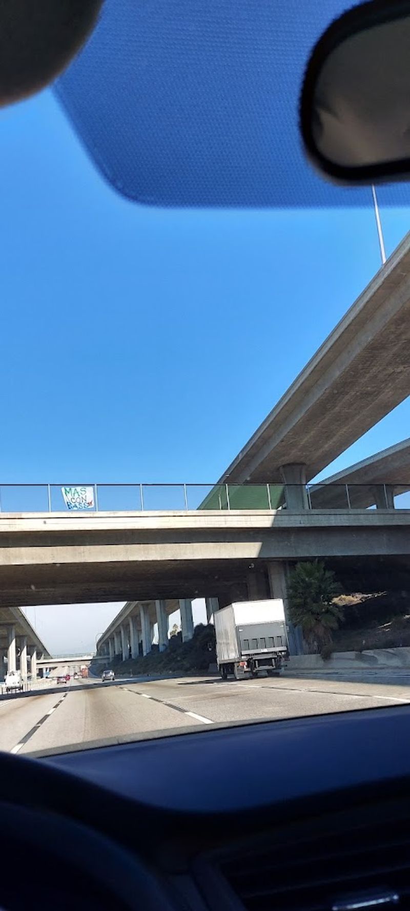
Interstate 5 (Los Angeles, California)
Half a million cars a day. That is not a typo.
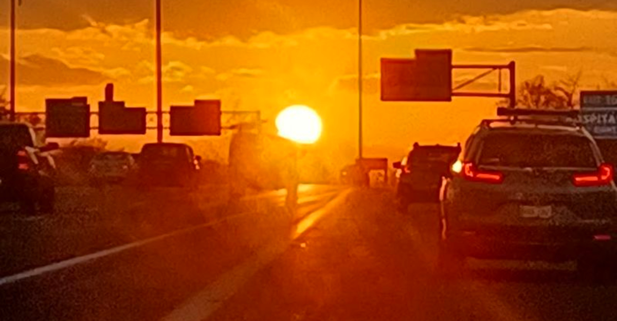
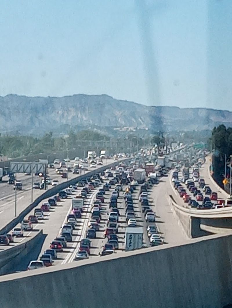
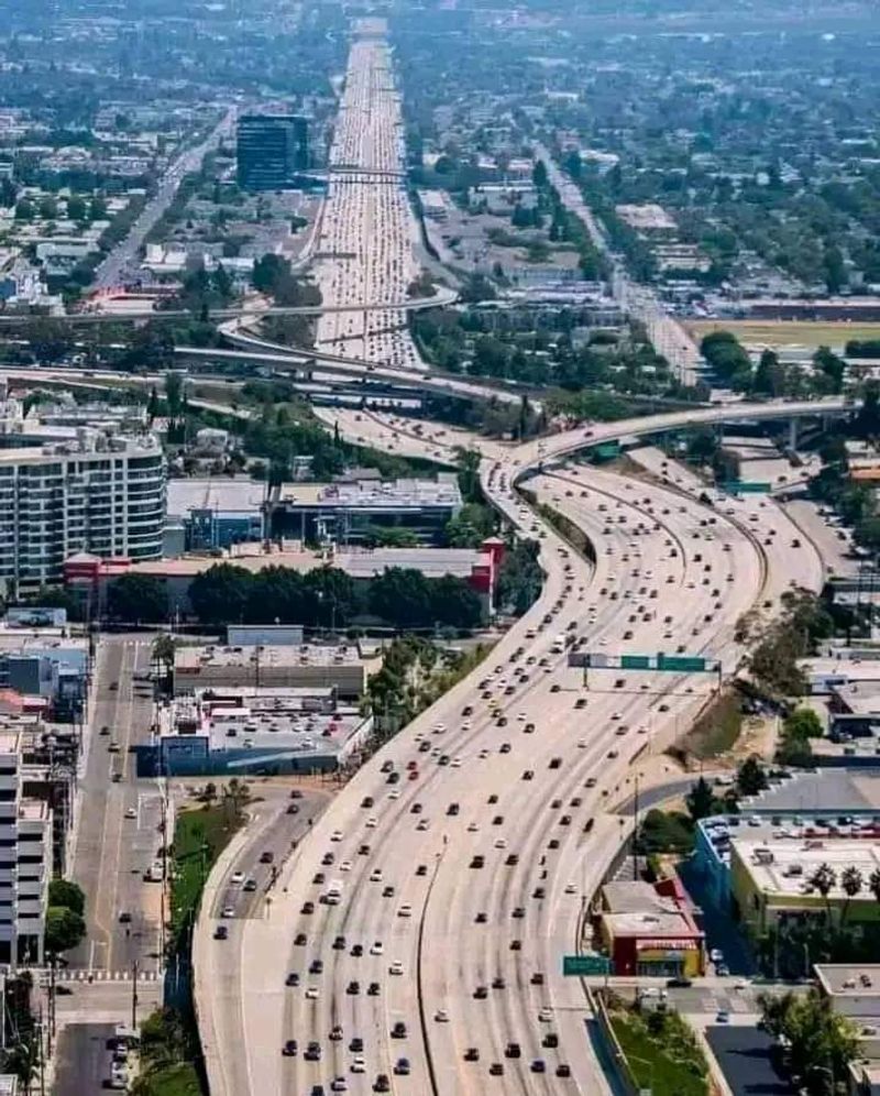
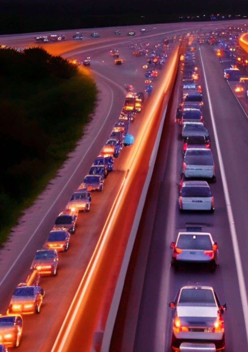
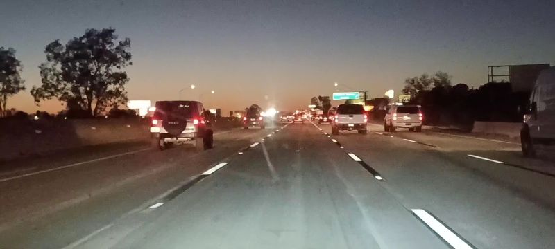
Interstate 5 through Los Angeles holds the crown as the single busiest highway in the entire United States, with some segments recording around 500,000 vehicles every single day. That number is almost impossible to picture, yet anyone who has driven it during rush hour knows exactly what it feels like.
I-5 is the backbone of the West Coast, running north to south and connecting major cities from San Diego all the way up to the Canadian border. Through Los Angeles, it carries a relentless mix of commuters, delivery trucks, and long-haul freight.
The sheer density of the surrounding urban area means there is almost never a quiet moment on this road.
Economic activity along this corridor is enormous. Ports, warehouses, distribution centers, and millions of households all depend on I-5 to move goods and people efficiently.
During peak hours, speeds can crawl to under 10 miles per hour on certain stretches. If you ever plan to drive it, an early morning start or a late evening departure can save you serious time and frustration.
Interstate 75 (Atlanta, Georgia)
Atlanta has a well-earned reputation for brutal traffic, and I-75 is one of the main reasons why. This corridor sees over 400,000 vehicles per day, making it one of the most congested stretches of highway in the entire Southeast.
Drivers who commute on it daily often describe it as a test of patience more than a road trip.
The highway serves a dual purpose that keeps it constantly busy. On one hand, it is a critical long-distance route connecting the Midwest all the way down to Florida, meaning it sees heavy freight and tourist traffic year-round.
On the other hand, it is a daily commuter artery for hundreds of thousands of Atlanta residents moving in and out of the city center.
Bottlenecks are especially common near the downtown connector, where I-75 and I-85 merge into one of the most notoriously congested road sections in the country. Construction projects and lane closures frequently make things worse.
Travel apps like Waze and Google Maps are practically mandatory for Atlanta drivers navigating this stretch. If you are passing through, budget extra time and expect the unexpected when it comes to delays.
Interstate 405 (Los Angeles, California)
Ask any Los Angeles local about the 405, and you will probably get a groan in response. Widely considered one of the most congested freeways in the entire country, I-405 carries around 380,000 or more vehicles every single day through the heart of suburban Southern California.
It has even earned its own nickname among frustrated commuters: “the parking lot.”
Running parallel to I-5, the 405 serves densely packed neighborhoods like Sherman Oaks, Inglewood, and Long Beach. It is a go-to route for people trying to avoid the main freeway, which ironically means both roads end up equally jammed.
There are few alternative routes in the area, which traps drivers with limited options when traffic backs up.
A massive widening project called the “405 Sepulveda Pass Improvements” added an extra carpool lane, but congestion relief was short-lived as more drivers filled the new space almost immediately. This phenomenon is known as induced demand, and it is a real challenge for traffic planners.
If you need to cross the Sepulveda Pass between the San Fernando Valley and the Westside, plan on leaving extra time no matter what hour you choose to travel.
Interstate 10 (Houston, Texas)
Everything really is bigger in Texas, including the highways. I-10 through Houston, often called the Katy Freeway, is one of the widest highways on earth, stretching up to 26 lanes at its broadest point when you count the frontage roads.
Traffic regularly exceeds 300,000 vehicles per day, making it a Texas-sized traffic problem that matches its Texas-sized design.
This east-west corridor is a powerhouse for both local commuting and long-distance freight. Houston is a major hub for the energy industry, shipping, and manufacturing, so the highway handles an enormous mix of passenger cars, commercial trucks, and tankers on any given day.
The combination of local and through traffic creates congestion that can stretch for miles without warning.
A massive reconstruction and expansion project completed in 2008 was expected to dramatically cut travel times. Instead, commute times actually increased within a few years as new drivers filled the added lanes.
It became a famous real-world example of why simply widening roads does not always solve congestion. Still, the Katy Freeway remains an essential lifeline for one of the fastest-growing metropolitan areas in the United States, and traffic shows absolutely no signs of slowing down anytime soon.
Interstate 95 (Miami, Florida)
Stretching nearly the entire length of the East Coast, I-95 is arguably the most iconic highway in America, and its Miami segment is among the busiest sections of the whole route. Around 339,000 vehicles travel this stretch daily, a number that swells even higher during winter when snowbirds from the north flood into South Florida looking for sunshine and warm weather.
Miami’s I-95 is famous for its elevated sections that weave through the urban core, offering dramatic views of the city skyline while simultaneously delivering some of the most nerve-wracking lane changes you will ever experience. The highway connects Miami to Fort Lauderdale and West Palm Beach, creating a dense commuter corridor that is active from early morning straight through the evening rush.
Express lanes were added to help manage demand, offering faster travel in exchange for a variable toll depending on congestion levels. On the worst days, the toll price spikes significantly as the system tries to keep traffic flowing.
The strategy works reasonably well, but the overall volume of vehicles means delays are still common. For anyone visiting Miami, using public transit or planning travel outside peak hours is a genuinely smart move worth considering before you get behind the wheel.
Interstate 90 (Chicago, Illinois)
Chicago sits at the crossroads of America, and I-90 makes sure everyone knows it. Carrying over 320,000 vehicles daily through the Chicago metro area, this stretch of the country’s longest interstate highway is a non-stop parade of commuters, truckers, and travelers passing through the Midwest’s biggest city.
The volume is relentless, and the weather does not help matters.
I-90 is remarkable for its sheer geographic reach, running all the way from Seattle, Washington, to Boston, Massachusetts. But the Chicago segment is where things get particularly intense.
The highway passes through densely populated neighborhoods and connects to major expressways that funnel traffic from multiple directions. The interchange with I-94, known locally as the Dan Ryan, is one of the most trafficked road junctions in the country.
Winter weather adds an unpredictable layer of chaos to an already complicated traffic picture. Snowstorms can turn a 20-minute commute into a two-hour ordeal with little warning.
Chicago drivers are famously tough and experienced, but even veterans of the local roads find I-90 humbling on bad weather days. If you are passing through, checking road conditions before you merge onto this highway could genuinely save you from a very unpleasant surprise.
Interstate 15 (Las Vegas, Nevada)
Friday afternoon on I-15 heading into Las Vegas might be the closest thing to a real-life slow-motion parade that exists in the American West. This highway sees more than 330,000 vehicles per day near the Las Vegas metro, driven almost entirely by a combination of locals, regional commuters, and an endless stream of tourists rolling in from Southern California for the weekend.
The stretch between the California-Nevada state line and the Las Vegas Strip is particularly notorious. On holiday weekends like Memorial Day and Labor Day, traffic can back up for 20 miles or more, turning a two-hour drive into a four-hour ordeal.
Rest stops become staging areas for frustrated families, and the desert heat makes a slow crawl even more uncomfortable during summer months.
Despite the congestion, I-15 is absolutely essential to the Nevada economy. Las Vegas tourism generates billions of dollars annually, and the vast majority of visitors from California arrive by car on this highway.
Freight trucks use it heavily as well, moving goods between California’s massive port system and inland distribution hubs. If you are planning a Vegas road trip from LA, leaving on a Thursday evening or very early Friday morning can make a significant difference in your overall travel experience.
CA-60 (Los Angeles, California)
Not every busy highway gets the fame it deserves, and CA-60 is a perfect example. California State Route 60 quietly handles around 350,000 vehicles daily in the Los Angeles metro area, making it one of the busiest state routes in the country despite flying well under the radar compared to its flashier neighbors like the 405 or I-10.
What makes Route 60 stand out is its heavy freight component. The highway serves as a critical link between the Ports of Los Angeles and Long Beach and the sprawling Inland Empire region to the east.
Massive semi-trucks loaded with shipping containers share the road with commuters heading to cities like Pomona, Ontario, and Riverside. The mix of slow-moving freight and impatient passenger traffic is a recipe for regular bottlenecks.
Air quality along the CA-60 corridor is a genuine concern for communities living nearby. The concentration of diesel trucks contributes to elevated pollution levels, and local advocacy groups have pushed for cleaner freight solutions over the years.
For everyday drivers, the congestion is the most immediate problem. Peak hours in both directions can be brutal, and there are limited parallel alternatives that offer meaningful relief.
Knowing your alternate surface streets can be a lifesaver when the freeway grinds to a halt.
Interstate 10 (Los Angeles, California)
Two entries for I-10 on this list might seem like overkill, but the data backs it up completely. The Los Angeles segment of Interstate 10, separate from the Houston stretch, handles approximately 355,000 vehicles daily, making it one of the busiest east-west corridors anywhere in the United States.
It is the kind of highway that makes even seasoned LA drivers shake their heads.
Known locally as the Santa Monica Freeway on its western end and the San Bernardino Freeway to the east, I-10 cuts straight through the urban core of Los Angeles before heading out toward the Inland Empire and eventually all the way to Florida. This dual nature as both a local commuter route and a cross-country artery keeps it perpetually busy at nearly every hour of the day.
The stretch through downtown Los Angeles is particularly intense, where multiple on-ramps and off-ramps create a constant weaving of vehicles competing for position. Accidents here can trigger traffic backups stretching for many miles in both directions within minutes.
Real-time traffic apps are practically a necessity for regular I-10 commuters. If you are new to driving in Los Angeles, this highway will introduce you very quickly to the realities of Southern California traffic culture.
US-101 (Los Angeles, California)
US-101 through Los Angeles has a personality all its own. Unlike the wide-open desert stretches of 101 further north, the LA section is a tight, twisting urban freeway that runs through some of the most famous neighborhoods in the world, including Hollywood, Silver Lake, and downtown LA.
Around 318,000 vehicles travel it every day, and many of those drivers are going just a few miles from one neighborhood to the next.
The highway is a vital connector for daily commuters who live on one side of the Hollywood Hills and work on the other. The Cahuenga Pass, where the 101 cuts through the hills between the San Fernando Valley and Hollywood, is one of the most congested pinch points in the entire Los Angeles freeway system.
Even small incidents here can create massive ripple effects across the whole network.
Because US-101 runs through so many distinct urban neighborhoods, it also carries a high volume of short-distance trips that might otherwise be made on surface streets. This adds up quickly and keeps the highway busy even during off-peak hours.
For visitors exploring Los Angeles, the 101 offers a genuine slice of what daily life feels like for millions of Southern Californians who call this sprawling, traffic-soaked city home.
Interstate 85 (Atlanta, Georgia)
Back in 2017, a section of I-85 in Atlanta literally collapsed after a fire broke out under the elevated structure, and the city’s entire traffic network went into immediate meltdown. That single event showed just how much Atlanta depends on this highway every single day.
Under normal conditions, I-85 carries more than 300,000 vehicles daily, serving as a crucial corridor in the Southeast.
The highway connects Atlanta to major cities like Charlotte, North Carolina, and Montgomery, Alabama, making it a key route for both regional travel and long-haul freight. Inside the Atlanta metro area, it functions as a primary commuter artery for the northeastern suburbs, funneling thousands of cars in and out of the city center during morning and evening peaks.
The junction where I-85 meets I-75 to form the downtown connector is consistently ranked among the most congested highway merges in the entire United States. The sheer volume of vehicles trying to navigate that interchange daily is staggering.
Georgia DOT has invested in managed lanes and express toll options to help ease the pressure, with mixed results. For commuters who use I-85 daily, flexibility in departure times and a reliable traffic app are two of the most useful tools for surviving the daily grind on this demanding stretch of road.
Interstate 110 (Los Angeles, California)
Short in length but absolutely massive in importance, I-110 packs an enormous amount of traffic into a relatively compact stretch of Southern California highway. Handling around 315,000 vehicles per day, this corridor connects downtown Los Angeles directly to the Port of Los Angeles in San Pedro, one of the busiest and most economically significant ports in the entire Western Hemisphere.
That port connection is what gives I-110 its unique character. Unlike most urban freeways that are dominated by passenger commuters, this highway sees a notable volume of commercial freight moving between the port and distribution centers throughout the region.
Loaded container trucks share lanes with office workers, creating a mix that contributes to persistent congestion throughout the day, not just during traditional rush hours.
The highway also passes through historic neighborhoods like Watts and South Central Los Angeles, areas where transportation access has long been a significant community issue. Investments in public transit along the corridor, including the Metro Silver Line express bus service, have offered some relief for riders who prefer not to deal with the daily traffic grind.
Still, for drivers, I-110 remains a consistently busy route that rewards patience and punishes anyone who underestimates how quickly conditions can change between exits on this compact but critical Los Angeles freeway.


