Despite satellites, GPS, and modern technology, large parts of Earth remain mysterious and only partially explored. Extreme environments such as deep oceans, dense rainforests, and polar regions make access difficult or dangerous, limiting human exploration.
In some cases, legal protections or indigenous communities prevent entry, while in others, harsh conditions simply make exploration nearly impossible. From the deepest ocean trench to vast untouched forests, these places remind us that our planet still holds secrets waiting to be discovered.
The Mariana Trench, Pacific Ocean
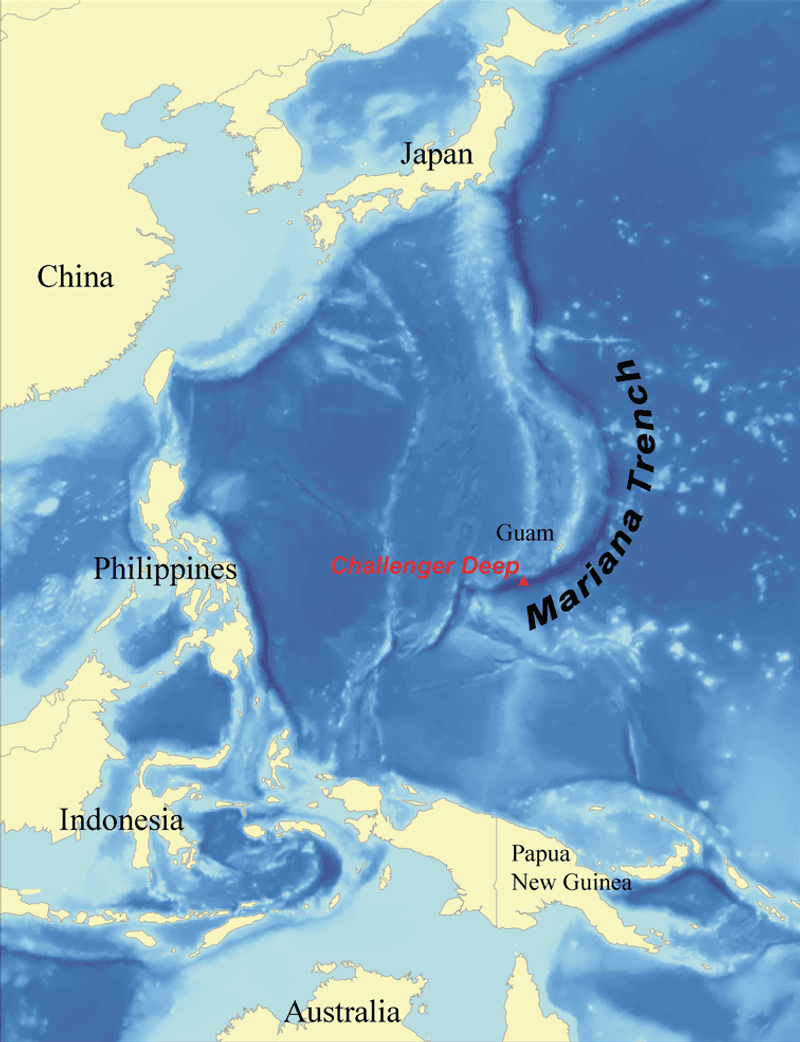
Imagine a place so deep that Mount Everest could fit inside it with room to spare. That is the Mariana Trench, the deepest point on Earth, plunging nearly 11 kilometers beneath the Pacific Ocean’s surface.
Only a handful of people have ever reached the very bottom, making it one of the least visited places on the planet.
Crushing water pressure at those depths is over 1,000 times greater than at sea level, which destroys most standard equipment. Special submersibles costing millions of dollars are required just to survive the journey down.
Even then, visibility is almost zero without powerful artificial lights.
Scientists have collected samples revealing creatures that look almost alien, including snailfish, amphipods, and translucent organisms adapted to survive in total darkness. Many species down there have never been formally named or studied.
Researchers estimate we have only explored a tiny fraction of the trench’s full length. With roughly 2,550 kilometers of unexplored seafloor still waiting, the Mariana Trench continues to be one of science’s greatest frontiers.
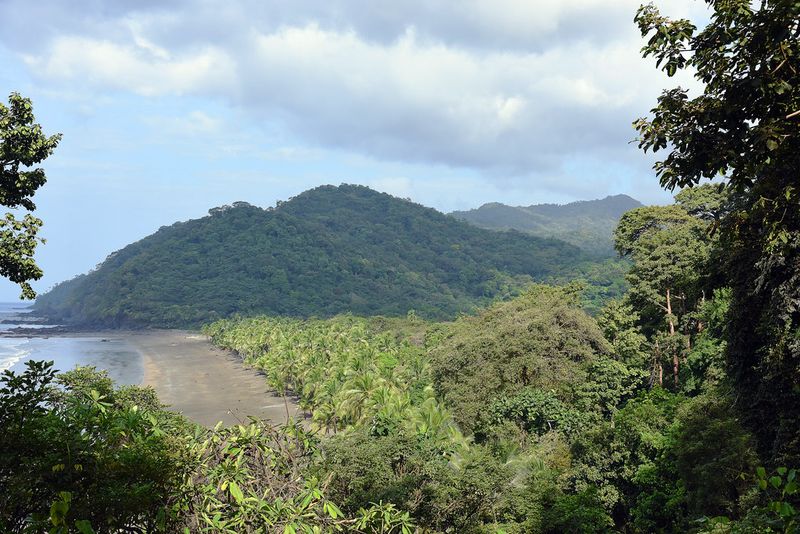
Amazon Rainforest (Vale do Javari), South America
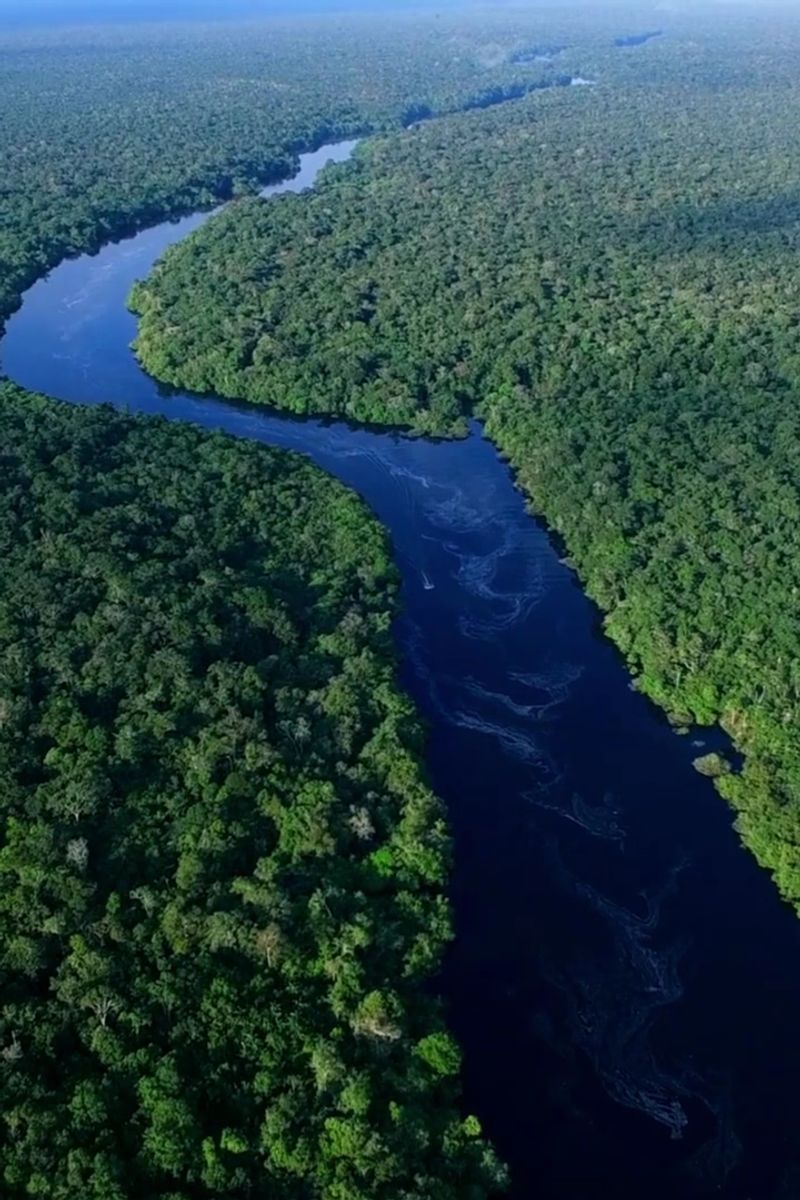
Somewhere inside the Amazon, people live who have never seen a smartphone, a road, or a city. Vale do Javari, a protected region in western Brazil, is home to the largest concentration of uncontacted tribes anywhere on Earth.
The Brazilian government strictly limits access to protect these communities from outside diseases and disruption.
The forest itself is so thick that sunlight barely reaches the ground in some areas. Canopy layers stack on top of each other like a living skyscraper, creating entirely separate ecosystems at different heights.
Scientists working at the edges of this region regularly discover new species of plants, insects, and animals.
Getting into Vale do Javari is not just difficult, it is largely illegal without special authorization. Unauthorized entry risks both legal consequences and genuine danger.
Even authorized researchers face logistical nightmares involving boats, small aircraft, and weeks of travel just to reach the outer boundaries. Biologists estimate thousands of plant species in this region have not yet been formally catalogued.
The Amazon is not just a rainforest; it is a living library where most of the pages have never been read.
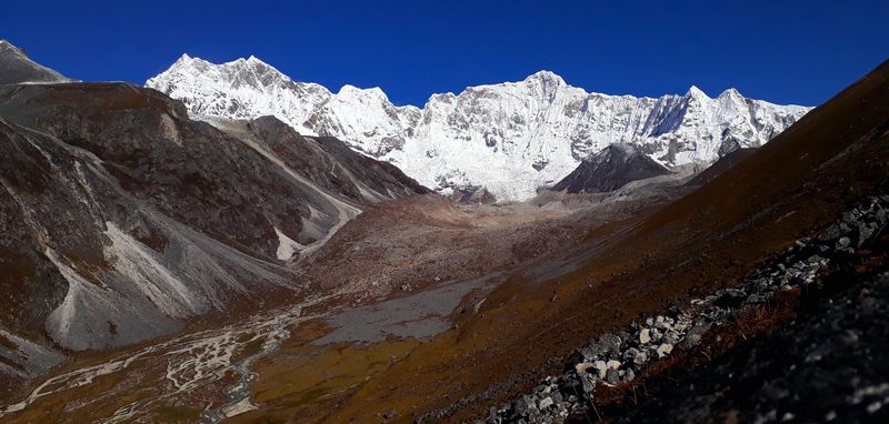
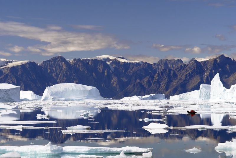
Northern Greenland Ice Sheet
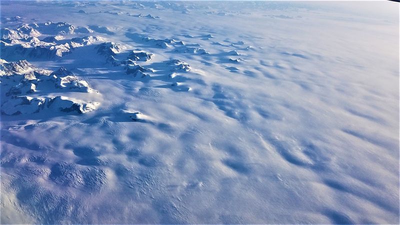
About 80 percent of Greenland is buried under ice so thick it could swallow entire mountain ranges. The northern portion is especially isolated, with temperatures dropping so low that exposed skin can freeze in minutes.
Very few scientific stations exist up there, and supply missions require specially equipped aircraft capable of landing on ice.
What lies beneath all that ice is genuinely unknown in many areas. Radar surveys have revealed hidden valleys, ancient riverbeds, and geological formations that have not seen sunlight in hundreds of thousands of years.
Some scientists believe liquid water may exist in pockets deep below the ice sheet.
Reaching the interior requires extreme cold-weather gear, trained survival teams, and careful planning against sudden blizzards that can appear with almost no warning. Crevasses hidden under snow create invisible traps that swallow sleds and equipment whole.
Even satellites struggle to give accurate ground-level readings through the dense ice. Climate researchers are racing to study Greenland because melting ice here directly affects sea levels worldwide.
Yet most of the northern sheet remains a frozen mystery that humans have barely scratched the surface of, quite literally.
Gangkhar Puensum, Bhutan/Tibet
No human has ever stood on its summit, and the government wants to keep it that way. Gangkhar Puensum, rising over 7,570 meters on the border of Bhutan and Tibet, holds the title of the highest unclimbed peak in the world.
Bhutan banned all mountaineering above 6,000 meters in 2003 out of respect for local spiritual beliefs that consider high peaks sacred.
Before the ban, a handful of expeditions attempted the mountain in the 1980s and all failed due to brutal weather and treacherous terrain. The peak sits in an area where maps are historically inaccurate, making route planning nearly impossible.
Storms can roll in without warning and temperatures plummet far below freezing even in summer months.
Local Bhutanese communities believe the mountain is the home of protective spirits, and disturbing it could bring harm to the region. That belief carries serious cultural weight, and the government enforces the climbing ban strictly.
Researchers cannot even conduct full geological surveys because access to the upper slopes is restricted. Gangkhar Puensum stands as a rare example of a place kept unexplored not by physical impossibility alone, but by a conscious human decision to leave nature untouched.
The Sahara Desert (Remote Regions), Africa
The Sahara is so enormous it could swallow the entire United States and still have room left over. Most people picture it as one endless sea of sand, but huge sections include rocky plateaus, hidden valleys, and dried riverbeds that have barely been studied.
Temperatures swing from scorching highs above 50 degrees Celsius during the day to near-freezing at night.
Archaeologists have found cave paintings, ancient fossils, and stone tools in remote Saharan regions, suggesting that parts of it were once green and inhabited thousands of years ago. Many researchers believe far more ancient sites are still buried beneath shifting sands, waiting for someone to find them.
Sandstorms that last for days can bury or uncover entire landscapes overnight.
Accessing the deep interior requires serious desert survival skills, specialized vehicles, and large water supplies. Even with modern GPS, getting lost in the Sahara’s most remote zones is a genuine risk.
Some regions near the borders of Libya, Niger, and Chad are also politically unstable, making scientific expeditions nearly impossible to organize safely. The Sahara holds geological and historical secrets that researchers have only begun to uncover, and much of it remains beautifully, stubbornly unknown.
Krubera Cave Depths, Georgia
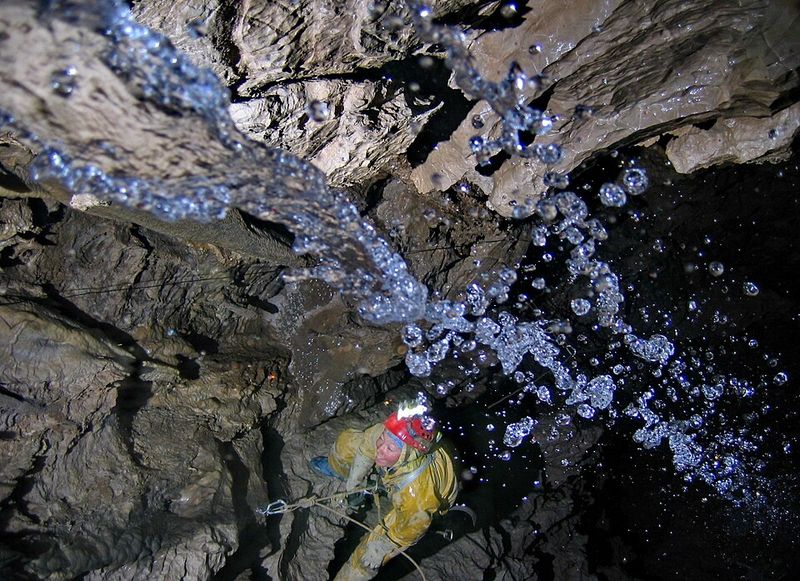
Going deeper into Krubera Cave means squeezing through passages barely wide enough for a human body while rappelling into chambers that have never seen daylight. Located in the Arabika Massif in Georgia, this is the deepest known cave system on Earth, reaching over 2,200 meters underground.
Explorers have spent weeks camped inside the cave just to push a few hundred meters further down.
Beyond certain flooded sections called sumps, the cave continues into unmapped territory that no one has yet reached. Cave divers have managed to push through some of these underwater obstacles, but many remain impassable with current technology.
The pressure, cold water, and near-zero visibility make each sump crossing a serious risk.
Scientists are fascinated by Krubera because isolated underground ecosystems can harbor life forms found nowhere else on Earth. Tiny crustaceans and microbes discovered in the cave’s deeper sections have already surprised researchers.
The cave also holds clues about how water moves through mountain rock systems over thousands of years. Mapping the full extent of Krubera would require entirely new diving and drilling technology.
For now, the deepest sections remain silent, dark, and spectacularly unexplored.
North Sentinel Island, India
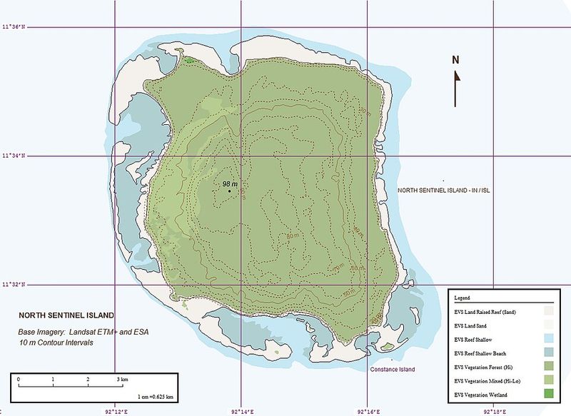
Try approaching this island and you might be greeted with arrows. The Sentinelese, the indigenous people of North Sentinel Island in the Andaman Sea, have rejected all contact with the outside world for thousands of years.
India’s government enforces a strict exclusion zone around the island, making it illegal to even sail within five kilometers of its shore.
The island covers roughly 60 square kilometers of dense jungle that no scientist has ever properly surveyed. Nobody outside the tribe knows what languages they speak, what their social structure looks like, or how many people live there.
Estimates range from as few as 15 to as many as 500 individuals.
The protection exists for good reason. Uncontacted peoples have no immunity to common diseases like the flu, meaning a single sick visitor could accidentally wipe out the entire population.
Attempts at contact in the past have been met with hostility, and in 2018, an American missionary who illegally visited the island was killed. Researchers observe the island carefully from a distance using satellite imagery, but the interior remains completely unknown.
North Sentinel Island is perhaps the most human mystery on this entire list.
The Darien Gap, Panama-Colombia
Every road in North and South America connects except for one notorious stretch. The Darien Gap is an approximately 160-kilometer break in the Pan-American Highway where jungle, swamp, and rugged terrain make road construction practically impossible.
This wild region sits on the border of Panama and Colombia and has defeated engineers, adventurers, and explorers for decades.
The terrain shifts constantly between dense rainforest, flooded wetlands, and steep ridges that appear on maps but look completely different on the ground. Jaguars, venomous snakes, and insects carrying serious diseases all call the Darien home.
The combination of wildlife hazards and the presence of armed groups has kept large sections almost entirely unmapped.
Scientists who have managed to reach parts of the Darien report extraordinary biodiversity, including plant and animal species found nowhere else in the world. Indigenous Embera and Wounaan communities live in the region and hold deep knowledge of the ecosystem, though much of that knowledge has never been formally documented.
Satellite images reveal forest patches that no researcher has ever physically visited. The Darien Gap is not just a gap in a road; it is a gap in human knowledge that the planet seems determined to protect.
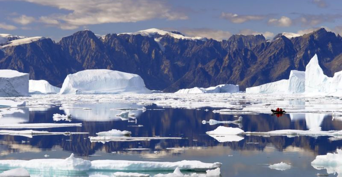
Northeast Greenland National Park
Bigger than most countries, Northeast Greenland National Park covers about 972,000 square kilometers, making it the largest national park on Earth by a massive margin. For comparison, it is roughly twice the size of France.
Despite that staggering size, it has no permanent human population and receives only a few hundred visitors per year, mostly scientists and military personnel.
Polar bears, musk oxen, Arctic foxes, and walruses roam freely across landscapes that look almost prehistoric. The terrain ranges from frozen fjords and towering glaciers to rocky coastal cliffs that drop straight into the Arctic Ocean.
Weather conditions can turn life-threatening within hours, which keeps casual visitors well away.
Researchers who do reach the park face enormous logistical challenges. Supply drops require aircraft, and any medical emergency becomes a multi-hour evacuation mission.
Despite these obstacles, scientists have discovered ancient geological formations and rare plant species in the park that exist nowhere else. Climate researchers use the park as a critical monitoring zone for Arctic changes affecting the whole planet.
Most of the interior has never been walked on by a human being, and given the access challenges, that is unlikely to change anytime soon.
Bouvet Island, South Atlantic Ocean
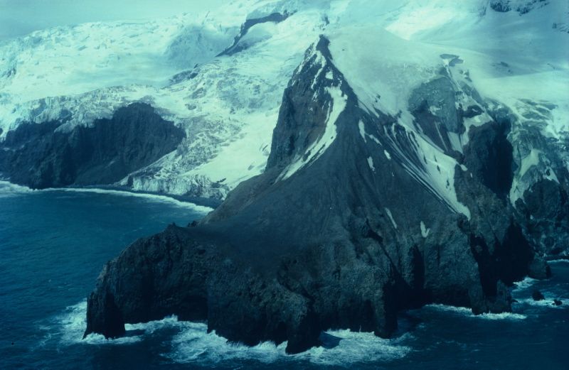
Bouvet Island holds a record most places would not want: it is officially the most remote island on Earth. Located in the South Atlantic Ocean, the nearest inhabited land is Tristan da Cunha, which is itself one of the most isolated settlements on the planet, sitting roughly 2,500 kilometers away.
The closest continent, Antarctica, is about 1,700 kilometers to the south.
The island is almost entirely covered by a glacier that extends right to the cliff edges, making landing nearly impossible. Rough seas, unpredictable weather, and the lack of any harbor mean ships cannot safely anchor nearby for long.
Norway claims sovereignty over Bouvet but maintains no permanent station on the island.
A handful of scientific expeditions have managed brief visits over the decades, usually by helicopter from research vessels. Each visit has revealed new details about the island’s geology and wildlife, including large seal and seabird populations that thrive without any human disturbance.
In 1964, a British expedition found an abandoned lifeboat on the island with no explanation for how it got there, a mystery that has never been solved. Bouvet Island is strange, isolated, and wonderfully unexplained.
Surtsey Island, Iceland
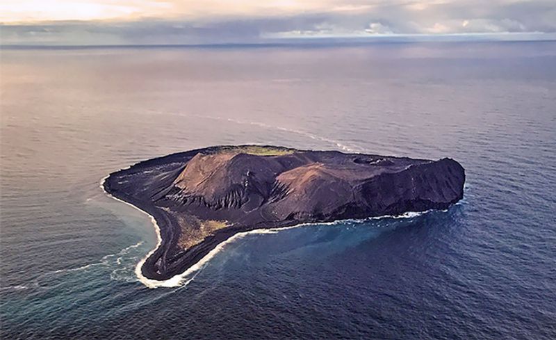
Surtsey did not exist until 1963. That year, an underwater volcanic eruption off the southern coast of Iceland broke the ocean surface and kept erupting for nearly four years, building a brand-new island from nothing.
Scientists immediately recognized it as a unique opportunity to watch an ecosystem develop from absolute zero.
Access to Surtsey is restricted to a small group of authorized researchers, and visits are kept extremely short to avoid introducing outside bacteria, seeds, or animals that could contaminate the natural process. The island is essentially a living science experiment, and human footprints are considered a form of pollution.
Even the scientists who do visit follow strict protocols about what they can bring and where they can walk.
Over the decades, birds arrived first, followed by plants carried by wind and ocean currents, then insects, and eventually earthworms brought in by nesting seabirds. The progression has matched and sometimes surprised ecological predictions.
Researchers have documented over 335 plant and animal species establishing themselves naturally on the island. Surtsey offers a rare window into how life colonizes barren land, a process that normally takes thousands of years but here can be watched in real time.
Very few humans will ever set foot on it.
The Namib Desert, Namibia
The Namib is not just old; it is ancient by desert standards, estimated to be between 55 and 80 million years old, making it one of the oldest deserts on the planet. Its famous red dunes near Sossusvlei reach heights of over 300 meters, among the tallest in the world.
Yet enormous stretches of the Namib, particularly inland sections and remote northern zones, have received very little scientific attention.
The desert’s coastal fog, which rolls in from the Atlantic Ocean, supports a surprising web of life including beetles, lizards, and plants found nowhere else on Earth. Scientists studying these fog-dependent ecosystems regularly discover species with unique survival strategies.
However, reaching the most isolated interior regions requires serious off-road capability and careful planning around extreme heat.
Some areas near the Namibian border with Angola remain politically sensitive and poorly mapped, limiting research missions. Geologists believe the Namib’s rocky interior holds clues about ancient African continental shifts that could reshape understanding of the region’s geological history.
Drone surveys have recently started revealing landforms and dry riverbeds that ground teams never knew existed. The Namib rewards those who reach its remote corners with some of the most dramatic and scientifically rich landscapes on Earth.
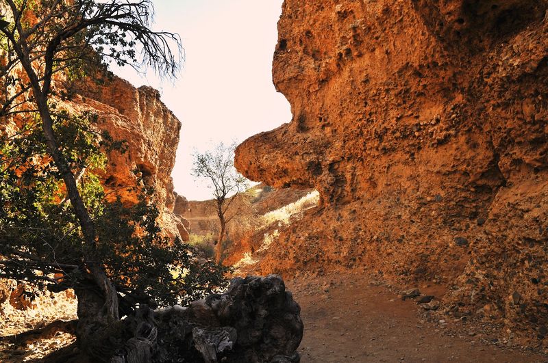
The Star Mountains, Papua New Guinea
Hidden in the western highlands of Papua New Guinea, the Star Mountains are so remote that even local communities in surrounding areas rarely venture deep into them. The range sits near the border with Indonesia and contains some of the most rugged terrain in the Pacific region.
Cloud forests, limestone karst formations, and steep river gorges make movement through the area extraordinarily difficult.
Biologists who have conducted brief expeditions into the Star Mountains have returned with remarkable findings. New species of frogs, birds, and orchids have been discovered on almost every visit.
The region is believed to contain entire ecosystems that science has not yet formally described, tucked away in valleys that no researcher has ever reached on foot.
Papua New Guinea as a whole is considered one of the world’s last great biodiversity frontiers, and the Star Mountains represent its most unexplored corner. The combination of difficult terrain, lack of infrastructure, and limited funding for expeditions means that scientific knowledge of the range is still at a very early stage.
Local indigenous communities hold oral knowledge about the landscape and its creatures, but much of that has not been shared or recorded in any scientific context. The Star Mountains are genuinely waiting to be understood.
Antarctic Subglacial Lakes (Lake Vostok)
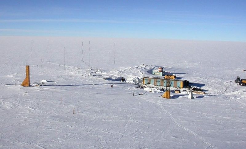
Sealed beneath four kilometers of Antarctic ice lies a lake the size of Lake Ontario that has been completely cut off from the outside world for somewhere between 15 and 25 million years. Lake Vostok is the largest of Antarctica’s roughly 400 known subglacial lakes, and it sits directly below Russia’s Vostok research station, which is already one of the coldest places on Earth.
Drilling through kilometers of ice to reach the lake without contaminating it took decades of engineering effort. When Russian scientists finally broke through to the lake water in 2012, they had to be extremely careful not to introduce any outside microbes that could compromise what might be an entirely isolated ecosystem.
The water refreezes quickly, adding another layer of complexity to sample collection.
Preliminary analysis of ice cores from just above the lake’s surface has already hinted at the presence of microbial life. If confirmed, it would suggest that life can persist in complete darkness, under enormous pressure, and without any contact with the surface world for millions of years.
That finding has major implications for the search for life on other planets with subsurface oceans, like Jupiter’s moon Europa. Lake Vostok remains one of science’s most tantalizing unsolved puzzles.
The South Pacific Gyre (Oceanic Desert)
Scientists call it the oceanic desert, and the nickname is well earned. The South Pacific Gyre is a massive rotating current system covering millions of square kilometers between South America and Australia, and it is one of the least biologically productive regions on the entire planet.
Nutrient levels in the water are so low that almost nothing grows there, earning it a reputation as the clearest and emptiest ocean zone on Earth.
The water in the gyre is so clear that sunlight penetrates to extraordinary depths, yet there is almost nothing alive to absorb it. Researchers describe it as the closest thing to a biological desert that exists in the ocean.
Even plankton, the foundation of most marine food chains, is nearly absent across vast stretches of the gyre.
Getting research vessels out to the gyre’s most remote center is enormously expensive and logistically complex. It sits thousands of kilometers from the nearest inhabited land, making resupply missions impractical.
Despite that, a few dedicated research cruises have ventured into the region and found surprising results, including microbes that survive on almost nothing and trace amounts of plastic pollution that have drifted in from distant coastlines. The South Pacific Gyre proves that even emptiness has stories worth telling.


