Some roads in America are more than just a long drive — they are a white-knuckle experience that even seasoned drivers dread. From icy mountain passes to congested urban freeways packed with aggressive drivers, certain highways have earned a truly terrifying reputation.
Federal crash data and real driver stories back it up: these roads are responsible for thousands of fatal accidents every year. Buckle up, because this list of the most dangerous roads in America might make you think twice before planning your next road trip.
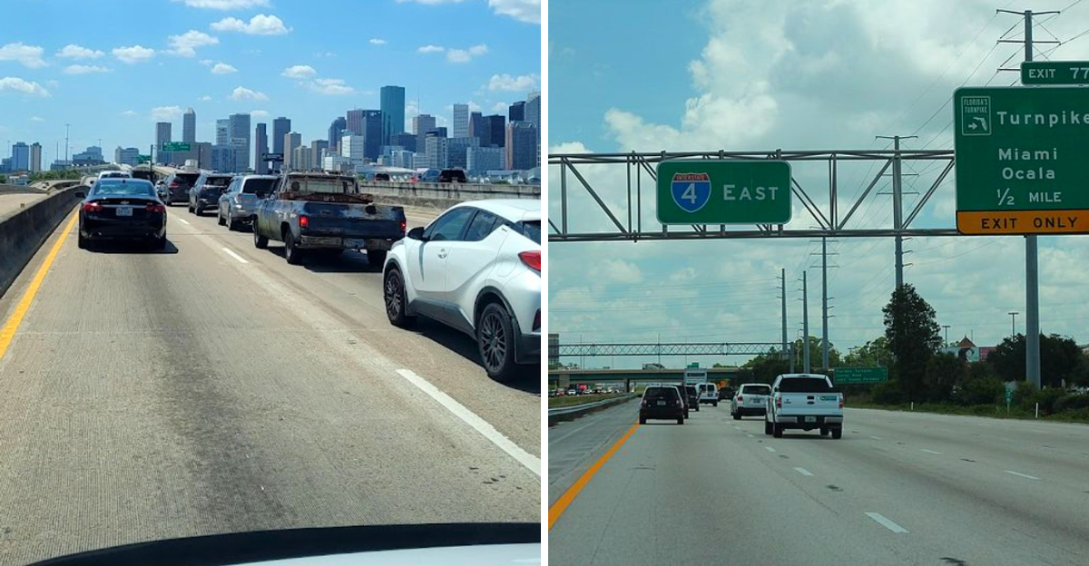
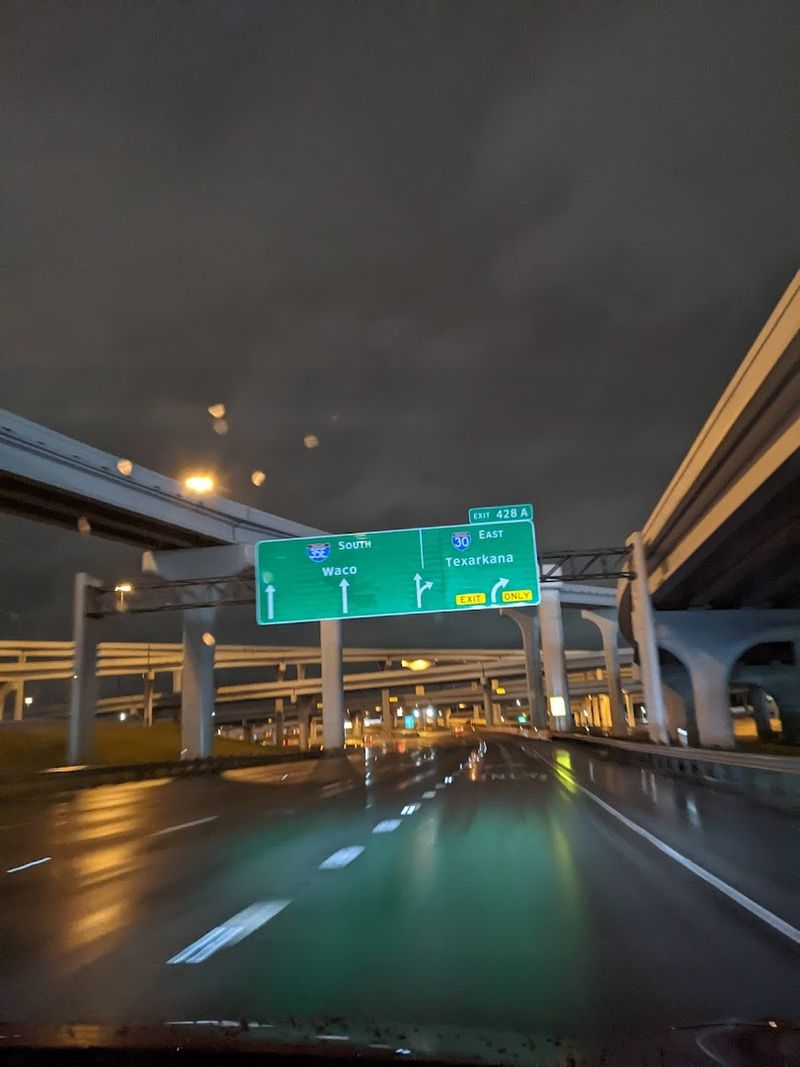
Interstate 45 (Texas)
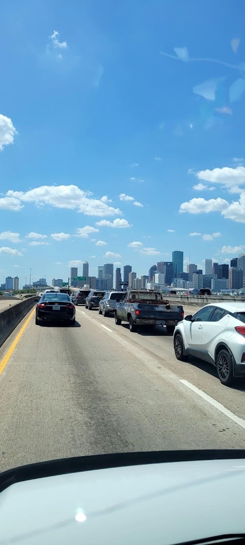
Ask any Houston driver about I-45 and watch their expression change instantly. This highway has earned a grim nickname among road safety researchers — the deadliest urban interstate in the United States.
That is not a title anyone wants to hold.
Stretching from Dallas to Galveston, I-45 cuts right through the heart of Houston, where traffic never really seems to stop. The combination of high speeds, tangled interchanges, and an overwhelming number of vehicles creates a pressure cooker of driving stress.
Rear-end collisions and sideswipe crashes happen here with alarming regularity.
Studies from the Insurance Institute for Highway Safety have repeatedly flagged this corridor for its high fatal crash density. Pedestrian fatalities are also a serious concern, particularly in urban stretches where crossings are poorly designed.
If you must drive I-45 through Houston, avoid rush hour at all costs and stay alert at every interchange. Defensive driving is not optional here — it is survival strategy.
Keep your following distance generous and your eyes constantly scanning ahead.
Interstate 95 (Multiple States)
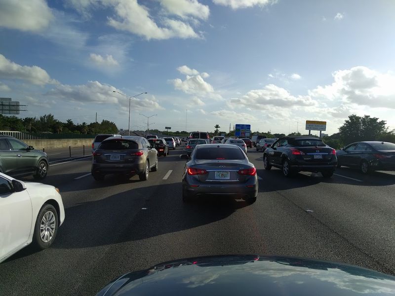
Running nearly 2,000 miles from Florida to Maine, I-95 is the backbone of the entire East Coast — and one of the most nerve-wracking drives in the country. It connects some of America’s biggest cities, which means it is almost never quiet.
Miami’s stretch of I-95 is particularly notorious. Aggressive lane changes, speeding, and an almost theatrical disregard for turn signals make it feel less like a highway and more like a high-stakes video game.
Accident rates in South Florida consistently rank among the worst in the nation.
Further north, the congestion shifts but never disappears. Around New York, New Jersey, and the Washington D.C. area, merging traffic and construction zones add fresh layers of chaos.
Truck traffic is heavy throughout, and distracted driving incidents are reported constantly. Weather throws in its own curveballs — winter ice in the north, sudden Florida downpours in the south.
Experienced travelers recommend using GPS to track real-time incidents and always leaving extra buffer space between vehicles. Patience is genuinely your best co-pilot on this beast of a highway.
Interstate 4 (Florida)
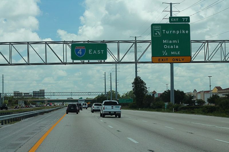
Central Florida is famous for theme parks, sunshine, and unfortunately, one of the most dangerous stretches of highway in America. Interstate 4 runs about 132 miles through the heart of the state, passing through Orlando and connecting Tampa to Daytona Beach.
The problem is a perfect storm of bad driving conditions. Millions of tourists unfamiliar with local traffic patterns share the road with commuters who are in a genuine hurry.
Lane changes happen at terrifying speeds, and the highway’s design in several sections makes safe merging feel nearly impossible. Florida’s sudden, blinding rain showers do not help matters either.
Data from the National Highway Traffic Safety Administration has repeatedly placed I-4 among the deadliest highways per mile in the entire country. The stretch near downtown Orlando is especially hazardous, with high crash frequency and a troubling number of fatal incidents involving pedestrians.
Construction has been ongoing for years, adding confusing lane shifts to the mix. If you are visiting Florida, consider using alternate surface roads when possible.
When you have no choice but to drive I-4, keep your speed in check and never assume another driver will signal before cutting across three lanes.
US Route 1 (Florida)
Forget the glamour of Florida’s coastline for a moment — US Route 1 through the Sunshine State has a dark side that traffic safety experts have been warning about for years. Unlike a controlled-access freeway, Route 1 is a surface road lined with driveways, traffic lights, and unpredictable entry points every few hundred feet.
That accessibility is exactly what makes it so dangerous. Local drivers, delivery trucks, tourists in rental cars, and cyclists all share the same narrow lanes with wildly different goals and speeds.
The constant stop-and-go rhythm lulls some drivers into complacency, which is exactly when accidents happen.
Fatality rates along certain Florida sections of US-1 are among the highest recorded for any surface highway in the state. Pedestrian deaths are a particular crisis, especially in areas where crosswalks are sparse and traffic moves fast.
Speed zone changes happen frequently and without much warning, catching unfamiliar drivers off guard. Locals know to stay sharp at every intersection and never assume a driver turning out of a parking lot has actually looked both ways.
If you are driving this route, treat every block like a new hazard zone — because it basically is.
California State Route 99
Cutting through California’s Central Valley like a long gray scar, State Route 99 is the agricultural heartland’s main artery — and one of the deadliest highways in the western United States. It stretches roughly 425 miles and carries an enormous mix of commercial trucks, farm vehicles, and everyday commuters.
The sheer volume of freight traffic is staggering. Eighteen-wheelers dominate this corridor, and their presence dramatically increases the severity of any collision that occurs.
Passenger vehicles squeezed between massive trucks at highway speeds have very little margin for error. Fatigue is another major factor — long, straight stretches of monotonous scenery through flat farmland can cause drivers to zone out dangerously.
A multi-year study found hundreds of fatalities along Route 99, with some segments recording crash rates far above the state average. Infrastructure along many sections is outdated, with narrow shoulders and limited lighting at night.
Fog is a seasonal hazard that reduces visibility to near zero during winter mornings, causing chain-reaction pile-ups that make headlines every few years. Drivers traveling this route should plan rest stops every two hours, use fog lights when conditions demand, and give trucks a wide, respectful berth at all times.
Million Dollar Highway (Colorado)
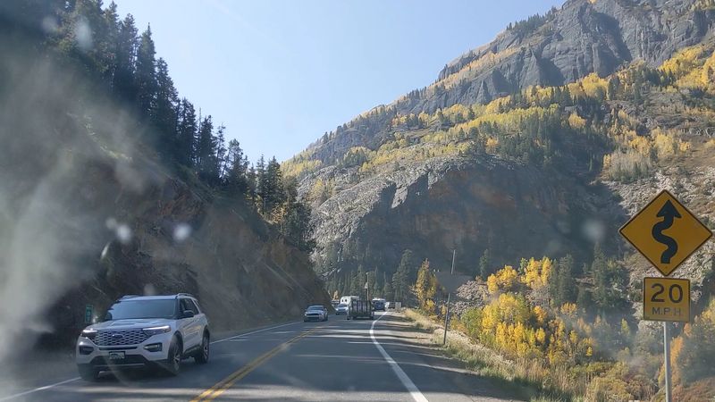
There is no guardrail standing between your car and a several-hundred-foot drop — and somehow, that is not even the scariest part of driving the Million Dollar Highway. This legendary stretch of US-550 in southwestern Colorado winds through the San Juan Mountains between Ouray and Silverton, covering about 25 miles of pure, unfiltered terror.
The road earned its dramatic nickname from the gold and silver ore reportedly embedded in its original gravel fill, though drivers today are less focused on history and more focused on not plummeting off the edge. Lanes are narrow, switchbacks are sharp, and the sheer cliff faces on either side leave no room for mistakes.
In wet or icy conditions, the road becomes genuinely treacherous.
Local authorities strongly advise against driving it in winter unless you are experienced with mountain roads and your vehicle is properly equipped. Summer brings better conditions but also more tourist traffic, which creates its own hazards on blind curves.
If you do attempt this drive, take it slow, use pullouts generously to let faster traffic pass, and never attempt to pass another vehicle on a curve. The views are jaw-dropping — but only if you keep the car on the road long enough to enjoy them.
Interstate 10 (Multiple States)
Spanning nearly 2,460 miles from Santa Monica, California to Jacksonville, Florida, I-10 is one of the longest interstates in America — and its sheer size means it carries all kinds of dangers depending on where you happen to be driving it.
In Texas, speed limits hit 80 mph in some rural sections, and the distances between exits can stretch to uncomfortable lengths. Out in the desert Southwest, extreme heat causes tire blowouts and engine overheating at alarming rates.
New Mexico and Arizona sections have seen high rates of wrong-way driving incidents, which are among the most fatal crash types on any highway.
Louisiana and Florida add their own flavor of danger, with hurricane-season flooding and slick roads from sudden heavy rainfall. The urban stretches through Phoenix, San Antonio, and Los Angeles bring dense traffic and aggressive driving into the picture.
One particularly grim stretch near El Paso consistently appears on lists of the nation’s most dangerous highway segments. Across its entire length, I-10 records thousands of crashes annually.
Drivers covering long distances should rotate behind the wheel with a passenger when possible, stay hydrated in desert sections, and always check weather conditions before entering flood-prone areas.
Interstate 35E (Texas)
Dallas drivers have a complicated relationship with I-35E — they need it, they use it daily, and they absolutely dread it. This urban stretch of interstate carries a brutal combination of heavy commercial truck traffic and commuter vehicles all competing for the same tight lanes through one of Texas’s busiest cities.
The merging situations along I-35E are genuinely baffling. Some on-ramps feed directly into high-speed lanes with almost no acceleration room, forcing drivers into dangerous gap-hunting maneuvers during peak hours.
Construction zones have been a near-constant feature for years, shrinking lanes and shifting traffic patterns with little notice.
Crash data from the Texas Department of Transportation consistently flags the Dallas segment of I-35E as a high-incident corridor. Rear-end collisions are the most common type, driven largely by sudden slowdowns that catch speeding drivers off guard.
Trucking accidents add a terrifying element — when a semi loses control in heavy traffic, the consequences can be catastrophic. Morning and evening rush hours are the absolute worst times to be anywhere near this highway.
If your schedule has any flexibility, shifting your commute by even 30 minutes can dramatically reduce your exposure to the most dangerous conditions on this relentlessly busy stretch.
Interstate 70 (Colorado & Utah)
Winter on I-70 through Colorado is not for the faint-hearted. This stretch of interstate climbs through some of the most dramatic terrain in the Rocky Mountains, crossing Vail Pass at nearly 10,600 feet and threading through the stunning but nerve-shredding Glenwood Canyon.
The scenery is breathtaking — and so is the danger.
Colorado law actually requires chain laws and traction requirements on specific mountain segments during winter months, and for good reason. Black ice forms without warning, snowstorms can reduce visibility to nearly zero within minutes, and the steep grades put enormous strain on brakes during descents.
Runaway truck ramps exist along the route for a reason, and they get used.
Summer is not entirely safe either. Rockslides have closed Glenwood Canyon multiple times, and the sheer volume of ski-season and vacation traffic creates congestion on a road that was not designed for modern traffic loads.
Weekend warrior drivers heading to ski resorts in rented SUVs — many unfamiliar with mountain driving — add an unpredictable element. Colorado DOT provides real-time road condition updates online, and checking them before departure is genuinely essential.
Carrying an emergency kit with blankets, food, and water is strongly advised for any winter trip on this iconic but unforgiving highway.
Tail of the Dragon (US 129, Tennessee/North Carolina)
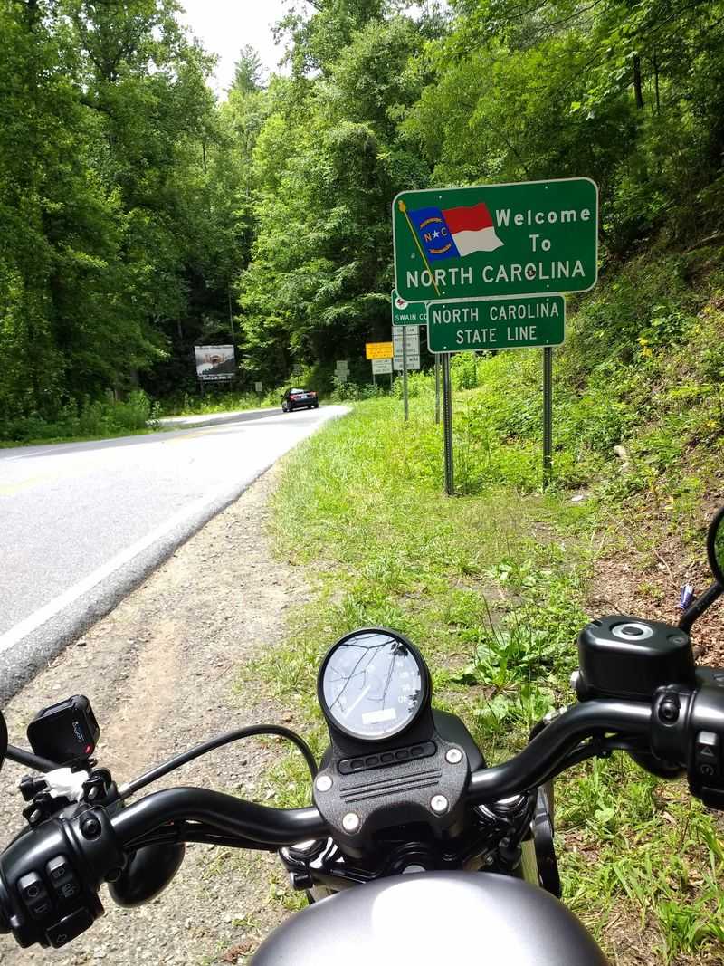
Three hundred eighteen curves packed into just eleven miles — the Tail of the Dragon is not a road so much as a dare. Straddling the Tennessee and North Carolina border near Deals Gap, this legendary stretch of US-129 draws thrill-seekers from across the country, and it sends a surprising number of them to the hospital.
Motorcyclists are especially drawn to the Dragon’s twisting layout, and the road has developed a cult following among riding enthusiasts. A nearby towing service even displays the wrecked bikes and cars they have pulled from the roadside — a grim trophy wall nicknamed the Tree of Shame.
That should tell you something about the Dragon’s bite.
The road has no intersecting streets, no driveways, and almost no margin for error on its tightest curves. Overconfidence is the most common cause of crashes here.
Drivers who have watched too many YouTube videos of others nailing the curves at speed tend to discover very quickly that skill in a video is different from skill behind the wheel. Speed limits are posted for good reason — they reflect the actual geometry of the turns.
If you visit, treat every curve with fresh respect, stay in your lane at all times, and remember that the Dragon has claimed far more confident drivers than cautious ones.


