There is a stretch of Oregon where ancient trees crowd the highway, rivers flash silver through canyon gaps, and the road ahead keeps promising something even better around the next bend. That place is Willamette National Forest, a 1.6-million-acre stretch of the Oregon Cascades that rewards every kind of traveler.
I have driven its corridors in autumn fog, summer sun, and early spring drizzle, and every single time the forest finds a new way to stop me cold. From volcanic peaks to rushing waterfalls to hot springs tucked along river banks, this forest packs more scenery per mile than almost anywhere else I have been in the Pacific Northwest.
Pack snacks, charge your camera, and keep reading because the drives ahead are absolutely worth your time.
McKenzie River Highway: The Forest’s Crown Jewel Drive
The McKenzie River Highway, Oregon Route 126, is the kind of road that makes you forget you had anywhere else to be. Running alongside the crystal-clear McKenzie River through the heart of Willamette National Forest near Blue River, OR 97413, this route delivers one postcard view after another without ever asking you to work hard for it.
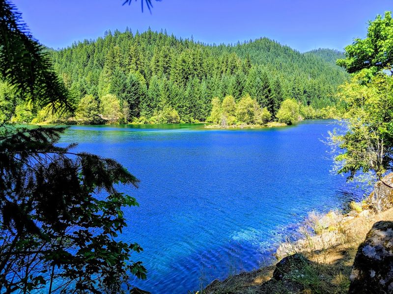
The river itself is a deep, almost impossible shade of blue-green, fed by snow melt and underground springs from the High Cascades above. Old-growth Douglas firs and western red cedars line the shoulders, their root systems gripping mossy basalt boulders that were left behind by ancient lava flows thousands of years ago.
Sahalie Falls and Koosah Falls are both reachable from short pullouts along this highway, and both are genuinely jaw-dropping even if you have seen a hundred waterfalls before. The Belknap Hot Springs resort also sits right along this corridor, making a convenient stop after hours behind the wheel.
Travelers coming from as far away as Oklahoma have listed this highway among the most memorable drives of their entire road trips, and honestly, that reputation is fully earned.
Aufderheide Scenic Byway: A Hidden Corridor Through the Trees
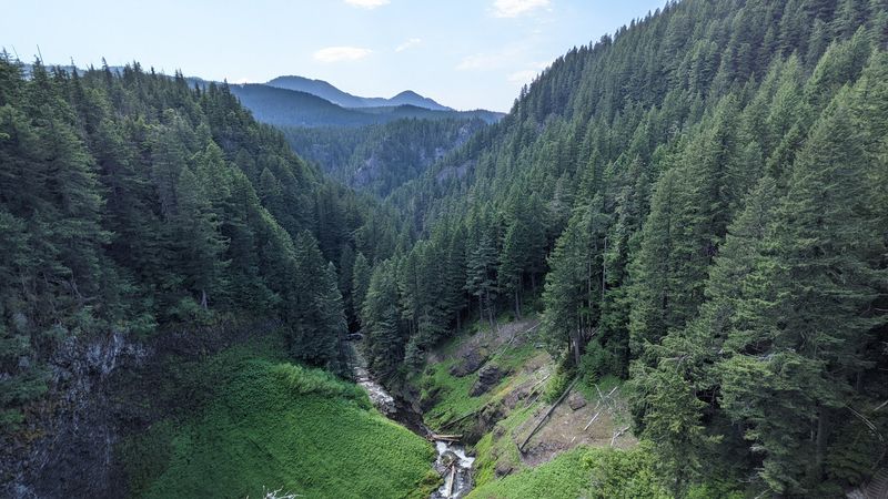
Not every great drive announces itself with a famous name, and the Aufderheide Scenic Byway is proof of that. This 58-mile route threads through the quieter western side of Willamette National Forest, connecting the towns of Westfir and Blue River along Forest Road 19 through terrain that feels genuinely untouched.
The road follows the North Fork of the Middle Fork Willamette River for much of its length, and the water is clear enough that you can watch fish holding in the current from the bridge pullouts. Old-growth groves press close on both sides, and the filtered light on overcast mornings gives the whole drive a soft, almost dreamlike quality that no photograph fully captures.
Campsites appear at regular intervals, so turning this into an overnight trip is easy and very much worth considering. The byway also passes Terwilliger Hot Springs, a popular natural pool where visitors soak in geothermally heated water surrounded by forest.
Few roads in Oregon feel this genuinely remote while still being entirely paved, and the lack of crowds compared to better-known routes makes every mile feel like a small personal discovery.
Santiam Pass Corridor: Volcanic Drama at Every Turn
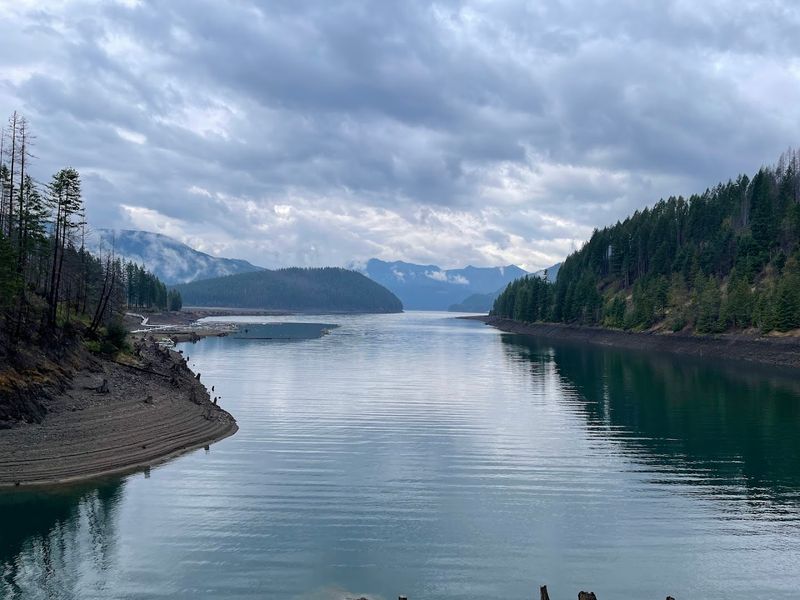
Some roads make you feel small in the best possible way, and the Santiam Pass corridor through Willamette National Forest on US Highway 20 is one of them. The terrain here shifts noticeably from dense forest to open subalpine meadow as the road climbs toward the 4,817-foot pass, and the volcanic peaks surrounding you start to feel very real and very close.
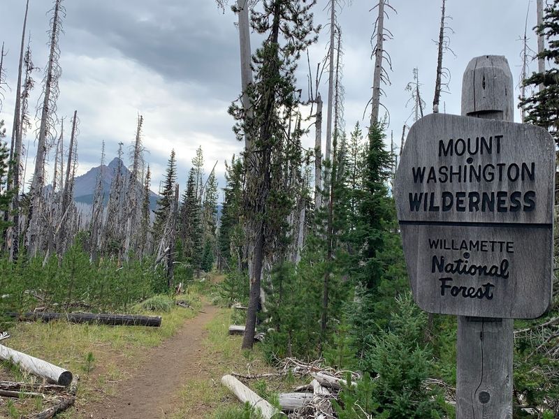
Mount Washington and Three Fingered Jack both dominate the skyline along this stretch, their jagged ridgelines formed by centuries of glacial erosion on ancient volcanic cores. Lava fields from relatively recent eruptions spread across the forest floor on both sides of the highway, and a short hike from the Santiam Wagon Road trailhead puts you right on top of that history.
Big Lake, visible from a short side road off the main highway, reflects the surrounding peaks on calm mornings and offers camping, kayaking, and quiet shoreline walks. Detroit Lake is another highlight just east of the pass, its turquoise water famous among Oregon anglers and paddlers.
Visitors from Oklahoma and across the country make this corridor a regular stop on cross-Cascades road trips, and the scenery fully justifies the detour every single time.
Quartzville Back Country Byway: Gold Country Roads
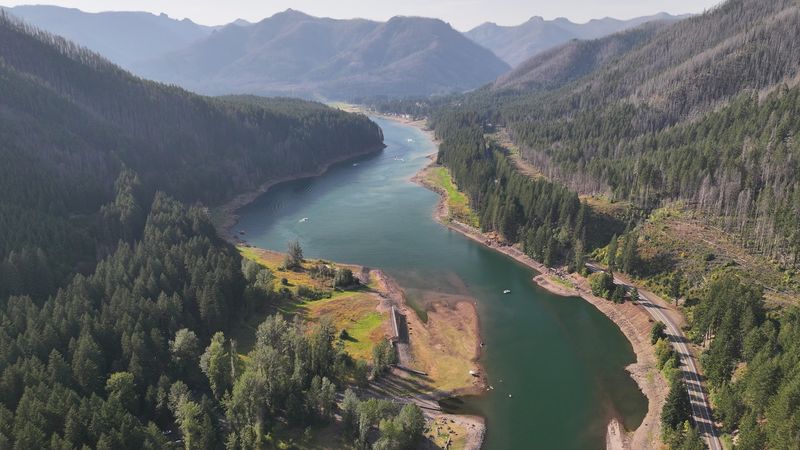
Not many scenic drives come with a side of gold prospecting lore, but the Quartzville Back Country Byway near Sweet Home, Oregon, is not your average forest road. This 24-mile route follows Quartzville Creek into the Cascade foothills, passing through land that drew prospectors during the 19th century and still rewards patient visitors today.
The creek runs alongside the road for most of the drive, and the gravel bars along its banks are popular spots for recreational gold panning. Green Peter Reservoir marks the western gateway to the byway, and its wide blue surface surrounded by forested ridges makes a strong first impression before the road narrows into the canyon proper.
Campgrounds along the creek are quiet and well-spaced, and the fishing for rainbow trout gets serious attention from locals who know the area well. The road surface transitions from paved to gravel partway through, so a vehicle with decent clearance handles it more comfortably than a low sedan.
The overall vibe here is rugged, unhurried, and genuinely off the beaten path, which is exactly what makes it so satisfying to explore on a clear Oregon morning.
Salt Creek Falls Pullout: The Waterfall Drive Worth Every Mile
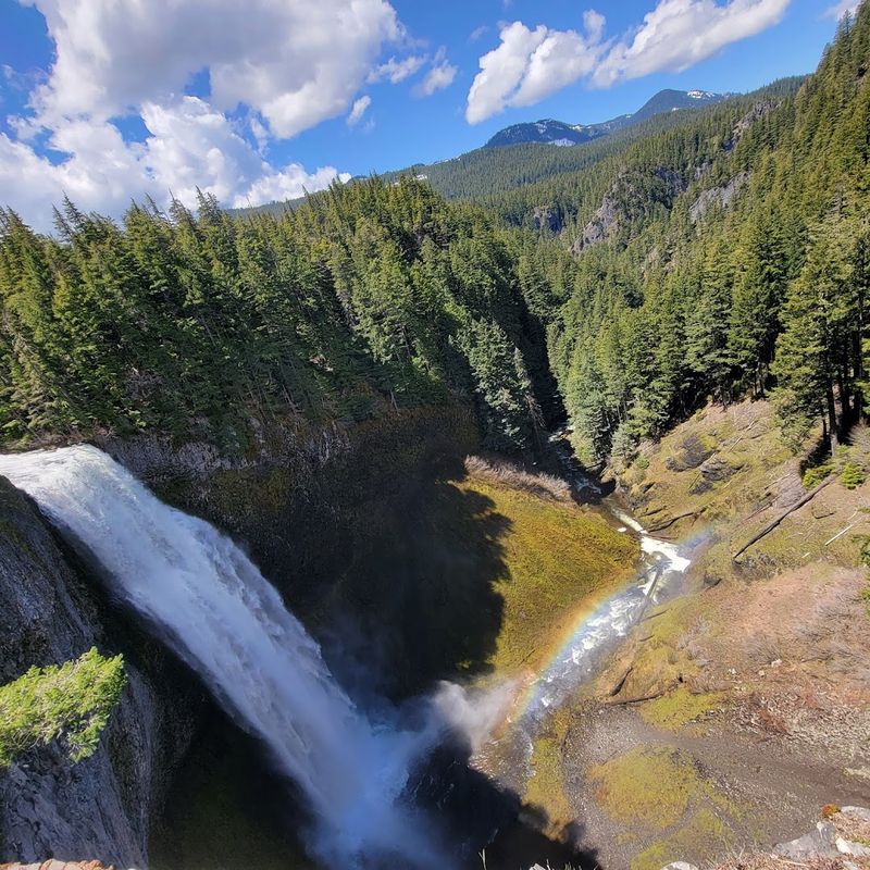
Oregon Highway 58 through the southern end of Willamette National Forest earns its reputation as a beautiful drive on its own, but the Salt Creek Falls pullout turns a good road trip into a great one. At 286 feet, Salt Creek Falls is the second-tallest waterfall in Oregon, and the volume of water it throws over that basalt lip is something you feel in your chest before you even see it clearly.
The main viewpoint is paved and accessible, meaning visitors of all mobility levels can reach it without a strenuous hike. A shorter trail leads down toward the base of the falls for a closer perspective, though that route involves some steps and uneven ground.
The designated picnic area nearby is spacious and genuinely peaceful, with old-growth trees providing shade even on warm summer afternoons.
Highway 58 itself connects the Willamette Valley to the Cascades through a series of river canyon views and forested straightaways that make the entire drive enjoyable, not just the waterfall stop. Visitors traveling east on this route also pass Odell Lake and Crescent Lake, two beautiful alpine lakes that extend the scenic value of the trip well past the forest boundary.
Oakridge and the Hills East of the Valley: Trails Meet Tarmac
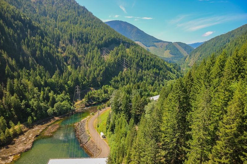
The town of Oakridge sits at the eastern edge of the Willamette Valley where the flat farmland gives way to serious Cascade terrain, and the roads leading out of town into the national forest are some of the most enjoyable in the entire region. The riding and driving community around Oakridge has grown steadily because the trail network here is genuinely world-class, but even visitors who stick to paved roads find plenty to appreciate.
Forest roads branch off Highway 58 in several directions, leading to quiet campgrounds along the North Fork of the Middle Fork Willamette River and to trailheads that access the Waldo Lake Wilderness. Waldo Lake itself, reached by a paved road from Oakridge, is one of the purest lakes in North America and looks almost artificially blue on a sunny day.
The mountain biking trail system around Oakridge has attracted riders from Oklahoma, California, and beyond, and the town has responded with bike-friendly infrastructure including a dedicated shop and shuttle services. Even a short drive up any of the forest roads east of town delivers dense old-growth scenery and river crossings that reward the effort immediately, with no serious technical driving required for most of the main routes.
Detroit Lake Loop: Water, Mountains, and Forest History
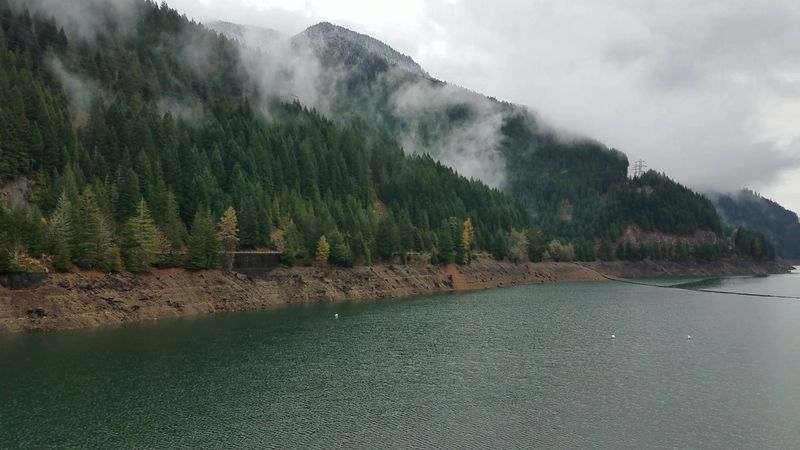
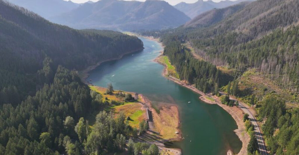
Detroit Lake is one of those places where the scenery hits you all at once. The reservoir stretches across a wide valley carved by the North Santiam River, its water a vivid turquoise in direct sunlight that contrasts sharply with the deep green of the surrounding forest.
The drive around its perimeter on Oregon Route 22 keeps the water in view for long stretches and rewards patient driving with multiple overlooks.
The lake itself sits at about 1,567 feet elevation and covers roughly 3,580 acres when full, making it large enough to feel genuinely expansive from the road. The old town of Detroit was flooded when the dam was built in 1952, and during low water years the foundations of the original streets sometimes reappear, which gives the lake an unexpected layer of human history beneath its natural beauty.
Camping around the lake is popular from late spring through early fall, with several Forest Service campgrounds offering direct lake access. The North Santiam River corridor below the dam continues east into the forest with more pullouts, picnic areas, and fishing access along a road that stays scenic well past the point where most visitors turn around and head back toward Salem.
Cascades Lakes Scenic Byway Connection: Where Two Forests Meet
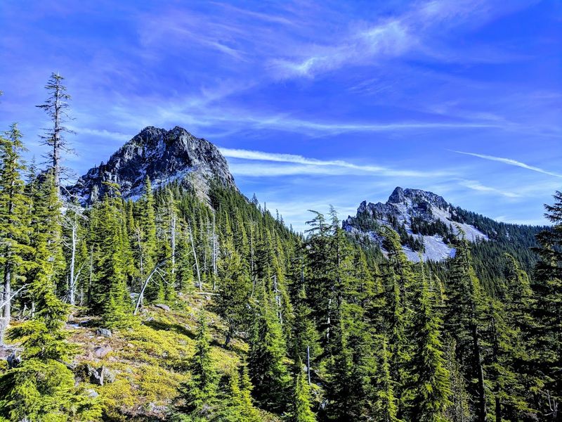
The eastern edge of Willamette National Forest brushes against the Deschutes National Forest along a stretch of high Cascades terrain where the vegetation changes noticeably and the volcanic landscape takes over from the mossy west-side forest. The roads connecting these two forests through the Three Sisters Wilderness boundary offer some of the most dramatic driving in central Oregon.
Oregon Route 242, the McKenzie Pass Highway, climbs from the McKenzie River valley through dense forest before breaking out into a massive open lava field with unobstructed views of Mount Washington, the Three Sisters, and Mount Jefferson. The road is narrow and closed in winter, which keeps traffic light during the summer season and gives the drive an exclusive, almost private feel.
The Dee Wright Observatory at the summit of McKenzie Pass was built from volcanic rock by the Civilian Conservation Corps in the 1930s and offers a 360-degree view from its rooftop that includes more major Cascade peaks than almost any other single viewpoint in the state. Visitors who have driven similar volcanic corridors in other western states, including some who started their Oregon road trips from as far away as Oklahoma, consistently rate this pass among the most visually striking drives they have ever completed.
Black Canyon Campground and the River Road: A Drive Worth Lingering On
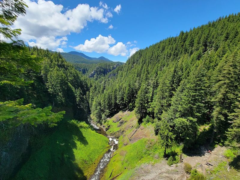
Black Canyon Campground sits along the Middle Fork Willamette River at a spot where the canyon narrows and the river picks up speed, and the road leading to it from Oakridge follows the water closely enough that you can hear the current through an open car window. The drive itself is short but packs in a lot of riverside character, with pullouts that let you stop and watch the water without leaving the pavement.
The campground has a day-use area directly on the river that draws kayakers and anglers throughout the season. Watching a kayaking club launch from the gravel bar on a summer morning is one of those spontaneous travel moments that no itinerary can plan but that sticks with you for years afterward.
The forest on both sides of the river road is dense and largely undisturbed, with big conifers shading the road and ferns carpeting the understory all the way down to the water’s edge. Side roads branch off toward higher elevations where the views open up and the crowds thin out considerably.
For travelers who want a scenic drive with immediate access to the river rather than just views of it from a distance, this corridor delivers that experience with very little competition for space.
Planning Your Visit: Practical Notes for First-Timers
Willamette National Forest headquarters is based in Blue River, OR 97413, and the main ranger district offices are reachable by phone at 541-225-6300 or through the official website at fs.usda.gov/willamette. Office hours run Monday through Friday from 8 AM to 4:30 PM, so calling ahead to check road conditions or permit requirements before a weekend trip is smart planning.
The forest spans eight designated wilderness areas across 1.6 million acres, which means road conditions, access points, and required permits can vary significantly from one area to the next. Some forest roads require high-clearance vehicles, and rock slides can leave debris on secondary roads without much warning, so checking current conditions before heading out is genuinely useful rather than just cautious.
Visitors from Oklahoma and other states often underestimate how much ground there is to cover here, so building extra time into any itinerary prevents the frustration of rushing past the best spots. Fire danger levels and seasonal closures affect access during dry summer months, so confirming current restrictions before arrival saves real headaches.
The forest consistently earns a 4.7-star rating across thousands of reviews, and with a little preparation, it is easy to understand exactly why that number stays so high.
Share this story