Some trails are just walks. Others are the kind of adventures you talk about for years.
The United States is packed with hikes so stunning, so wild, and so memorable that skipping them feels like a personal offense against your own bucket list. Whether you are a weekend warrior or a seasoned trail veteran, these 14 hikes deserve a spot on your radar.
Angels Landing – Zion National Park, Utah
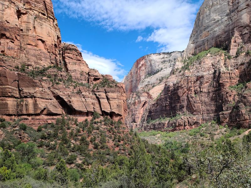
Few hikes in America make your palms sweat before you even lace up your boots, but Angels Landing has that reputation fully earned. The trail climbs from Zion Canyon through Walter’s Wiggles, a series of tight switchbacks, before reaching a narrow ridge with chains bolted into the rock for safety.
The final half-mile is not for the faint of heart. Drop-offs on both sides are serious, and the exposure is real.
A permit is now required to hike the upper section, so book early or your plans will be grounded before they even get off the ground.
The payoff is a panoramic view over the red-rock canyon that makes every wobbly-kneed step worth it. Strong hikers who are comfortable with heights and strenuous climbs will find Angels Landing unforgettable.
Pack water, wear solid footwear, and check the NPS permit system well in advance of your trip.
Half Dome – Yosemite National Park, California
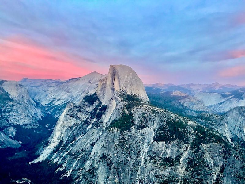
Half Dome is the kind of hike that earns you serious bragging rights at every dinner party for the next decade. The route covers roughly 14 to 16 miles round trip and gains over 4,800 feet of elevation, passing iconic Yosemite scenery the whole way up.
The cable section near the summit is where things get spicy. Steel cables bolted into the granite help hikers pull themselves up a nearly vertical face, which is as thrilling as it sounds.
Gloves are a smart call because your hands will thank you later.
Permits are required when the cables are up, typically from Memorial Day weekend through mid-October. Spots sell out fast, so plan months ahead.
Fitness matters here. This is a full-day, high-effort adventure best suited for hikers who have trained for it and packed enough snacks to fuel a small army.
Bright Angel Trail – Grand Canyon National Park, Arizona
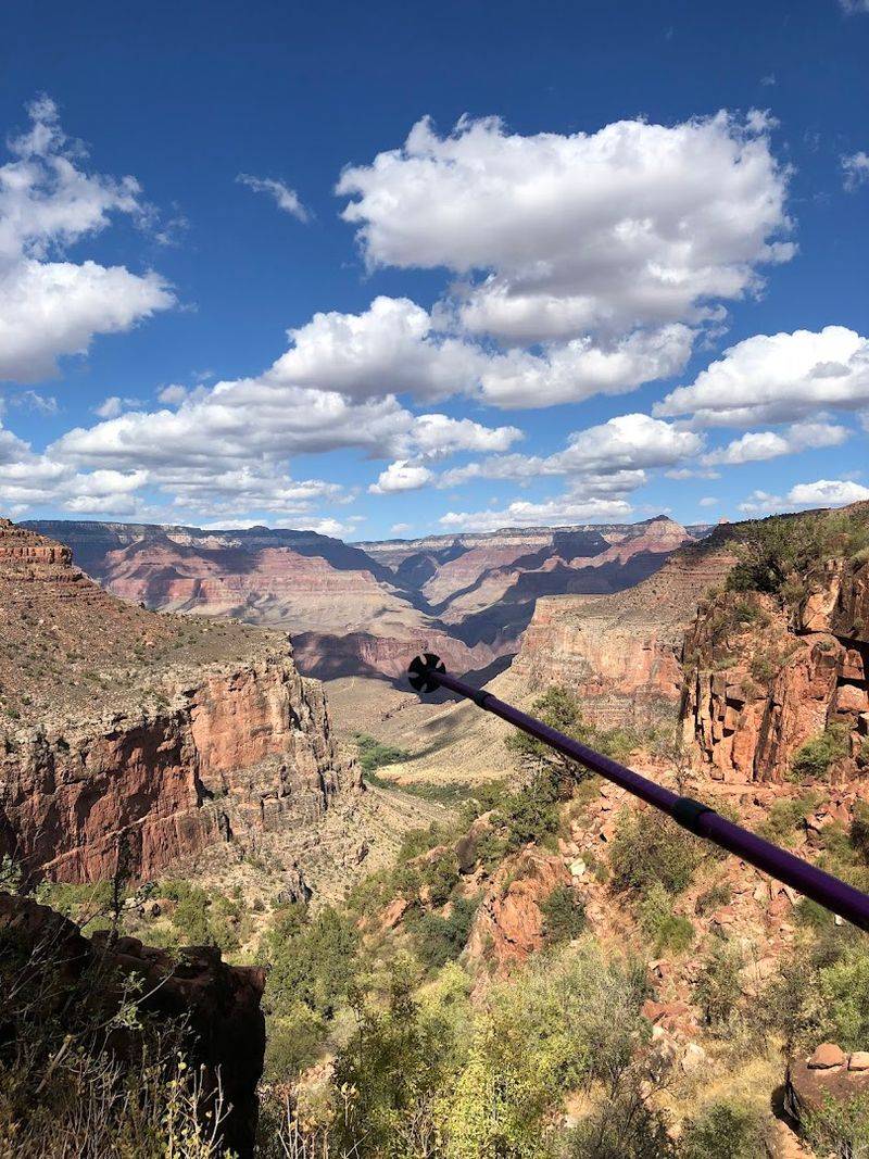
Here is a fun fact about Bright Angel Trail: going down is the easy part, and the canyon will absolutely remind you of that on the way back up. The trail descends through layers of ancient rock that read like a geology textbook, each band of color representing millions of years of Earth history.
You do not need to reach the Colorado River to have a great time. Most day hikers should pick a reasonable turnaround point, like the 1.5-mile Resthouse or 3-Mile Resthouse, and call it a success.
The canyon heat is no joke, especially in summer, so carry more water than you think you need.
Rest houses along the way offer water and shade during the warmer months. Check the National Park Service website for current trail conditions and any inner-canyon closures before heading out.
Starting at sunrise gives you cooler temperatures and softer light for photos.
Harding Icefield Trail – Kenai Fjords National Park, Alaska
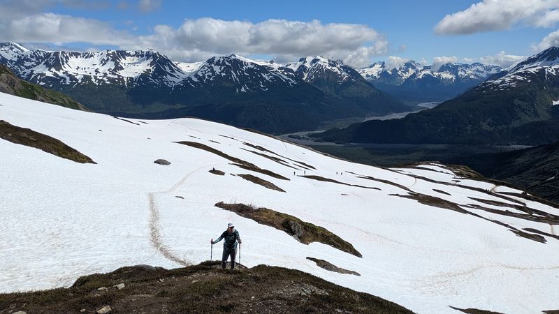
Not many hikes end with a view of one of the largest icefields in North America, but the Harding Icefield Trail delivers exactly that. Starting near Exit Glacier outside Seward, the trail climbs through forest and wildflower meadows before the trees give way to a jaw-dropping sweep of ancient ice.
The stats are humbling: roughly 8.2 miles round trip with about 3,800 feet of elevation gain. Snow lingers well into summer at the upper elevations, so microspikes and trekking poles are worth bringing along.
Weather in Alaska does whatever it wants, so pack layers even on a sunny morning.
Wildlife sightings are common, including black bears, marmots, and mountain goats on the rocky slopes. I did this trail on a partly cloudy day and the views were still absolutely ridiculous.
Check the Kenai Fjords visitor center for current conditions before you go, because this trail is not one to wing.
Highline Trail – Glacier National Park, Montana
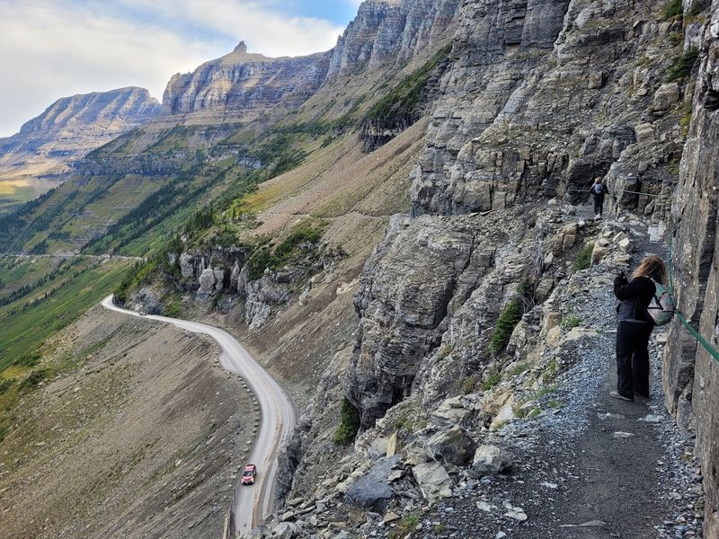
Glacier National Park has no shortage of spectacular trails, but the Highline Trail is the one that shows up in everyone’s highlight reel. Starting at Logan Pass, the trail hugs the Garden Wall with open alpine terrain, wildflowers, and mountain goats doing their best to photobomb every shot.
Much of the route is exposed and sits at high elevation, which means weather can flip fast. Early season hikers may encounter snow on the trail, so check conditions before heading out.
The views across the park are the kind that make you stop mid-step to stare.
The full Highline Trail to Goat Haunt covers about 11.6 miles one way, but most day hikers do a shorter out-and-back from Logan Pass. A shuttle can simplify logistics if you plan the full route.
Road and trail status updates are posted on Glacier’s official NPS page, and checking them before your visit is always a smart move.
Cascade Pass and Sahale Arm – North Cascades National Park, Washington
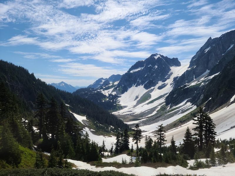
The North Cascades have a reputation for being seriously wild, and the Cascade Pass trail does nothing to soften that image. The route to the pass alone is worth the drive, offering views of glacier-carved valleys and the kind of jagged peaks that look like they were designed by someone with a dramatic flair.
Strong hikers who continue up the Sahale Arm gain even bigger, more sweeping panoramas as the terrain opens up above treeline. The extra elevation push is strenuous, and mountain weather here shifts without much warning.
Trekking poles and layers are always a good call in the Cascades.
The trail is seasonal, and the road to the trailhead can be gated early or late in the year. Always check current road access and trail conditions through North Cascades National Park before making the drive.
Getting there to find a locked gate is a comedy no one wants to be part of.
Alum Cave Trail to Mount Le Conte – Great Smoky Mountains, Tennessee
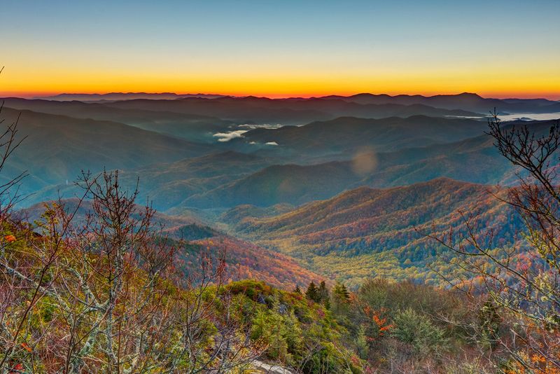
The Smokies are famous for their misty ridges and dense forest, and the Alum Cave Trail captures everything that makes this park special in one satisfying route. The trail follows a mountain stream, passes through a natural tunnel called Arch Rock, and arrives at the dramatic Alum Cave Bluffs, a massive overhanging ledge that looks straight out of a fantasy novel.
Hikers who push on to Mount Le Conte are rewarded with a serious summit experience at one of the highest peaks in the park. The round trip to the summit is about 10 miles, making it a full day of hiking.
Parking at the trailhead fills up early, so arriving before 8 a.m. is practically a requirement.
The trail is well-maintained and marked, making it accessible for fit hikers without technical experience. Fall foliage turns this route into something almost unfairly beautiful.
Pack snacks, water, and a camera with a full battery.
Delicate Arch Trail – Arches National Park, Utah
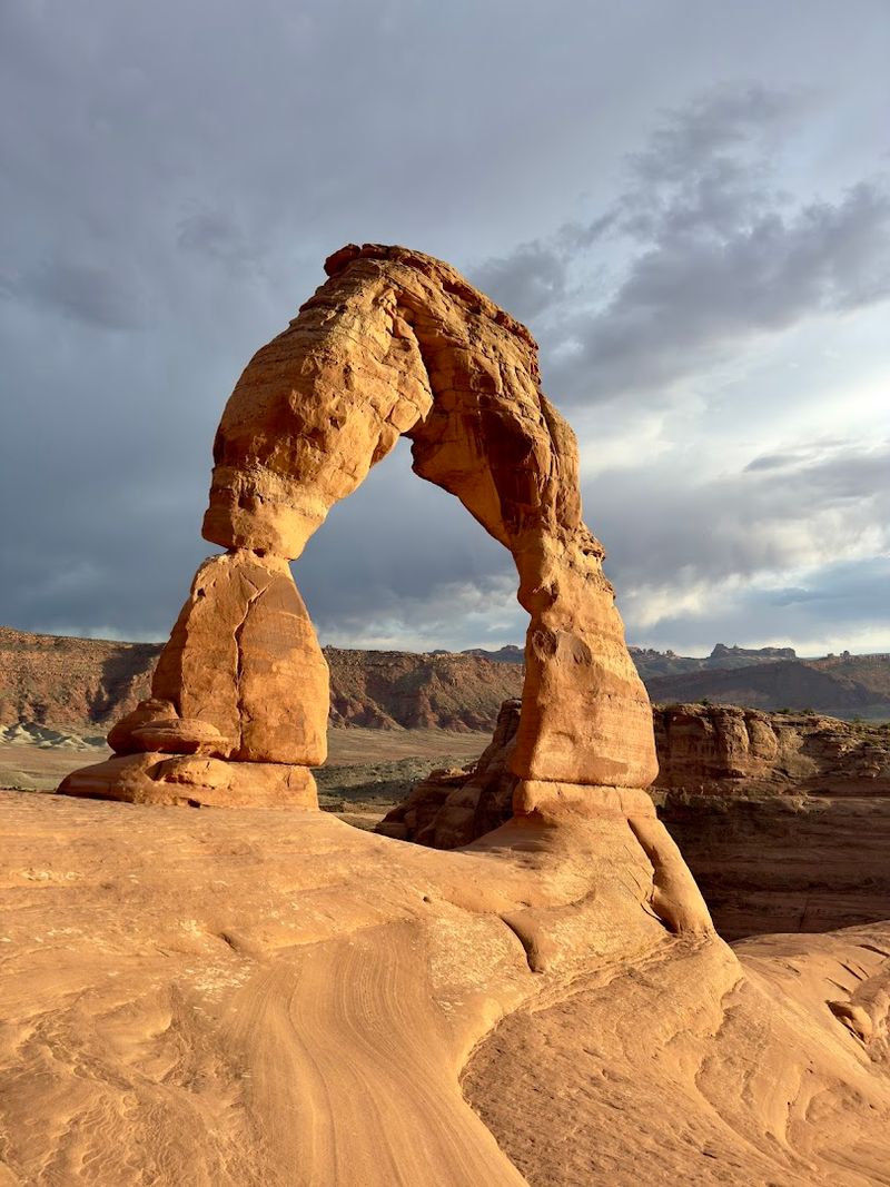
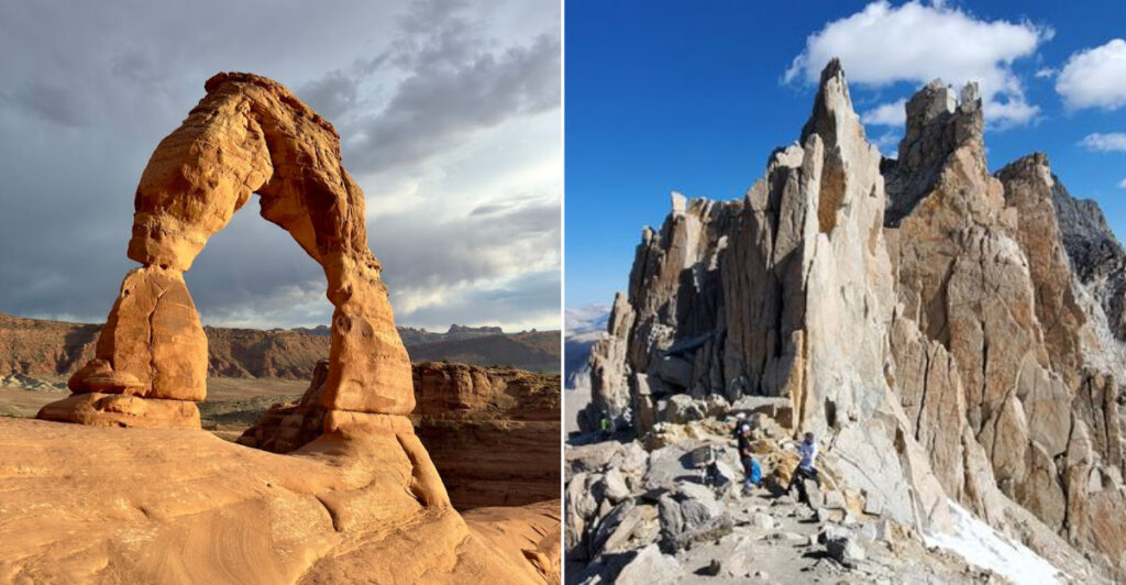
Delicate Arch is basically Utah’s mascot, and the trail to reach it is one of those rare cases where the landmark actually lives up to the hype. At 65 feet tall and completely freestanding, this sandstone arch looks almost too perfect to be real when you round the final rocky slope and it appears in full view.
The hike is 3 miles round trip with about 480 feet of elevation gain, mostly over open slickrock. There is no shade on the route, which turns the trail into a heat trap during summer afternoons.
Sunrise and sunset visits are cooler and more photogenic, and the arch glows a deep orange in evening light.
Winter visits are stunning but can be icy, so traction devices may be needed. Carry plenty of water regardless of the season.
This is a short hike, but it punches well above its weight class in the memorable-experience department. Permits may be required for peak season visits, so check ahead.
Queen’s Garden and Navajo Loop – Bryce Canyon National Park, Utah
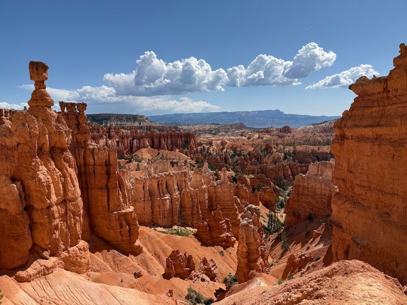
Bryce Canyon from the rim looks like someone knocked over a giant box of orange crayons and just left them standing upright. The Queen’s Garden and Navajo Loop combination gets you down among those hoodoos, which is a completely different and far more surreal experience than watching from above.
The combined loop covers about 2.9 miles and drops roughly 500 feet into the amphitheater. As of recent official updates, the Wall Street section of the Navajo Loop has had closures due to hazardous conditions, so check the current route status before you go and use the open side of the loop.
This is one of Bryce’s most popular trails, so crowds are part of the deal, especially midday in summer. An early morning start helps you avoid the rush and catch softer light filtering through the hoodoos.
Wear layers because temperatures at Bryce’s elevation can surprise you even in warmer months.
Old Rag Circuit – Shenandoah National Park, Virginia
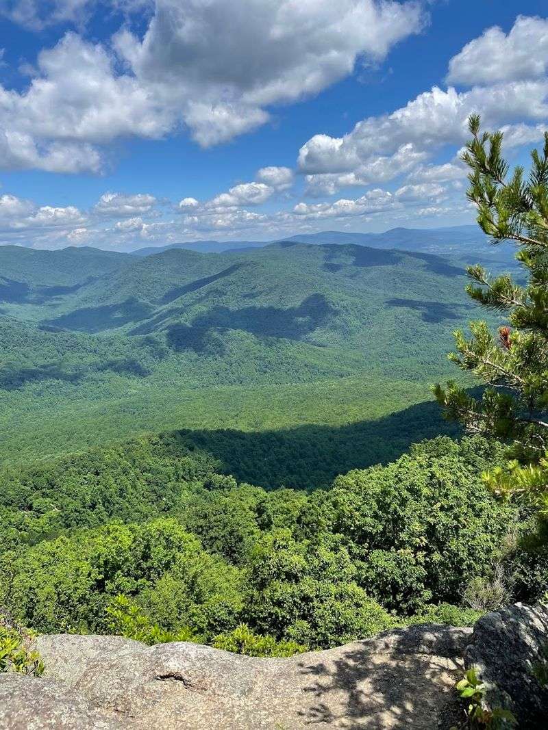
Old Rag has a cult following in the mid-Atlantic hiking world, and once you do the boulder scramble section, you will understand exactly why. The granite boulders near the summit require hands and feet, squeezing through rock cracks, and a willingness to look slightly ridiculous while doing it.
It is genuinely fun.
The full circuit covers about 9 miles and is rated strenuous for good reason. This is not a trail for pets, small children, or anyone who prefers a flat, paved surface.
The summit panorama over the Shenandoah Valley is the reward waiting at the end of all that effort.
Day-use tickets are required during much of the year, and current parking-area updates mean you should check official NPS access instructions before arriving. Showing up without a ticket during a busy weekend is a quick way to end your hike before it starts.
Book ahead and arrive ready to work for that view.
Skyline Trail – Mount Rainier National Park, Washington
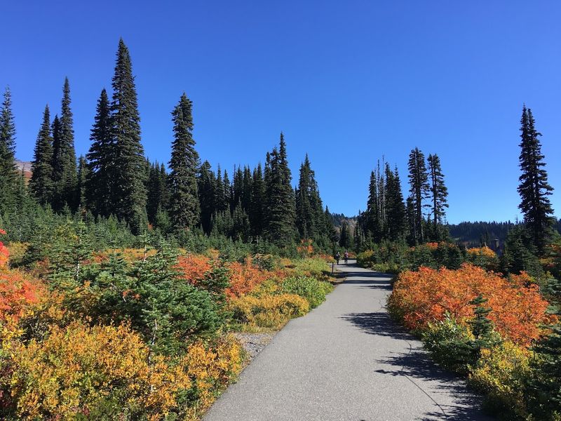
Mount Rainier is the kind of volcano that dominates every view for miles around, and the Skyline Trail at Paradise puts you right in its backyard. On a clear day, the mountain fills the sky in a way that makes every other peak you have ever seen feel a bit underdressed.
The full Skyline Trail loop is about 5.5 miles with roughly 1,400 feet of elevation gain, passing wildflower meadows, glacier viewpoints, and Myrtle Falls along the way. Snow can persist on portions of the trail well into summer, and weather around Rainier changes fast.
Layers are non-negotiable here.
Staying on constructed trails is critical because the alpine meadows are fragile and take decades to recover from foot traffic damage. Check current trail and road conditions through the Mount Rainier NPS website before visiting.
The Paradise area is one of the most visited spots in the park, so weekday visits tend to be calmer and more enjoyable.
Hoh River Trail – Olympic National Park, Washington
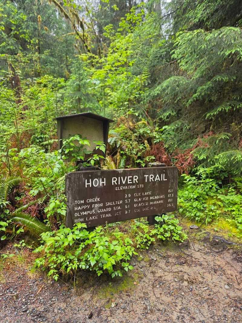
Most hikes reward you with big views, but the Hoh River Trail offers something completely different: a deep, green, dripping-wet rainforest that feels like walking through a nature documentary. Massive maple trees draped in thick moss line the trail, and the whole place has a quiet, ancient quality that is hard to put into words.
The trail follows the Hoh River into the heart of the Olympic wilderness, and you can hike as little or as much as you like. A short out-and-back of a few miles gives you the full rainforest experience without committing to a multi-day backpacking trip.
Longer routes push deeper into the wilderness toward Mount Olympus base camp.
Olympic conditions can change quickly, and some park areas may have closures due to fire or storm damage. Check official NPS alerts before heading out.
Rain gear is basically mandatory here, and not just for show. This is a rainforest, after all, and it earns that title regularly.
Mount Whitney Trail — Inyo National Forest and Sequoia National Park, California
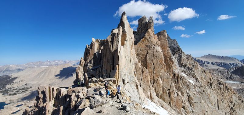
Mount Whitney tops out at 14,505 feet, making it the highest peak in the contiguous United States, and the trail to the summit is every bit as demanding as that title suggests. The classic Whitney Trail covers about 22 miles round trip with over 6,000 feet of elevation gain, which is a full commitment no matter how fit you are.
Altitude is a genuine concern here. Many hikers acclimatize in the area for a day or two before attempting the summit to reduce the risk of altitude sickness.
Pushing hard without acclimatization is a common mistake that turns a bucket-list day into a miserable retreat.
Permits are required for the Whitney Zone and are distributed through a lottery system that opens in February. Competition is fierce, so apply early and have a backup plan.
This is a hike to train for over months, not something to attempt on a casual weekend whim. The summit views are extraordinary and absolutely worth every ounce of effort.
Kalalau Trail — Napali Coast State Wilderness Park, Kauai, Hawaii
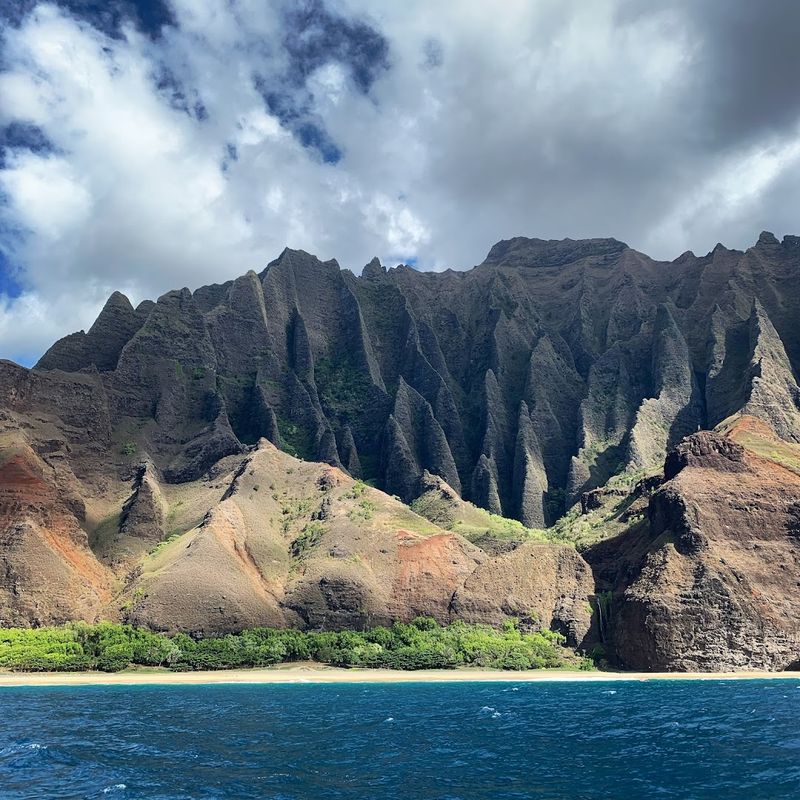
The Napali Coast is one of those places that looks too beautiful to be real, and the Kalalau Trail is the only way to experience it on foot. The trail hugs towering sea cliffs, dips into lush valleys, and delivers ocean views that make every muddy, slippery step feel like a fair trade.
Access is tightly managed, and that is a good thing. Day-use reservations, parking permits, or valid camping permits are required depending on how far you plan to hike.
The first two miles to Hanakapiai Beach are the most accessible, but even that section demands respect after rain when the trail turns genuinely treacherous.
Conditions here can go from gorgeous to dangerous quickly, especially during winter months when surf and rain intensify. Check the Hawaii DLNR website for current access requirements and trail conditions before you book anything.
This trail rewards careful planning and punishes overconfidence. Come prepared, stay humble, and the Napali Coast will deliver one of the most extraordinary hiking experiences in the country.
Share this story