There is a trail in the Twin Cities area that quietly does something remarkable: it turns an old railroad corridor into a long, green escape route from the city. Starting in the heart of Saint Paul and stretching more than 18 miles into the countryside, this paved path carries joggers, cyclists, and curious walkers past ponds, farmland, horses, and wild things most people never expect to find so close to a metro area.
The trail follows the old right-of-way of a railroad line, which means it runs smooth, straight, and steady through neighborhoods before opening up into something that feels genuinely rural. Wildlife shows up without warning, the tree canopy closes in overhead in the best way, and the whole experience has a quiet, unhurried quality that is surprisingly hard to find anywhere near a major city.
The Railroad History Behind the Route

Long before cyclists and joggers claimed this corridor, trains rolled through it. The Gateway State Trail follows the historic route of the Northern Pacific Railway, a line that once connected communities across the eastern Twin Cities metro to the wider countryside of Washington County.
When rail service ended, the corridor did not sit idle for long. Minnesota converted the right-of-way into a recreational trail, which is why the path runs so arrow-straight and flat compared to most trails you find carved through natural terrain.
That railroad legacy is part of what makes the trail feel different. There are no steep climbs or switchbacks because the original rail engineers graded the land to keep trains moving efficiently.
Riders today benefit from that old engineering every time they cruise along a section that feels almost effortlessly level, even as the landscape shifts around them.
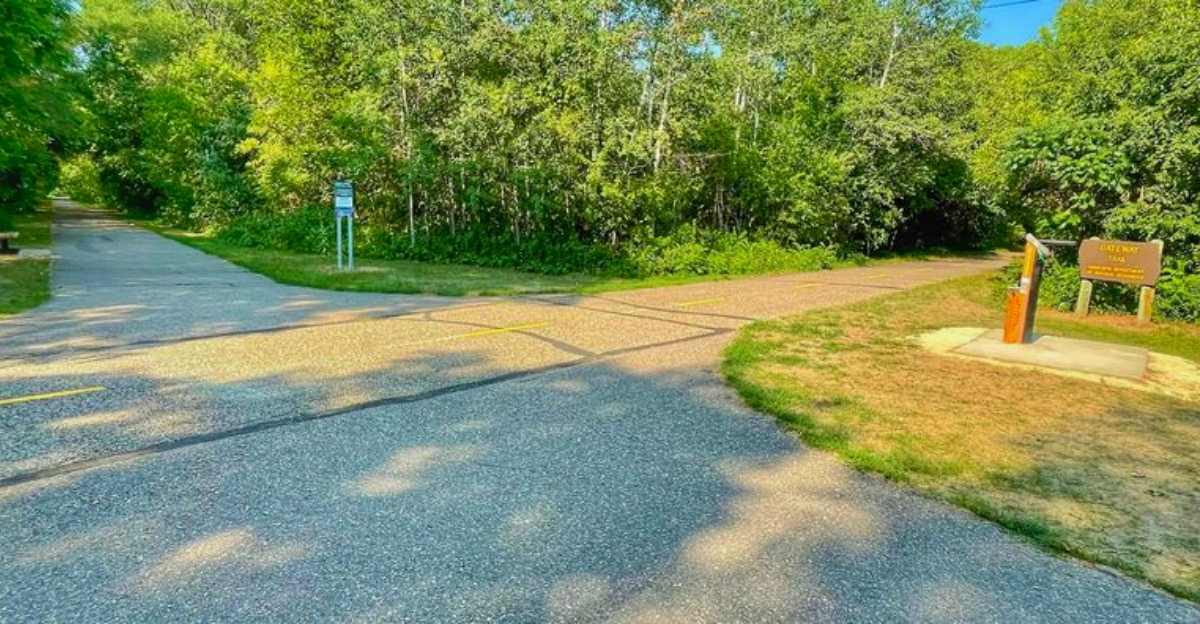
Where the Trail Begins in Maplewood

The Maplewood section of the Gateway Trail sits right at the urban edge, where Saint Paul’s grid of streets gives way to quieter residential blocks and then, fairly quickly, to something that feels much more open. The trail officially begins near the Saint Paul city limits and runs northeast, with Maplewood being one of the first communities you pass through heading out of the city.
A large billboard at the main parking area shows a trail map, and it is worth snapping a photo of it before heading out, especially if you are new to the route. The trailhead area includes parking that most visitors find easy to use without much competition for spots.
From Maplewood, the path transitions steadily from suburban surroundings into greener, more open terrain. That shift happens gradually, and watching the landscape change as you move northeast is one of the quiet pleasures of the whole experience.
The Full 18-Mile Reach of the Trail

Covering more than 18 miles from Saint Paul to Pine Point Regional Park near Stillwater, the Gateway State Trail is one of the longer paved rail-trails in the Twin Cities metro region. That length means you can tailor the experience to whatever energy level you bring on a given day.
A short out-and-back ride from Maplewood covers a manageable few miles without demanding a full-day commitment. Riders who want a genuine workout can push all the way to the eastern end, where the trail connects with Brown’s Creek Trail for even more distance.
The trail uses mile markers along the route, which makes it easy to plan turnaround points and track progress without constantly checking a phone. Knowing that marker 10 through 18 offers some of the most scenic terrain is useful intel for anyone planning their first longer ride on this corridor.
Wildlife That Shows Up Uninvited (in the Best Way)
")
The wildlife on this trail has a way of appearing when you least expect it. Deer graze near the path in the early morning hours, turtles cross the asphalt with zero urgency, ducks settle on the ponds that dot the route, and frogs announce themselves from the tall grass along the edges.
Birdwatchers find the trail genuinely rewarding, particularly in the sections that run near wetlands and open water. The ponds scattered along the route attract waterfowl in good numbers, and patient observers can rack up a solid list without ever leaving the pavement.
The stretch near Grant, further east on the trail, adds something unexpected: horses grazing on private land visible right from the path. It is one of those small details that reminds you how quickly this trail moves from metro to countryside, and it tends to stop riders in their tracks for a moment.
Tree Canopy and Shade Along the Path

On a warm Minnesota summer day, the tree cover along the Gateway Trail earns real appreciation. Much of the route runs under a canopy of mature trees, which keeps temperatures noticeably cooler than riding an exposed path in full sun.
The shaded sections feel almost tunnel-like in the best stretches, with branches arching overhead and filtering the light into shifting patterns on the pavement. That kind of natural shade makes mid-afternoon rides far more comfortable than they might otherwise be in July or August.
The trees also contribute to the sense that you have left the city behind, even in sections where suburban neighborhoods are technically not far away. Green walls on both sides of the trail create a visual buffer that lets you focus on the path ahead rather than what lies beyond the tree line, which is part of what gives this corridor its surprisingly rural feel.
Biking the Trail: What to Know Before You Go

The Gateway Trail is paved, which makes it accessible to most bike types, but the surface condition varies depending on which section you ride and when you last visited. Smoother asphalt tends to be found in the middle and eastern sections, while some stretches closer to the urban end can be rougher, especially after a hard winter or storm season.
Riders on road bikes with narrow tires may want to lower tire pressure slightly on bumpier sections to avoid a jarring experience. Fat-tire bikes and hybrid bikes handle the occasional rough patch without much drama.
One practical tip worth knowing: the bike repair stations along the route have been reported to have worn tools, so carrying your own basic kit is smart if you are heading out for a long ride. Bringing water and snacks is equally important, since services are limited along the trail itself once you leave the urban end.
Walking and Running the Route

Not every visitor arrives with a bike. The Gateway Trail works just as well for walkers and runners, and the flat, rail-grade surface makes it an appealing option for people who want a low-elevation workout with good scenery.
Families with young children find the paved surface forgiving and easy to navigate. A three-year-old can run and explore along the edges of the path without much risk, and the wild plants that grow along the sides add a natural curiosity element that keeps kids engaged on longer walks.
Runners training for longer distances appreciate the consistent, predictable terrain. There are no surprise elevation changes to throw off a pace, and the mile markers make it easy to track distance without relying on a watch or app.
The calm atmosphere on most weekday mornings means the trail rarely feels crowded, which is a genuine bonus for anyone who prefers quiet miles.
The Ponds and Wetlands Along the Way

Water is a recurring theme on the Gateway Trail, and the ponds scattered along the route are worth slowing down for. They attract a steady rotation of waterfowl throughout the warmer months, and the reflections of surrounding trees on calm mornings make for genuinely beautiful views that feel out of proportion to how easy they are to reach.
The wetland areas also support a broader ecosystem that explains the trail’s wildlife variety. Frogs, turtles, and various bird species all depend on these wet margins, and the trail’s position along the old rail corridor means it threads right through habitat that might otherwise be inaccessible.
Stopping at one of the ponds for a few minutes is a habit that experienced trail users have picked up over time. There is almost always something moving on the water or in the reeds nearby, and those unplanned pauses tend to become the moments people remember most from a day on the trail.
Picnic Areas and Rest Stops on the Trail

Long trails work best when there are places to stop, rest, and eat something, and the Gateway Trail delivers on that front. Picnic areas are spaced along the route, giving families and solo travelers a reason to pack a lunch and turn a ride into a full outing rather than just a point-to-point commute.
Restroom facilities are also available at certain points along the trail, which is a detail that matters enormously on an 18-mile route. Knowing that facilities exist makes it easier to commit to a longer ride without spending the whole time calculating how far the nearest gas station might be.
The combination of picnic spots, restrooms, and trail parking creates a structure that supports casual users and dedicated athletes alike. It is the kind of infrastructure that makes a trail genuinely welcoming rather than just technically accessible, and it shows in how comfortably families use this corridor on weekends.
Bridges Over Roads and What They Mean for Safety

One of the practical advantages of a rail-trail is the infrastructure that comes with it. The Gateway Trail includes bridges over major roads at several points along the route, which means riders and walkers can cross busy intersections without interacting with vehicle traffic.
Those grade-separated crossings are a significant safety feature, especially for families with children or less experienced cyclists who are not comfortable navigating busy intersections. Being able to stay on the trail without stopping for traffic lights or watching for turning cars changes the rhythm of the whole experience.
The bridges also reinforce the trail’s identity as a true linear park rather than just a sidewalk next to a road. When you cross over a highway on a dedicated trail bridge, the separation from everyday traffic feels complete, and the ride takes on a different quality entirely.
That sense of being genuinely removed from the road network is harder to find than you might expect in a metro area.
Connecting to Other Trails and Parks

The Gateway Trail does not exist in isolation. At its eastern end, it connects with Brown’s Creek Trail, which extends toward Stillwater and offers additional miles of paved riding through some of Washington County’s most scenic terrain.
Brown’s Creek Nature Preserve sits near that eastern connection and draws birdwatchers and wildlife enthusiasts who want to extend their time outdoors beyond the main trail corridor. Snakes, birds, and other wildlife are commonly spotted there, adding a different texture to the experience.
At the western end, the trail connects to the broader Saint Paul trail network, which means motivated riders can link up routes that cover significant distances across the metro without ever needing to share a lane with cars. Pine Point Regional Park anchors the far end of the Gateway Trail and provides a satisfying destination with open space and natural surroundings that reward the effort of riding the full distance.
Foraging and Wild Plants Along the Edges

The edges of the Gateway Trail are not just scenery. Wild plants grow thick along the sides of the path, and people who know what to look for can find garlic mustard, morel mushrooms in season, and various other edible and interesting plants within easy reach of the pavement.
Garlic mustard is actually an invasive species in Minnesota, which means foraging it carries a minor ecological benefit alongside the culinary one. Morel mushrooms, on the other hand, are a seasonal treat that serious foragers plan entire outings around, and the trail corridor’s mix of habitat types makes it a reasonable place to look in spring.
For most trail users, the wild plants are simply part of the visual texture of the route, something that makes the edges feel alive and layered rather than manicured. Young children especially seem to find the plant life along the path endlessly interesting, which makes family walks move at a pleasantly unpredictable pace.
Best Times of Year to Visit the Trail

Spring through fall covers the prime season for the Gateway Trail, with each period offering something distinct. Spring brings the first flush of green along the corridor, morel mushrooms in the surrounding vegetation, and the return of waterfowl to the ponds.
Summer delivers the full canopy experience, with maximum shade and the highest wildlife activity around the wetland areas. Early mornings in July and August are particularly good for spotting deer and birds before trail traffic picks up and the day’s heat builds.
Fall may be the most visually rewarding season of all. The tree canopy that shades the trail in summer transforms into a corridor of orange, red, and yellow that makes even a short ride feel like a significant event.
Winter use is limited by snow and cold, though some hardy visitors do walk sections of the trail year-round when conditions allow.
Making the Most of Your Visit

A few practical habits separate a great day on the Gateway Trail from a frustrating one. Arriving with a full water bottle and snacks matters more than it might seem, especially if you plan to ride past the first few miles where urban amenities are still within easy reach.
Downloading a trail map or photographing the billboard at the trailhead parking area before heading out gives you a reference point for the whole route without depending on cell service, which can be inconsistent in some of the more rural eastern sections.
Starting early on weekends avoids the peak foot and bike traffic that builds by mid-morning, and it puts you on the trail during the best wildlife-watching hours. Bringing your own basic bike repair tools is worth the small extra weight if you are planning a long ride.
The trail rewards preparation, and visitors who come ready tend to leave wanting to come back.


