Most roads look ordinary at first glance. Paved surfaces, road signs, maybe a few historic markers if you are lucky. But some of the world’s most traveled routes carry histories that go far beyond what any tourist brochure would tell you. From ancient Roman highways used to send brutal political messages to remote Siberian roads built at enormous human cost, these routes connect geography to some of the most significant and sobering chapters in recorded history.
Whether they run through European countryside, American farmland, or Southeast Asian mountains, each road on this list holds a story worth knowing. Some of these histories are well documented, others are only now receiving the attention they deserve. Understanding what happened on these roads gives us a clearer picture of how power, conflict, migration, and injustice have shaped the physical world around us. Read on to discover what lies beneath the surface of fifteen roads that carry far more weight than their mileage suggests.
1. Route Nationale 7, France

French families in the postwar decades knew Route Nationale 7 as the road to summer vacation, a ribbon of asphalt running from Paris to the Riviera that became shorthand for freedom and leisure. Charles Trenet even wrote a popular song about it in 1955. But the N7 carries a much darker chapter from only fifteen years earlier.
In May and June of 1940, as German forces advanced rapidly through France, millions of civilians attempted to flee south along the same highway. The mass movement, known in France as “l’Exode,” created one of the largest refugee crises in European history, with an estimated eight to ten million people on the roads simultaneously.
German aircraft targeted the crowded highway in several documented attacks. The road that became a symbol of peacetime joy had first served as a corridor of chaos and loss during one of France’s most difficult wartime moments.
2. Trail of Tears National Historic Trail, United States

What is now a federally designated historic trail follows the routes used during one of the most consequential forced relocations in American history. Beginning in 1830, the Indian Removal Act authorized the U.S. government to displace Native American nations from their ancestral homelands in the southeastern United States.
The Cherokee, Choctaw, Muscogee, Seminole, and Chickasaw nations were among those forced westward. The Cherokee removal of 1838 and 1839 alone resulted in the deaths of an estimated 4,000 people out of roughly 16,000 who made the journey, according to documented records from the period.
Modern highways in Tennessee, Alabama, Georgia, Arkansas, and Oklahoma now overlap sections of these routes. Many drivers pass through these areas daily without realizing the ground beneath the pavement carries the memory of a journey made under military escort, in brutal conditions, with no choice involved.
3. The Ho Chi Minh Trail, Vietnam, Laos, and Cambodia

Few supply routes in military history were as vast, as contested, or as costly as this one. Stretching approximately 16,000 kilometers through jungle terrain across three countries, the Ho Chi Minh Trail was not a single road but an interconnected network of paths, roads, and waterways used by North Vietnamese forces to supply operations in the south during the Vietnam War.
Between 1964 and 1973, the United States dropped more than two million tons of bombs on Laos alone in an attempt to disrupt the trail, making Laos the most heavily bombed country per capita in history. Cambodia received similar treatment during Operation Menu, a classified bombing campaign that ran from 1969 to 1970.
Decades after the war ended, unexploded ordnance continues to cause casualties in Laos and Cambodia. Farmers, children, and construction workers encounter live bombs regularly. The trail’s legacy is still unfolding in real time across communities that had little direct stake in the conflict.
4. Appian Way, Italy

Long before asphalt existed, Roman engineers built a road so well constructed that much of it still stands more than 2,300 years later. The Appian Way, completed in stages beginning in 312 BC, connected Rome to the southern port city of Brindisi and served as the backbone of Roman military and commercial movement.
Its role in Roman history took a grim turn in 71 BC, when the slave revolt led by Spartacus was finally crushed by Roman general Marcus Crassus. Rather than simply imprisoning the roughly 6,000 surviving rebels, Crassus ordered them crucified along the Appian Way from Capua to Rome, a distance of about 130 miles.
The display was a deliberate political statement meant to discourage future uprisings. Ancient sources, including the historian Appian, recorded the event in detail. Today, visitors walk the same stones largely unaware of what once lined the roadside.
5. Route 61, Mississippi, United States

Music historians celebrate this highway as the road that carried the blues out of the Mississippi Delta and into American culture, and that legacy is real and significant. But Route 61 also runs directly through a region where some of the most severe racial violence in American history was documented throughout the late 19th and early 20th centuries.
The Mississippi Delta counties along Route 61 recorded some of the highest rates of racial terror in the country during the era studied by the Equal Justice Initiative. The 1955 murder of Emmett Till near Sumner, Mississippi, a town just off this corridor, became a turning point in the civil rights movement after his mother insisted on an open casket funeral that was photographed and published nationally.
The highway connects communities that were central to both the Great Migration north and the civil rights campaigns of the 1950s and 1960s. Its asphalt carries the weight of both cultural achievement and profound injustice in equal measure.
6. Burma Road, Myanmar and China

Built between 1937 and 1938 under extraordinary pressure, the Burma Road stretched nearly 1,200 kilometers from Lashio in Burma to Kunming in China. Its purpose was urgent: Japan had cut off China’s coastal supply lines, and the road represented one of the last viable overland routes for Allied military supplies to reach Nationalist Chinese forces.
Construction was carried out primarily by an estimated 200,000 Chinese laborers working with hand tools in mountain terrain. Historians estimate that thousands died during the building process from accidents, disease, and the extreme physical demands of the work.
When Japan seized Burma in 1942, the road was cut off entirely, forcing the Allies to rely on the dangerous aerial route known as “the Hump” over the Himalayas. The road was eventually retaken and reopened in 1945, renamed the Ledo-Burma Road. Its construction cost remains one of the overlooked human tolls of World War II’s Asian theater.
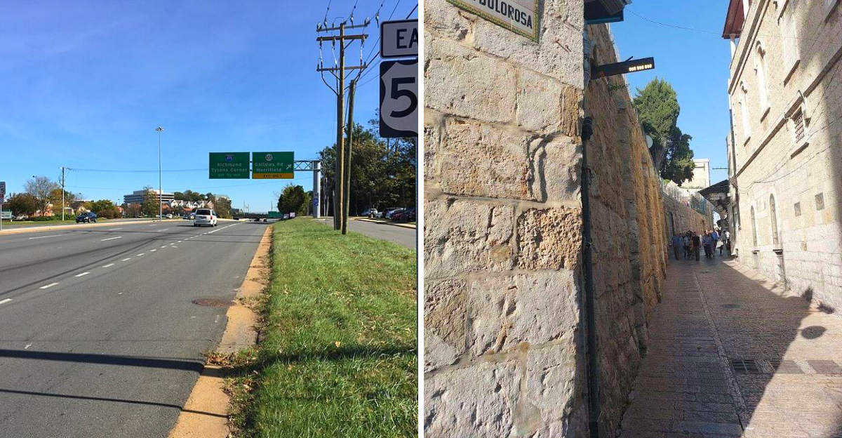
7. Via Dolorosa, Jerusalem

Pilgrims have walked the Via Dolorosa for centuries, tracing what Christian tradition holds to be the path Jesus traveled on the way to his crucifixion. The route winds through Jerusalem’s Old City across approximately 600 meters, marked by fourteen stations that correspond to events described in the New Testament.
The street itself has been a site of continuous conflict throughout history. Jerusalem changed hands repeatedly over the centuries, passing through Roman, Byzantine, Arab, Crusader, Ottoman, and British control before becoming part of modern Israel in 1948. Each transition brought its own period of upheaval to the city and to this particular road.
During the Crusades, the Via Dolorosa was the center of intense religious and military confrontations. In more recent history, the surrounding neighborhoods have been the site of political disputes and periodic unrest. Few streets in the world carry as many layered histories within such a short distance.
8. Bloody Lane, Antietam Battlefield, Maryland

Before September 17, 1862, this was just a worn farm road connecting fields in rural Maryland, its banks eroded over decades of use by wagon wheels until it sat several feet below the surrounding ground. That sunken position made it a natural defensive trench, and Confederate forces used it exactly that way during the Battle of Antietam.
For roughly three hours that morning, Union troops repeatedly charged the position while Confederate soldiers fired from the protected lower ground. Casualty estimates for the fighting in this section of the battlefield alone run into the thousands on both sides within that single morning.
Antietam became the bloodiest single day in American military history, with approximately 23,000 casualties total across the battlefield. President Lincoln used the Union’s narrow strategic victory at Antietam as the moment to issue the preliminary Emancipation Proclamation five days later. The road’s grim nickname stuck, and it remains one of the most visited Civil War sites in the country.
9. Camino de Santiago, Spain

Modern pilgrims completing the Camino de Santiago often describe the experience as peaceful, even transformative, and today’s route is well-maintained with hostels, clear waymarkers, and support infrastructure at regular intervals. That version of the journey is relatively recent.
Medieval pilgrims traveling to the Cathedral of Santiago de Compostela in northwestern Spain faced a fundamentally different set of conditions. Bandits regularly preyed on travelers, knowing that pilgrims often carried valuables and were far from home. Disease spread quickly in crowded roadside inns. Food scarcity and harsh weather claimed many who had set out in good faith.
The Codex Calixtinus, a 12th-century guide to the pilgrimage, actually warned travelers about specific towns and local populations considered hostile or dishonest. Church authorities worked to establish hospitals and protective infrastructure along the route, but the journey remained genuinely risky for centuries. The modern experience of the Camino bears almost no resemblance to its medieval reality.
10. Highway of Tears, British Columbia, Canada

Highway 16 cuts through 724 kilometers of remote northern British Columbia, connecting Prince Rupert on the coast to Prince George in the interior. The scenery is striking: dense forest, mountain views, and long stretches with no services. For many residents of the region’s Indigenous communities, the highway has represented something far more troubling than scenic remoteness.
Beginning in the early 1970s, women and girls began disappearing or were found harmed along this corridor. The victims were disproportionately Indigenous. By some counts, more than 40 cases have been linked to the highway over the decades, though advocates argue the true number is higher due to underreporting.
The highway’s nickname reflects both the documented cases and the broader systemic failures that allowed them to persist. Limited public transportation in the region meant that many residents had no choice but to hitchhike. A 2021 report by Canada’s National Inquiry into Missing and Murdered Indigenous Women and Girls addressed conditions along this corridor directly.
11. Road of Bones, Siberia, Russia

The Kolyma Highway runs approximately 2,000 kilometers through some of the most remote and frigid territory on Earth, connecting Magadan on the Sea of Okhotsk to Yakutsk in the interior of Siberia. Temperatures in the region regularly drop below minus 50 degrees Celsius in winter. The road was built almost entirely by forced labor.
During the 1930s and 1940s, the Soviet government sent hundreds of thousands of prisoners to the Kolyma region under Stalin’s Gulag system. These prisoners were assigned to road construction, mining, and logging under conditions that produced extraordinarily high mortality rates. Historians estimate that between 1932 and 1953, as many as 500,000 people died in the Kolyma region overall.
The road earned its grim name from accounts, supported by survivor testimony and historical research, that some workers who died during construction were buried directly beneath or alongside the roadbed when the frozen ground made digging conventional graves impossible. The highway remains in use today.
12. Omaha Beach Exit Roads, Normandy, France

The Allied landings on June 6, 1944, are remembered as a pivotal turning point in World War II, but the immediate hours after the initial beach assault involved some of the most concentrated and costly fighting of the entire operation. Omaha Beach was the most heavily defended of the five Allied landing zones, and the situation on the beach itself has been extensively documented.
Less discussed are the narrow draw roads leading off the beach and inland. There were only a handful of viable exit points, and German defenders had positioned artillery and machine gun positions to cover each one. American units attempting to move off the beach and through these exits faced concentrated fire in terrain that offered almost no cover.
The exits with designations like Dog Green, Easy Red, and Fox Green became focal points of the day’s most intense combat. Today, those quiet country lanes near Colleville-sur-Mer and Vierville-sur-Mer are largely unmarked, surrounded by farmland, with only a handful of small memorials indicating what occurred there.
13. Gallows Road, Fairfax County, Virginia, United States

The name on the road sign is not a coincidence, a creative invention, or a developer’s marketing choice. Gallows Road in Fairfax County, Virginia, earned its name through documented use during the 18th and early 19th centuries, when a public gallows stood near what is now the intersection with Route 50.
Convicted individuals in colonial and early American Virginia were transported along this road to the execution site as part of the formal legal process of the period. Public executions were common practice throughout colonial America and were considered both punishment and public deterrent.
Today, the road is lined with strip malls, chain restaurants, and office parks. Most people who turn onto Gallows Road are heading to a grocery store or a dentist appointment. The name persists on official maps and street signs, quietly preserving a piece of Northern Virginia’s legal history that most commuters pass without a second thought.
14. Road to Babi Yar, Kyiv, Ukraine

On September 29 and 30, 1941, German Einsatzgruppen units and their collaborators carried out a mass shooting at the Babi Yar ravine on the outskirts of Kyiv. In just two days, more than 33,771 Jewish men, women, and children were killed at the site, according to the perpetrators’ own operational reports. It remains one of the largest single mass shootings of the Holocaust.
Victims were ordered to gather near the ravine under the pretense of resettlement, then marched along the roads leading to the site. In the months that followed, the ravine was used repeatedly for additional killings, including Soviet prisoners of war, Roma individuals, and Ukrainian civilians. Total estimates for all victims at Babi Yar reach 100,000 or more.
The Soviet government largely suppressed public acknowledgment of the site for decades after the war, and a 1961 poem by Yevgeny Yevtushenko condemning the silence became internationally significant. A formal memorial now stands at the location, and the roads that once led victims there are part of a preserved historical site.
15. Route 20, New York, United States

U.S. Route 20 is the longest U.S. highway by mileage, stretching from Boston to Newport, Oregon, and its New York section passes through some of the most historically eventful territory in early American history. The stretch through western and central New York cuts through what historians call the Burned-over District, a region that experienced repeated waves of religious revival between roughly 1800 and 1850.
The area produced or hosted multiple new religious movements, including early Mormonism, Millerism, and the Spiritualist movement centered in Hydesville. It also became the setting for one of the era’s most controversial events: the 1826 disappearance of William Morgan in Batavia, New York, after he announced plans to publish a book exposing Masonic rituals.
Morgan’s disappearance generated national outrage and gave rise to the Anti-Masonic Party, one of America’s first significant third political parties. The route through this corridor connects towns where those events unfolded, though most highway signs focus on speed limits rather than the remarkable history just off the shoulder.


