In southeastern Montana, a massive canyon stretches for miles with towering cliffs, a 71-mile lake, free-roaming wild horses, and some of the most spectacular overlooks in the American West. Visitors come to hike ancient trails, fish for trophy trout, cruise through steep canyon walls by boat, and spot bighorn sheep, bald eagles, and other wildlife in a landscape that feels far removed from the state’s busier national parks. Despite its remarkable scenery, many travelers pass right by without realizing what’s waiting just off the highway.
The recreation area also preserves thousands of years of human history, from ancient Indigenous travel routes and sacred Crow Nation landscapes to historic ranches and one of the West’s most impressive engineering projects at Yellowtail Dam. Whether you’re planning a road trip, a fishing getaway, or a weekend of hiking and boating, it’s one of Montana’s most rewarding outdoor destinations.
Here’s why Bighorn Canyon National Recreation Area has become one of the American West’s most unforgettable places to explore and a destination that’s well worth the detour.
Welcome to Bighorn’s Montana Gateway
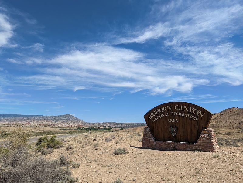
The road into Fort Smith, Montana does not announce itself with fanfare. There are no billboards, no chain restaurants, and no traffic jams, just a quiet rural stretch that suddenly gives way to one of the most dramatic natural landscapes in the American West.
Bighorn Canyon National Recreation Area sits at Fort Smith, MT 59035, and can be reached by phone at +1 406-666-2412 or explored further at nps.gov/bica. The recreation area spans an impressive 120,296 acres, stretching across both Montana and Wyoming, with the North District accessible directly from Fort Smith.
The Yellowtail Dam Visitor Center is located just a couple of miles beyond town, though it is currently closed to the public. The mailing address for the park is P.O. Box 7458, Fort Smith, MT 59035. Arriving here feels like crossing a threshold into a world that operates on its own terms, unhurried, unfiltered, and absolutely worth every mile of the drive.
Five Hundred Million Years on Display: The Canyon’s Geological Story
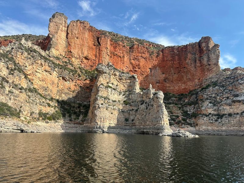
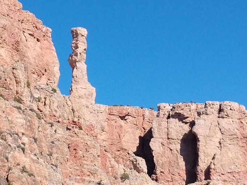
Few places on Earth let you read half a billion years of planetary history just by looking up. The canyon walls of Bighorn Canyon rise up to a thousand feet above the shimmering surface of Bighorn Lake, and every visible layer tells a chapter of that ancient story.
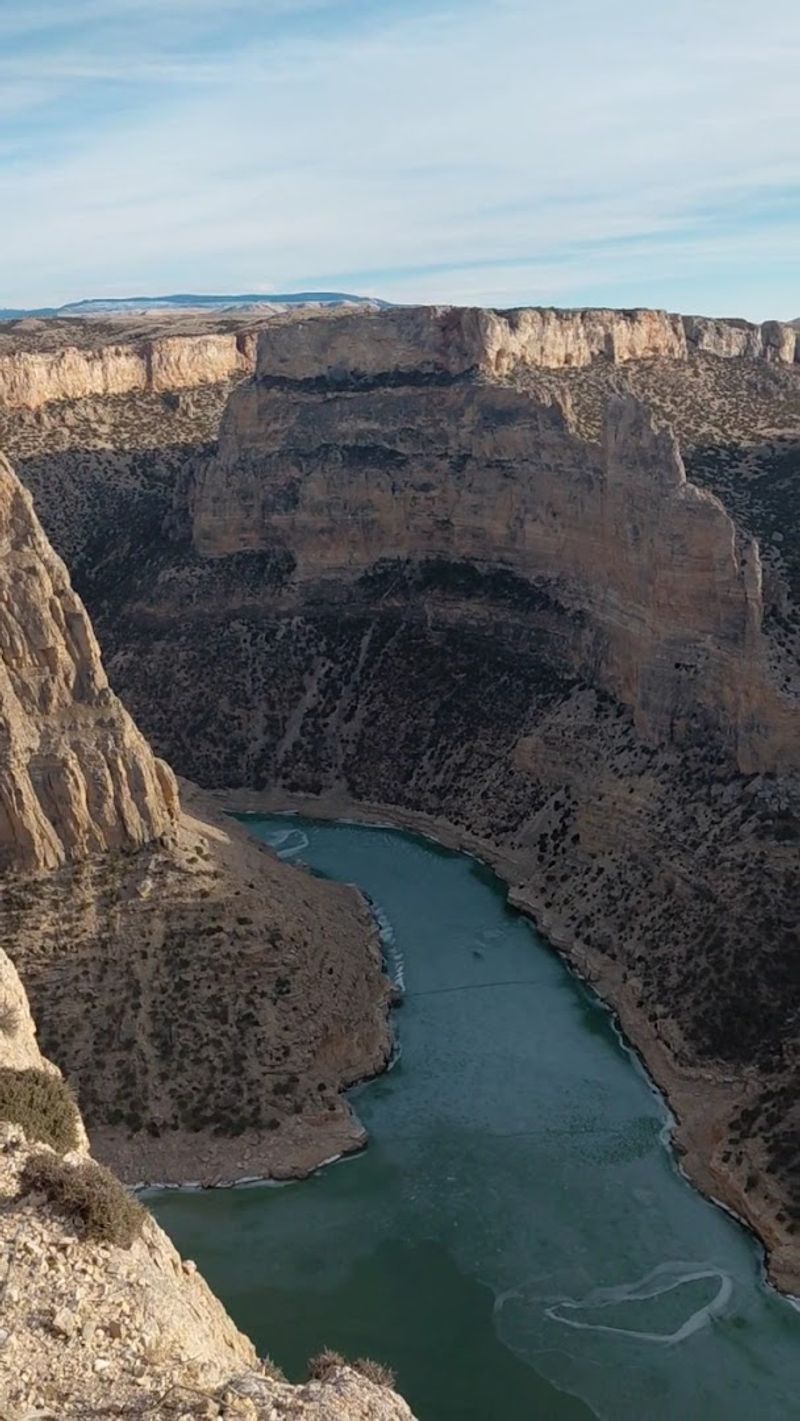
The exposed strata include sandstone, mudstone, gypsum, shale, limestone, and dolomite, deposited across geological eras and then carved apart by the Bighorn River over roughly five million years. The river’s superposition through the uplifting Bighorn and Pryor Mountains created dramatic entrenched meanders, where the waterway winds through solid bedrock in wide, sweeping curves.
Researchers have also found fossilized dinosaur bones and tracks from the Upper Jurassic period embedded in these formations, along with fish scale impressions in the Mowry Shale. The Madison Limestone and Bighorn Dolomite formations hide numerous caves beneath the surface, including Bighorn Cavern, part of a system that extends approximately fourteen miles underground.
The Dam That Created a 71-Mile Playground
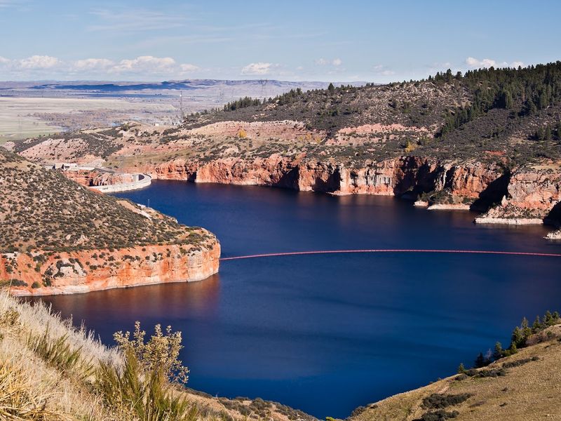
Before 1968, the Bighorn River carved quietly through this canyon without much fanfare. Then the Yellowtail Dam changed everything, creating one of the most scenic reservoirs in the entire National Park system almost as a side effect of its primary engineering mission.
The dam stands 525 feet tall and is an arch-type structure, one of the most technically impressive of its kind. It generates electric power, supports irrigation across the region, and provides flood control downstream, but for most visitors, its most celebrated contribution is Bighorn Lake itself, a 71-mile-long expanse of water that winds 55 miles through the heart of the recreation area.
The dam was named after Robert Yellowtail, a respected leader of the Crow Nation whose legacy is deeply tied to this land. Below the dam, the Bighorn River transforms into a world-class trout fishery, celebrated for its brown and rainbow trout populations. The lake itself holds walleye, sauger, ling, and perch, making it a genuinely diverse destination for anglers of every skill level.
Sacred Ground: The Crow Nation’s Enduring Connection
Long before any dam was built or any recreation area was designated, the Bighorn Canyon belonged to the Crow, or Absarokaa, meaning “People of the large-beaked bird.” Their presence here stretches back more than 10,000 years, and their connection to this land runs far deeper than any map boundary could capture.
The Bad Pass Trail, a historic route still traceable across 13 miles of rugged terrain and marked by approximately 500 rock cairns, was used by indigenous peoples for millennia and was added to the National Register of Historic Places on October 29, 1975. For the Crow, this canyon is sacred, woven into spiritual beliefs and oral traditions, including a legend involving a bighorn sheep chief and a rescued boy that gave the canyon its name.
The construction of Yellowtail Dam was met with significant opposition from the Crow, who resisted the flooding of sacred lands. Their resilience through that period, and their ongoing stewardship of much of this landscape through the adjacent Crow Nation reservation, is a story that deserves far more attention than it typically receives.
Wild Horses, Bighorn Sheep, and the Canyon’s Incredible Wildlife
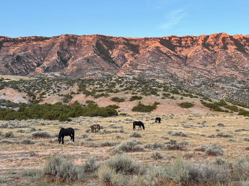
There is something genuinely surreal about rounding a bend on a canyon road and finding a wild stallion standing in the middle of it, completely unbothered, essentially daring you to blink first. That kind of encounter happens here more often than you might expect.
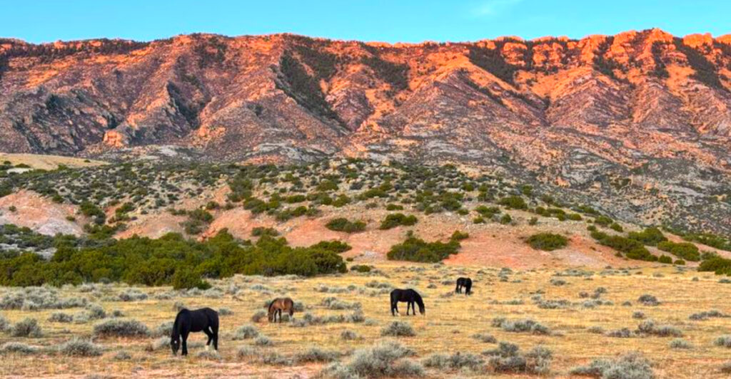
Portions of the Pryor Mountain Wild Horse Range fall within the recreation area, providing sanctuary for roughly 120 to 140 wild horses that roam the plateaus and canyon rims with remarkable freedom. The park is also home to its namesake bighorn sheep, whose effortless navigation of sheer canyon walls remains one of the most mesmerizing wildlife spectacles in the American West.
Beyond these headline animals, the recreation area supports over 200 bird species, including bald eagles, pelicans, herons, and wild turkeys. Mule deer, white-tailed deer, coyotes, beaver, porcupines, mountain lions, and occasional bears round out a wildlife roster that reflects the park’s five distinct climatic zones, ranging from high desert to near-alpine environments. Every season brings a different cast of characters to watch.
On the Water: Boating, Fishing, and Lake Life at Its Best
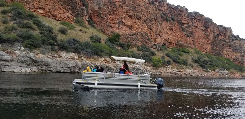
Bighorn Lake does not just sit there looking pretty, though it absolutely does that too. The 71-mile reservoir is a fully operational aquatic playground, and the options for getting out on the water range from leisurely to genuinely thrilling depending on your energy level.
The Ok-A-Beh Marina in the North District offers pontoon boat rentals, making it easy to cruise the canyon without your own vessel. Barry’s Landing and Horseshoe Bend both provide boat ramps for those who bring their own equipment. Guided boat tours are also available and offer a particularly informative way to absorb the canyon’s layered history while scanning the clifftops for wildlife.
Below the Afterbay Dam, the Bighorn River is widely regarded as one of the top trout fisheries in the country, with brown and rainbow trout drawing serious anglers from across the nation. The lake itself yields walleye, sauger, ling, and perch throughout the warmer months. Even winter has its appeal here, as ice fishing around Horseshoe Bend keeps the angling tradition alive when the temperatures drop.
Trails That Go Somewhere Worth Going: Hiking in the Canyon
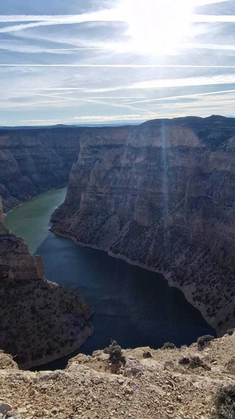
The Sullivan’s Knob Trail is only 0.75 miles long, but it might be the most rewarding short hike in Montana. At the top, you get a sweeping panoramic view of Horseshoe Bend and the surrounding canyon walls, and if you shout into the open air at just the right angle, a triple echo bounces back from the rock faces below.
Bighorn Canyon offers over 27 miles of hiking trails spread across 15 distinct paths, with options ranging from flat, accessible nature walks to rugged ascents that demand some effort. The Sykes Mountain Trail covers 3.75 miles through desert terrain and rewards hikers with elevated overlooks of the canyon and Horseshoe Bend that feel genuinely hard-earned.
History-minded hikers will find the Bad Pass Trail particularly compelling, a 13-mile ancient route marked by 500 rock cairns that indigenous peoples walked for thousands of years before any tourist ever showed up. The Beaver Pond Nature Trail offers a gentler family-friendly option with reliable wildlife sightings. Bicycling is permitted on the Ok-A-Beh road and the South District park road for those who prefer wheels.
Old West Preserved: The Historic Ranches of Bighorn Canyon
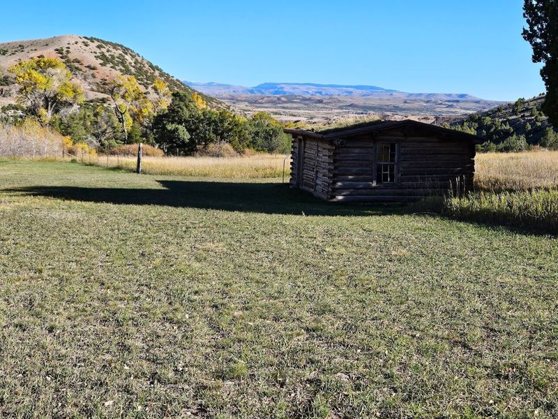
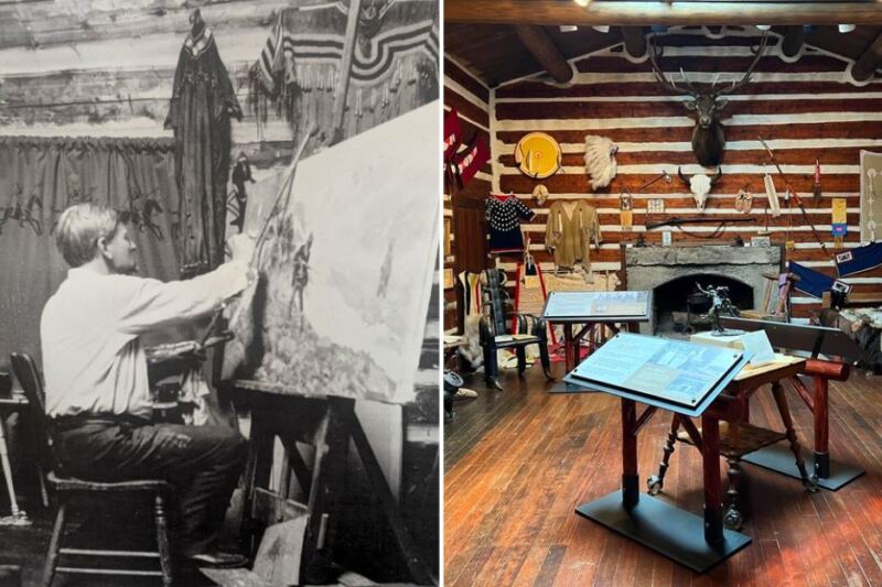
Caroline Lockhart started ranching at age 56, which is the kind of biographical detail that makes you immediately want to know everything else about her. Her ranch, preserved within the recreation area, is one of four historic cattle and dude ranches that offer a vivid window into the Old West era of this canyon country.
The Mason-Lovell Ranch dates back to 1883, when it operated as the headquarters of a classic open-range cattle operation. The Hillsboro site, once known as Cedarvale Guest Ranch, even housed a post office between 1915 and 1945, serving as a vital community hub in an otherwise remote stretch of landscape. The Ewing-Snell Ranch site carries nearly a century of continuous use, giving it a depth of history that is palpable even in its weathered structures.
Nearby, the remnants of Fort C.F. Smith, which once guarded the historic Bozeman Trail, speak to the military history of expansion and conflict in this region, though the site now sits on private land. Walking through any of these preserved ranch sites makes the canyon’s human story feel immediate and real.
Devil Canyon Overlook: The View That Stops Everyone Cold
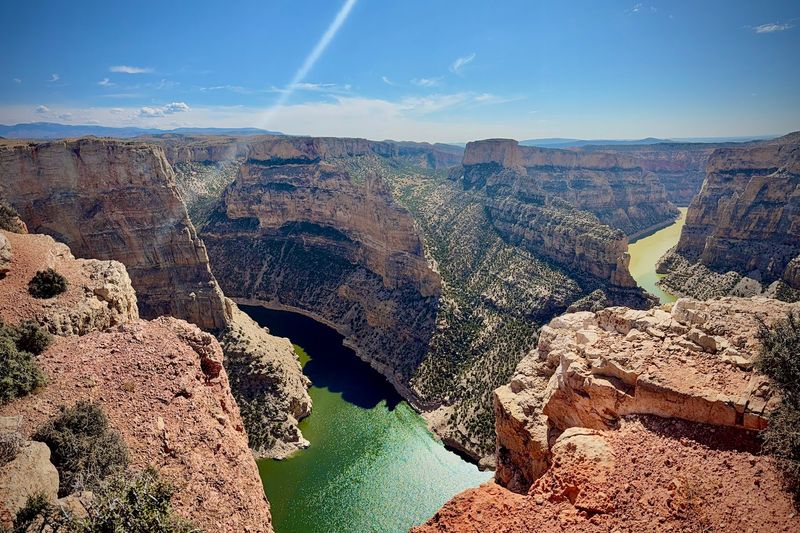
No photograph does it justice, and nearly everyone who visits says exactly that after standing at the edge of Devil Canyon Overlook for the first time. The canyon drops roughly a thousand feet straight down to the glittering surface of Bighorn Lake, framed on both sides by walls of layered red, tan, and cream-colored rock that seem almost too dramatic to be real.
The overlook is accessed via a one-mile road off Wyoming Highway 37 in the South District, and the payoff at the end of that short drive is genuinely staggering. You can walk the rim in both directions to take in different perspectives of the canyon’s sweeping curves, and the changing light throughout the day shifts the colors of the walls in ways that make multiple visits feel entirely different.
Visitors consistently rank this as the single most memorable stop in the entire recreation area, and it is easy to understand why. The combination of scale, color, and silence creates an experience that is hard to replicate anywhere else in the American West. Arrive early or late in the day for the most dramatic lighting conditions.
Navigating the Canyon: Essential Tips Before You Go
One detail that catches many first-time visitors completely off guard: the North District in Montana and the South District in Wyoming have no connecting road within the park itself. Driving between the two sections takes approximately three hours on public roads, so planning each district as a separate day trip is the smartest approach.
The Cal S. Taggart Visitor Center in Lovell, Wyoming operates year-round and is the best place to pick up maps and current information, since the Yellowtail Dam Visitor Center in Fort Smith is currently closed. No entrance fee is required as of May 25, 2018, making this one of the most accessible free natural areas in the country.
Five designated campgrounds offer more than 100 sites across both districts, including Afterbay and Grapevine in the North and the larger Horseshoe Bend in the South with 68 sites, some with utility hookups. There are no gas stations or hotels within park boundaries, so stocking up in Fort Smith, Hardin, or Lovell before entering is essential. Paper maps are strongly recommended, as cell service is unreliable throughout most of the area.
Every Season Has Its Own Personality Here
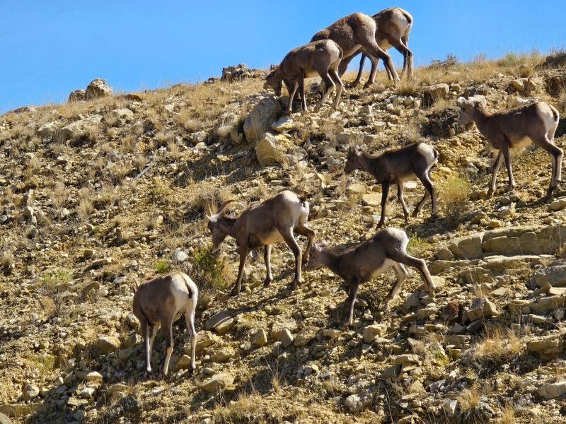
Spring visitors arriving in May and June find the plateau blanketed in wildflowers, temperatures sitting comfortably between 22 and 28 degrees Celsius, and bighorn sheep lambs testing their legs on canyon ledges. The mornings are ideal for hiking before the canyon floor heats up to 35 degrees Celsius or more by afternoon, often punctuated by dramatic thunderstorms rolling in from the west.
July and August bring peak water recreation, with lake temperatures hovering around 22 to 24 degrees Celsius and boating activity at its highest. The Crow Fair, held the third weekend of August in nearby Crow Agency, draws thousands of visitors and roughly 1,000 teepees, offering a remarkable cultural experience worth building into any summer itinerary.
September and October are arguably the most beautiful months of all, when cottonwood trees turn a vivid gold, crowds thin out considerably, and wildlife moves to lower elevations in greater numbers. Winter drops temperatures to around minus 10 degrees Celsius, but the minimal light pollution makes this canyon one of the finest stargazing locations in the entire region, a quiet reward for those willing to brave the cold.
Share this story