Oceans cover more than 70 percent of our planet, and for centuries, sailors and mapmakers believed in islands that later vanished without a trace. Some were swallowed by rising seas, others were never real to begin with, and a few actually came back after being declared gone forever.
The stories behind these lost and found islands are some of the most fascinating in all of exploration history. From volcanic eruptions that built brand-new land overnight to phantom islands that fooled entire generations of cartographers, each story is a reminder of just how surprising our world can be.
1. Ferdinandea Island (Italy)
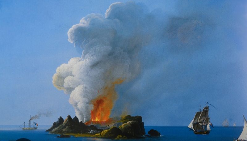
Few islands have caused as much political drama as Ferdinandea. When this volcanic island burst out of the sea off the coast of Sicily in July 1831, it triggered an immediate territorial dispute among Britain, France, Spain, and the Kingdom of the Two Sicilies.
Everyone wanted to claim it before anyone else could plant a flag.
The island reached a height of about 65 meters and stretched nearly five kilometers across at its widest point. Then, just as quickly as it appeared, it sank beneath the waves by December of the same year.
The volcano responsible, now known as Ferdinandea, sits about 30 meters below the surface and has continued to show signs of activity over the years.
Scientists have monitored the area closely, and in 2000, another eruption nearly pushed the cone back above sea level. The underwater volcano remains geologically active, meaning this dramatic island could return at any time.
2. Surtsey (Iceland)
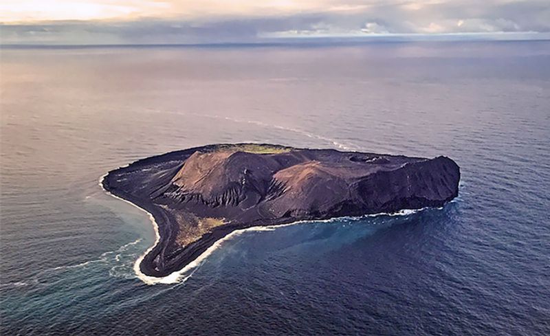
Imagine watching a brand-new island grow out of the ocean in real time. That is exactly what happened when Surtsey erupted from the North Atlantic seafloor on November 14, 1963, about 32 kilometers south of Iceland.
Fishermen nearby were among the first to witness the dramatic underwater eruption that would change geography forever.
By the time the eruption ended in 1967, Surtsey had grown to about 2.7 square kilometers. Scientists treated it like a living laboratory, watching plants, birds, and insects arrive on their own without any human help.
It became a UNESCO World Heritage Site in 2008 because of its extraordinary scientific value.
Erosion has gradually reduced its size since then, but Surtsey still exists today. It remains one of the most closely studied islands on Earth, giving researchers a rare window into how life colonizes completely new land from scratch.
3. Nishinoshima (Japan)
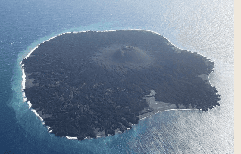
Nishinoshima had been a tiny, unremarkable speck of rock in the Pacific Ocean for decades. Then, in November 2013, a new volcanic eruption began just offshore, and everything changed.
Lava poured into the sea and eventually merged with the original island, creating something far more dramatic than what existed before.
By 2020, the island had grown to more than 11 times its previous size, reaching roughly 4 square kilometers. Eruptions continued in cycles, sometimes shrinking the island slightly before building it back up again.
Japan officially extended its maritime boundaries as a result of the new land, which has real geopolitical significance in a busy region of the Pacific.
Biologists are now watching closely to see how wildlife colonizes the expanded terrain, much like scientists did with Surtsey. Nishinoshima is a perfect modern example of how volcanic activity can effectively create a new island within a single human lifetime.
4. Hunga Tonga-Hunga Ha’apai (Tonga)
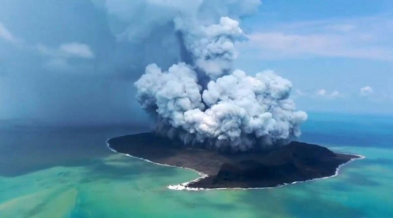
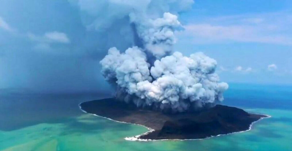
When a volcanic eruption between 2014 and 2015 connected two older islands in the Kingdom of Tonga, scientists were amazed. The new landmass, named Hunga Tonga-Hunga Ha’apai, was one of the very few entirely new islands formed in the 21st century.
NASA researchers even compared its terrain to parts of Mars, calling it a rare chance to study how planets form landmasses.
The island grew to about 1.5 square kilometers and reached heights of around 120 meters. Scientists predicted it would erode away within a few years, but it held on longer than expected, partly because a hardened lava shell protected its interior from wave damage.
Then came January 15, 2022, when one of the most powerful volcanic eruptions in recorded history destroyed most of the island in a matter of hours. The explosion sent shockwaves around the globe and generated a tsunami.
What volcanic activity built, it ultimately took back.
5. Bermeja (Mexico)
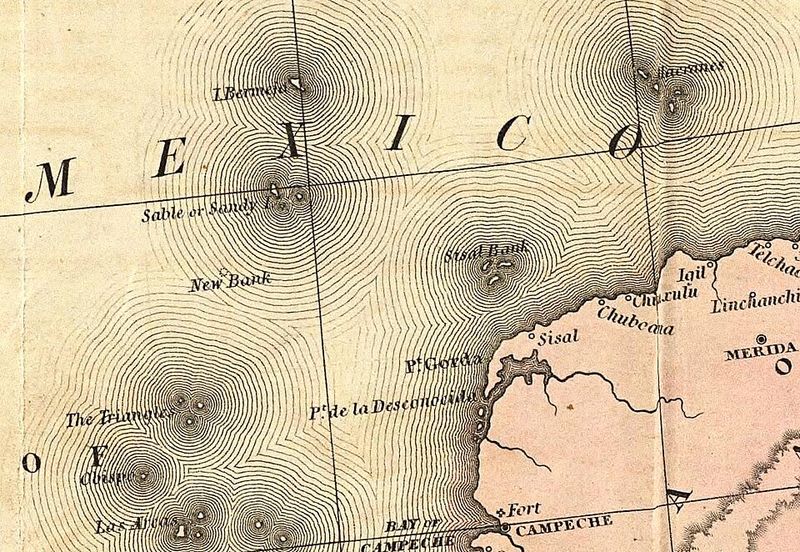
For roughly 400 years, Bermeja appeared on maps of the Gulf of Mexico as a real island located northwest of the Yucatan Peninsula. Spanish cartographers first documented it in the early 1500s, and it continued to appear on maps well into the 20th century.
No one questioned its existence for centuries because everyone simply copied it from earlier charts.
The island mattered enormously because its location would have given Mexico a much larger claim over Gulf of Mexico oil-rich waters under modern maritime law. When Mexican officials went looking for it in the 1990s and again in 2009, they found absolutely nothing.
The ocean at that location was hundreds of meters deep.
Conspiracy theories quickly spread, with some suggesting the island was deliberately erased from maps to benefit American oil interests. No evidence ever supported that claim.
The most likely explanation is that Bermeja was simply a cartographic error that survived for centuries through repetition.
6. Sandy Island (Coral Sea)
Sandy Island appeared on maps and even in Google Maps as recently as 2012. Located between Australia and New Caledonia in the Coral Sea, it was shown as a sizeable landmass on nautical charts that had been copied and recopied for more than a century.
Nobody had apparently stopped to verify whether it was actually there.
In November 2012, Australian scientists aboard a research vessel sailed directly to its supposed coordinates and found only open ocean about 1,400 meters deep. The crew shared their findings online, and the story spread worldwide almost instantly.
Google Maps and other digital mapping services quickly removed the phantom island from their databases.
The origin of the error likely traces back to a 19th-century whaling ship that recorded a hazard in the area. That report was eventually translated into a mapped island and repeated uncritically for generations.
Sandy Island is now a well-known case study in how mapping errors can persist far longer than anyone expects.
7. Buss Island (North Atlantic)
Buss Island has one of the most entertaining origin stories in the history of phantom islands. In 1578, a sailor aboard Martin Frobisher’s third Arctic expedition claimed to have spotted a large island in the North Atlantic while sailing home.
His ship was called a “buss,” a type of Dutch fishing vessel, and the supposed island took that name.
For nearly a century afterward, Buss Island appeared on maps as a real place, sometimes shown as quite large and even described as a potential base for fishing operations. Expeditions set out to find it and came back empty-handed, yet the island stayed on the charts.
By the late 1600s, repeated failures to locate Buss Island finally convinced cartographers to drop it from their maps. It became an early example of how a single sailor’s questionable sighting could shape maps and exploration plans for generations before anyone bothered to double-check.
8. Thompson Island (South Atlantic)
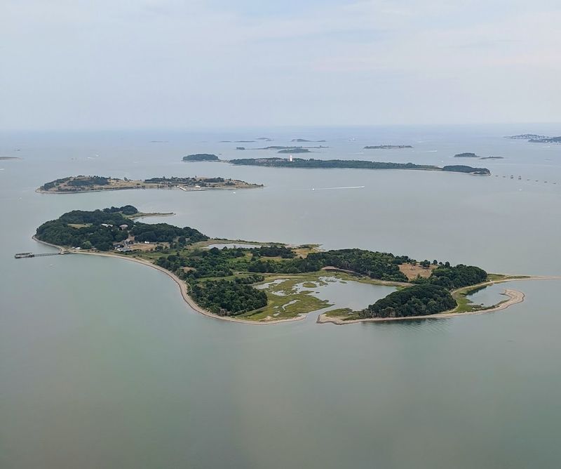
Thompson Island appeared on South Atlantic charts for nearly a century after a British sealer named George Norris claimed to have discovered it in 1825. He reported it lying close to Bouvet Island and gave a reasonably detailed description, which was enough for mapmakers to record it as a real place.
Subsequent charts dutifully included it without anyone going back to verify.
Several expeditions that passed through the area during the late 19th and early 20th centuries looked for Thompson Island and found nothing. A 1898 German scientific expedition conducted a particularly thorough search and concluded it simply did not exist.
Despite that, it stubbornly remained on some charts for years afterward.
The most charitable explanation is that Norris may have spotted an iceberg or a floating ice shelf and mistaken it for land in the difficult conditions of the far South Atlantic. Thompson Island was eventually removed from official maps, joining a long list of phantom islands born from honest but costly mistakes.
9. Julia Island (Mediterranean)

Julia Island is simply the French name for the same volcanic feature that the British called Graham Island and the Sicilians called Ferdinandea. The French named it Ile Julia because it first emerged in July, a month named after Julius Caesar.
French naval officers arrived quickly and planted their tricolor flag, determined to claim the prize before their rivals could react.
What makes the French claim particularly interesting is that their scientists were among the first to document the island’s geology in detail. They recognized immediately that it was volcanic in origin and predicted it might not survive for long.
They were right, but that did not stop the political excitement while it lasted.
The story of Julia Island captures something almost absurd about the colonial era: three nations arguing passionately over a piece of volcanic rock that the ocean had already decided to take back. It disappeared beneath the waves before any legal settlement could be reached, leaving the dispute permanently unresolved.
Share this story