There is a trail in Oregon that feels like it was designed specifically to make you forget about everything else. Turquoise water so clear you can count the pebbles on the bottom, towering Douglas firs casting cool shadows, and waterfalls that roar loud enough to drown out your thoughts.
The McKenzie River Trail stretches 26 miles through some of the most jaw-dropping scenery in the Pacific Northwest, and most people have no idea it exists. By the time you finish reading this, you will want to pack your boots and head straight for McKenzie Bridge.
Where the Trail Begins: Location and Access
The official address for the McKenzie River Trail is 56621 McKenzie Hwy, McKenzie Bridge, OR 97413, tucked into the heart of the Willamette National Forest in western Oregon. Getting there from Eugene takes roughly an hour heading east on Highway 126, and the drive itself is a preview of the beauty waiting ahead.
One thing worth knowing before you go: Google Maps has a habit of pointing hikers to the wrong starting point near Jennie B. Harris Wayside.
The actual trailhead sits about a mile east of that marker. The ranger station roughly two miles east of the wayside is a smarter place to start, and the staff there can answer questions and hand out maps.
Parking can be tight on weekends, especially in summer, so arriving early in the morning pays off. The trail is open 24 hours a day, seven days a week, every season of the year.
You can reach the McKenzie River Ranger District at (541) 822-6272 for current conditions before heading out.
The Full 26-Mile Route and What to Expect
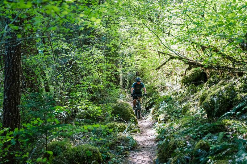
Twenty-six miles of single-track trail sounds like a lot, and it is, but the McKenzie River Trail is designed to reward hikers and mountain bikers at every level. The lower section, starting near the valley floor, runs mostly flat and well-maintained, making it approachable for beginners and families.
The upper section is where the trail gets more serious. Lava rock fields, steep descents, and technical terrain demand more experience and attention.
Cliff sections appear on both the upper and lower halves, so keeping your footing is part of the adventure.
Most visitors do not tackle all 26 miles in a single outing. Instead, they pick a section based on their fitness level and how much time they have.
The trail is well-marked throughout, though snow can linger on higher sections through April. Bring enough water, wear sturdy footwear, and watch for root and rock trip hazards that show up without much warning.
The payoff for every challenging stretch is a view or landmark that makes the effort feel completely worth it.
Tamolitch Blue Pool: The Turquoise Treasure
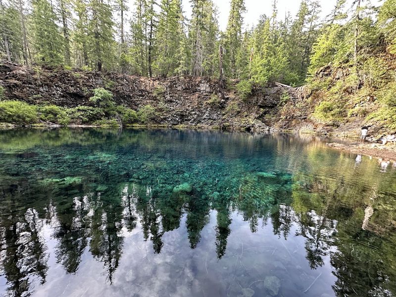
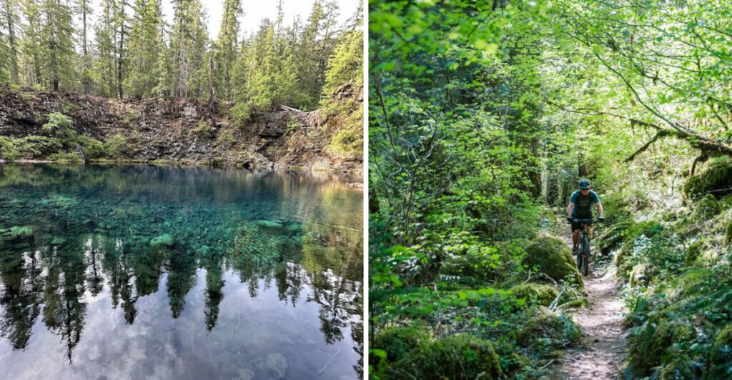
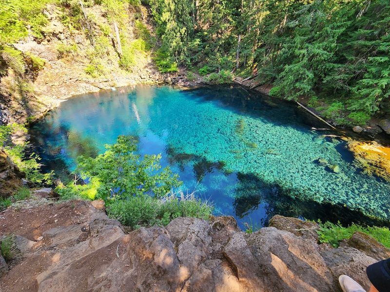
Few natural features in Oregon generate as much excitement as the Tamolitch Blue Pool, and the color of the water is the reason why. Fed by an underground spring that pushes through ancient lava fields, the pool glows a shade of turquoise that looks almost unreal in photographs and even more striking in person.
The hike to reach it covers about 3.5 miles one way from the Ice Cap Creek trailhead, starting easy before turning rocky and winding at the halfway point. The final descent to the pool itself is steep and requires careful footing, but every step of the approach builds anticipation.
Water temperatures at the Blue Pool stay cold year-round because the spring source runs through volcanic rock deep underground. Swimming is popular in summer, though the chill is not for the faint-hearted.
Autumn visits bring a bonus: the surrounding forest lights up with fall color that frames the turquoise water beautifully. Arriving on a weekday morning gives you the best chance of enjoying the pool without a crowd pressing in around you.
Sahalie and Koosah Falls: A Two-for-One Waterfall Loop
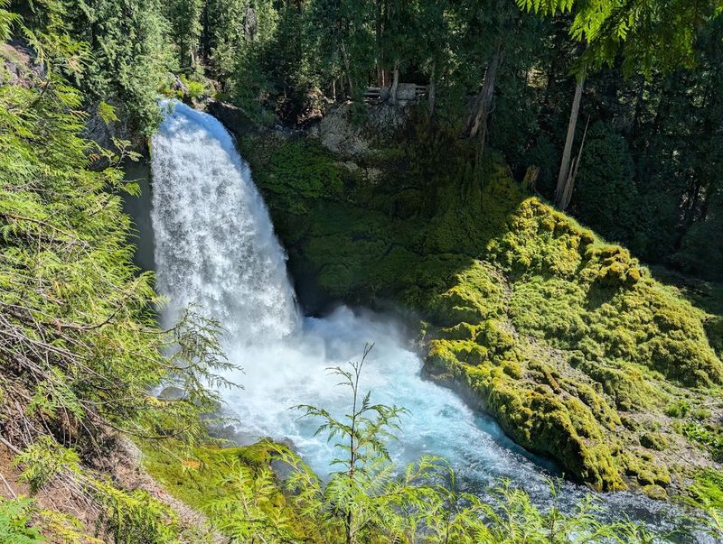
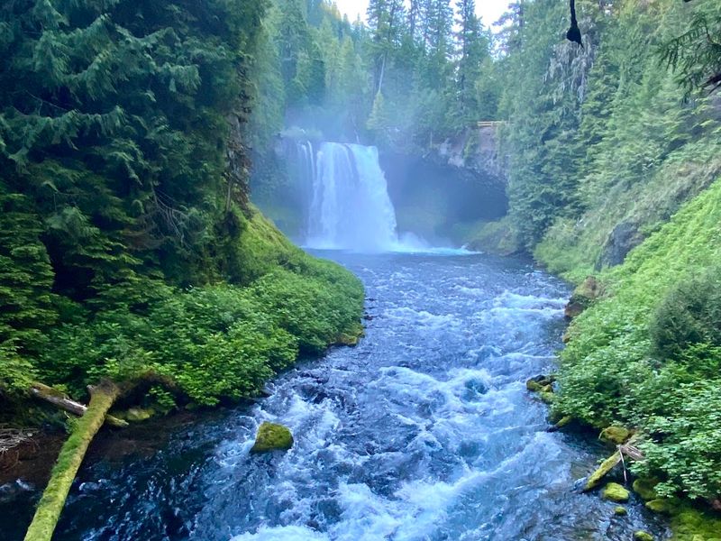
Sahalie Falls is the kind of waterfall that stops you mid-stride. The McKenzie River drops roughly 100 feet over a basalt ledge, sending up a permanent mist that coats the surrounding ferns and moss in a fine, cool spray.
The roar is constant and deeply satisfying.
Just downstream, Koosah Falls adds a second act to the show. The water here drops about 70 feet in a slightly wider curtain, and the color of the river between the two falls holds a rich blue-green that photographers love.
A 2.5-mile loop trail connects both waterfalls and offers viewpoints from multiple angles along the way.
The loop takes most visitors around two to three hours to complete at a comfortable pace. Trail markers are clear and the path is well-worn, though rocky and rooted sections deserve attention.
Searching for Koosah or Sahalie Falls directly rather than relying on generic GPS directions tends to get you to the right parking area faster. Dogs on leashes and children with steady legs handle this loop without trouble.
Old-Growth Forest and the Douglas Firs
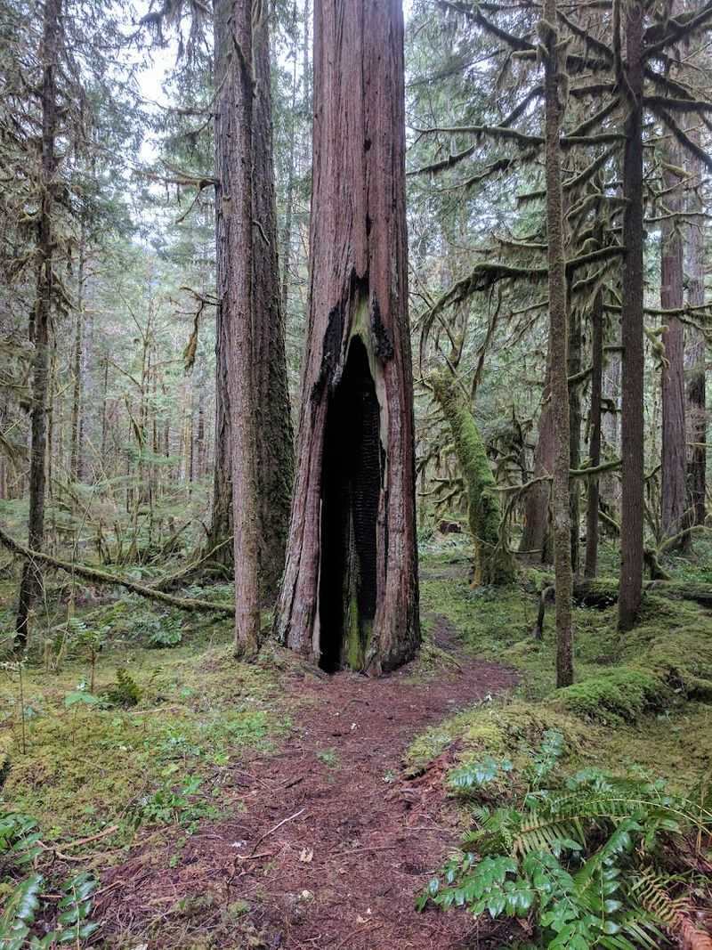
Walking beneath the Douglas firs on the McKenzie River Trail puts the scale of old-growth forest into perspective fast. These trees have been growing for centuries, and their trunks reach widths that make a grown adult look small standing beside them.
The canopy overhead filters sunlight into soft, shifting patterns on the forest floor.
The trail also passes through groves of trees sometimes described as resembling redwoods in their height and presence, though they are distinct species native to the Cascade Range. The forest above the Rainbow area is particularly lush and largely untouched, while sections below Rainbow show evidence of past wildfire activity that has since begun to recover.
Ferns, mosses, and native shrubs fill in the understory, and the air carries a clean, piney scent that city lungs genuinely appreciate. Wildlife sightings are common here too.
Deer, squirrels, and various bird species move through the trees with casual confidence. The forest feels alive in a way that is hard to describe without standing inside it, so the most useful advice is simply to slow down and look around.
Mountain Biking the McKenzie River Trail
Mountain bikers have been calling the McKenzie River Trail one of Oregon’s best rides for decades, and the reputation is well-earned. The 26-mile singletrack route offers a range of terrain that keeps experienced riders engaged from start to finish without ever feeling monotonous.
The lower half, running roughly from Paradise to Deer Creek, sits in the beginner-to-intermediate range and covers about 15 miles round-trip from that section. The upper half steps up the difficulty with lava rock fields, cliff-edge sections, and faster, more technical descents that reward riders with solid bike-handling skills.
Riders who want to skip the most demanding terrain can start at the Blue Pool trailhead, which bypasses the heaviest lava sections while still delivering long stretches of fast, flowing downhill singletrack through dense forest. One practical note: a trail closure west of the Blue Pool trailhead has required riders to use a stretch of Highway 126 as a detour, so checking current conditions before your ride saves a surprise mid-route.
The trail is shared with hikers, so speed management and courteous passing keep everyone’s day running smoothly.
Clear Lake and the Lava Fields
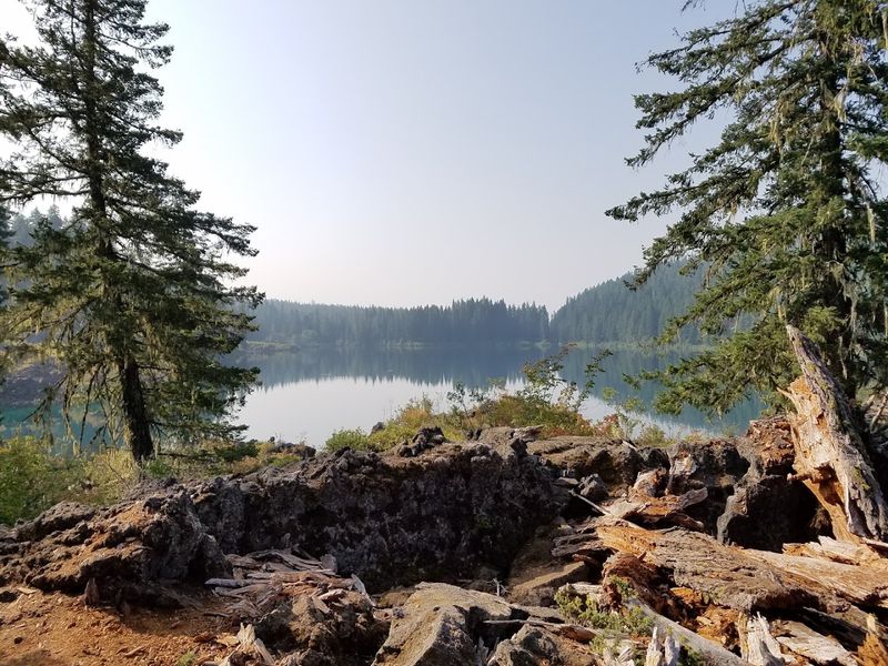
Clear Lake sits near the upper end of the McKenzie River Trail and earns its name without exaggeration. The water is so transparent that the submerged ancient forest on the lake bottom is visible from the surface, preserved by the cold spring water that feeds the lake.
It is one of those natural details that feels almost too strange to be real.
The lake formed roughly 3,000 years ago when a lava flow dammed the McKenzie River, and the volcanic landscape surrounding it still shows that geological history clearly. Black lava rock fields stretch across sections of the upper trail, creating a stark contrast against the green forest that frames them.
Paddling on Clear Lake is a popular activity for visitors who want to see the submerged trees up close. Rental rowboats are available at the resort on the lake’s edge during the warmer months.
The combination of the lake, the lava fields, and the surrounding Cascade peaks makes the upper section of the trail feel like a different world from the river-level hiking lower down. Hot springs in the broader area add another reason to linger.
River Activities Beyond Hiking
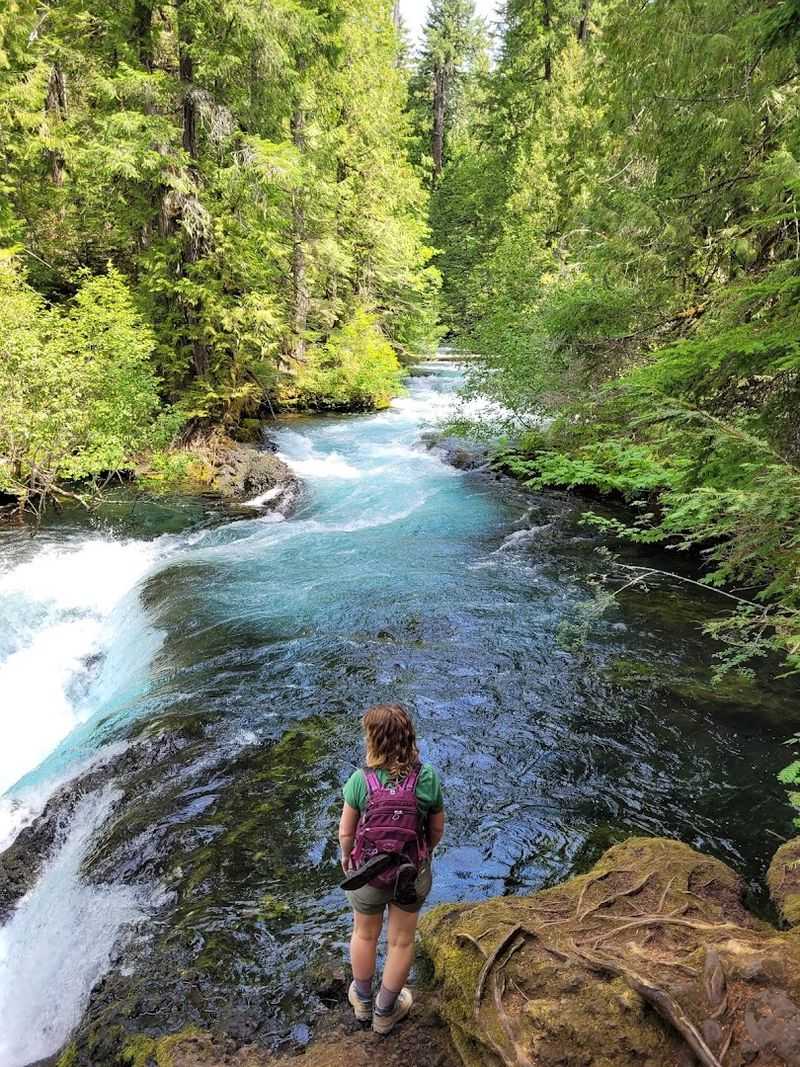
The McKenzie River does not just look good from a trail. It also happens to be one of the more entertaining rivers in Oregon for anyone who prefers their adventure to involve a paddle or a current.
A kayak, canoe, and paddleboard launch point sits along the trail corridor, giving water-oriented visitors easy access to the river.
Rafting is a beloved tradition on the McKenzie, and watching rafters navigate the current from the riverbank is its own form of entertainment. Cheering them on from a sunny rock beside the water turns a rest break into a genuinely fun moment, especially when the rafters wave back with equal enthusiasm.
Fly fishing on the McKenzie River draws anglers from across the Pacific Northwest. The river is famous for its native rainbow trout, and drift boat fishing with a local guide is a classic way to spend a day on the water.
The clarity of the river makes sight fishing possible in calmer stretches, which adds a whole different layer of skill and patience to the experience. Whether you are on the water or watching from the bank, the river itself is always the main event.
Best Times to Visit and Seasonal Highlights
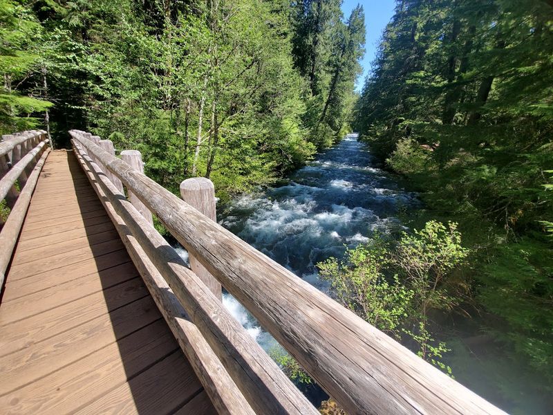
Summer brings the biggest crowds to the McKenzie River Trail, and for good reason. Warm temperatures, long daylight hours, and the appeal of the Blue Pool make July and August the busiest months by a significant margin.
Arriving early on summer mornings, especially on weekends, is the single most effective strategy for finding parking and enjoying the trail without constant company.
Spring offers a quieter experience, though snow can still cover sections of the upper trail through April. The waterfalls run at their most powerful during spring snowmelt, which makes Sahalie and Koosah Falls especially dramatic in April and May.
Autumn is the personal favorite of many repeat visitors. Fall color transforms the forest canopy into warm shades of orange and gold, and the crowds thin out considerably after Labor Day.
October hiking along the Ice Cap Creek to Blue Pool route delivers some of the most visually rewarding miles on the entire trail. Winter visits are possible since the trail stays open year-round, but checking road and snow conditions beforehand is essential, particularly for the higher elevation sections near Clear Lake.
Tips for a Smooth Visit
A few practical details can make the difference between a smooth outing and a frustrating one on the McKenzie River Trail. Parking fills quickly at popular access points, particularly near the waterfalls and the Blue Pool trailhead, so a dawn start is not just poetic advice but a genuinely useful tactic.
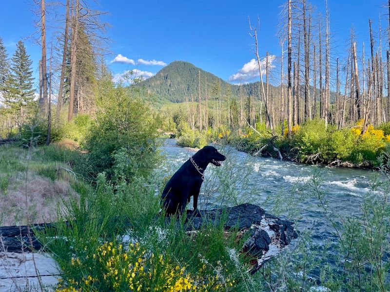
The trail is dog-friendly and kid-friendly, which makes it a strong choice for families who want a nature experience that does not require elite fitness. Keep dogs on a leash, carry enough water for everyone in your group, and pack out everything you bring in.
The leave-no-trace ethic is taken seriously by the hiking community here.
Cell service along the trail is unreliable, so downloading an offline map before leaving the car is a smart move. The McKenzie River Trail website at mckenzierivertrail.com offers current information on closures and conditions.
Trekking poles help on the rocky and rooted sections, and waterproof footwear pays off near the waterfalls where mist keeps the ground damp. With a little preparation, this trail delivers exactly the kind of day that makes you rearrange your schedule to come back as soon as possible.
Share this story