Most people think of the Grand Canyon when they hear the word canyon, and honestly, that makes sense. But the United States is packed with stunning canyon landscapes that most travelers never even hear about.
From Georgia’s colorful gullies to Oregon’s remote desert cliffs, these places offer the kind of raw, dramatic scenery that stops you mid-step. If you are tired of crowded overlooks and overflowing parking lots, this list is exactly what you need to save, share, and start planning around.
Little Wild Horse Canyon, Utah
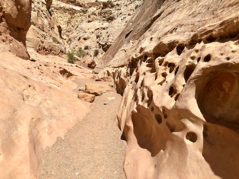
Few slot canyon hikes in Utah are as approachable as Little Wild Horse Canyon, and yet it flies under the radar compared to Antelope Canyon or Zion Narrows. Managed by the Bureau of Land Management in Emery County, the canyon sits inside the Muddy Creek Wilderness, far from the state’s busiest tourist corridors.
The most popular route is an 8-mile loop that connects Little Wild Horse Canyon with Bell Canyon, typically taking around four hours to complete. You will move through narrow sandstone passages where the walls curve and twist just inches from your shoulders, with a few scrambling sections that add a genuine sense of adventure.
Families with older kids tend to enjoy this one, since the terrain is challenging enough to feel exciting without requiring technical gear. Parking is at the Bell Canyon trailhead off Goblin Valley Road.
There are no fees, but bring plenty of water since services are minimal out here.
Cathedral Gorge State Park, Nevada
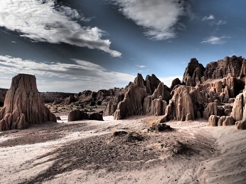
Cathedral Gorge is one of those places that genuinely stops people in their tracks, not because of marketing, but because the landscape is just that unusual. Soft bentonite clay has been carved by erosion into fluted columns, narrow passages, and formations that look almost architectural from certain angles.
Nevada State Parks manages this long, narrow valley in southeastern Nevada, and it remains an active park with walking trails, a campground, and regular condition updates posted by the state. The park sits near Panaca, a small town that most cross-country drivers skip entirely, which is exactly why Cathedral Gorge stays quiet.
The Miller Point overlook gives a sweeping view of the entire valley, while the lower trails take you directly into the clay formations at ground level. Camping here is a genuine draw, especially for stargazers, since the remote location keeps light pollution very low.
Check Nevada State Parks for current alerts before your visit.
Providence Canyon State Park, Georgia
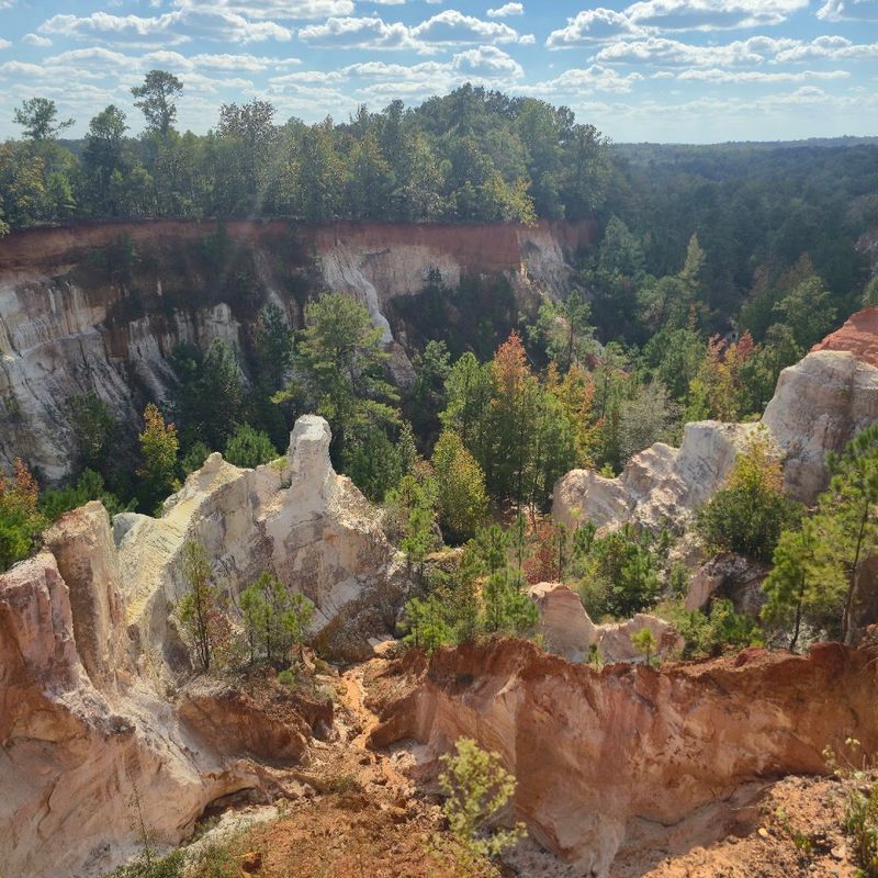
Providence Canyon earned its nickname honestly. The layered gullies and colorful canyon walls genuinely do echo the look of a miniature western canyon, but the story behind them is completely different from anything you would find in Arizona or Utah.
Georgia State Parks explains that these formations were not carved by ancient rivers over millions of years. Instead, poor agricultural practices in the 1800s caused severe erosion of the Coastal Plain, and over time the land opened up into what visitors now see as a surprisingly vivid canyon landscape.
The colors range from deep red to white, purple, and even pink in certain light.
The park is open year-round as an official Georgia State Park, offering hiking trails, primitive camping, and stargazing programs. The backcountry loop trail runs about 7 miles and takes hikers down into the canyon floor.
Spring wildflowers are a bonus for anyone visiting between March and May. Admission fees apply.
Black Canyon of the Gunnison National Park, Colorado
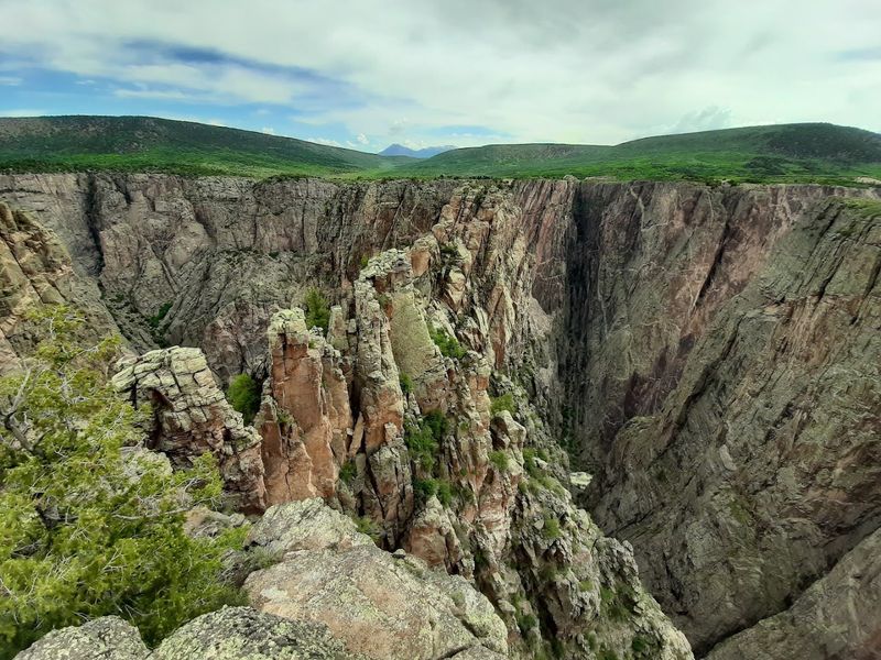
Black Canyon of the Gunnison carries a national park designation, but visitor numbers here are a fraction of what you see at Zion, Bryce, or Rocky Mountain. That gap is hard to explain once you actually stand at the rim and look down into one of the most dramatic canyon drops in the country.
The National Park Service describes the canyon as a place of steep cliffs, ancient rock, craggy spires, and walls carved by the Gunnison River over two million years. The rock at the bottom is some of the oldest exposed geology in North America, with formations dating back nearly two billion years.
Both the South Rim and North Rim offer driving routes and overlooks, though the South Rim is more developed and accessible. Current NPS alerts include fire restrictions, so checking conditions before arrival is important.
The Painted Wall, Colorado’s tallest cliff face, is visible from several overlooks along the South Rim Road.
Cloudland Canyon State Park, Georgia
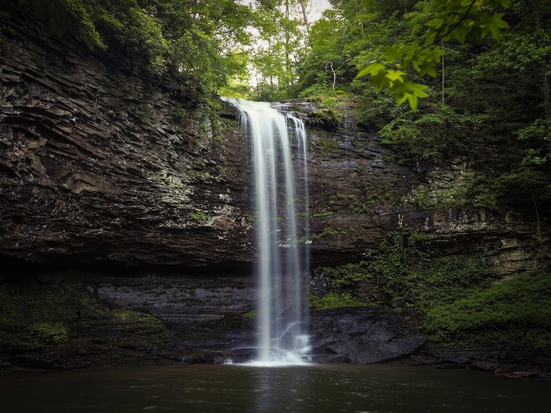
Georgia does not get nearly enough credit for its canyon scenery, and Cloudland Canyon is the clearest proof of that. Perched on the western edge of Lookout Mountain, this park drops visitors into a thousand-foot-deep canyon carved through layers of sandstone and shale.
Georgia State Parks describes the landscape as a combination of deep canyons, cliffs, waterfalls, cascading creeks, dense woodland, and wildlife that includes white-tailed deer, wild turkey, and various bird species. The Waterfalls Trail is the most popular route and requires descending hundreds of steps to reach two cascades on Daniel Creek, which makes the climb back out a real workout.
For hikers who want views without the strenuous descent, the Overlook Trail is a gentler option with good rim-level scenery. The West Rim Loop Trail covers about 4.9 miles and gives a fuller picture of the canyon’s scale.
Camping, cottages, and yurts are available, so this works well as an overnight destination rather than just a day trip.
Palo Duro Canyon State Park, Texas
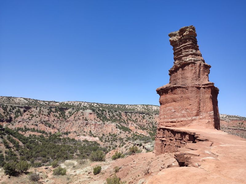
Texas Panhandle travelers driving through Amarillo sometimes skip Palo Duro entirely, which is one of the more surprising oversights in American road trip history. This canyon is enormous, colorful, and genuinely unexpected in a region most people picture as flat and featureless.
Texas Parks and Wildlife calls it the grandest canyon in Texas, with more than 30 miles of trails accessible by foot, mountain bike, or horse. The geologic layers exposed along the canyon walls span hundreds of millions of years, with colors shifting from deep red to yellow, orange, and white depending on the formation.
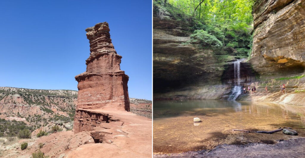
Hoodoos, the Lighthouse formation being the most photographed, rise from the canyon floor and give the landscape a sculptural quality that surprises first-time visitors. The park also hosts an outdoor musical drama called Texas during summer months, performed in an amphitheater inside the canyon.
Camping is available, and the park is located just outside Canyon, Texas, about 25 miles south of Amarillo.
The Needles District, Canyonlands National Park, Utah
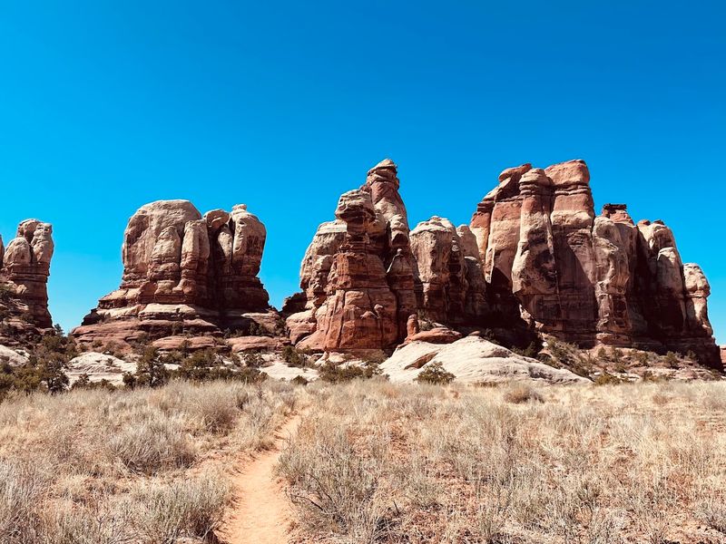
Canyonlands National Park gets a reasonable amount of attention, but almost all of it goes to the Island in the Sky district, which is easy to reach and offers dramatic overlooks with minimal effort. The Needles District, located about an hour away by road, is a completely different experience.
The National Park Service notes that the Needles Visitor Center is open daily from spring through fall, with water available year-round. The defining trails here include the Chesler Park Loop and Joint Trail, which wind through open meadows and into narrow fractures in the rock that squeeze hikers through passages barely wide enough for a backpack.
The banded red and white sandstone spires that give the district its name are visible from several points along the main access road, even before you start hiking. This is a strenuous area overall, so proper footwear and enough water matter more here than at most Utah parks.
Permits are required for overnight camping in the backcountry.
Cottonwood Canyon State Park, Oregon
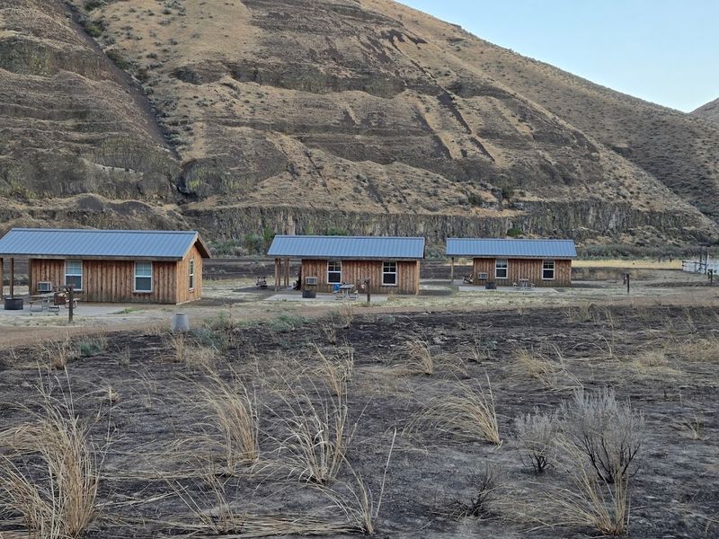
Covering more than 8,000 acres along the John Day River in north-central Oregon, Cottonwood Canyon State Park is one of the largest state parks in Oregon and also one of the least visited. That combination is rare and worth paying attention to.
Oregon State Parks describes the landscape as a mix of vertical cliffs carved by the river, deep side canyons, rocky grasslands, and some of the best dark-sky stargazing in the region. Wildlife sightings are common here, including mule deer, chukar, and various raptors that use the canyon walls for nesting.
Annual seasonal trail closures affect parts of Pinnacles Trail and Hardstone Trail to protect golden eagle nesting sites, so checking current notices before hiking is a smart move. The park has primitive camping along the river, with basic facilities.
The nearest services are in the small town of Wasco, so arriving with supplies already packed is the right approach. The remoteness is a feature, not a flaw.
Leslie Gulch, Oregon
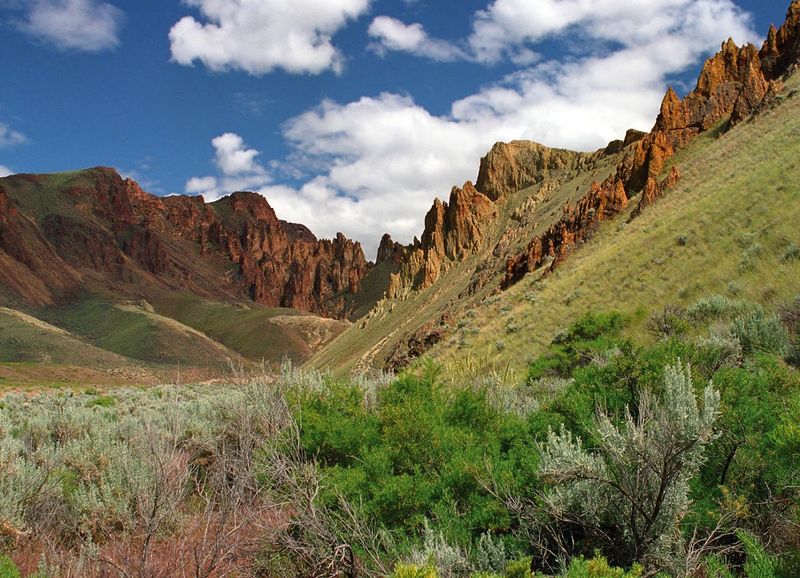
Leslie Gulch sits in one of the most remote corners of Oregon, near the Idaho border in Malheur County, and the landscape there looks like something that belongs in a science fiction film. The Bureau of Land Management describes towering cliffs painted in desert tones, honeycombed rock formations, and rare plant species found almost nowhere else.
Wildlife in the area includes bighorn sheep, mule deer, elk, coyotes, bobcats, and various raptors. The canyon drains into Owyhee Reservoir, and the road into the gulch is unpaved and rough, requiring a high-clearance vehicle for safe travel.
That road condition alone keeps the crowds away, which is exactly why the place feels so untouched.
The Bureau of Land Management manages the area, and camping is available near the reservoir. Cell service is essentially nonexistent, so paper maps and a full gas tank are non-negotiable before heading out.
Visiting in spring gives travelers the best mix of mild temperatures and wildflower color along the canyon floor.
Big Jacks Creek Wilderness, Idaho
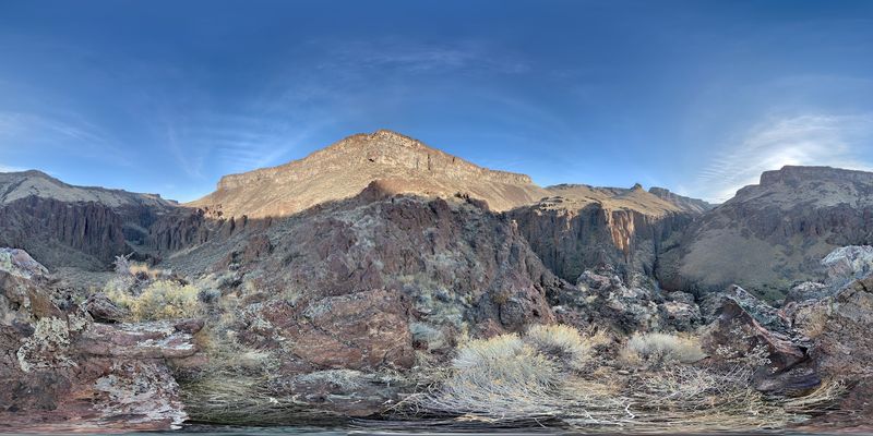
The Owyhee Canyonlands in southwestern Idaho is one of the least-visited canyon regions in the American West, and Big Jacks Creek Wilderness sits right at the heart of it. The Bureau of Land Management manages more than 52,000 acres here, with deep canyon systems carved by the Owyhee, Bruneau, and Jarbidge rivers cutting through a high-desert plateau.
Big Jacks Creek itself flows between sheer and terraced canyon walls, with riparian vegetation lining the creek bottom and providing habitat for redband trout and bighorn sheep. Trails accessing the wilderness are minimal and not well-marked, so this is a destination for experienced hikers and backcountry travelers who are comfortable with route-finding.
Getting here requires driving remote roads through open rangeland, and services are sparse across the entire region. The payoff is genuine solitude in a canyon landscape that very few people ever see.
Spring and early fall are the most practical seasons for visiting, since summer heat in this high desert can be intense.
Matthiessen State Park, Illinois
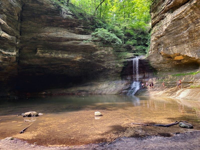
Matthiessen State Park gets overshadowed by its famous neighbor, Starved Rock, even though it offers canyon-style hiking that many visitors find equally impressive. The Illinois Department of Natural Resources describes the park as a place where canyons, streams, prairie, and forest come together across roughly 1,900 acres in La Salle County.
The park has about five miles of hiking trails, with routes that drop into the dells and follow canyon floors past rock formations, streams, and seasonal waterfalls. The trails into the canyon interiors can be more challenging during spring and early summer when water levels are higher and some paths become slippery.
What makes Matthiessen worth the separate visit is the quieter atmosphere. Starved Rock tends to pull the bigger crowds, which means Matthiessen’s trails are noticeably less congested on most weekends.
The park is free to enter, open year-round, and picnic facilities are available near the upper dells area. Waterfall flow is typically strongest in early spring after snowmelt.
Tallulah Gorge State Park, Georgia
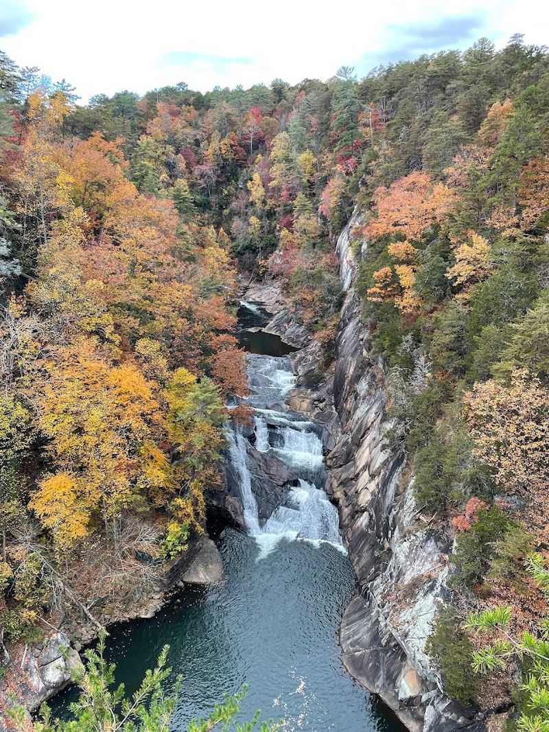
Tallulah Gorge punches well above its reputation. At two miles long and nearly 1,000 feet deep, this gorge in northeastern Georgia rivals canyon scenery that most people assume you have to travel west to find.
Georgia State Parks manages the site, which includes rim trails, multiple overlooks, waterfalls, and a suspension bridge hanging 80 feet above the rocky gorge floor.
The rim trails are accessible without a permit and give solid views of the gorge and its cascades, including Tempesta Falls and Hurricane Falls. For travelers who want to go deeper, free permits are available to access the gorge floor itself, though permits are limited in number and are not issued during scheduled water releases from the upstream dam.
Permits are distributed in person at the park on the day of your visit, so arriving early is important if gorge-floor access is your goal. The park sits near the town of Tallulah Falls and makes a strong anchor stop for a north Georgia weekend trip.
Share this story