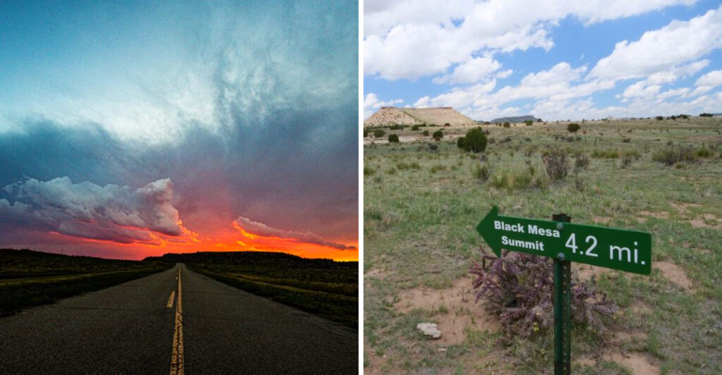
Most people think of Oklahoma as flat red-dirt country, but tucked into the far western panhandle is a place that will completely change that assumption. The Black Mesa Summit Trail near Kenton, Oklahoma, is an 8.4-mile round-trip hike that takes you to the highest point in the entire state at 4,973 feet above sea level.
The trail winds through open rangeland, climbs a dramatic mesa, and rewards you with sweeping views that stretch into three states. I made the trek out here and came back with tired legs, a full camera roll, and a serious appreciation for Oklahoma’s wild side.
Where the Trail Begins: Trailhead Location and First Steps
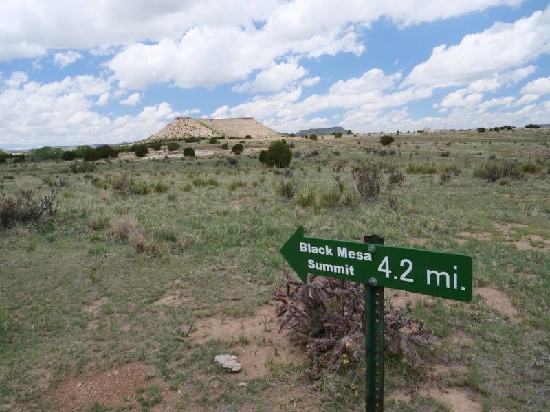
The address that gets you here is Black Mesa Trail, Kenton, OK 73946, and fair warning: the drive through the Oklahoma panhandle is just as remote as the hike itself. Kenton is a tiny town, and the trailhead sits in a wide-open landscape that feels like the edge of the world.
When I pulled up, there was a small parking area, a restroom, and a clear trailhead marker. That restroom matters more than you might think, because once you step onto the trail, there are no facilities for the entire 8.4-mile round trip.
The trailhead is open 24 hours according to official listings, but most experienced hikers strongly recommend starting at dawn to avoid the heat of the day and to give yourself plenty of daylight.
The first two miles stretch out almost completely flat across open rangeland, and the mesa you are heading toward is visible in the distance the whole time. That early view of your destination is both motivating and humbling.
The trail is well-marked and easy to follow from the very first step, which is a relief when you are standing in the middle of seemingly endless high plains country.
The Flat Opening Miles: Grassland, Sky, and Wide-Open Space
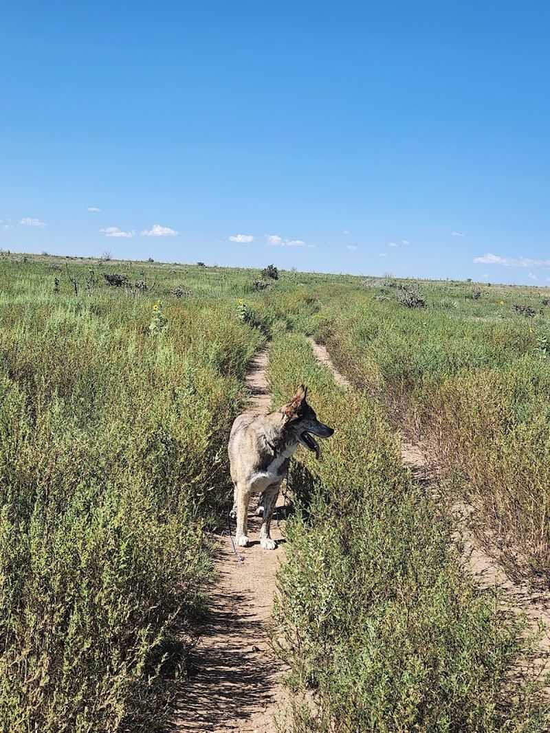
The first two and a half miles of this trail are a lesson in patience and perspective. The path rolls through open rangeland with almost no shade, and the horizon seems to go on forever in every direction.
It is the kind of landscape that makes you feel very small in the best possible way.
I spotted pronghorn antelope grazing off to the side of the trail during this section, and their speed when startled is genuinely astonishing. Keep your eyes open and your binoculars handy, because wildlife sightings are common here.
Bighorn sheep have been spotted along the mesa rim near rock formations, and the open terrain makes scanning for them surprisingly rewarding.
The trail surface during this flat section is basically a wide dirt road, easy on the feet and simple to navigate. Benches are placed roughly every mile, which gives you a chance to rest, drink water, and take in the scenery without guilt.
There is no shade from trees, so a hat, sunscreen, and plenty of water are not optional extras here. The sky above the panhandle is enormous, and on a clear morning, the light across the grassland is genuinely beautiful.
The Steep Climb Up the Mesa: Where the Real Work Begins
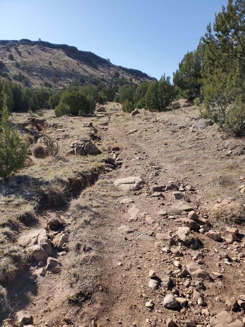
Around the 2.5-mile mark, the trail stops being polite and starts being serious. The switchbacks up the mesa face are roughly one mile long and gain about 500 feet in elevation, and that section hits your legs in a way the flat opening miles absolutely do not prepare you for.
I found myself stopping more than I expected on this climb, not just to catch my breath but to turn around and look at the view spreading out behind me. The panhandle landscape opens up dramatically as you gain altitude, and the effort of the climb starts to feel worth it before you even reach the top.
There is an emergency water box located just before the switchbacks begin, near the two-mile marker. It is good to know it exists, but every experienced hiker I talked to agreed: do not count on it being stocked.
Carry your own water, at least two to three liters per person, and more in summer. The climb itself is challenging but manageable for anyone with reasonable fitness and proper footwear.
Hiking boots with ankle support make a noticeable difference on the loose rocky surface of the switchbacks, and your future self will thank your present self for wearing them.
On Top of the Mesa: A Different World at High Elevation
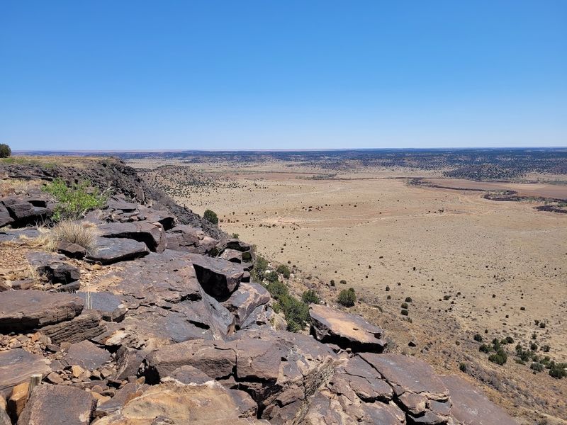
Once you crest the top of the mesa, the landscape shifts in a way that genuinely surprises you. The flat mesa surface feels like a completely different environment from the grassland below, with volcanic rock outcroppings, hardy desert plants, and a wide, windswept plateau stretching ahead.
From the top of the climb, you still have about one more mile of walking to reach the actual high point monument. That final mile across the mesa top is mostly flat, and after the switchbacks, it feels almost easy.
The trail remains well-marked, and the views in every direction are sweeping and clear on a good weather day.
The geology up here is fascinating even if you are not a rock enthusiast. Black Mesa is the remnant of ancient lava flows, and the dark basalt cap rock is what gives the mesa its name.
The contrast between the black volcanic rock and the surrounding red and tan landscape is striking and unlike anything else in Oklahoma. Keep watching the rim of the mesa for bighorn sheep, which tend to hang out near the rocky edges.
A close encounter with one of these animals near the top is the kind of moment that makes the whole hike feel like a genuine adventure rather than just exercise.
The High Point Monument: Oklahoma’s Highest Mark at 4,973 Feet
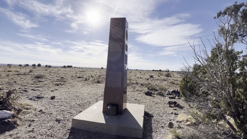
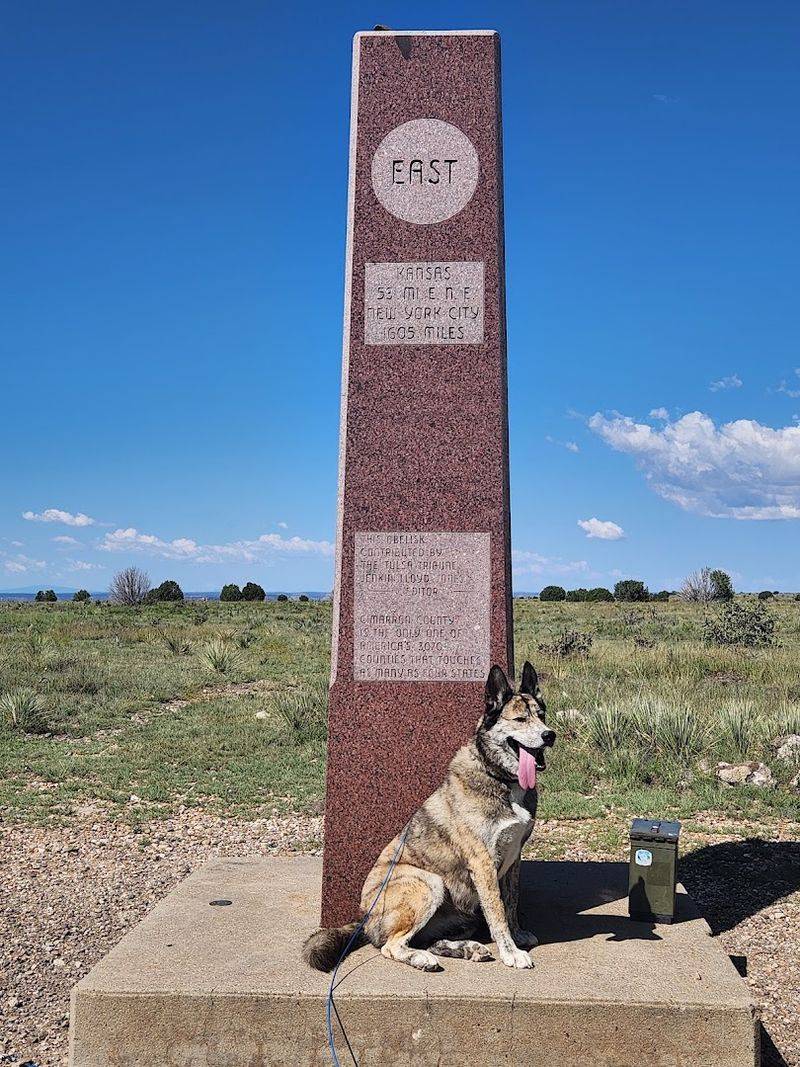
The obelisk at the summit is the kind of landmark that earns every step it took to reach it. The monument marks the official highest point in Oklahoma at 4,973 feet above sea level, and standing next to it feels like a genuine accomplishment regardless of your hiking experience level.
The obelisk itself is reportedly about 65 years old and remains in surprisingly solid condition. It is tall enough to photograph well and simple enough in design that it does not distract from the landscape surrounding it.
Most hikers spend at least 20 to 30 minutes at the summit, taking photos, resting, and soaking in the views before heading back down.
From the monument, you can see Capulin Volcano National Monument to the west in New Mexico on a clear day, which adds a remarkable multi-state dimension to the experience. A short unofficial trail heads south from the monument to a fantastic overlook that adds roughly 0.9 miles to the total distance but delivers some of the best views on the entire route.
The summit also sits at the convergence of Oklahoma, New Mexico, and Colorado, making it a genuinely rare geographic spot that most people never know exists in this corner of the Great Plains.
Wildlife You Might Meet Along the Way
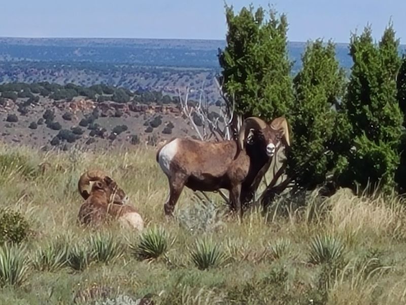
One of the underrated pleasures of this hike is the wildlife. The open terrain and remote location mean animals are present and visible in ways that more trafficked trails simply cannot offer.
Bighorn sheep are the headline attraction, often spotted along the rocky rim of the mesa near the top of the climb.
Pronghorn antelope are common in the grassland sections of the lower trail, and they are fast enough to make any wildlife photographer feel humbled. Rabbits appear frequently along the trail edges, and in certain seasons, large orange crickets show up in numbers that range from amusing to genuinely startling depending on your feelings about insects.
Bird activity is consistent throughout the hike, and the open sky makes raptor spotting particularly satisfying. Red-tailed hawks and other large birds of prey use the mesa updrafts regularly.
Bringing binoculars is not just useful for wildlife here, it genuinely upgrades the experience. The remote location means the animals are relatively undisturbed by human activity, so encounters tend to feel more natural and less staged than at busier parks.
A close-up moment with a bighorn sheep near the mesa rim is the kind of wildlife memory that stays with you long after the leg soreness fades.
Weather and Timing: Getting These Details Right Matters
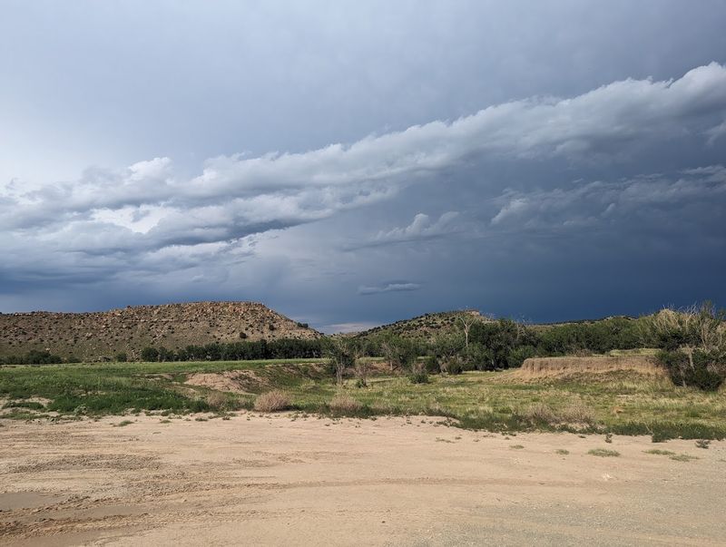
The weather on Black Mesa can change faster than you might expect, and getting caught at the top during a thunderstorm is a situation worth actively avoiding. The mesa summit is fully exposed, and lightning on an open plateau with no shelter is a serious concern that should not be dismissed.
Early spring and fall are widely considered the best seasons for this hike. Temperatures in the 50s and 60s with light winds make for near-perfect conditions, and the trail feels entirely different on a sunny day versus a cold gray one.
Summer heat is intense and unforgiving on a fully shadeless trail, and starting before 7 a.m. is practically mandatory if you visit between June and August.
Checking the weather forecast before you go is not just a good idea, it is essential planning for a trail this exposed. Wind speeds on the mesa can be dramatically higher than at the trailhead, and 30 to 40 mph gusts are not unusual in the afternoon.
The reward for good timing is extraordinary: a clear day on the mesa delivers views across three states, a sky full of stars at night from the nearby state park, and a hiking experience that feels genuinely world-class for a trail that most people outside Oklahoma have never heard of.
What to Pack: Gear and Supplies That Make the Difference
Water is the single most important thing to bring on this trail, and the general recommendation from experienced hikers is a minimum of two to three liters per person in mild weather and up to six liters per person on hot summer days. The trail offers zero natural water sources you can rely on, and the emergency water boxes along the route should be treated as backup only.
Footwear matters more than many first-time visitors expect. The switchback section up the mesa involves loose rock and uneven terrain, and shoes that lack ankle support create real problems on the descent.
Proper hiking boots are the clear choice, and the difference between a comfortable hike and an agonizing one often comes down to this single gear decision.
Beyond water and boots, the essentials are straightforward: sunscreen, a hat, snacks with real calories, a light jacket for wind at the summit, and a fully charged phone with a downloaded offline map. Trekking poles are not required but reduce knee strain on the descent noticeably.
A small first aid kit rounds things out. The trail is remote enough that self-sufficiency is not optional, and arriving prepared turns a challenging hike into a genuinely enjoyable one from start to finish.
The Night Sky and Nearby Camping at Black Mesa State Park
The hike itself is the main event, but what happens after you finish might be the best-kept secret about this area. Black Mesa State Park is roughly a 15-minute drive from the trailhead, and the night sky above the Oklahoma panhandle is genuinely spectacular in a way that few places east of the Rockies can match.
Light pollution out here is minimal to the point of being almost nonexistent. On a clear night, the Milky Way is visible with the naked eye, and the sheer number of stars overhead feels almost disorienting if you are used to city skies.
Camping at the state park the night before or after the hike turns a single-day trip into a full outdoor experience that is hard to beat.
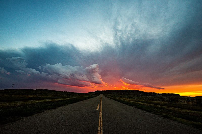
The campground is basic but functional, and the surrounding landscape at dusk has a quiet beauty that is completely different from the midday harshness of the trail. Sitting outside after a long hike, watching the sky darken and fill with stars above a mesa silhouette, is the kind of experience that does not require any additional selling.
This corner of Oklahoma earns its reputation as one of the best dark sky destinations in the central United States, and spending the night here is the natural conclusion to a day well spent on the trail.
Tips for First-Timers: Making the Most of Your Visit
A few practical details can make the difference between a great day and a rough one on this trail. Start as early as possible, especially in warmer months.
The trailhead is officially open 24 hours, but hiking in full darkness without proper lighting is genuinely unsafe, and the only restroom on the entire route is at the trailhead, so plan accordingly before you set off.
The round-trip distance of 8.4 miles with over 2,100 feet of total elevation change means the hike takes most people between four and six hours depending on pace and stops. Building in extra time is always smarter than rushing, particularly on the descent, when tired legs on rocky terrain require more care than the ascent did.
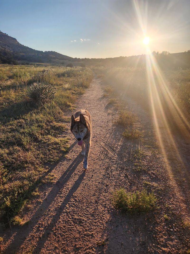
Dogs are welcome on the trail but need their own water supply and struggle with the heat and lack of shade more than humans do. If you bring a dog, watch for signs of overheating and carry more water than you think you need.
Arriving with realistic expectations and solid preparation means you will finish the hike with that particular kind of satisfaction that only comes from earning a view. The highest point in Oklahoma is out there waiting, and it rewards everyone who shows up ready for it.
Share this story