Massachusetts has a way of surprising people who think they already know it. Beyond the freedom trails and lobster shacks, the state holds mountain summits, marble gorges, coastal cliffs, and reservoir landscapes that most visitors never find.
Whether you have a free Saturday morning or a full weekend to burn, these spots deliver the kind of scenery that makes you stop walking and just look. This list covers thirteen outdoor destinations spread across the state, from the Berkshires to the Outer Cape, each one offering something genuinely worth the trip.
Mount Greylock State Reservation, Lanesborough
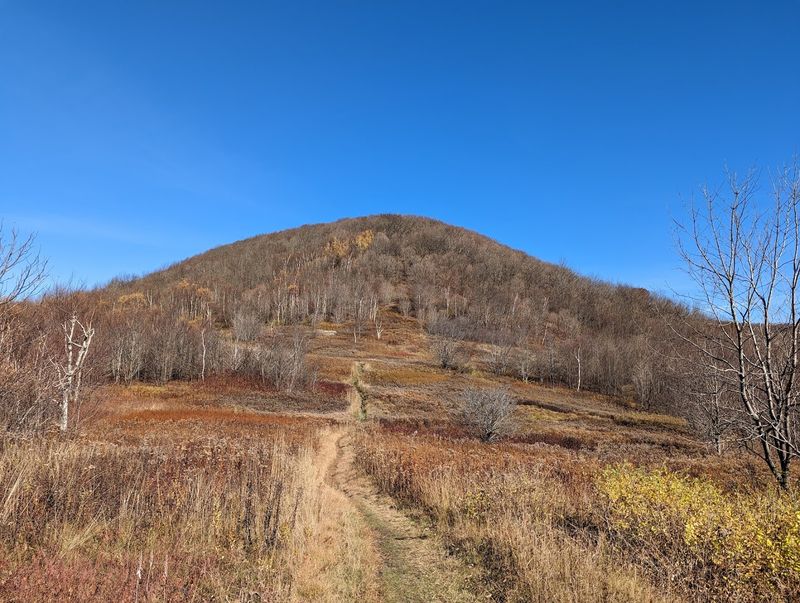
At 3,491 feet, Mount Greylock holds the title of Massachusetts’ highest point, and on a clear day, the summit delivers views that stretch across multiple states. The Berkshires spread out in every direction, and the scale of it tends to catch first-time visitors off guard.
The reservation became the state’s first official state park after land acquisition began in 1898. Today, visitors can hike through dense spruce forest, walk sections of the Appalachian Trail, or follow the Mount Greylock Scenic Byway when the seasonal summit road opens, typically from late May through late October.
A weekday heating and cooling project was scheduled at the visitor center through July 31, 2026, but trails and the broader reservation remain open for recreation. Weekday visits tend to be quieter, and early morning arrivals are rewarded with the best chances of unobstructed views before afternoon clouds roll in.
Cape Cod National Seashore, Outer Cape
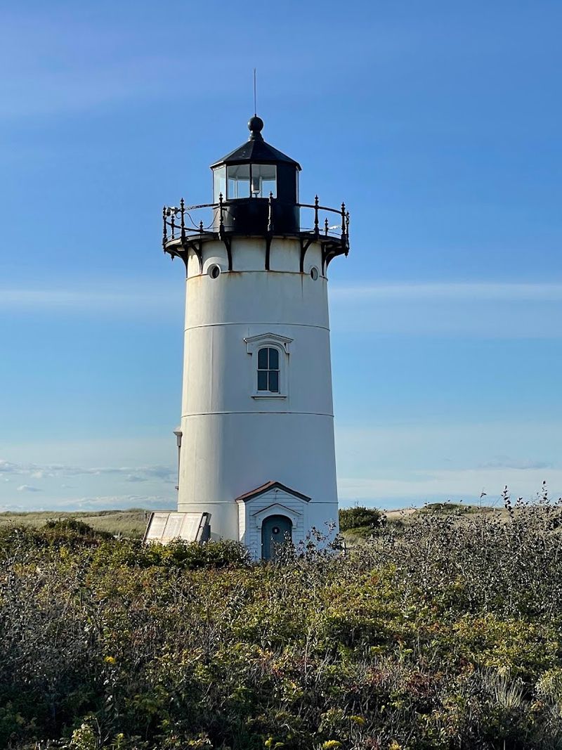
Forty miles of Atlantic shoreline protected by the federal government means Cape Cod National Seashore is one of the few places on the East Coast where the beach still looks the way it did a century ago. No boardwalks, no resort towers, just open ocean, shifting dunes, and salt marsh stretching as far as the eye can follow.
The seashore operates year-round, though summer brings the fullest range of ranger programs, open facilities, and accessible parking areas. Beaches and trails are generally open between 6 a.m. and midnight.
The Salt Pond Visitor Center in Eastham runs year-round and is a solid first stop for maps, exhibits, and current beach conditions.
Lighthouses, freshwater ponds, and wildlife viewing areas add variety beyond the main beach experience. Tide schedules and temporary closures can shift quickly here, so checking conditions before heading out makes the visit run considerably smoother.
Halibut Point State Park, Rockport
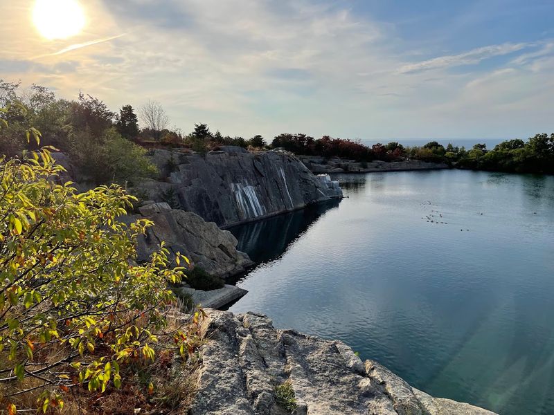
Rockport is known for its art galleries and seafood, but Halibut Point State Park is the reason some people drive all the way out to Cape Ann. The park combines an abandoned granite quarry, exposed coastal ledges, tide pools, and open Atlantic views into a compact landscape that feels genuinely rugged.
The former Babson Farm Quarry sits at the center of the park, and trails loop around it before leading toward the rocky shoreline. On an exceptionally clear day, the Isles of Shoals off New Hampshire and Mount Agamenticus in Maine are visible roughly 40 miles away.
That kind of long-distance visibility is rare along the Massachusetts coast.
World War II-era military structures on the property add a layer of history to the visit. The park is open year-round, though coastal rocks can become slippery after rain or fog.
Sturdy footwear is genuinely useful here, not just a suggestion.
World’s End, Hingham
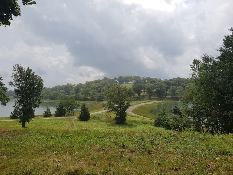
Frederick Law Olmsted designed the carriage roads here for a residential community that was planned in the 1880s and ultimately never constructed. That unbuilt neighborhood is now one of the most peaceful walking destinations on the South Shore, covering 251 acres of glacial drumlins, woodlands, meadows, and salt marsh.
From the outer hills, distant views of the Boston skyline appear across Hingham Harbor, which creates a quietly dramatic contrast between city and coast. The approximately 4.5 miles of paths accommodate walking, jogging, and seasonal cross-country skiing when conditions allow.
World’s End is open daily from 8 a.m. until sunset throughout the year. Advance parking passes are required on weekends and holidays, and the lot fills faster than most people expect.
Booking a pass ahead of time is not optional on a warm spring or fall weekend. The combination of landscape design history and genuine coastal scenery makes this one of the more distinctive reservations in the state.
Mount Sugarloaf State Reservation, South Deerfield
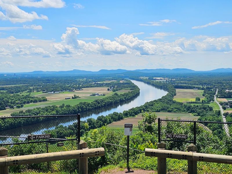
Few views in western Massachusetts match what you get from the top of Mount Sugarloaf. The Connecticut River curves through the valley below in wide, sweeping bends, and the surrounding farmland, small towns, and wooded ridges spread out in a way that rewards a slow, unhurried look.
A seasonal summit road runs from mid-May through mid-October, giving families and visitors who cannot manage a full hike the chance to reach the upper views by car. Hikers can also follow woodland trails to the top, and the summit pavilion and lawn create a natural place to settle in and take in the scenery.
Picnicking, mountain biking, and nature walks round out the available activities. The reservation becomes especially striking later in the season when agricultural fields and surrounding forests shift color across the valley.
South Deerfield sits in the Pioneer Valley, making Mount Sugarloaf a natural anchor for a longer western Massachusetts road trip.
Natural Bridge State Park, North Adams
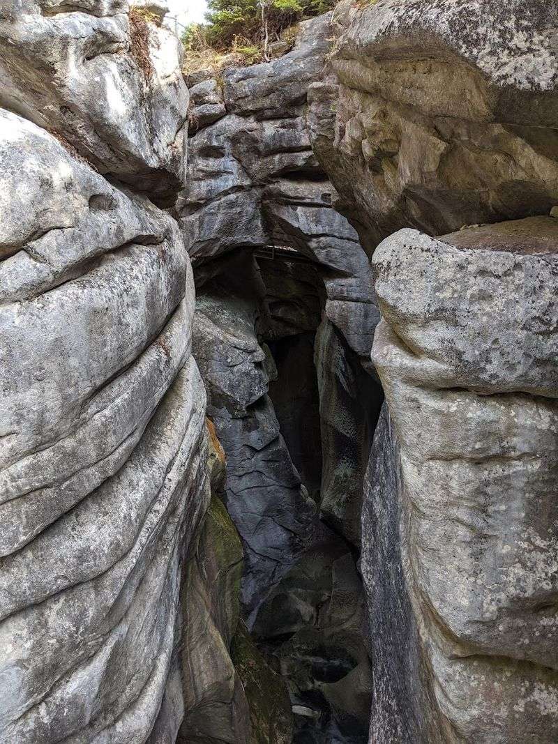
This one takes a moment to fully register. Natural Bridge State Park protects the only naturally occurring white marble arch in North America, and that distinction alone makes the short detour from North Adams worth considering.
The marble bedrock dates back approximately 550 million years, and glacial meltwater carved the gorge more than 13,000 years ago.
The arch spans Hudson Brook above a gorge roughly 60 feet deep. A self-guided route introduces visitors to both the geological formations and the site’s history as a working marble quarry.
The entire park covers only about 44 acres, so a full exploration does not require an entire day.
The visitor center, with exhibits, restrooms, drinking water, and regional travel information, operates daily from late May through mid-October. Natural Bridge pairs easily with a visit to the Massachusetts Museum of Contemporary Art nearby.
For a Berkshires weekend that balances art, history, and geology, this park fills an interesting gap in the itinerary.
Purgatory Chasm State Reservation, Sutton
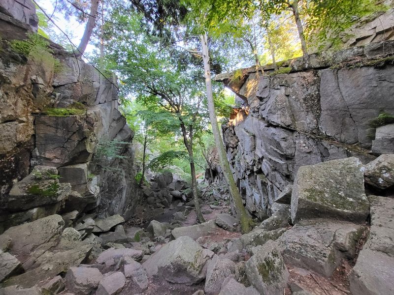
The name alone raises questions, and the landscape delivers on the intrigue. Purgatory Chasm is a quarter-mile stretch of massive boulders, tight passages, steep granite walls, and formations with names like The Coffin and Lovers’ Leap.
It reads more like a geology puzzle than a traditional hiking trail.
Sturdy footwear is a practical necessity here, not a casual recommendation. Rocks can become seriously slippery after rain, and the terrain inside the chasm requires careful footing throughout.
The main Chasm Trail closes during winter because of hazardous conditions, though surrounding reservation trails remain accessible.
During the warmer months, the reservation also offers picnic space and interpretive programs, making it possible to combine the rocky exploration with a more relaxed afternoon. The reservation is generally open from sunrise to sunset.
Families with younger children may find the outer trails more manageable than pushing through every tight section inside the chasm itself.
Quabbin Reservoir, Belchertown and Ware
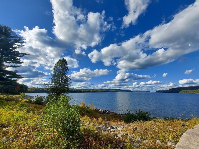
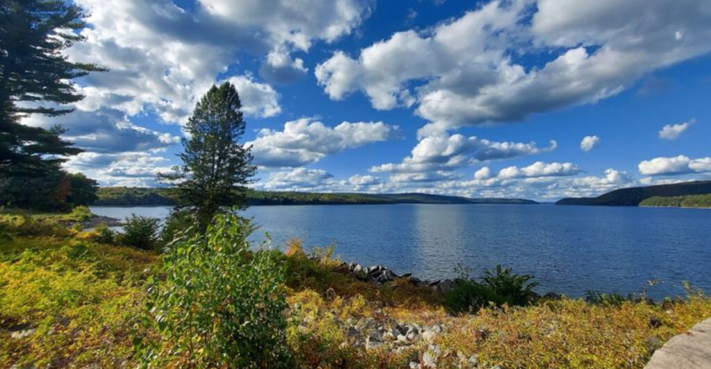
Quabbin Reservoir is one of those places that puts the scale of central Massachusetts into perspective. Covering approximately 39 square miles and holding around 412 billion gallons of water, it is one of the largest domestic water supplies in the United States.
The shoreline alone stretches roughly 181 miles.
Because the reservoir serves as a major drinking-water source, recreational access is carefully managed. Visitors can explore designated roads, overlooks, gate areas, and walking routes around the watershed.
The area near Winsor Dam and the Les and Terry Campbell Quabbin Visitor Center is a practical starting point, with exhibits covering both the natural landscape and the history of the towns that were disestablished to create the reservoir.
Public programs in 2026 include guided walks and watershed tours. Most designated public areas are accessible from one hour before sunrise until one hour after sunset.
Wildlife sightings, including bald eagles, are a genuine possibility throughout the year.
Wachusett Mountain State Reservation, Princeton
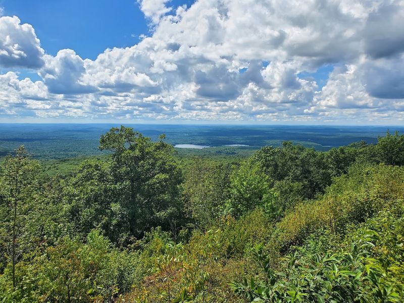
Central Massachusetts does not always get credit for its outdoor scenery, but Wachusett Mountain makes a strong case. The 2,006-foot summit sits at the center of a 3,000-acre reservation and offers a panoramic view that can reach distant hills and city skylines under clear conditions.
Trail options range from shorter introductory routes to more demanding climbs toward the summit. Seasonal automobile access makes the upper views available for visitors who cannot complete a full mountain hike on foot.
The John Hitchcock Visitor Center operates daily, though staffing and hours can vary depending on weather and season.
Exhibits inside the visitor center cover the mountain’s glacial history, local geology, wildlife, and its long relationship with surrounding communities. In winter, Wachusett Mountain Ski Area operates on the same property, adding a seasonal dimension that few other state reservations can match.
It is a genuinely versatile destination across multiple seasons.
Blue Hills Reservation, Milton
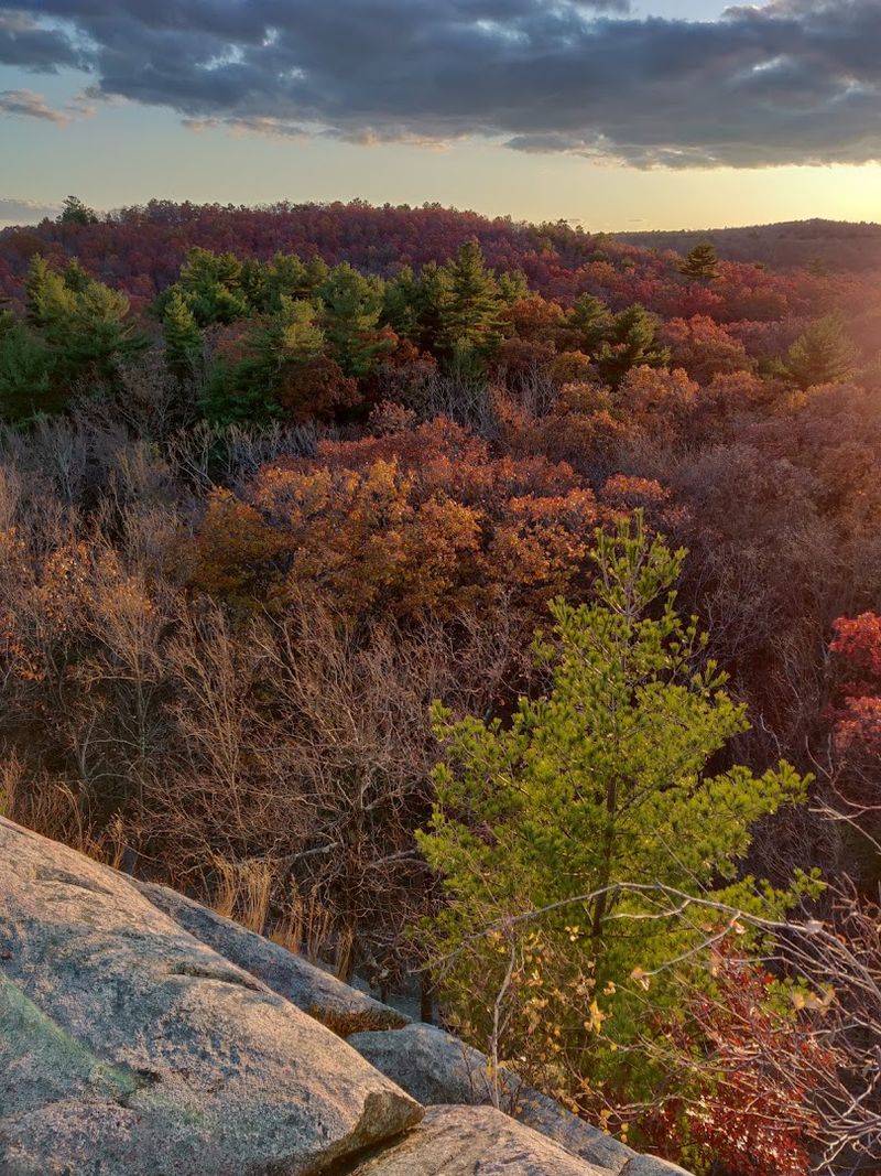
More than 7,000 acres of forests, ridges, wetlands, and ponds sitting just south of Boston is the kind of thing that surprises people who assume the city’s outskirts are mostly suburbs. Blue Hills Reservation is one of the largest open spaces in Greater Boston, and it delivers real outdoor scenery without requiring a long drive.
Great Blue Hill, at 635 feet, is the highest point in the chain, and its rocky summit provides a broad overlook of the metropolitan area. The reservation contains over 125 miles of trails covering everything from flat pond-side walks to challenging ridge routes.
Mountain biking, horseback riding, and winter recreation are also available depending on the season.
Houghton’s Pond offers a relaxed alternative for visitors who want a picnic or a calm afternoon near the water. The trail network is extensive, and intersections can be genuinely confusing, so carrying an official reservation map before setting out is a smart move.
Mohawk Trail State Forest, Charlemont
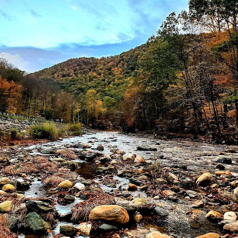
Six thousand acres of mountain ridges, river valleys, and deep forest in western Massachusetts create a setting that feels considerably more remote than the drive in would suggest. Mohawk Trail State Forest is one of those places where the trees are old enough and the terrain rugged enough to make the surrounding world feel genuinely far away.
Hiking, picnicking, nature study, and overnight camping options are available throughout the property. Trails range from manageable family walks along the Cold River corridor to more demanding climbs up surrounding ridges.
Interpretive programs scheduled during summer 2026 cover wildlife, forest ecology, and the history of Civilian Conservation Corps work completed here during the 1930s.
Visitors can also connect with sections of the Mohican-Mohawk Recreational Trail, which follows a historically significant travel route through the region. The forest pairs naturally with nearby Berkshires destinations, making it an anchor for a fuller weekend rather than a quick afternoon stop.
Maudslay State Park, Newburyport
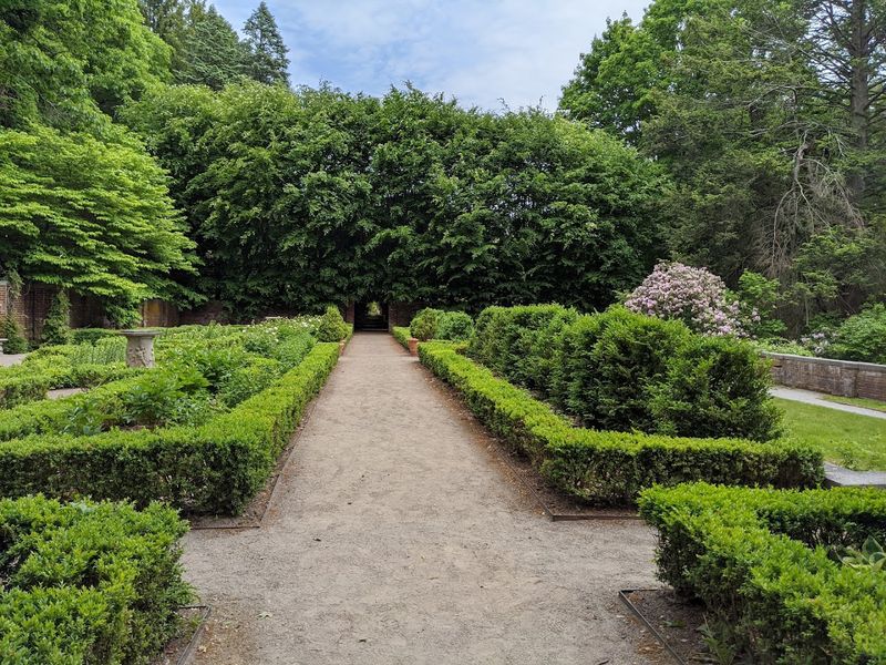
Maudslay does not announce itself with dramatic cliffs or sweeping summit views. What it offers instead is a slower kind of beauty, the kind that comes from walking through a former 19th-century estate where ornamental plantings, towering pines, rolling meadows, and views near the Merrimack River have had more than a century to settle into something genuinely lovely.
The park’s most notable natural feature is a large, naturally occurring stand of mountain laurel that puts on a remarkable display during its blooming season. Beyond that seasonal highlight, the grounds accommodate walking, bicycling, horseback riding, and picnicking throughout the year.
Shaded woodland paths and broad open lawns make Maudslay accessible and comfortable for visitors who prefer a relaxed outing over a strenuous climb. Current facilities include picnic areas and restrooms, and summer programs add guided activities for families.
Newburyport’s downtown is close enough to combine both into one easy day trip along the North Shore.
Bash Bish Falls State Park, Mount Washington
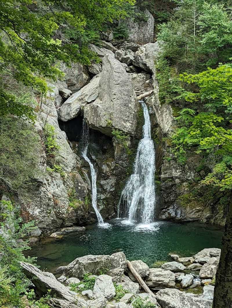
Massachusetts’ largest waterfall does not make itself easy to reach, and that is part of what makes arriving feel worthwhile. Bash Bish Brook drops roughly 60 feet into a clear emerald pool at the base, surrounded by steep forested slopes and rock formations that frame the scene without any assistance from park designers.
Two approach routes exist. The Massachusetts trailhead offers a shorter trip at approximately 0.6 miles round trip, but the terrain is rugged and strenuous.
The route from Taconic State Park in New York is longer at around 1.5 miles round trip, with a more gradual grade. Both paths involve rocky, uneven ground throughout.
Parking at the Massachusetts trailhead is limited, and roadside parking is not permitted, so weekend visitors should arrive early or have an alternate plan ready. The park is open from sunrise to sunset, with portable restrooms typically available from May through mid-October.
Plan accordingly and the payoff is real.
Share this story