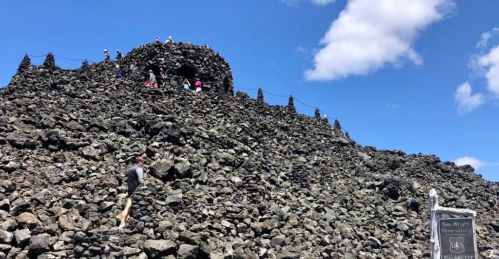
There is a place in Oregon where the ground looks so alien that NASA once used it to prepare astronauts for walking on the moon. A stone tower rises from a sea of jagged black lava, surrounded by snow-capped peaks that seem to float above the volcanic rubble.
The road to get there winds through scorched forest and ancient geology, and the views from the top are the kind that make you stop mid-sentence. Whether you are a history buff, a geology nerd, or just someone who loves a good road trip surprise, this place delivers something genuinely hard to forget.
Where Exactly You Will Find This Lava-Locked Landmark
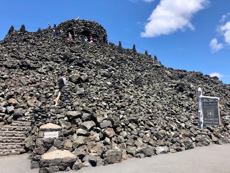
The address for Dee Wright Observatory is McKenzie Hwy, Blue River, OR 97413, right at the summit of McKenzie Pass in the Willamette National Forest. The GPS coordinates put you at an elevation of roughly 5,325 feet, which means the air is thinner, the wind is sharper, and the scenery is absolutely worth every hairpin turn you navigated to get there.
The observatory sits along Oregon Highway 242, also known as the Old McKenzie Highway, a seasonal road that closes each winter due to snow. Coming from the town of Sisters to the east, the drive is freshly paved and takes you through stretches of forest that tell a story of wildfire recovery and natural resilience.
From the west, the route follows the McKenzie River corridor through the Deschutes National Forest, offering its own dramatic scenery. The parking lot holds 30 or more vehicles comfortably, and there is no admission fee to visit.
Cell service disappears well before you arrive, so download your maps ahead of time and enjoy the digital detox that comes with the territory.
The Story Behind the Stone Tower
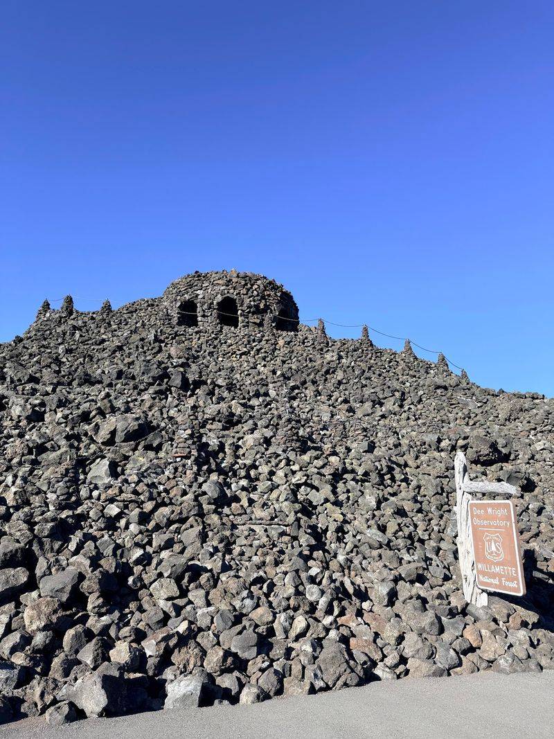
Built in 1935 by the Civilian Conservation Corps, the observatory was named after Dee Wright, a packer and guide who spent years leading expeditions through the Cascades. Wright passed away during the construction of the road through McKenzie Pass, and the tower was dedicated in his memory as a tribute to his deep knowledge of this rugged landscape.
The CCC workers crafted the entire structure from local lava rock, which means the building itself is made from the same volcanic material that surrounds it. Every stone was hand-placed, and the craftsmanship has held up remarkably well for nearly a century.
The result looks almost medieval, with thick walls, narrow windows, and a silhouette that one visitor compared to Castle Grayskull from an old cartoon.
The construction process was no small feat given the remote location and the challenging terrain. Workers had to haul materials and tools up a winding mountain road with limited equipment.
The finished tower stands as a lasting reminder of what skilled labor and determination can produce, even in the middle of a volcanic wasteland that looks like it belongs on another world entirely.
The NASA Connection That Makes This Place Legendary
Few roadside stops in America can claim a NASA training connection, but Dee Wright Observatory and the surrounding lava fields at McKenzie Pass genuinely can. Before the Apollo missions, NASA scientists and astronauts visited volcanic landscapes across the American West to study geology and prepare for what they might encounter on the lunar surface.
The McKenzie Pass lava fields were among the sites used for this kind of field preparation because the terrain closely resembles the moon’s cratered and rocky surface. The sprawling black basalt, the lack of vegetation across large stretches, and the raw geological formations made this area a practical classroom for space exploration training.
Standing in the middle of those lava fields today, it is easy to understand why scientists chose this spot. The ground stretches out in all directions in jagged, uneven formations that look completely otherworldly.
You half expect to see a rover rolling past. The lava here came from eruptions that occurred relatively recently in geological terms, around 3,000 years ago, meaning what you are walking on is a very fresh chapter in Earth’s volcanic history, which is both fascinating and slightly humbling to consider.
What You See From the Top of the Observatory
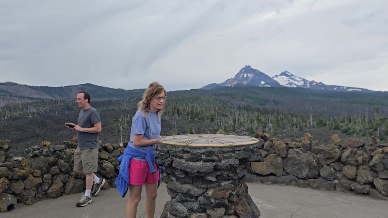
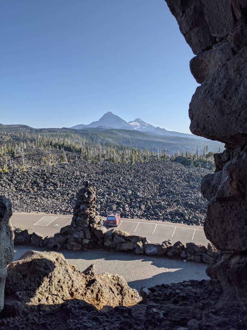
Climbing the spiral stone staircase inside the observatory brings you to a rooftop platform that offers one of the most complete mountain panoramas in all of Oregon. On a clear day, the peaks visible from up here include the Three Sisters, Mount Washington, Mount Jefferson, Black Crater, and Belknap Crater, all laid out in a sweeping arc around the summit.
At the center of the rooftop platform sits a brass compass rose that identifies each peak by name and distance. This detail transforms the view from simply beautiful to genuinely educational, because you can orient yourself and understand exactly what you are looking at rather than just admiring a blur of distant mountains.
Inside the tower walls, narrow window slots were built with specific peaks in mind. Each opening frames a different mountain, and small labels identify the view, though some of those labels have faded over the years and could use a refresh.
The thoughtfulness built into the observatory’s design shows that the people who constructed it wanted visitors to truly understand the landscape, not just glance at it and move on. Every angle from up top offers something worth pausing for.
The Lava Flow Trail That Circles the Observatory
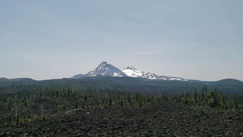
A paved interpretive trail loops around the lava fields near the observatory and covers just over a mile in total distance. The trail gains about 148 feet in elevation along the way, making it manageable for most fitness levels while still giving you a genuine sense of the volcanic terrain.
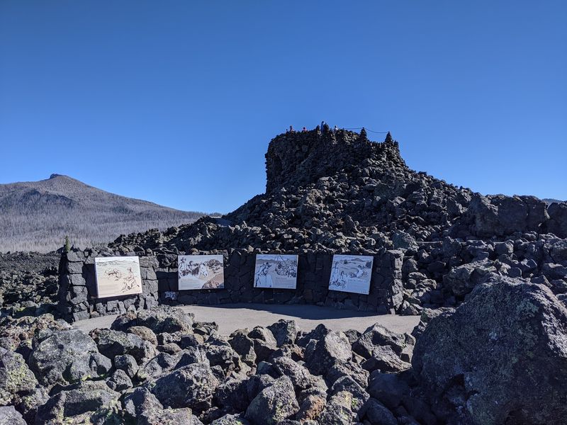
Along the path, informational kiosks and signs explain the geology of the lava flow, the history of the McKenzie Pass area, and the slow process by which vegetation is gradually reclaiming the rock. You can clearly see small islands of trees and shrubs that survived the original lava flow because the molten rock flowed around them rather than over them.
These tree islands are called kipukas, and spotting them gives you a real visual of how the eruption moved across the landscape thousands of years ago.
The trail is paved, which makes it accessible for families with younger children, though a few uneven sections mean that visitors with mobility concerns should proceed carefully since the path is not fully ADA compliant throughout. Bring plenty of water because there is almost no shade on the lava fields, and the sun reflects off the dark rock intensely.
Two people can easily go through a full gallon of water on a warm day out there.
What the Landscape Actually Looks and Feels Like
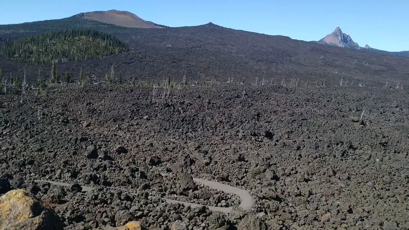
The first thing that hits you when you step out of your car at McKenzie Pass is the sheer scale of the lava field. Black rock stretches in every direction, broken and jagged, with almost no soil visible between the formations.
The silence is remarkable too, because the lava absorbs sound in a way that makes the whole area feel hushed and remote.
The rock itself is basalt from volcanic eruptions that geologists date to approximately 3,000 years ago, which makes this one of the younger lava fields in the continental United States. The fact that so little vegetation has grown back in three millennia tells you something important about how harsh the conditions are up here, with thin soil, extreme temperature swings, and a short growing season.
On overcast days, the landscape takes on an eerie, almost cinematic quality. The charred forest sections visible from the trail add to the atmosphere, left behind by wildfires that have moved through the area in recent years.
Some visitors find the burned trees haunting while others find them beautiful in a stark, skeletal way. Either reaction makes sense because this landscape operates on its own terms, completely indifferent to human expectations of what nature should look like.
When to Visit and What the Weather Does Up Here
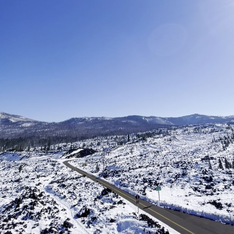
The road to McKenzie Pass and the observatory itself are only open seasonally, typically from late spring through early October, depending on snowfall. The gate closes for winter, and the exact opening date varies each year, so checking with the Willamette National Forest website or calling ahead before your trip is genuinely worth the effort.
Summer visits bring the warmest temperatures, but even in July and August the summit can be cool and breezy. The elevation means you should always pack a layer or two more than you think you need.
Rain can arrive without much warning, and the clouds that roll in actually add a moody, atmospheric quality to the lava fields that many visitors find more striking than a standard sunny day.
Fall visits before the road closes offer their own rewards. One visitor arrived on October 7th to find temperatures of 34 degrees, fresh snow on the ground, and almost no other people around.
The combination of snow on black lava with mountain peaks in the background created a scene that photographs could not fully capture. If you can handle the chill and dress in proper layers, a late-season visit to this summit rewards you with solitude and scenery that feels genuinely private and special.
Practical Tips for the Drive Up McKenzie Pass
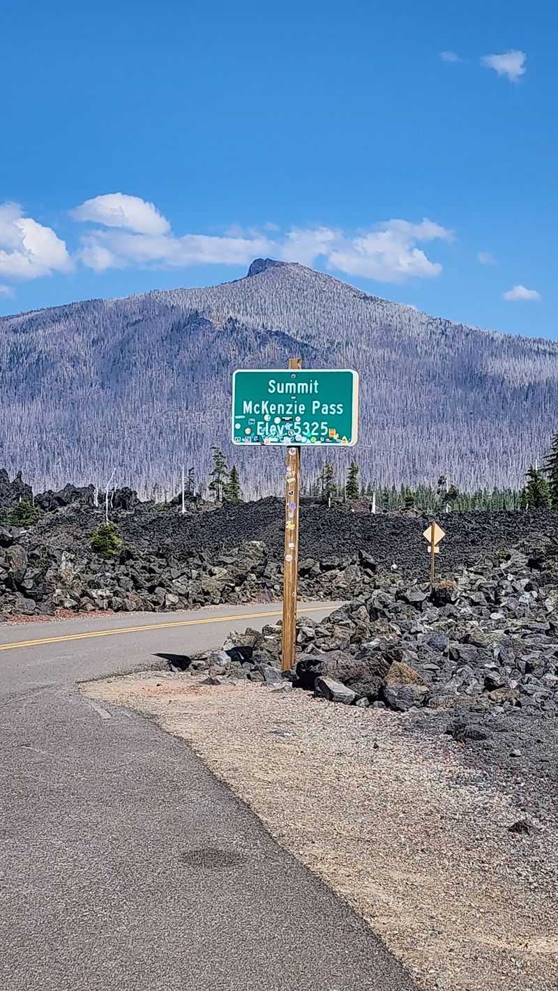
The road to the observatory is not the kind of highway you cruise on autopilot. Oregon Highway 242 is narrow, winding, and has minimal shoulders in many sections.
Sharp switchbacks and occasional single-lane stretches mean you need to stay focused and drive at a reasonable pace, especially if you are not used to mountain roads.
RVs and large trailers are not permitted on this route, full stop. The road simply cannot accommodate them safely, and signs at the entrance make this restriction clear.
Passenger cars and smaller vehicles handle the drive just fine as long as the driver stays alert and takes the curves at an appropriate speed.
Night driving on this road is not recommended. The darkness combined with the narrow lanes, no cell service, and the possibility of wildlife crossing makes evening travel a genuine challenge even for experienced drivers.
Plan to arrive during daylight hours and give yourself plenty of time to explore without rushing back down the mountain in fading light. The drive from Sisters takes you through freshly paved stretches that make the approach feel smoother than the reputation suggests, but respect for the road is still very much required from start to finish.
Activities Beyond the Observatory Itself
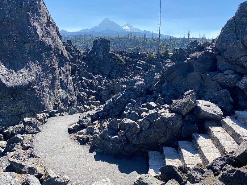
The observatory and its interpretive trail are the main attraction, but the surrounding area offers more for visitors who want to extend their time at McKenzie Pass. Several trailheads branch off from the highway nearby, leading into the Cascades for longer hikes with more elevation gain and deeper wilderness access.
Cyclists also make the trip up McKenzie Pass regularly, and the 13-mile climb from Sisters is a genuine physical test that rewards the effort with views that unfold gradually as you gain elevation. The route is popular enough that you will likely share the road with a few cyclists on any given summer weekend, so drivers should give them plenty of space.
After coming down from the pass, the McKenzie River corridor to the west offers picnic spots, viewpoints, and easy access to Clear Lake, where you can sit near the water and decompress after the intensity of the lava fields. The lake itself sits above a lava bed, and its water is exceptionally clear and cold, fed by springs rather than runoff.
The whole corridor from the summit down to the river valley feels like a complete outdoor day that covers geology, history, scenery, and quiet forest time all in a single outing.
Why This Stop Earns Its Near-Perfect Rating
With a 4.9-star rating across more than 1,300 reviews, this observatory punches well above its weight as a roadside attraction. There is no ticket booth, no gift shop, and no admission fee, which means every person who rated it that highly did so purely based on the experience the place delivers on its own merits.
What makes it work is the combination of things happening at once. The volcanic geology is genuinely rare and visually striking.
The hand-built stone tower has real historical character and a moving backstory. The mountain panorama from the top is legitimately one of the best in Oregon.
And the NASA training connection adds a layer of cool that you do not expect from a small stone building on a mountain pass.
The experience also scales well depending on how much time and energy you bring. A quick 30-minute stop gives you the tower views and a feel for the lava fields.
A two-hour visit lets you walk the full interpretive trail, read every sign, and sit quietly on the rocks long enough to really absorb where you are. Either way, this is the kind of place that people mention for years after visiting, and that kind of staying power is earned, not given.
Share this story