There is a stretch of high desert in southeastern Oregon where the ground tells a story that most people never get to read. Thousands of years ago, basalt lava poured across this landscape in nearly every way that geology allows, and the evidence is still sitting right there on the surface, waiting.
The result is a 17,000-acre outdoor classroom packed with cinder cones, lava domes, maars, lava tubes, and shield volcanoes, all within a single looping drive. Few places in the United States let you witness so many different eruption styles in one compact area, and the fact that it stays wide open around the clock makes it even more remarkable.
Pack a map, bring plenty of water, and get ready for one of the most geologically rich road trips Oregon has to offer.
Where on Earth You Actually Are
Diamond Craters Outstanding Natural Area sits on Lava Beds Road near the small community of Diamond, Oregon 97722, deep in Harney County in the southeastern corner of the state. The Bureau of Land Management oversees this 17,000-acre preserve, and you can reach them at +1 541-573-4400 or visit their official site at https://www.blm.gov/visit/diamond-craters-outstanding-natural-area.
Getting here is part of the adventure. The area lies roughly eight miles northwest of the town of Diamond, accessible via Highway 205 from Burns or Highway 78 from Crane.
Neither route feels like a quick errand run, so fuel up and plan your timing carefully.
The preserve is open 24 hours a day, every day of the year, with no entry fee. There are no restrooms, no food vendors, and no cell service to speak of.
The remoteness is real, but that same isolation keeps the landscape raw, unfiltered, and completely worth the drive out here.
The Geological Backstory Behind This Landscape
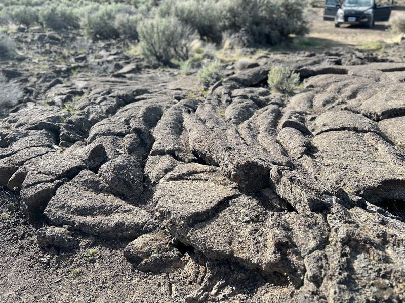
About 25,000 years ago, a series of basalt eruptions reshaped a broad section of Oregon’s high desert in ways that geologists still find remarkable today. What makes Diamond Craters so special is not just that it had volcanic activity, but that it managed to produce nearly every known style of basalt eruption within a single, compact area.
Most volcanic fields specialize in one or two eruption types. This one delivered cinder cones, lava domes, maars, shield volcanoes, lava tubes, and multiple lava flow styles all within the same 17,000 acres.
That kind of variety in such a concentrated space is genuinely rare on a global scale.
The BLM officially designated the area as Outstanding Natural Area specifically because of this geological diversity. Scientists and educators use it as a field study site because the features are well-preserved and accessible by vehicle or short walk.
The surface has not been heavily altered, so what you see today closely mirrors what solidified thousands of years ago when the last flows finally cooled and stopped moving.
Cinder Cones Rising From the Desert Floor
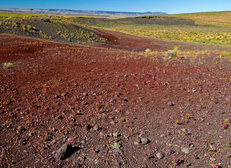
Cinder cones are the most recognizable feature at Diamond Craters, and they are hard to miss once you start the loop drive. These steep-sided hills formed when gas-charged lava fragments blasted into the air, cooled quickly, and rained back down around the vent opening.
The cinders, which are small, porous chunks of volcanic rock, piled up fast during eruptions. Some cones here rise noticeably above the surrounding desert floor, giving you an elevated vantage point if you are willing to scramble up the loose, gravelly slopes on foot.
The reddish and dark brown tones of the cinder material contrast sharply with the pale desert sage below, making these cones visually striking even from a distance. Each one represents a distinct eruptive episode, and the BLM brochure assigns numbered markers to each major feature so you can match what you see to a written explanation.
Standing at the base of one of these cones and looking up at the angular, jagged cinders stacked overhead gives you a concrete sense of the energy that built this landscape so many thousands of years ago.
Maars: The Craters That Fill With Water
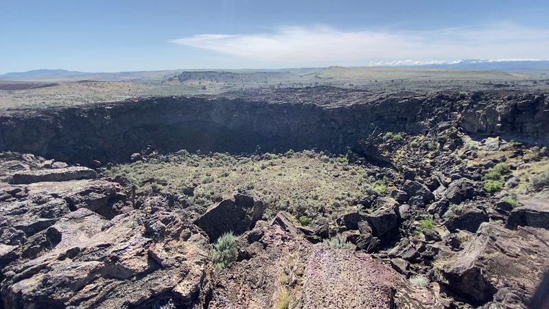
Maars are one of the more unusual features at Diamond Craters, and they form through a completely different process than cinder cones. When rising magma meets groundwater or surface water, the resulting steam explosion can be violent enough to blast a wide, shallow crater into the earth without building much of a cone above the surface.
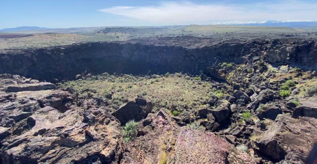
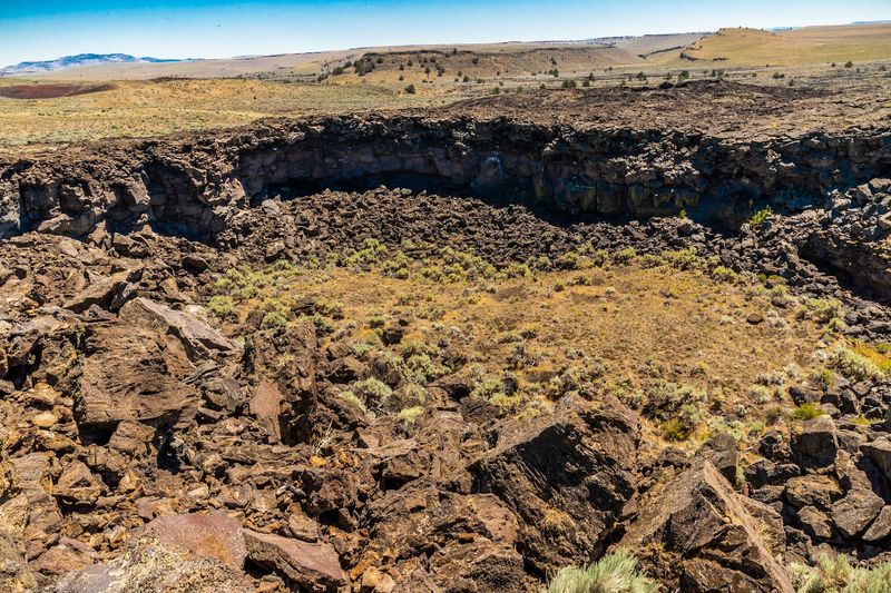
The Malheur Maar, located at stop 10 on the numbered driving tour, holds water and presents a striking contrast to the dry volcanic rock surrounding it. Just about 400 yards away, the Dry Maar shows what these depressions look like when no water has collected inside, giving you a side-by-side comparison of the same feature in two different states.
The low rim of fragmented rock surrounding each maar is a telltale sign of how the explosion ejected material outward rather than building upward. Maars are found in volcanic fields worldwide, but having two so close together and in such different conditions makes this particular spot a genuinely useful teaching example.
A short walk out to the rim of either maar rewards you with a perspective on volcanic geology that most people never encounter in person.
Lava Domes and Shield Volcanoes on the Same Loop
Not every volcanic feature here explodes dramatically upward. Lava domes and shield volcanoes form through quieter, slower processes where fluid lava oozes out steadily and spreads across the landscape in broad, low-profile mounds rather than building tall steep peaks.
The shield volcanoes at Diamond Craters are small compared to the massive Hawaiian examples most people picture, but they demonstrate the same basic mechanics. Thin, runny basalt lava flowed outward from a central vent over time, creating a gently sloping shape that resembles a warrior’s shield lying flat on the ground.
Lava domes, by contrast, form when thicker, slower-moving lava piles up close to the vent instead of flowing far. Both features sit within the Diamond Craters loop and are marked with numbered posts that correspond to the brochure description, so you can read exactly how each one formed.
Seeing a cinder cone, a maar, a lava dome, and a shield volcano all within a single afternoon drive is the kind of geological cross-section that textbooks describe but rarely deliver so neatly in real life, and this area does it without any admission charge.
Lava Tubes Hidden Beneath the Surface
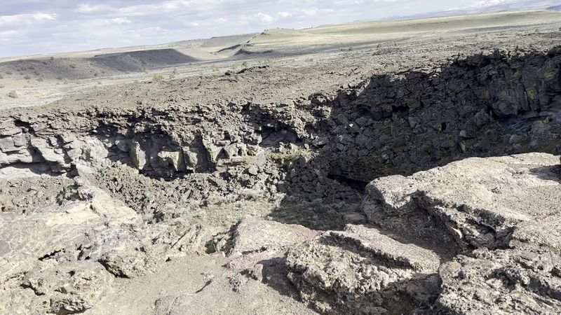
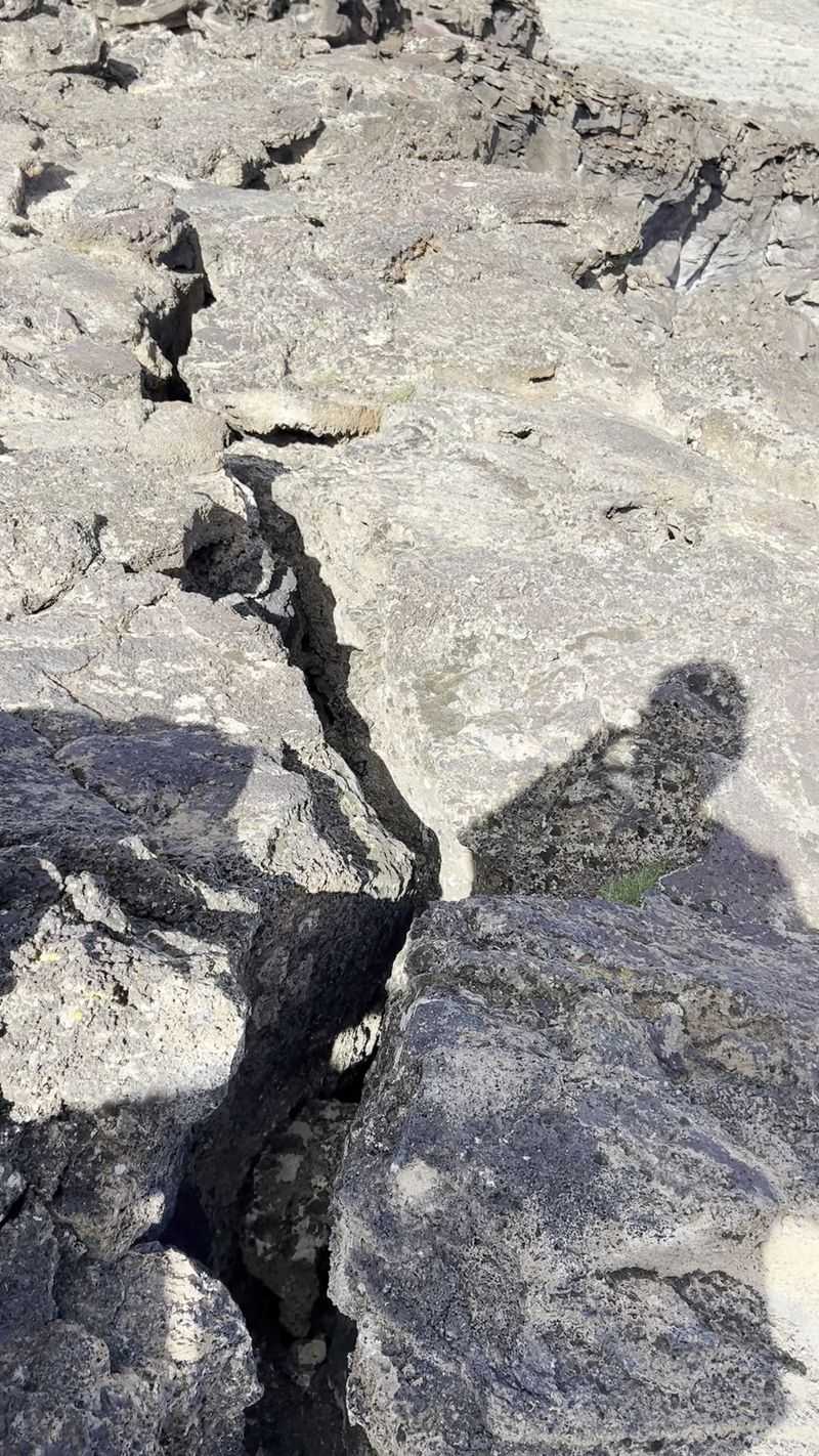
Beneath the surface of Diamond Craters, a network of lava tubes adds another layer to the area’s geological variety. Lava tubes form when the outer crust of a flowing lava stream cools and hardens while molten rock continues to flow through the interior, eventually draining out and leaving a hollow tunnel behind.
Some of these tubes have partially collapsed, creating pit craters and open sections that you can peer into from above. The darkness inside these openings gives a real sense of the scale and structure of the tunnels that once carried lava across this landscape.
Exploring near lava tube entrances requires careful footing, since the surrounding basalt can be uneven and sharp-edged. The BLM brochure identifies key tube locations along the loop route, and numbered posts guide you to spots where the geology is most visible and accessible.
Lava tubes are found in volcanic regions around the world, from Iceland to Hawaii, but the ones at Diamond Craters formed from the same basalt eruptions that created all the other features on this loop, making them part of a single, connected volcanic episode rather than a separate event entirely.
The Self-Guided Driving Tour and How to Navigate It
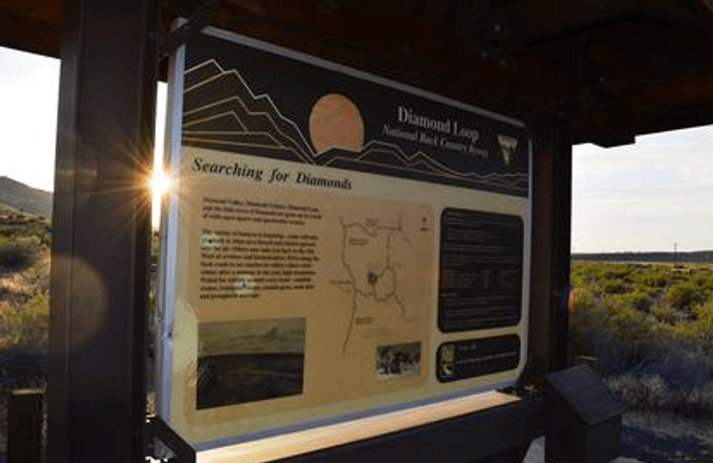
The primary way to experience Diamond Craters is through a self-guided driving loop that winds through the preserve on hard-packed dirt roads. Brown numbered posts mark each major geological feature along the route, and each number corresponds to a description in the official BLM brochure that explains what you are looking at and how it formed.
Getting the brochure before you arrive makes an enormous difference. Visitors who show up without one often find the numbered posts confusing, since the signage on-site is minimal by design.
The brochure is available at the Round Barn Visitor Center, the Frenchglen Mercantile, and sometimes at the BLM Burns District Office, so plan your pickup accordingly.
The roads are not paved, and some sections include dead ends, so a vehicle with decent clearance helps. That said, careful drivers in standard cars have completed the loop without serious trouble.
The full tour covers multiple stops and can take anywhere from two hours to a full day depending on how much time you spend walking out to individual features.
Downloading or printing a backup map before leaving cell service range is a smart move, since navigation apps become unreliable once you are deep in Harney County’s remote high desert terrain.
What to Bring and How to Prepare for the Visit
Preparation is not optional at Diamond Craters. The area has zero facilities, meaning no restrooms, no drinking water, no food stands, and no rangers stationed on-site during your visit.
The nearest towns are small and spread out, so arriving self-sufficient is the only reliable strategy.
Water is the most critical supply. The high desert sun in southeastern Oregon can be intense, especially between late spring and early fall, and the open terrain offers almost no shade.
Bringing at least two liters of water per person, plus extra for emergencies, is a reasonable baseline for a half-day visit.
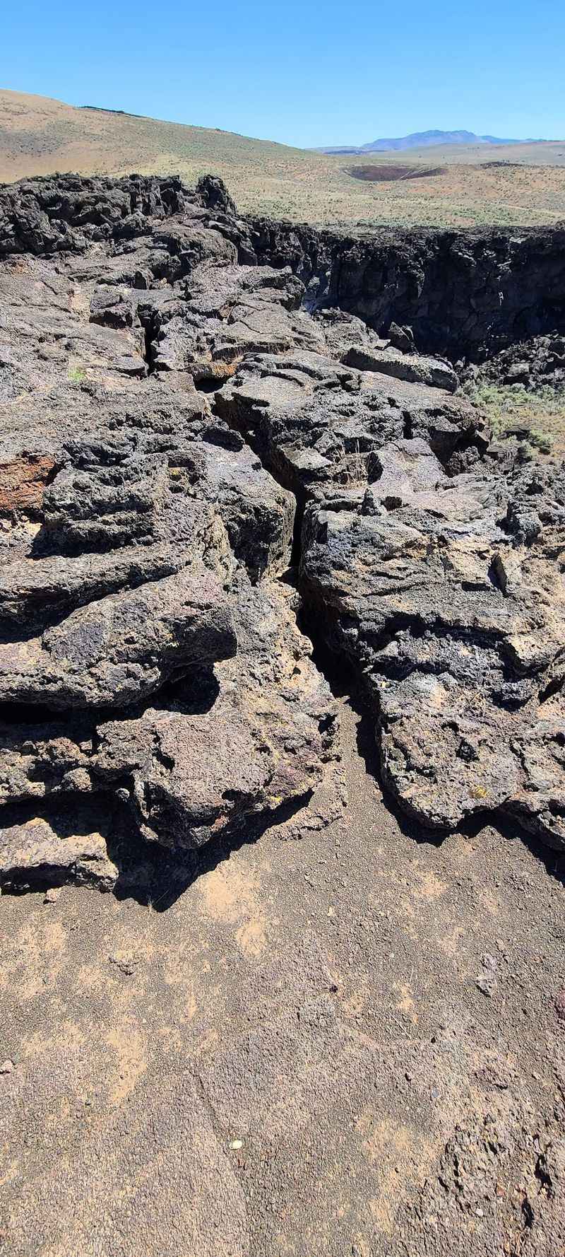
Sturdy footwear matters too. Basalt lava rock is rough, uneven, and can have sharp edges, particularly near lava tube entrances and cinder cone slopes.
Lightweight hiking shoes or trail runners with good grip handle the terrain much better than sandals or casual sneakers.
A printed map, a camera with extra battery power, sunscreen, and a basic first aid kit round out a solid packing list. Cell service is essentially nonexistent in this part of Harney County, so downloading offline maps and informing someone of your plans before heading out are both genuinely useful precautions rather than just cautious suggestions.
Wildlife and the Broader Landscape Around the Craters
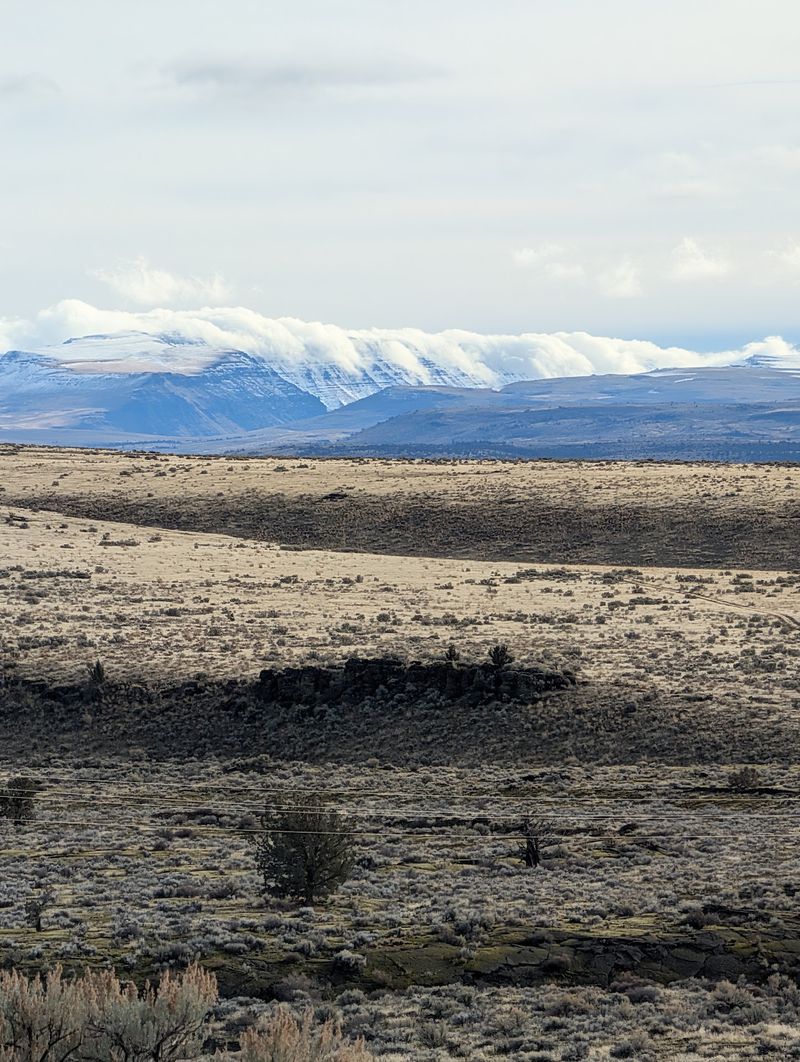
The volcanic geology gets most of the attention at Diamond Craters, but the surrounding high desert ecosystem is genuinely worth noticing on its own terms. Harney County is one of the largest counties in the continental United States, and much of it remains open, undeveloped rangeland that supports a diverse mix of wildlife.
Pronghorn antelope move through the area regularly, and their speed across the open terrain is something you notice immediately when a group decides to cross the road ahead of your vehicle. Sage grouse, various raptors, and a long list of migratory bird species also use this landscape throughout the year.
The sagebrush steppe surrounding the craters has its own quiet beauty that complements the volcanic features rather than competing with them. In spring, wildflowers push up through the volcanic soil, adding unexpected color to a landscape that looks almost monochromatic in summer.
Malheur National Wildlife Refuge sits nearby to the north, and combining a visit to Diamond Craters with a morning at Malheur creates a full-day itinerary that covers both geological and ecological wonders without requiring a long additional drive from your base in the Burns or Frenchglen area.
Best Times to Visit and Closing Thoughts on the Experience
Late spring and early fall offer the most comfortable conditions for exploring Diamond Craters. May and September tend to bring moderate temperatures, manageable wind, and enough daylight to complete the full loop without rushing.
Summer visits are absolutely possible but require earlier start times to avoid the peak midday heat in the open desert.
Winter access depends on road conditions, and the unpaved loop roads can become impassable after heavy rain or snow. Checking with the BLM Burns District Office before a winter or early spring visit is a practical step that can save you a long drive out to a closed or muddy road.
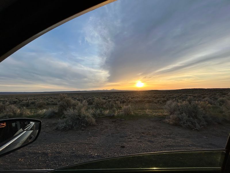
The area is open 24 hours, which means sunrise and sunset visits are entirely possible and genuinely rewarding. The low-angle light during those hours brings out the texture of the lava fields and cinder cones in ways that flat midday sun simply does not.
Diamond Craters is the kind of place that turns a casual detour into a lasting memory. The geology is real, the silence is deep, and the sense that you are standing on top of something ancient and powerful stays with you long after the dirt road disappears in your rearview mirror.
Share this story