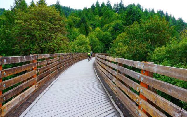
Oregon has a way of hiding its best stories in plain sight, and one of them runs along a former lumber railroad through the foggy foothills of the Coast Range. The Banks-Vernonia State Trail stretches 21 miles across northwest Oregon, threading through farmland, riparian corridors, and old-growth forest before arriving at a small city shaped entirely by timber and rail.
Along the way, riders cross 13 bridges, including the towering Buxton Trestle, a structure that makes you feel the weight of the industry that once rolled beneath your wheels. Whether you ride the full length or just a satisfying stretch of it, this trail rewards anyone curious enough to follow where the railroad used to go.
A Former Lumber Railroad Became a State Trail
Long before cyclists rolled along this corridor, freight cars loaded with freshly cut timber made the same journey. The railroad line at the heart of the Banks-Vernonia State Trail dates to the 1920s, built to connect the timber-rich hills around Vernonia with markets to the south.
Oregon Encyclopedia’s entry on Vernonia traces the town’s railroad connection to the Oregon-American Lumber Company and the Spokane, Portland and Seattle Railway, which constructed the line specifically to haul lumber out of the Nehalem Valley.
The railroad carried more than logs. Passengers, freight, and the economic lifeblood of isolated communities all moved along this same right-of-way for decades.
The southern endpoint, Banks, grew directly from that rail development. The Oregon Encyclopedia’s account of Banks explains that in 1901, a nearby community called Greenville relocated closer to the railroad’s planned route, and the post office eventually took the name Banks, cementing the town’s identity around the line.
By 1973, the railroad’s commercial purpose had run its course. The rails were salvaged that year, and the state purchased the right-of-way in 1974.
The corridor sat in transition until 1990, when it was transferred to Oregon Parks and Recreation. Oregon State Parks identifies the Banks-Vernonia State Trail as Oregon’s first rails-to-trails linear state park, a distinction that reflects both its pioneering conversion and its lasting significance to the state’s trail network.
Understanding that history changes how the ride feels. The gentle curves, the wide right-of-way, the occasional burst from forest into open sky, all of it follows the logic of a railroad built for efficiency through difficult terrain.
Riding it now, you are tracing a route that shaped two communities and helped define the economic character of northwest Oregon for generations.
Thirteen Bridges, but Not Thirteen Open Historic Trestles
Thirteen bridges sounds like a headline, and it is, but the story behind those bridges deserves a closer look before you picture a parade of perfectly preserved Victorian railroad ironwork. The route does include 13 bridges, and Travel Oregon describes them as a mix of old bridges and wooden trestles, not a uniform collection of museum-quality historic structures.
Some are straightforward crossings built or rebuilt for trail use. Others carry genuine railroad heritage in their bones.
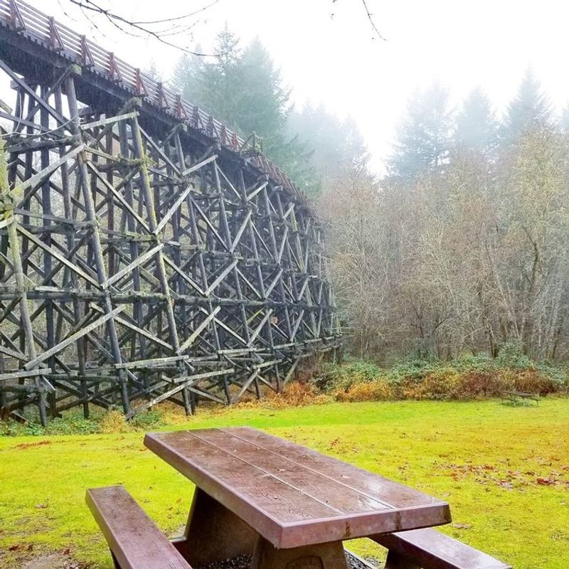
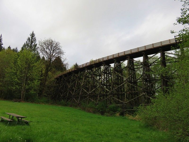
The undisputed centerpiece is the Buxton Trestle. Stretching 733 feet and rising 80 feet above the valley floor, it is the kind of structure that stops riders mid-pedal.
Oregon State Parks confirms the Buxton Trestle is open to hikers and bicyclists, and crossing it gives a visceral sense of how railroad engineers once solved the problem of moving heavy loads through folded terrain. The open deck and the drop below make it memorable in a way that a simple bridge never could.
The Tophill and Horseshoe area tells a different story. Older planning documents noted that the trestle in that section was unusable, and the current official trail map shows a bypass near Tophill with steep grade sections rather than an open trestle crossing.
Riders do not cross both major trestles on this route. The Buxton crossing is the one to anticipate; the Tophill area asks for a different kind of effort, one measured in climbing rather than elevation-spanning drama.
Taken together, the 13 bridges reflect the full character of a working trail built on a working railroad corridor. Some are historic, some are practical, and at least one is genuinely breathtaking.
That mix is part of what makes the Banks-Vernonia route feel honest rather than curated.
The Scenery Shifts from Farmland to Forest
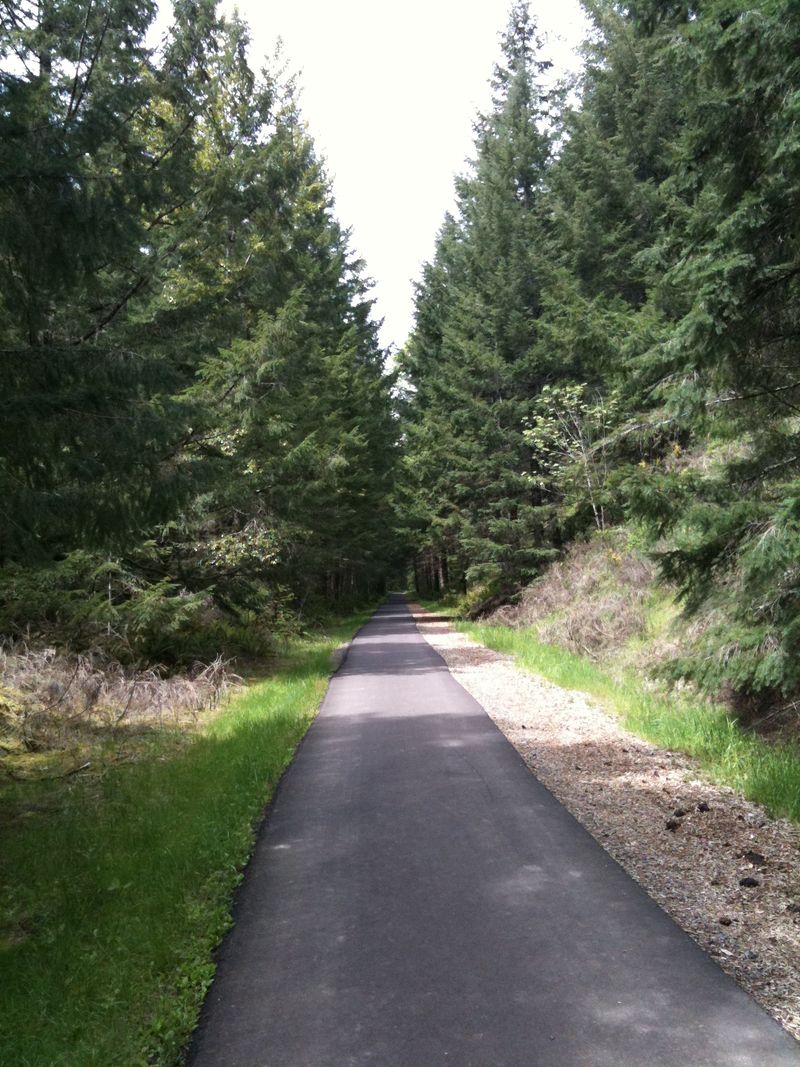
Starting at the Banks Trailhead, the landscape feels open and agricultural. Fields stretch out on either side, and the sky sits wide overhead.
That openness is part of what makes the southern portion feel like a warm-up, a gradual invitation into a ride that grows more enveloping as you move north through the Coast Range foothills.
The trail passes through the areas of Manning, Buxton, Tophill, and Beaver Creek as it heads toward Vernonia. These are communities, trailhead areas, and local place names rather than a chain of incorporated towns with main streets and coffee shops.
The official trail map shows them as trailhead access points along the corridor, useful for planning your start or turnaround but not destinations in themselves. The character of the ride comes from the land between those points, not from services clustered around them.
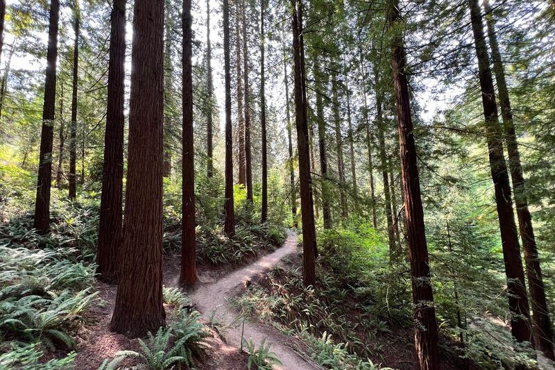
Riparian habitat takes over in the middle sections, where the trail follows creek corridors and the tree canopy closes overhead. Oregon State Parks describes the route as moving through farmland, riparian areas, and Coast Range forest, and that sequence feels accurate on the ground.
The forest thickens as elevation rises, and the shift from open sky to filtered green light is one of the trail’s quiet pleasures.
The L.L. “Stub” Stewart State Park area intersects the route and adds camping access for riders who want to turn the trip into an overnight. Vernonia sits in the Nehalem Valley at the northern end, a small city shaped by the same timber economy the trail commemorates.
The landscape arrival there, dropping out of the forested hills into a valley community, feels earned in a way that a flat urban trail rarely manages.
The Grade Is Generally Gentle, Not Completely Flat
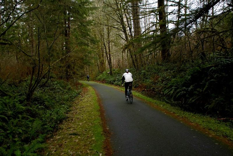
Railroad grades are engineered for loaded freight cars, which means they rarely climb steeply. That logic works in a trail rider’s favor along most of the Banks-Vernonia route, where the grade stays manageable enough that the scenery gets your attention before the effort does.
Oregon State Parks describes the main trail as an approximately eight-foot-wide paved hiking and bicycle path, with a separate gravel route for equestrian users running alongside much of the corridor.
“Generally gentle” is the honest framing, not “flat.” The official trail map marks grades of up to 11 percent near the Tophill and Horseshoe bypass area, which is a meaningful climb on a loaded touring bike or for a rider who has not trained for sustained elevation gain. That section also includes unpaved stretches, so the surface underfoot changes along with the pitch.
The distinction between paved, unpaved, and steep-grade sections matters for planning. Most of the trail rewards casual riders who simply want to cover ground through beautiful country.
The bypass near Tophill is the exception, not the rule, but ignoring it in your preparation would be a mistake. Riders who are newer to longer distances or who prefer a mellower experience might consider a shorter out-and-back from Banks or from one of the mid-trail trailheads, avoiding the steepest section entirely while still experiencing the trail’s best features.
The surface variations also mean that tire choice and bike fit matter more here than on a uniformly smooth urban path. A hybrid or gravel-capable bike will handle the full route more comfortably than a narrow-tired road bike, particularly through the unpaved and bypass segments.
Pick a Trailhead for the Ride You Want
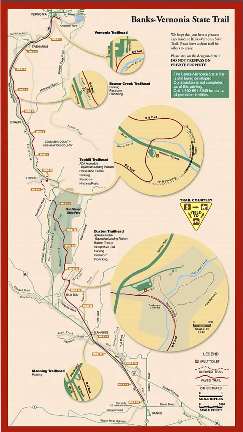
Five trailheads give riders genuine flexibility on the Banks-Vernonia route, and choosing the right one is the most practical decision you will make before the trip. Oregon State Parks lists Banks, Manning, Buxton, Tophill, and Beaver Creek as the five official access points, each positioned at a different point along the 21-mile corridor.
Your starting trailhead effectively sets the length, terrain, and character of your ride.
Banks is the southern anchor, surrounded by agricultural land and offering the most open, gradual terrain at the start of the route. Riders who want the full experience, including the Buxton Trestle and the forested midsection, typically begin here and head north.
The full out-and-back covers approximately 42 miles, which is a committed day for most cyclists. That number is editorial planning guidance based on the trail’s official mileage, not an official difficulty rating assigned by Oregon State Parks.
Starting from Buxton puts you closer to the trestle and the riparian forest sections without the full southern farmland stretch. The trail map shows Buxton sitting in the heart of the corridor, making it a natural midpoint for riders who want to go either direction without committing to the full length.
Manning offers a similar mid-route option with road access, while Tophill puts you squarely in the steeper bypass zone, which makes it a better fit for riders who know what they are getting into.
Beaver Creek, near the northern end, is the practical choice for riders based in Vernonia or those who want to explore the trail’s forested northern character without tackling the full distance. Pairing a Beaver Creek start with a turnaround at Buxton gives a solid ride through some of the trail’s most scenic and historically interesting terrain.
Whatever you choose, match your trailhead to your fitness, your time, and the specific features you most want to experience.
Check Conditions and Rules Before Departure
A few minutes reviewing the current Oregon State Parks page before you leave can save you a frustrating surprise at the trailhead. Conditions, fees, and closures on this trail have changed before and will change again.
The most important active notice involves the southern Shoofly Trail bridge, which Oregon State Parks lists as closed for safety, with a temporary crossing in place. That notice has been displayed on the official trail page for an extended period, and riders should confirm the current status before planning a route that depends on that section.
Parking at the Banks Trailhead now requires a day-use permit. The Oregon State Parks statewide FAQ confirms that the Banks Trailhead is among the locations where a fee requirement began in 2026.
Fee amounts, payment methods, and which other trailheads require permits can change, so verify before you go rather than assuming the situation matches what you read here.
Trailhead hours vary by season. Oregon State Parks lists hours ranging from 7 a.m. to 5 p.m. in the shortest winter period up to 7 a.m. to 9 p.m. from May 1 through September 1.
Plan your turnaround time accordingly, especially if you are starting a long out-and-back in a season with early closing times.
Electric-assisted bicycles are currently permitted on this trail because it meets the minimum eight-foot width requirement. The state defines eligible e-bikes as pedal-equipped vehicles with motors no larger than 1,000 watts and a maximum motor-assisted speed of 20 mph, unless signs at a specific location say otherwise.
Verify that rule before departure, as posted conditions can override the general policy.
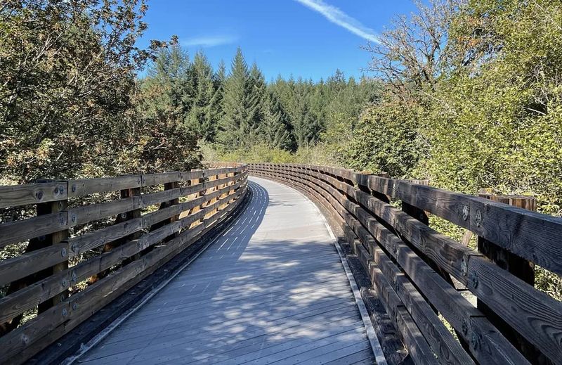
For trail behavior, Oregon State Parks asks users to travel at a safe speed, announce themselves clearly before passing other users, and use extra caution on bridge decking that may be uneven or slippery. Pets must stay on a leash no longer than six feet.
Cell service is limited along much of the route, so download the trail map before leaving and do not count on being able to call for help or look up information mid-ride.
Vernonia Extends the Outing Beyond the Trail
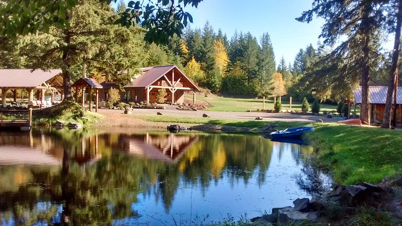
Arriving in Vernonia at the end of a long ride, you are rolling into a community whose entire modern history is tangled up with timber and rail. The Oregon Encyclopedia’s account of Vernonia connects the town’s growth directly to the lumber industry and the railroad that made large-scale logging of the Nehalem Valley possible.
That context gives the northern endpoint a different kind of weight than a simple rest stop. You have ridden the same corridor that once carried the industry that built this place.
The city maintains several parks that connect directly to the trail system and offer ways to extend your visit beyond the parking lot. Vernonia’s city parks page identifies Anderson Park, Spencer Park, Vernonia Lake, and other city green spaces as access points to the local trail network.
Vernonia Lake is the most significant option for riders considering an overnight stay, offering primitive tent sites during its operating season.
The city lists a winter closure for Vernonia Lake from October 15 through April 15. That seasonal window matters if you are planning a camping-based trip, since arriving outside those dates means no tent sites available at the lake.
Verify current amenities, site availability, and any reservation requirements directly with the city before making overnight plans, as conditions and policies can shift from year to year.
Even without camping, Vernonia gives the ride a natural conclusion. Oregon State Parks’ trail page frames Banks and Vernonia as the two endpoint communities of the 21-mile corridor, and reaching Vernonia after a long day of pedaling through forest and over bridges earns its place as a genuine destination rather than just a turnaround cone.
A Historic Route Worth Riding at Your Own Pace
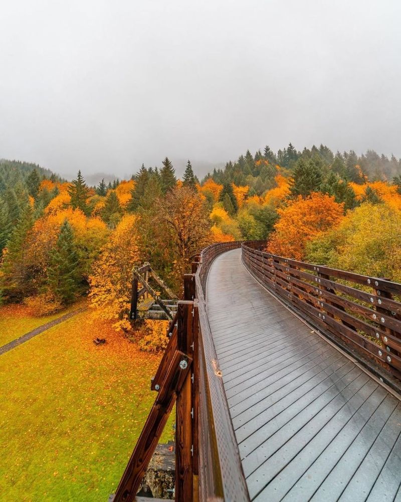
Few trails in Oregon pack this much layered meaning into a single corridor. Riding the Banks-Vernonia State Trail means following a former railroad through landscapes that shift from open farmland to riparian forest to Coast Range foothills, crossing bridges that range from utilitarian spans to the genuinely dramatic Buxton Trestle, and connecting two communities whose identities were forged by the same industry that once ran freight along this exact line.
The experience holds up best when you match your expectations to the actual route. Oregon State Parks and the official trail map together tell you everything you need: respect the Tophill bypass, prepare for variable surfaces and limited cell service, check the current bridge advisories, and choose a distance that fits your legs and your day.
The trail does not need exaggeration. A former lumber railroad reborn as a 21-mile public corridor through northwest Oregon is already a story worth riding.
Share this story