Picture yourself cruising down a busy Oregon highway when a dark, cone-shaped hill suddenly pulls your eyes off the road. Most drivers zip right past it, never guessing that this quiet mound is actually a volcano that shaped the land around it thousands of years ago.
Climb to its rim and central Oregon spreads out in every direction, with snowy peaks lined up like they are posing for a photo. It is one of those spots that feels like a secret hiding in plain sight, and once you know it is there, you will wonder how you ever missed it.
A Sleeping Giant Just Off Highway 97
Cruising south out of Bend along Highway 97, you would be forgiven for treating that dark hill on the horizon as just another bump in the landscape. It is anything but ordinary.
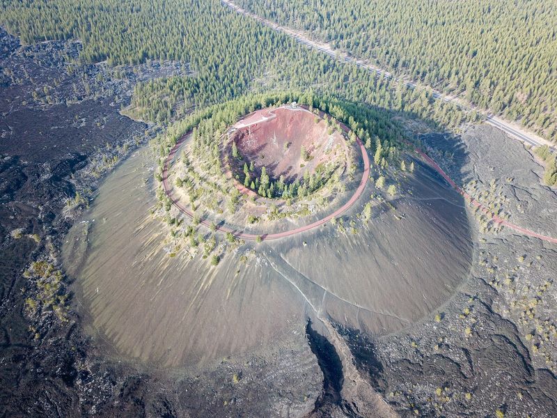
Lava Butte is a cinder cone that rises roughly 500 feet above the surrounding forest, part of the larger Newberry National Volcanic Monument. Visitors love how easy it is to reach, describing it as an excellent stop that sits right off the freeway with almost no effort required to find it.
What makes this place so special is the contrast between how quietly it waits and how loudly it once made its mark. The cone last erupted around 7,000 years ago, and today it sits calm and green-fringed while traffic hums past below.
For an in-the-know Oregonian, it is the perfect kind of landmark, hiding its story behind a plain roadside face.
Seven Thousand Years of Slumber
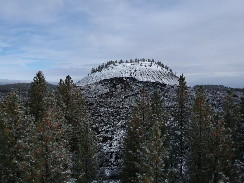
Seven thousand years is a stretch of time hard to wrap your head around. When Lava Butte last stirred, the world looked wildly different, yet the shape of the cone has barely changed since then.
Guests who have made the trip often marvel at that number, calling it a beautiful drive to visit and learn about a cinder cone that has existed for nearly 7,000 years. The math alone gives the place a quiet kind of drama.
Geologists categorize this as a dormant volcano rather than an extinct one, which means it is resting rather than finished. The reddish and black cinders underfoot are the leftovers of that ancient event, frozen in place like a snapshot of a very loud afternoon long ago.
Standing on the rim, you get the sense of walking on something that has outlasted almost everything around it. It is a humbling reminder that Oregon’s landscape is still very much a work in progress.
The 360-Degree Reward at the Summit
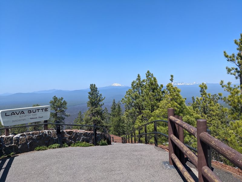
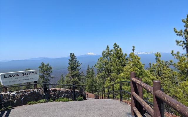
Reaching the top delivers a payoff that visitors rave about again and again. From the rim, the view swings a full 360 degrees across central Oregon, and it genuinely stops people in their tracks.
On a clear day, folks report seeing the Three Sisters, Mount Hood, Broken Top, and mountains stretching all the way toward Washington. One guest pulled off the freeway on a whim, paid for a day pass, and ended up gazing at nearby peaks and endless forest, calling it an outstanding view.
The scene really does give you perspective on how vast Oregon country is. Rolling forests, distant volcanoes, and layers of ridgelines all fan out below your feet.
Haze can occasionally soften the far peaks, so timing matters. Regulars suggest coming on a clear day and early, while the light is behind you, if you want those postcard shots of the Cascades to the west.
Circling the Rim on the Quarter-Mile Trail
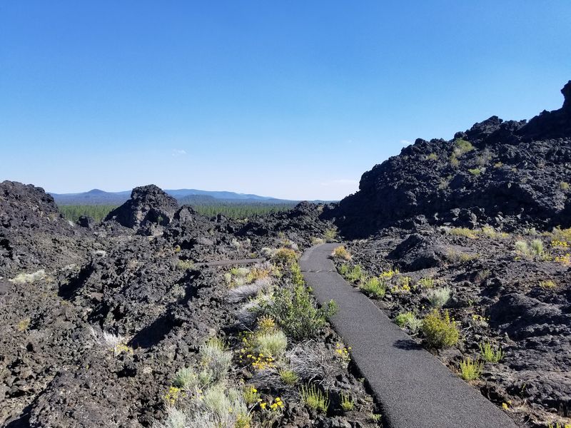
Once you have soaked in the first view, the real fun begins with a loop around the very top of the cone. A quarter-mile trail circles the rim, and it hands you a fresh angle at every turn.
Walkers describe it as a nice hike with very unique views, taking roughly 20 minutes to complete with some gentle ups and downs but no big boulders to scramble over. Families with curious kids seem to enjoy it especially.
Watch your footing in a few spots, since the path can be a little steep and covered in loose pumice gravel. Comfortable shoes make a big difference here.
The genuine perk of the loop is that it wraps the whole panorama around you, so you never have to pick just one direction to admire. Every few steps reveal a different peak, a different sweep of forest, a different reason to pause.
Riding the Shuttle to the Top
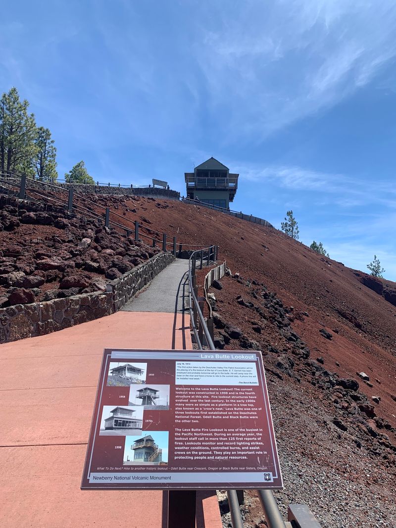
Not everyone wants to hike a steep road to reach the summit, and thankfully there is a clever solution. A short shuttle runs from the visitor center up to the top of the cone and back.
The ride is inexpensive, with past visitors mentioning a fee of around two to three dollars per person, and the return trip comes free. One tip that comes up often: the shuttle does not give change, so bring exact coins.
Buses have historically run about every 20 minutes, and riders agree the view is well worth any short wait. The trip up is quick, making it friendly for those who would rather skip the climb.
Because parking at the summit is limited, folks are usually asked to keep their visit under 30 minutes. It sounds tight, but guests say that window is plenty of time to circle the rim and drink in the scenery before heading back down.
The Visitor Center That Tells the Whole Story
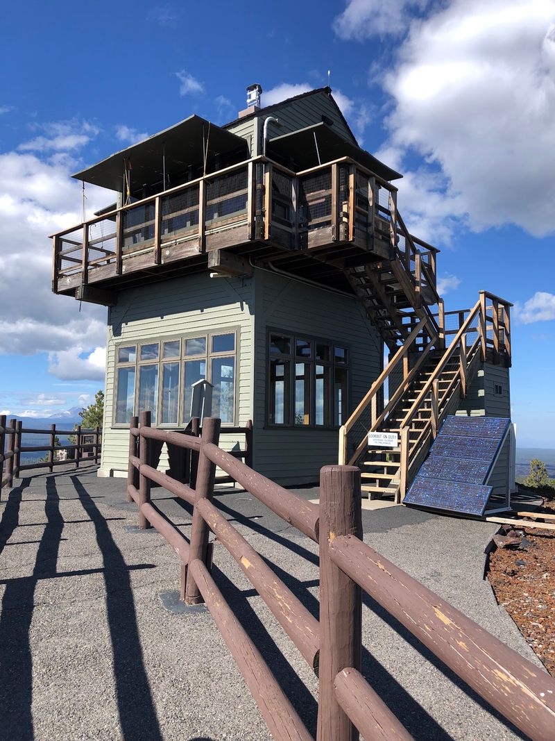
Before you head uphill, the visitor center is worth every minute you give it. Guests consistently call it educational and well-stocked, covering the entire Newberry Volcanic Monument in one tidy stop.
The exhibits walk you through the amazing geological history of the area, so by the time you reach the summit you actually understand what you are looking at. Rangers here get plenty of credit for their deep knowledge of both the site and the surrounding region.
A gift shop rounds out the space, and it is where you can pick up your shuttle ticket or day pass. Staff happily point you toward other things to do nearby, which comes in handy if you are planning a bigger central Oregon loop.
Think of it as the friendly front door to the whole monument. A little time inside makes the climb up so much richer.
A Ranger’s History Lesson at the Fire Lookout
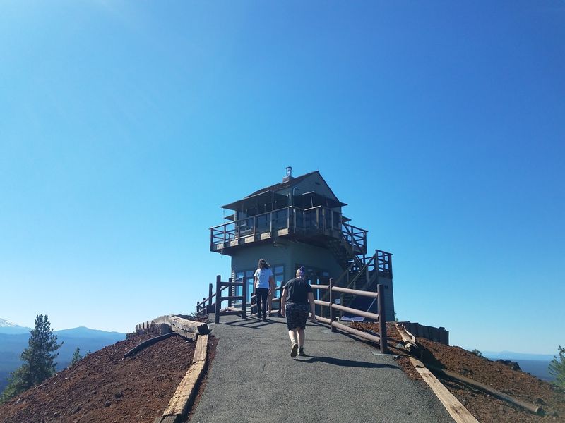
Perched at the summit sits a fire lookout that adds a whole extra layer to the visit. Step inside and you will find panoramic maps that name every neighboring peak on the horizon.
Those maps turn a pretty view into a full geography lesson, helping you match each snowy summit to its title. Even when clouds hide the distant mountains, the illustrations keep the identification game going.
Rangers stationed up top are a favorite among visitors, with one guest recalling how the ranger offered a little history lesson simply because they asked. Curiosity is genuinely rewarded here.
The lookout also frames the sheer reach of the ancient lava flow in a way photos struggle to capture. Standing beside those maps, you get a real feel for how one eruption reshaped miles of land in every direction.
Walking the Lava Land Trails Below
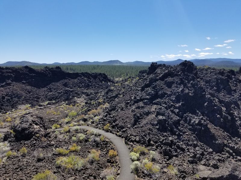
Down at the base, another set of paths invites you to wander straight through the aftermath of the eruption. These trails thread across the lava flow itself, and they are surprisingly gentle underfoot.
Informational plaques line the way, telling the story of how a lava flow forms and how life slowly returns to it. Visitors describe these as very nice paths that make the whole area come alive with context.
The route ends at a pleasant viewing area facing west, looking toward Mount Bachelor, the Three Sisters, and Broken Top. For the sharpest photos, longtime visitors suggest walking this early in the day while the sun sits behind you.
It is a mellow contrast to the climb up the cone, trading elevation for a close-up look at the raw volcanic ground. Kids and grown-ups alike tend to linger, reading the signs and spotting new plants pushing up through the rock.
Visiting Across the Seasons
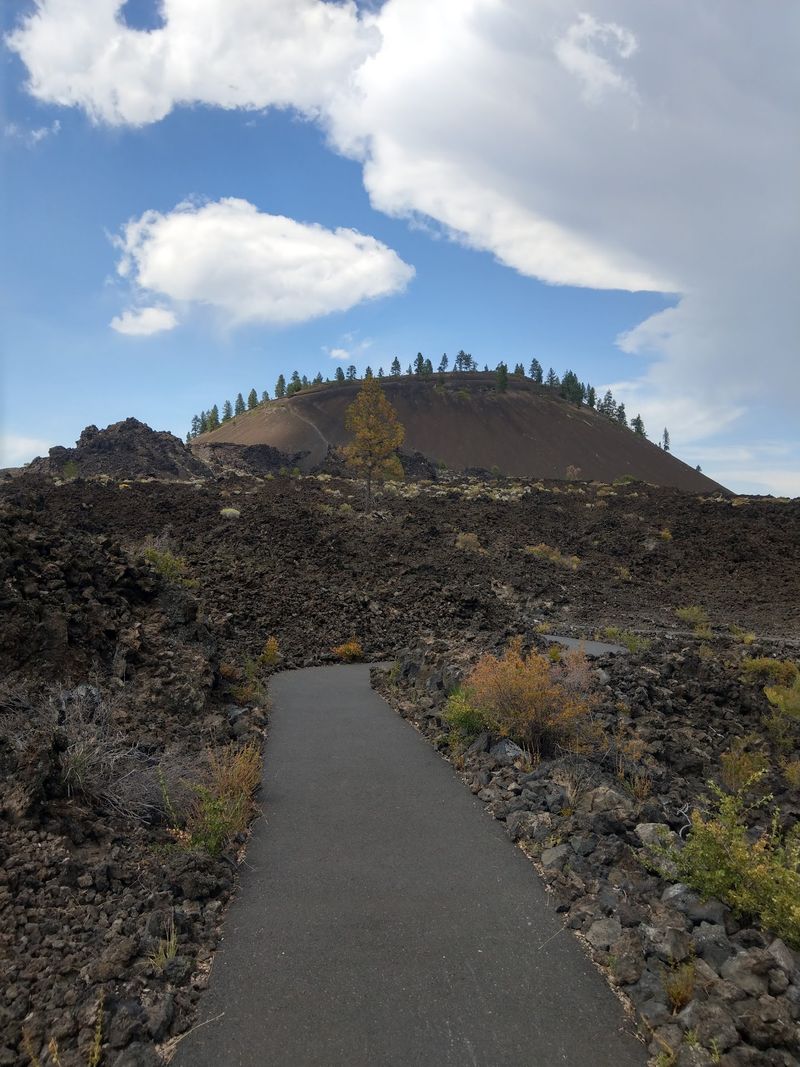
Timing your trip changes the whole personality of the place. Come in late September and you might catch the first dusting of snow, which one guest said made a beautiful contrast against what could otherwise look barren and dark.
Summer is the easy season, when you can drive to the top or hop the shuttle and the visitor center hums with activity. Warm, long days make the rim loop and the lava trails feel effortless.
In the off season, gates to vehicles close, though a pedestrian gate stays open for those willing to hike the road up. Keep in mind a nearby cave attraction also shuts for winter, so plan around it.
The butte itself stays open to enjoy year round, and quieter months mean fewer people sharing the view. For an Oregonian chasing uncrowded scenery, an off-peak visit is a quiet win.
Getting There, Passes, and Practical Notes
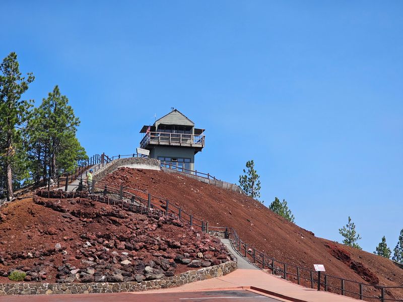
Finding the place could not be simpler, sitting right off Highway 97 at NF-100 near Bend. That easy access is a big reason travelers heading to spots like Crater Lake fold it into their route.
Entry works on a day pass system, and the site accepts the America the Beautiful national parks pass, which longtime visitors appreciate. The shuttle to the summit carries its own small per-person fee, purchased at the gift shop, so keep a little cash handy.
Hikers should know the road to the top climbs at an 8 percent grade for about a mile, which is why it is not ideal for very small children or anyone in fragile health. Much of that road hugs the highway, so expect some traffic noise on the way up.
For questions on hours or seasonal access, the monument line at 541-593-2421 is your best bet. A quick call before you go can save a wasted trip during closures.
Why This Quiet Cone Deserves Your Detour
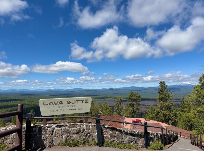
Some places earn a permanent spot on your Oregon map, and this ancient cone is one of them. Visitors keep returning to the same idea: it is a unique, fascinating stop unlike anything they have seen before.
The mix of easy access, a genuinely educational visitor center, and those sweeping summit views makes it punch well above its size. Whether you take the shuttle or earn the climb on foot, the reward at the top rarely disappoints.
Guests who spent 20 years driving past finally stopped and walked away glad they did, which says plenty about how easy it is to underestimate the spot. It is the sort of hidden gem that fellow Oregonians would happily keep to themselves.
Next time the road south from Bend calls, let that dark hill pull you off the highway. Standing on a volcano that has slept for 7,000 years, with the Cascades lined up before you, is a memory worth the small detour.
Share this story