Somewhere in Oregon’s Western Cascades, a remote gravel road leads to a place that operated for decades as a mining camp, then an education center, and now stands altered by one of the most destructive wildfires in recent state history. The story behind it is the kind that rewards curious readers willing to look past the popular “ghost town” label and understand what actually happened here.
Before the September 2020 Beachie Creek Fire tore through the Opal Creek watershed, roughly 3.1 miles separated a locked Forest Service gate from Jawbone Flats, a historic settlement that attracted thousands of visitors every year. That route is closed to the public right now, but the history it leads to is very much worth knowing.
Jawbone Flats Was a Mining Camp Before It Became a Mountain Destination
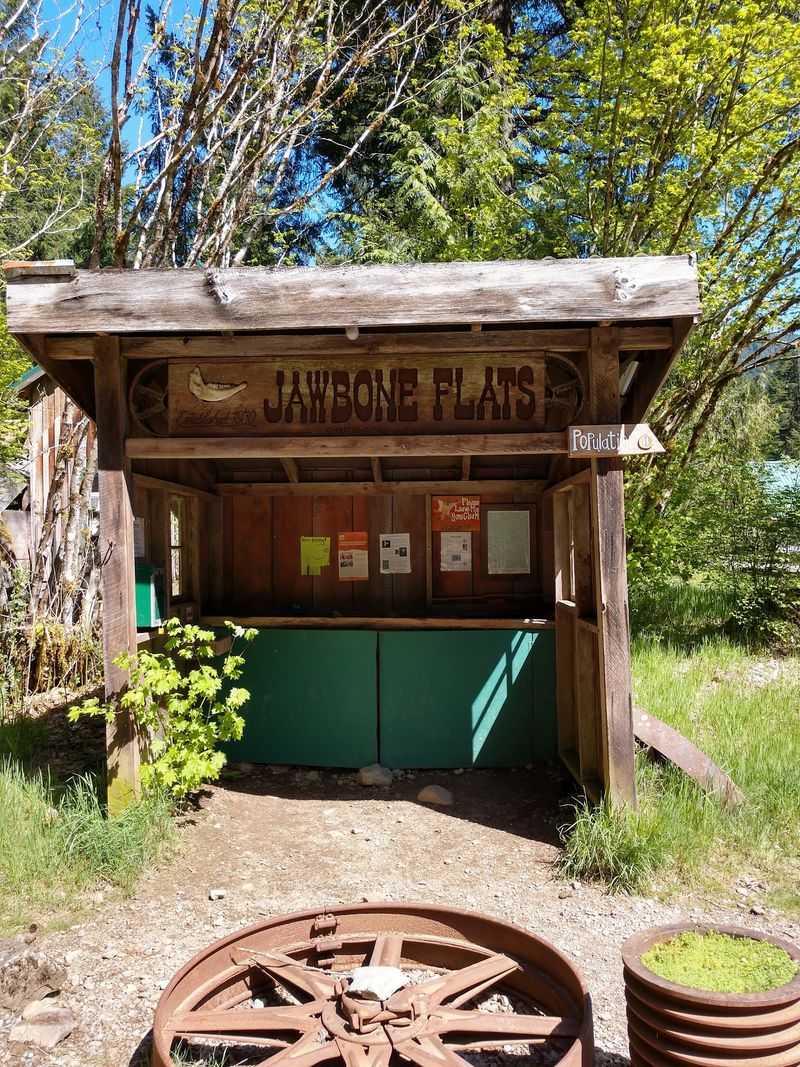
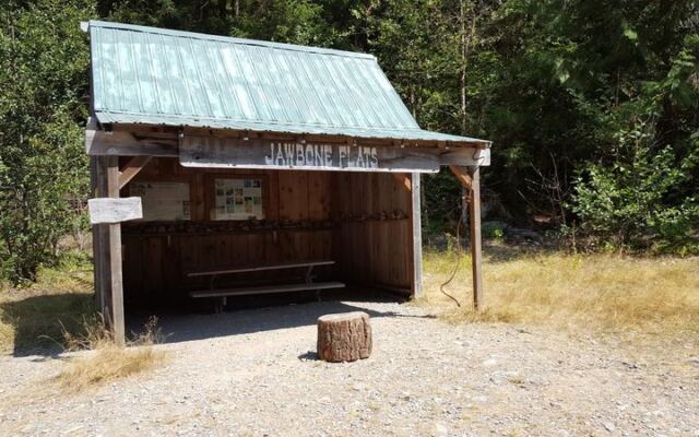
Tucked into the Opal Creek watershed of Oregon’s Western Cascades, Jawbone Flats sits near the Little North Santiam River in a landscape that has drawn people for well over a century. Mining exploration in the area began in the mid-19th century, when prospectors worked the surrounding ridges looking for promising ore.
Larger-scale development at the camp itself expanded significantly in the 1930s, when the site took on the clustered, functional character that later earned it the “ghost town” nickname.
That nickname, while atmospheric, misses something important. Jawbone Flats was never simply an abandoned settlement frozen in time.
According to the Opal Creek Ancient Forest Center’s history of the site, the camp processed ore and housed workers through active decades of operation before eventually transitioning into a base for education, research, and outdoor recreation under the stewardship of the Opal Creek Ancient Forest Center. That evolution from working mine to environmental learning hub is what makes the place genuinely unusual in Oregon.
At its peak as a recreation and education destination, Jawbone Flats attracted roughly 20,000 visitors per year. Programs brought students, researchers, and outdoor enthusiasts to a setting where old-growth forest, a working creek, and industrial-era structures existed side by side.
Calling it forgotten undersells both the community effort that kept it operating and the visitor numbers that came through its gates before the fire.
Understanding that layered history matters because it changes how you read the site’s current condition. Jawbone Flats was not quietly waiting to be discovered by a lucky hiker.
It was an active place, carefully managed and widely visited, before the events of 2020 reshaped it entirely. The story of how it got from there to here is the real reason this corner of Oregon deserves attention.
The Historical Route Covered About 3.1 Miles One Way
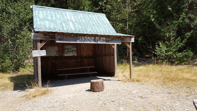
Before the Beachie Creek Fire changed everything, reaching Jawbone Flats meant parking at a locked Forest Service gate and walking an old mining road through dense Western Cascades forest. Older Opal Creek program materials described that one-way distance as approximately 3.1 miles, putting the full out-and-back at roughly 6.25 miles.
That is where the commonly cited mileage figure originates.
Pre-fire accounts characterized the road walk as gentle and suitable for hiking or biking, with modest elevation change and the sound of Opal Creek running alongside much of the route. Those descriptions painted a picture of an accessible, rewarding day out for families and casual hikers who were willing to leave their vehicles at the gate.
The locked gate itself was not a new development or a sign of obscurity; it was simply how access to Jawbone Flats had always worked, a deliberate arrangement that kept vehicle traffic off a narrow historic road.
None of those older descriptions should be used to plan a visit today. Reporting on the aftermath of the 2020 fire makes clear that the Beachie Creek Fire burned through the surrounding forest, damaged bridges and roads, and fundamentally altered the terrain along the entire corridor.
The mileage from gate to camp has not changed, but the character of everything in between has. Burned slopes, debris, and infrastructure damage make the pre-fire difficulty rating unreliable as a guide to current conditions.
Treat the 3.1-mile figure as a historical reference point rather than an active trail description. The route exists in older materials as context for understanding the site’s former accessibility, not as an invitation to set out from a trailhead that remains closed to the public.
Mining History Gave Jawbone Flats Its Distinctive Character
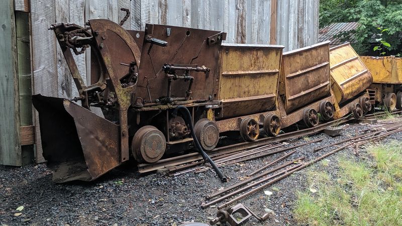
What set Jawbone Flats apart from an ordinary forest camp was the physical evidence of industrial-era mining that surrounded it. Visitors who made the walk from the gate arrived at a settlement where the built environment told a specific economic story: ore had been pulled from these hills, processed here, and shipped out, all within living memory of people who came to visit decades later.
The Amalgamated Mill, built in the 1930s and operational into the 1940s, stood as the most significant industrial structure on the site. Oregon Department of Geology and Mineral Industries documentation of the Amalgamated Mill site records the camp’s association with lead, zinc, copper, silver, and gold mining in the North Santiam district.
The mill processed ore extracted from the surrounding claims, and its presence shaped the physical layout of the camp that visitors later explored.
Pre-fire field-trip guidance published by Oregon’s geological survey instructed visitors to stay outside buildings, keep clear of equipment, and handle nothing. Oregon Geology journal materials covering the Opal Creek area reinforced that approach, treating the site as a place for observation rather than hands-on exploration.
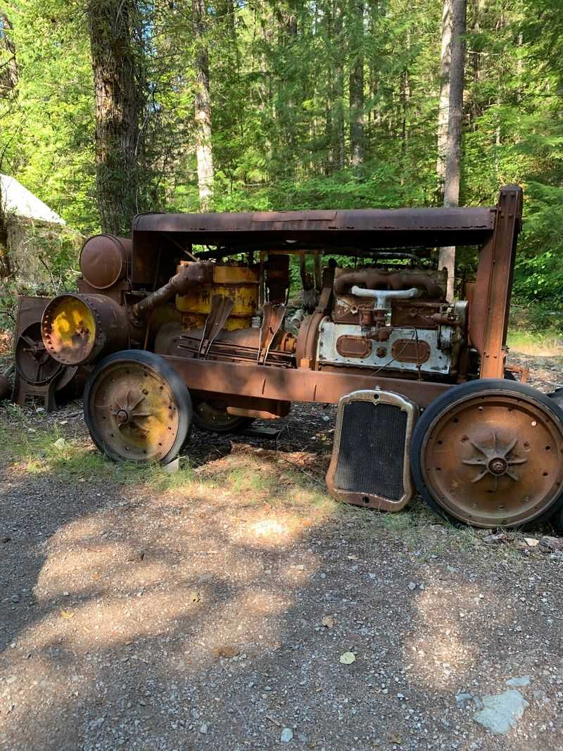
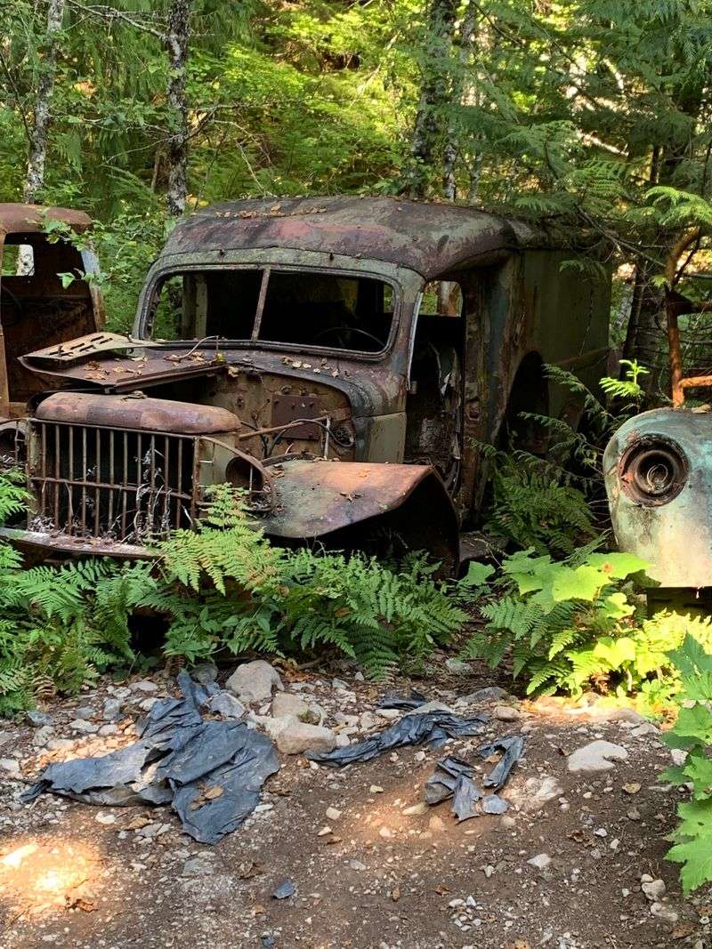
Old mining trucks, rusted equipment, and the structural bones of the mill operation gave the camp its visual texture, but they were never meant to be touched or entered.
Any account of what mining artifacts or equipment remain visible or accessible after the 2020 fire should be treated cautiously. Historical sources document what was there before; neither the current Forest Service page nor the Opal Creek Ancient Forest Center’s current visitor materials provide a complete inventory of what survived the fire or what a future authorized visitor might see.
The history is documented, but the present-day physical reality requires verification before anyone makes the trip.
The 2020 Fire Changed the Destination Readers Picture

September 2020 brought one of the most consequential wildfire events in the recent history of Oregon’s Cascade foothills. The Beachie Creek Fire swept through the Opal Creek watershed with enough force to reshape not just the forest canopy but the built fabric of Jawbone Flats itself.
The camp that appeared in countless pre-fire photographs, with its cluster of weathered wooden cabins and mill structures, largely ceased to exist in that form.
The Opal Creek Ancient Forest Center’s current account of Jawbone Flats history states plainly that nearly all of the historic cabins and buildings were destroyed by the fire. Three structures are identified as still standing: Cabin 4, an outdoor classroom, and a water-treatment plant.
That is a stark reduction from the settlement of interconnected structures that older trail guides and photographs depicted.
Beyond the buildings themselves, the fire altered the surrounding landscape in ways that make old images and written descriptions unreliable guides to current conditions. Coverage of the fire’s aftermath in the Opal Creek wilderness documented damaged bridges and roads, burned slopes, and the kind of widespread forest change that takes years to stabilize.
Snags, debris, and unstable terrain create hazards that would not have appeared in any pre-fire trip report.
Photographs taken before September 2020 should be understood as historical records, not previews of what a visitor would encounter today. The visual identity of Jawbone Flats as a cabin-lined mining camp exists now primarily in archives and memory.
What remains on the ground is a fire-altered landscape with a handful of surviving structures, a documented industrial past, and an uncertain timeline for any form of public access restoration.
Why the Route Is Not a Public Hike Right Now
Plain and direct: the Opal Creek Scenic Recreation Area, the access road leading to it, the trailhead, and Jawbone Flats itself are all closed to the general public. That is the current status according to the latest available Forest Service information, and it means the route described in pre-fire hiking guides cannot be treated as an open, self-guided day trip.
The Willamette National Forest’s Opal Creek Scenic Recreation Area page lists the site as closed, attributes the road closure to impacts from the Beachie Creek and Lionshead fires, and notes that potable water and restrooms are unavailable at the site. Those are not minor inconveniences; they are baseline conditions that make an unsanctioned visit genuinely unsafe regardless of a visitor’s experience level.
The Opal Creek Ancient Forest Center’s current programming reflects this reality. Their 2026 materials describe limited guided expedition and lodging opportunities, while explicitly stating that the surrounding federal wilderness remains closed to the general public.
Research, restoration, and educational access operate under separate authorization and do not represent a general reopening of the area to day hikers.
A road-repair proposal in the Forest Service planning pipeline deserves a clear-eyed reading as well. The Forest Service Schedule of Proposed Actions describes planned work to return a section of Forest Service Road 2209 to pre-fire condition, but a proposed project is not a completed repair, and a completed repair would not automatically reopen the area to recreational hikers without a separate official decision.
Readers should not interpret infrastructure planning as evidence that the gates are open or soon will be.
Before publishing anything about this site or making any future trip plans, verify current conditions directly with the Willamette National Forest and the Opal Creek Ancient Forest Center. Conditions in post-fire landscapes change, and the most reliable information will always come from the agencies managing the land.
An Authorized Future Visit Would Require Care and Preparation
If official access to Jawbone Flats is eventually restored, the planning involved will look nothing like pulling up a pre-2020 trail guide and heading out the door. The post-fire landscape, the site’s private inholding status, and the ongoing presence of mining-era hazards all require a more deliberate approach than most Oregon day hikes demand.
Start with the basics that the Forest Service already requires: carry all the water you will need for the full round trip, because the Forest Service confirms that potable water is unavailable at the site. Do not plan to filter creek water as a substitute without confirming that option is safe and permitted.
Pack out everything you bring in, stay on designated routes, and respect the private Jawbone Flats inholding, which is not public land and carries its own access rules separate from the surrounding federal area.
The mining history that makes the site compelling is also the source of its most serious hazards. Abandoned mine openings, adits, and shafts look like interesting features from the outside, but DOGAMI guidance on abandoned mine safety is unambiguous: these openings can contain deep vertical shafts, unstable ground, oxygen-depleted or toxic air, and contaminated materials.
The same caution applies to damaged structures, unstable ruins, and areas around scattered equipment. Looking from a safe distance is the only appropriate interaction with any of these features.
Post-fire terrain adds a separate layer of risk. Burned slopes can shift, snags fall without warning, and bridges or creek crossings that appeared in older trip reports may no longer exist in usable condition.
An authorized future visit is not the same as a casual afternoon walk, and informal access around a closure is not a safe workaround regardless of how confident a visitor feels about their abilities. Every recommendation here is conditional on official authorization being granted and verified before departure.
Jawbone Flats Is a Fire-Altered Oregon Story, Not a Forgotten Ghost Town
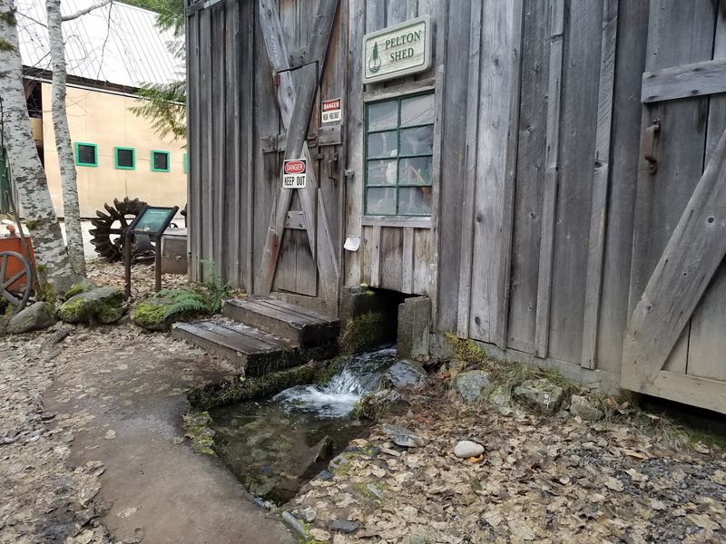
Jawbone Flats earns its place in Oregon’s story not because it was overlooked, but because it carried so many different identities across a single century: prospectors’ camp, industrial mill site, conservation battleground, outdoor classroom, and now a fire-altered landscape working its way toward an uncertain future. Those layers are more interesting than the simple ghost-town image, and they hold up better under scrutiny.
The approximate 3.1-mile figure belongs to a former route, documented in pre-fire materials and no longer applicable to current conditions. The site’s own history page makes clear that the camp at the end of that road is not an intact cabin town waiting for a curious hiker to wander through.
What remains is a handful of surviving structures, a documented industrial past, and a landscape that is still recovering from one of the most significant fires in the region’s recent memory.
Readers can appreciate all of that history right now, through the sources cited here and through the Opal Creek Ancient Forest Center’s ongoing restoration and education work. Any future visit to the site itself, though, requires one step first: checking directly with the Willamette National Forest and the Opal Creek Ancient Forest Center for current access status before making any plans.
Oregon’s most compelling places are not always the ones you can visit today, and Jawbone Flats is proof that a closed gate can still open onto a remarkable story.
Share this story