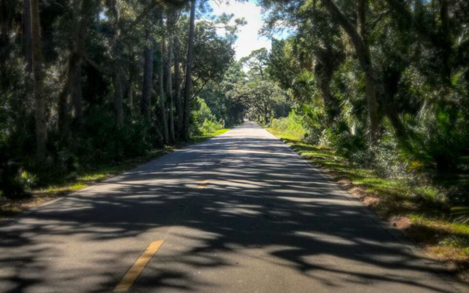
Florida has a way of hiding its most peaceful places in plain sight, and one Atlantic-coast byway in the northeast corner of the state is a perfect example. The Ormond Scenic Loop and Trail stretches 34 miles through live-oak canopy, tidal marshes, barrier-island dunes, and coastal scrub, all without a toll booth or a theme-park crowd in sight.
Whether you have a free Saturday morning or a full day to wander, this officially designated National Scenic Byway offers a genuinely unhurried escape that feels worlds away from the usual Florida rush.
Meet the Atlantic-Coast Loop Behind the Slow-Drive Idea

Tucked between Daytona Beach and Flagler Beach in Volusia County, the Ormond Scenic Loop and Trail is the kind of place that rewards drivers who slow down and actually look around. Officially recognized as a National Scenic Byway since 2009, the route covers roughly 34 miles and links the Atlantic shoreline with river corridors, marshland, and some of the most visually striking live-oak stretches in northeast Florida.
You can reach the loop from Interstate 95 or from A1A along the coast, which makes it accessible whether you are coming from inland or already cruising the shore.
The corridor follows a loose loop rather than a straight shot, tracing roads including A1A, North Beach Street, Old Dixie Highway, Walter Boardman Lane, Highbridge Road, and John Anderson Drive. That variety of roads means the landscape shifts as you travel, keeping the drive from feeling repetitive.
According to the official corridor management plan, the route connects the Atlantic Ocean with the Halifax River, Halifax Creek, and surrounding natural areas in a continuous arc of changing scenery.
Far from a hidden secret, the loop is a recognized regional attraction that the Daytona Beach Area Convention and Visitors Bureau describes as one of the area’s standout outdoor experiences. A more honest framing is that it tends to be overlooked by visitors who head straight for the major beach strips without realizing a quieter, greener alternative runs just inland.
For Florida residents looking for a low-cost, no-crowds-guaranteed drive through genuine coastal habitat, the Ormond loop gives you a solid geographic and scenic foundation before you ever leave the driveway.
The Landscape Changes From Shoreline to Marsh and Scrub
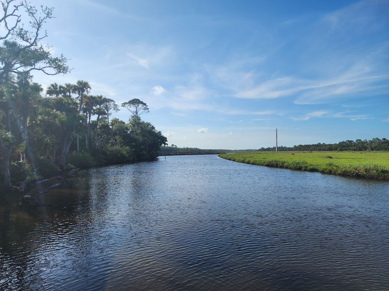
One of the most satisfying things about driving the Ormond loop is that the scenery genuinely changes as you move through it. The corridor management plan identifies a sequence of distinct habitats along the route, including Atlantic beach, barrier-island dunes, tidal creeks, open marshland, coastal scrub, and river frontage.
Each one has its own character, its own light, and its own sounds, so the drive rarely settles into a single visual mood for long.
Along the ocean-facing stretches, the Atlantic appears in glimpses between dune vegetation, the kind of salt-tinged view that makes you want to roll down the window regardless of the season. Pull inland slightly and the mood shifts: tidal creeks reflect the sky like hammered pewter, and marsh grasses move in slow, rhythmic waves even when the air feels still.
Coastal scrub, which the Florida Scenic Highways program identifies as part of the byway’s natural character, looks drier and more open, a sun-bleached contrast to the dense green of the hammock sections.
At North Peninsula State Park, the Atlantic beach and coastal marsh exist side by side, separated by just a thin strip of dune. The park also offers access to the Intracoastal Waterway at Smith Creek Landing, where the water takes on a darker, tea-colored tone from the surrounding vegetation.
Wildlife may be present throughout these habitats, including shorebirds, wading birds, gopher tortoises, and deer, though sightings are never guaranteed and animals should always be observed from a respectful distance without approaching or disturbing them. The route’s shifting ecosystems are what give a leisurely drive its visual rhythm, making each mile feel distinct from the last rather than a repetition of the same green corridor.
Live Oaks Give the Route Its Most Memorable Shade
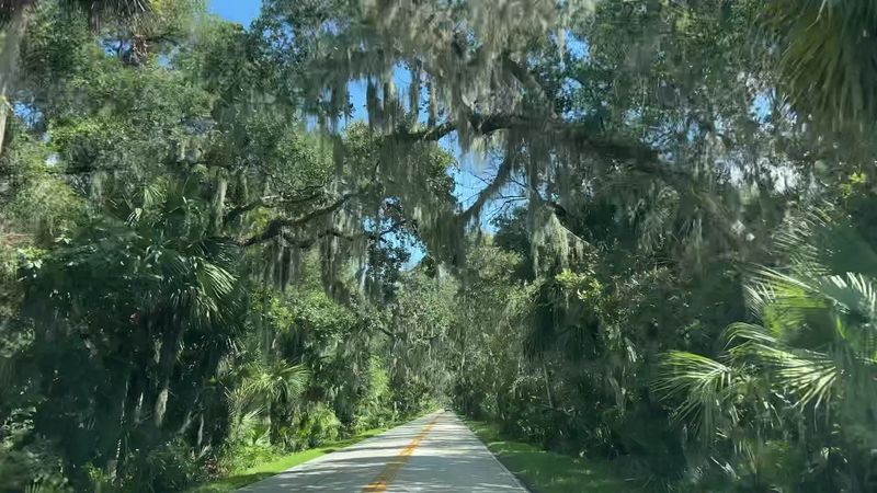
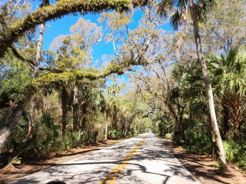
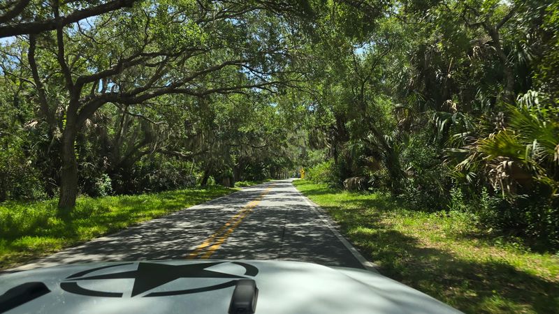
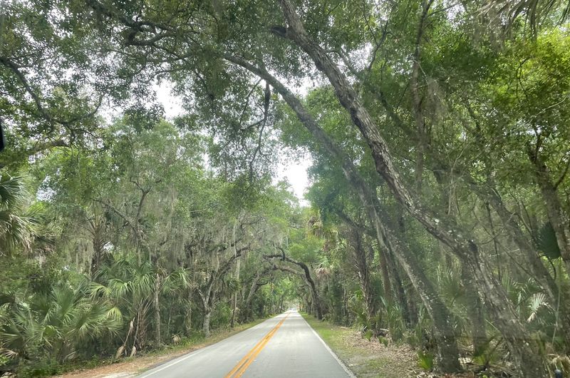
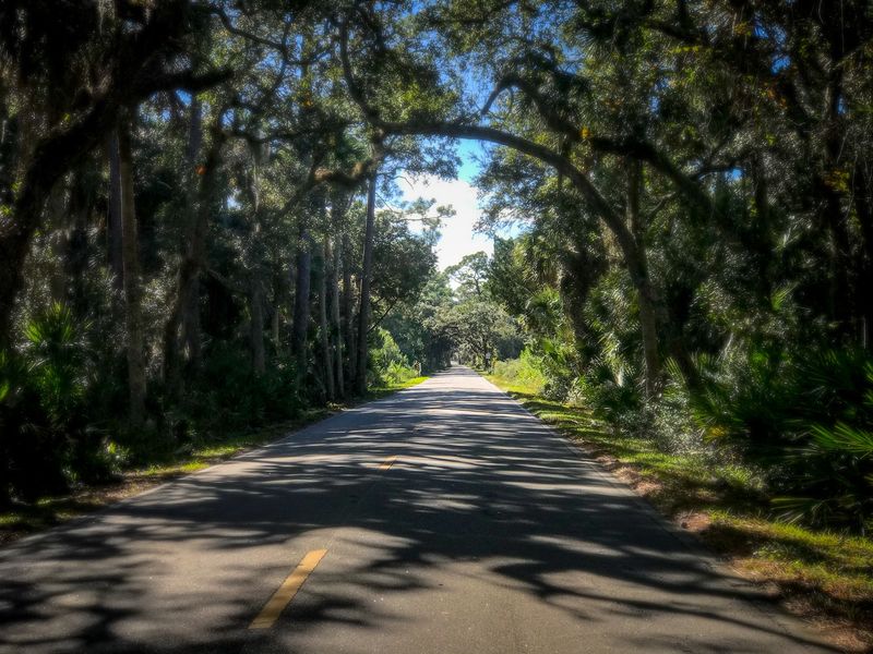
Ask anyone who has driven the Ormond loop what they remember most, and a significant number will describe the oaks. Sections of the route pass beneath a dense, interlocking canopy of live oaks that creates a shaded, almost cathedral-like atmosphere overhead.
The Daytona Beach area visitors bureau uses the word “tunnel” to describe this effect, though that is evocative shorthand rather than an official trail designation. The practical experience is that the light changes noticeably when you pass beneath the oldest stretches, shifting from open Florida sun to a cooler, dappled green.
Bulow Creek State Park is where the live-oak experience reaches its most impressive scale. According to Florida State Parks, the park protects nearly 5,600 acres and contains one of the largest remaining stands of southern live-oak forest along Florida’s entire east coast.
Within the park, the Fairchild Oak is described by the official state parks source as one of the largest live oaks in the South. Age estimates for the tree vary, so calling it definitively the oldest or largest in Florida would overstate what the documented record supports.
Standing near it, though, the scale is immediately clear.
Two trails give visitors a chance to walk among the oaks at their own pace. The Wahlin Trail is a 0.3-mile loop near the Fairchild Oak, manageable for most visitors and well-suited to a short stop.
The Bulow Woods Trail extends 6.8 miles one way through oak hammocks, wet hammock areas, pine forest, and salt marsh, offering a far more immersive experience for those with time and comfortable footwear. Portions of the Bulow Woods Trail are currently closed due to storm impacts, so check the park’s official page before planning a longer hike to confirm which segments are accessible.
The park is open 8 a.m. to sunset every day of the year and currently charges no entrance fee, though fees and hours can change.
Tomoka and North Peninsula Make Deliberate Stops Easy
Choosing a few deliberate stops rather than racing through every park along the loop is the approach that tends to make the drive most satisfying. Two state parks anchor the route with very different personalities, and understanding what each one offers helps you decide which fits your energy level and available time.
Tomoka State Park sits at the confluence of the Tomoka and Halifax rivers and earns its reputation through variety. Florida State Parks describes Tomoka as a place for paddling, fishing, picnicking, and birding, all organized around a river setting surrounded by hardwood hammock.
A half-mile interpretive trail winds through that hammock, giving visitors a short, accessible walk through one of coastal Florida’s most characteristic forest types. Current listed hours are 8 a.m. to sunset daily, with a $5 vehicle admission fee, though both details are subject to change and should be confirmed before you go.
North Peninsula State Park offers a sharply different atmosphere. Where Tomoka leans into river and hammock, North Peninsula combines an Atlantic beach with coastal marsh and Intracoastal Waterway access at Smith Creek Landing.
The park’s 2.5-mile Coastal Strand Trail threads between these contrasting habitats, making it a good choice for visitors who want both ocean air and a quieter inland view in a single stop. No entrance fee is currently listed, and hours follow the standard 8 a.m. to sunset schedule, though again, verifying on the official park page before departure is always the safer move.
Both parks offer wildlife habitat for birds, wading birds, gopher tortoises, and other coastal species, though encounters are never guaranteed. Treating each park as its own destination rather than a box to check on the way to the next one tends to yield a much richer experience than trying to cover all three parks in a single rushed afternoon.
Nature Exposure May Explain the Route’s Calmer Feeling
Many people finish a drive through the Ormond loop and notice they feel a little quieter inside, a little less pressed. That reaction has a plausible explanation rooted in research on nature exposure, though it comes with important caveats worth understanding before you treat a scenic byway as a substitute for anything medical.
A peer-reviewed systematic review found that nature exposure was associated with lower perceived stress in five of six studies and with lower physiological stress markers in all seven studies that measured them. Those are meaningful findings, but they describe associations across a range of nature-exposure settings and study populations.
They do not prove that driving this particular byway will produce a reliable, lasting, or clinically significant mental-health effect for any individual. A separate body of research on greenspace exposure and mental health pathways reinforces the general connection while also underscoring that the mechanisms are still being studied.
Questions about how much time in nature produces a noticeable effect remain genuinely unsettled. Researchers have examined exposures ranging from roughly ten minutes to several hours, and a review characterizing nature-exposure study designs notes that optimal duration and dose have not been established.
One widely cited study found that spending at least 120 minutes a week in nature was associated with better health and wellbeing, but that figure comes from one study’s findings, not an official public-health guideline.
The meditation-app comparison in the article’s title is playful editorial language, not a therapeutic claim. Nature time may feel restorative, and for many people it genuinely is a welcome mental break.
What it is not, based on current evidence, is a replacement for counseling, medication, or other forms of mental-health care. Treat the Ormond loop as a pleasant, accessible way to spend time outdoors in a visually rich environment, and let any calmer feeling be a welcome side effect rather than a guaranteed outcome.
Plan Safe Pauses Before You Start Driving
Getting the most out of a slow drive on the Ormond loop starts with a few minutes of planning at home, not at the side of the road. Identifying your intended stops in advance, including specific parking areas, park entrances, overlooks, and trailheads, means you can arrive at each one deliberately rather than making last-minute decisions while moving.
Florida highway-safety guidance is clear that drivers should keep their attention on the road and pull fully off the roadway in a designated area before stopping. Pausing in a travel lane or on a narrow shoulder to take a photograph is unsafe and should never be part of the plan.
Before leaving home, check the official page for each park you intend to visit. Florida State Parks advises visitors to review individual park pages because hours, visitor-center access, facilities, and closures can all change without much notice.
Bulow Creek State Park currently reports storm-related trail closures on portions of the Bulow Woods Trail, which is exactly the kind of detail that will save you a wasted trip if you check ahead.
Pack for the conditions you are likely to encounter rather than the conditions you hope for. Water is essential on any Florida trail or marsh walk, especially in warmer months when the heat builds quickly.
Sun protection, a hat, and insect repellent are practical necessities rather than optional extras in a coastal environment with limited shade between the oak canopies. Closed-toe shoes are strongly recommended for marsh-edge and trail stops, where the ground can be uneven, wet, or home to reptiles.
Wildlife encounters along the route and in the parks are possible but never certain. Federal wildlife refuge visitor guidance applicable to comparable Florida coastal environments advises staying aware around reptiles and leaving all plants and animals undisturbed.
Observe any animals you encounter from a comfortable distance, and resist the temptation to approach, feed, or photograph them at close range. A little preparation before you turn the key makes the whole drive more enjoyable and keeps the focus where it belongs: on the road and the landscape around you.
Let the Atlantic Loop Offer a Pause, Not a Promise
A 34-mile loop through marsh, live-oak canopy, dunes, and Atlantic shoreline is not a cure for anything, and it was never meant to be. What the Ormond Scenic Loop and Trail genuinely offers is a structured opportunity to slow down, move through distinct coastal habitats, and let the landscape set the pace for a few hours.
For Florida residents who spend most of their week indoors or in traffic, that kind of shift in environment can feel more restorative than a longer, more complicated trip.
Research on nature exposure and stress markers supports the idea that spending time outdoors is associated with short-term benefits for many people, even if the evidence does not point to a specific route or a guaranteed result. The corridor’s documented variety of habitats, from tidal creek to coastal scrub to hardwood hammock, gives the drive a natural, unhurried rhythm that a straight highway simply cannot replicate.
Solitude is plausible but not guaranteed: the loop also attracts cyclists, motorcyclists, and recreational vehicles, and conditions vary by day and season.
The practical takeaway is straightforward. Choose a small number of stops that genuinely interest you, verify current hours and trail conditions on each park’s official page before you leave, pack water and sun protection, and keep your eyes on the road while you are moving.
The Ormond loop rewards the patient driver who is willing to pull into a proper parking area and sit with the marsh for a few minutes. That small act of attention, more than anything else, is where the drive earns its reputation.
Share this story