Most drivers heading out of Las Vegas on US 93 have no idea they are about to cross one of the tallest bridges in the country. A wall along the roadway hides the view, so the most dramatic sight in the area slips by at highway speed.
Park the car, climb a few dozen steps, and the whole story changes, with Hoover Dam, the Colorado River, and the Black Canyon spread out far below. Here is everything worth knowing before making that walk, including the history, the jaw-dropping numbers, the wind, the heat, and the smartest way to plan the stop.
A Highway That Leaps a Canyon
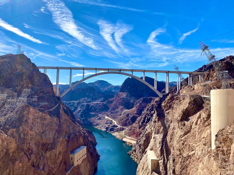
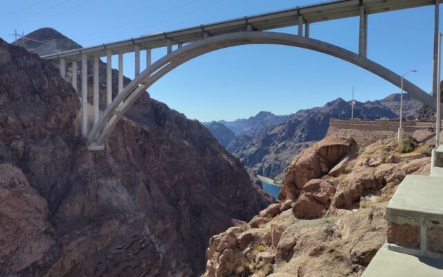
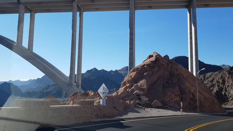
Somewhere between Las Vegas and the Arizona line, US Highway 93 does something bold. It leaves solid ground and sails across the Black Canyon of the Colorado River on a massive arch.
That arch is the Mike O’Callaghan–Pat Tillman Memorial Bridge, listed at 27953, 28689 Great Basin Hwy, Boulder City, NV 89005, United States. It sits right on the Nevada and Arizona state line, just downstream from Hoover Dam.
Many people know it by its other name, the Hoover Dam Bypass. Drivers heading across may barely notice the dam, since a tall wall along the roadway does a solid job of hiding it from car windows.
The real show belongs to anyone willing to park and walk. A pedestrian walkway runs along the span, offering one of the most celebrated views of the dam in the region.
Best of all, admission costs nothing, so the only investment is a bit of time and energy.
The Detour That Freed Hoover Dam
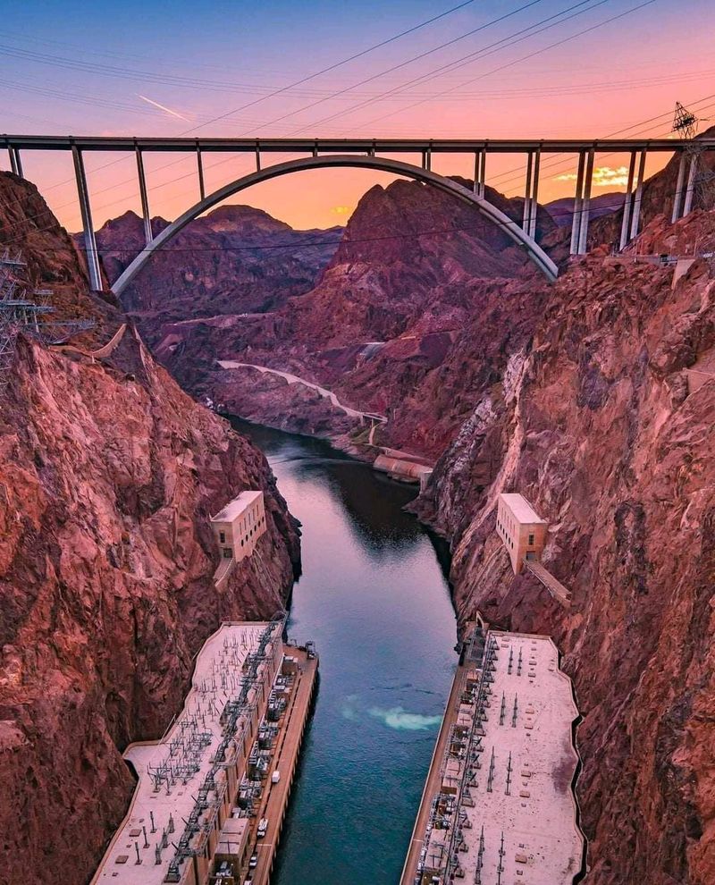
Before 2010, anyone traveling US 93 between Nevada and Arizona had to drive right across the top of Hoover Dam. That meant every kind of traffic squeezed onto the same crest road.
The bridge changed that routine for good. Its main job was to divert traffic that once rolled along the dam itself.
Opened in 2010, the span became the lynchpin of a major bypass built to ease congestion around the dam. The shift is so complete that crossing the bridge by car feels almost ordinary.
Plenty of drivers pass over without realizing one of the most famous structures in the country sits just upstream.
The design world noticed the achievement too. In 2012, the bridge won a bridge design award, a fitting nod for a project built across rugged canyon terrain.
Today it stands as proof that a practical fix can also become a destination in its own right.
Two Names, Two Stories
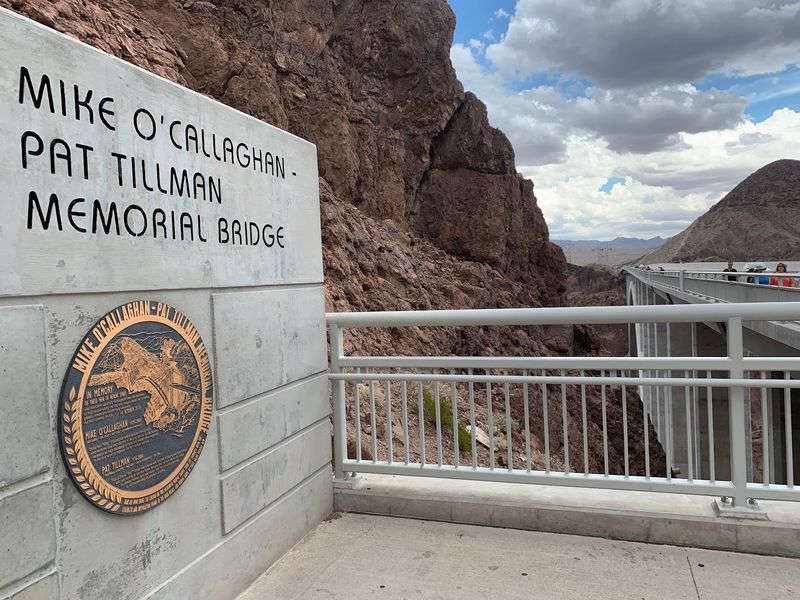
Every bridge gets a name, but few carry two stories at once. The plaques along the approach explain exactly who this crossing honors.
Mike O’Callaghan served as Governor of Nevada from 1971 to 1979. His name on the span ties the project firmly to the Silver State, which sits on its western end.
Pat Tillman was an NFL player who walked away from a professional football career to serve in the military. His choice made him a nationally known figure, and the bridge carries his name as a lasting tribute.
Together, the two names give the structure a meaning that goes beyond engineering. Many people come for the dam view and leave having learned something about both men.
Take a few minutes at the informational displays on the way up. They add real depth to the walk and turn a scenic stop into a small history lesson with a very big backdrop.
Numbers Worth Bragging About
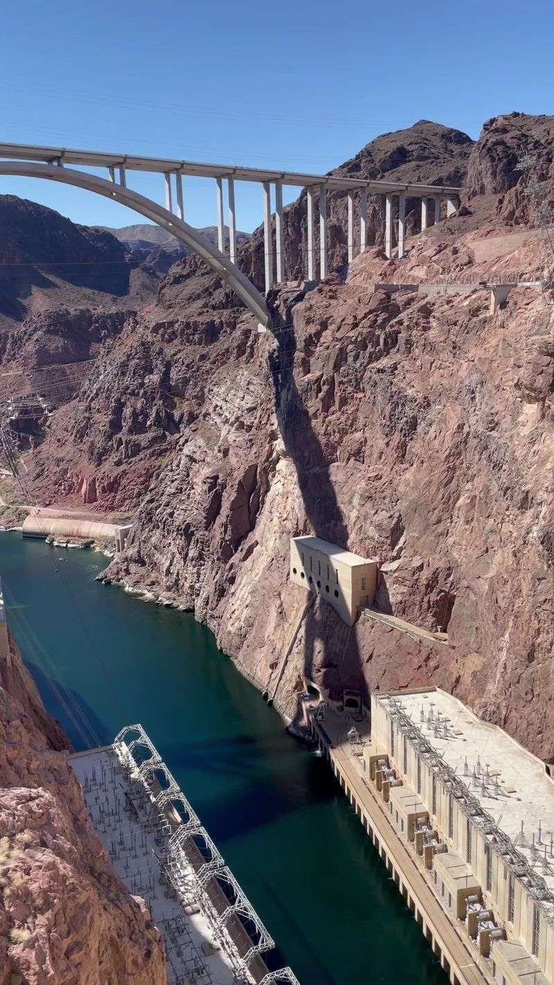
Numbers tell this story better than adjectives. The span stretches 1,905 feet, or about 579 meters, from end to end.
Height is where things get dizzying. The roadway sits roughly 890 feet, or 270 meters, above the Colorado River, which makes it the second tallest bridge in the United States.
That kind of elevation explains why the phrase engineering marvel comes up so often when people describe the place. Taking in the scale of both the bridge and the dam from the walkway leaves a strong impression, even on casual travelers.
Some people end up ranking the bridge above Hoover Dam itself. The reasoning is simple: one stop delivers a sweeping view and a major engineering accomplishment at the same time.
For bridge fans, it lands on the must-see list almost instantly. For everyone else, the figures above are handy ammunition for impressing travel companions on the drive back to Las Vegas.
Stairs, Ramps, and a Well-Earned Climb
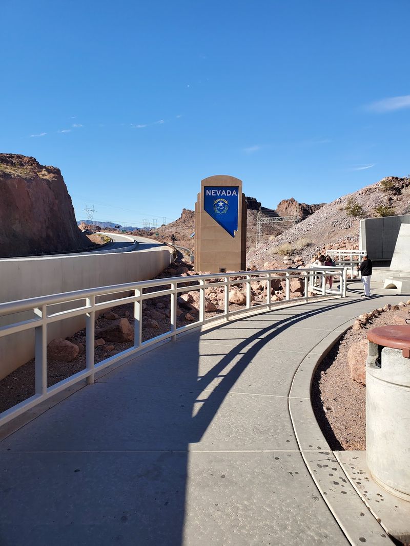
Nobody reaches the view by accident. The trip starts at a large free parking lot, sometimes signed as Boulder Dam Bridge Parking, where restrooms are available before the climb.
Clear signage points the way from the lot to the pedestrian walkway. The stairs are the most direct route, with roughly 69 steps between the lot and the top.
Ramps offer another option for anyone who would rather skip the stairs. Seats on most levels make it easy to pause and catch a breath along the way.
The effort is real, though. Plenty of people describe it as a genuine climb, and it can feel tougher for anyone who has difficulty walking.
Getting to the lot itself is simple thanks to good signage. On quieter days, open spaces are easy to find, but big holidays can turn parking into a real headache.
Budget a little extra time, lace up comfortable shoes, and treat the stairs as a warm-up act for the main event.
History Lessons Along the Ramp
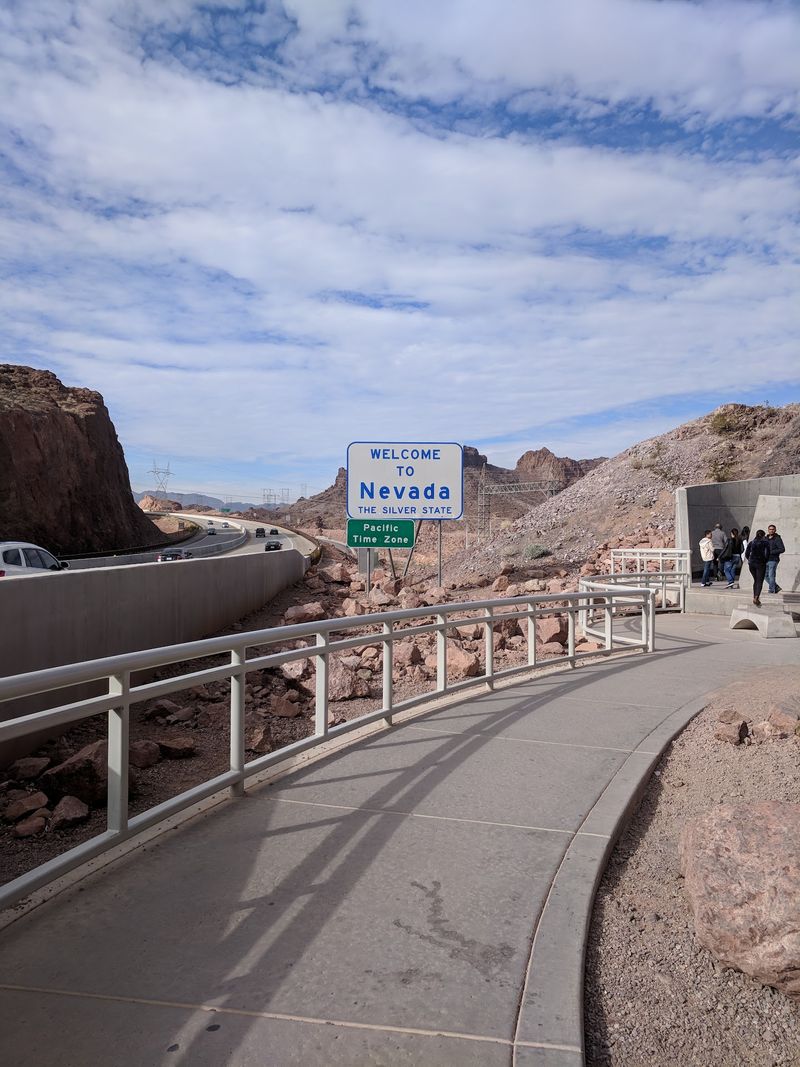
Halfway up the climb, a history class quietly takes shape. Informational signs and plaques line the route, and they give walkers a perfect excuse to pause.
Several placards briefly walk through the process of building the bridge. They lay out the construction story step by step, in bite-sized chunks that are easy to read on the go.
Other plaques focus on the two men the bridge honors. Reading them before reaching the top adds context that makes the final view feel more meaningful.
The displays also work as natural rest stops. On a hot afternoon, a minute spent reading beats a minute spent pretending not to be winded.
Travelers who enjoy a bit of background will find plenty to explore here. Even those who usually skip museum text tend to linger, since the signs are short and tied directly to what sits just ahead.
By the top, the payoff feels well earned.
The Bird’s-Eye Angle on Hoover Dam
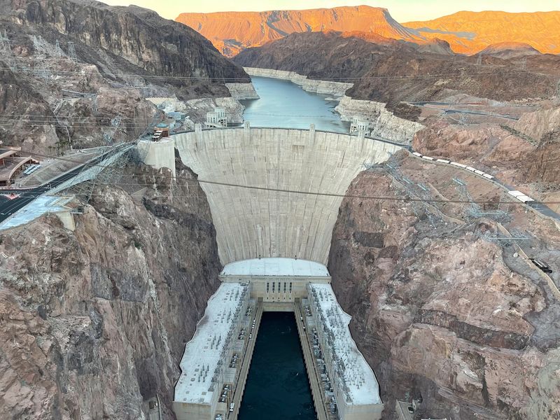
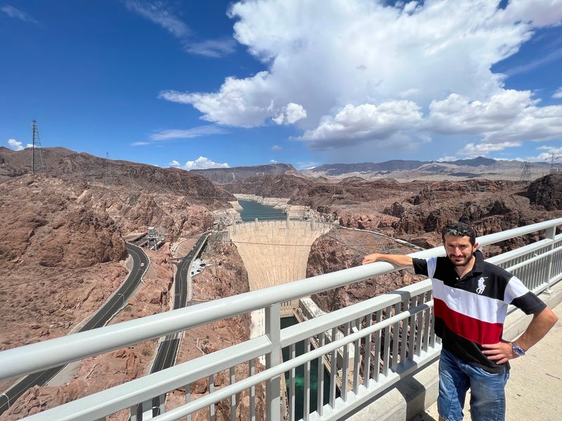
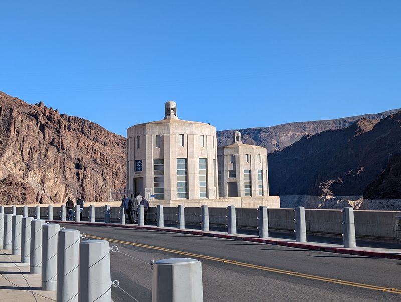
Here is the moment the whole detour builds toward. From the middle of the walkway, Hoover Dam comes into full view, framed by the walls of Black Canyon.
The perspective is a true bird’s-eye view, one that many people consider unmatched. Few spots let anyone take in the dam’s entire face, the river, and the canyon at the same time.
A handy trick for orientation: stand at the center facing the dam, and Arizona lies to the right while Nevada sits to the left.
Photographers tend to treat this as the definitive angle. If the goal is the most impressive shot of the dam, this is widely regarded as the place to get it.
Some arrivals feel skeptical along the walk up, since the full view stays hidden for a while. The doubt disappears once they reach the middle of the span.
Plan to stop there and linger, because rushing past the center defeats the purpose of the climb.
River, Canyon, and Desert Below
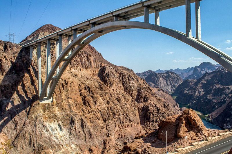
Beyond the dam, the landscape takes over. The Colorado River runs far below the deck, cutting through the rugged walls of Black Canyon.
Straight down is where nerves get tested. Looking directly at the river from 890 feet up is a little unnerving for many, and more than a few people advise simply not looking down.
The walkway also opens up views toward Lake Mead, the reservoir held back by the dam. In recent decades, lower water levels there have become a common topic among people who follow the region.
The surrounding desert rounds out the scene. On the way up, the dry landscape gives a sense of just how remote this crossing feels compared to the Las Vegas Strip.
Nature and human work share the same frame here. The river carved the canyon, people built the dam and bridge, and the walkway lets everyone see how those pieces fit together in one sweeping panorama.
Gusts That Collect Hats
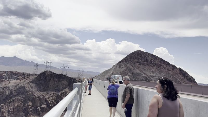
Hats beware. Gusts sweep through Black Canyon with real force, and the top of the bridge catches the full brunt.
Strong winds are one of the most common topics among people who make the walk. Some describe being pushed by the gusts, while others simply clutch their caps and keep moving.
The canyon holds proof of what happens when that advice goes ignored. Dozens of runaway hats have ended up along the side of the bridge, a quirky collection nobody plans to contribute to.
For some, the gusts turn the stop into a thrill. For others, the experience feels a bit scary, especially combined with the height.
A smart move is to check the weather advisory for winds before heading out. Removing a hat before stepping onto the walkway, or securing it well, saves a lot of disappointment.
Loose items of any kind deserve the same caution. The canyon breeze rarely asks permission before borrowing something.
A Bridge Built to Sway
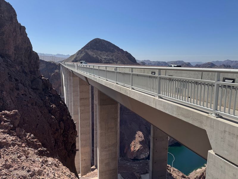
Here is a detail that surprises plenty of first-timers: the bridge moves. Traffic rolling across and wind passing through the canyon can make the structure flex and sway slightly.
That movement is intentional. A completely rigid structure would be damaged by the forces acting on it, so a bit of give is part of smart design.
Science does not always win over a nervous walker, though. Some people describe the bridge as shaking during strong winds, and they call the walk a unique but slightly scary experience.
Anyone with a fear of heights should keep this in mind before committing to the full stroll. The combination of elevation, wind, and motion can be a lot for some travelers.
On the flip side, many people find it all part of the adventure. A short walk out to the middle might be enough to grab the view without testing every nerve.
Going at a relaxed pace and pausing often can help anyone who feels uneasy.
Sun, Water, and Zero Shade
Desert sun does not take days off. Even in late March, temperatures can climb past 90 degrees Fahrenheit, and the heat can get extreme.
The walkway offers no shade. The bridge itself is not especially long, but crossing it under direct sun can feel far more demanding than the distance suggests.
Supplies matter here because the site has restrooms and nothing more. No refreshments are sold at the parking area, so bringing plenty of water is essential, especially with all those steps.
A small bag with a refillable bottle keeps hands free for the railing and the camera.
Sunscreen and a hat belong on the packing list as well. Just keep that hat secured, given how the wind likes to behave up top.
Timing can help too. Cooler parts of the day make the climb and the crossing much more comfortable for most people.
Treat hydration as part of the itinerary rather than an afterthought, and the walk stays fun instead of exhausting.
Smart Timing for a Quick Detour
Smart sequencing makes the day smoother. Many people pair the bridge with a Hoover Dam tour, and doing the tour first in the morning, then saving the bridge for later, works especially well.
Others flip the order and make the bridge their very first stop. It offers a proper introduction to the dam before heading down for a closer look.
Either way, the excursion is quick. Around 30 minutes is typical for the climb, the walk to the middle, and a round of photos.
The bridge also works as a standalone outing. Travelers short on time can see the dam from above without driving the rest of the way down to it, which makes it a popular side trip from Las Vegas and Henderson.
Walking the full length of the span is possible, although the path does not continue beyond the Arizona end. There is no Arizona welcome sign for photos, so plan on posing mid-span instead.
Holidays bring big crowds, so patience helps.
Worth the Climb, Hands Down
So is the climb worth it? For most people who make the trek, the answer is an easy yes.
The appeal is hard to argue with. Free parking, free admission, restrooms, ramps for accessibility, and one of the finest views of Hoover Dam add up to a stop with very few downsides.
The trade-offs are real but manageable. Bring water, respect the wind, keep a firm grip on that hat, and give the heat the attention it deserves.
Heights and a bit of sway may test some nerves. Even so, a short walk to the center usually rewards the effort many times over.
Drivers on US 93 can turn a routine highway crossing into a memorable pause with just a short detour. Pair it with the dam, or enjoy it on its own; the payoff holds up either way.
The roadway carries the traffic, but the walkway beside it holds the real reward, waiting patiently 890 feet above the river.
Share this story